Ness Head

Coastal Feature, Headland, Point in Caithness

Scotland

Ness Head

Layby on the A99 near Milltown The A99 follows the east coast of Caithness from Latheron, where it leaves the A9, though the town of Wick to John o' Groats at the north-east corner of the Highlands. The road is a trunk road between Latheron and Wick. It was part of the A9 until 1997, when the A9 was re-routed along what had been the A895-A882 link between Latheron and Thurso.

The A99 forms part of the North Coast 500 (NC500) which was launched in 2015. NC500 is a 516-mile scenic route around the north coast of Scotland, starting and ending at Inverness Castle,
Layby on the A99 near Milltown Credit: David Dixon

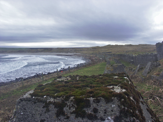
Ness Head is a prominent coastal feature located in Caithness, a county in the northern part of Scotland. This headland, also referred to as a point, extends into the North Sea and is known for its stunning natural beauty and rugged landscape.

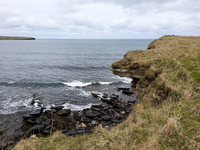
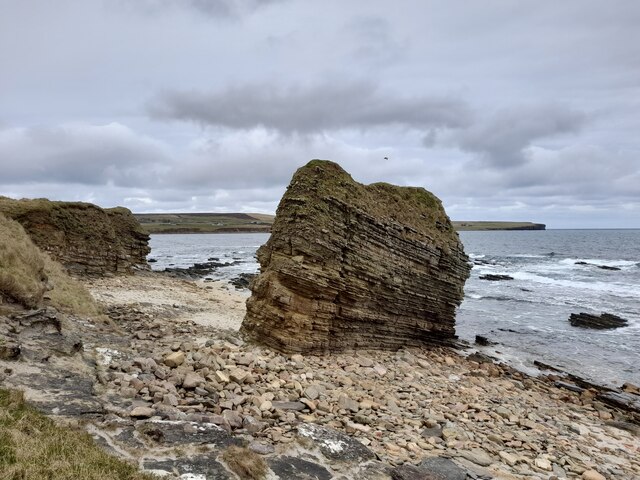
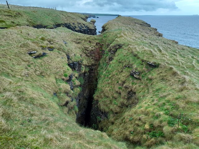
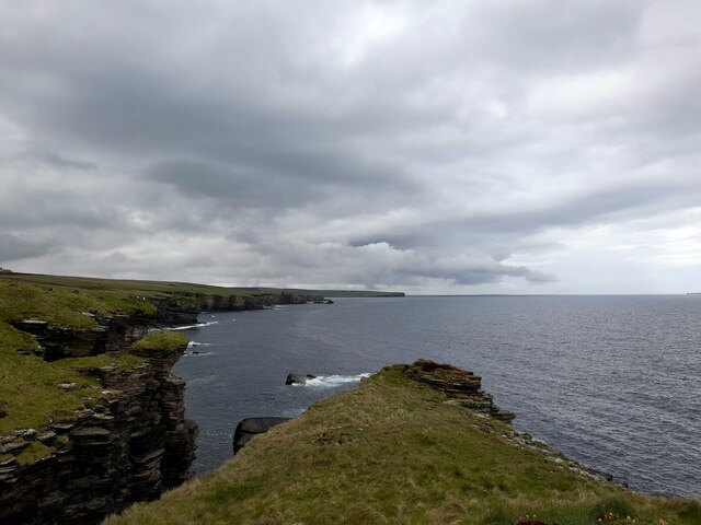
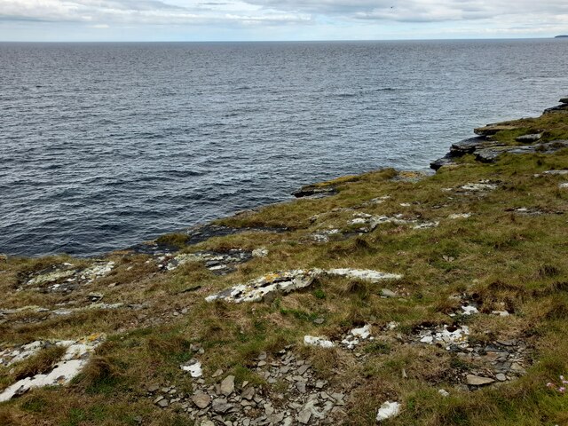
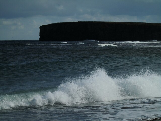
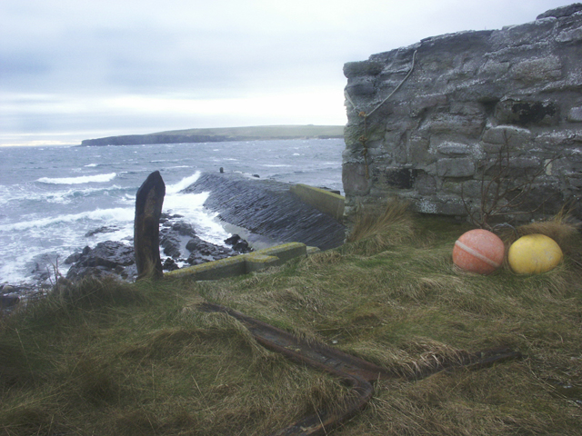
Situated near the town of Wick, Ness Head offers breathtaking views of the surrounding sea and coastline. The headland is characterized by steep cliffs that rise dramatically from the water, creating a striking and dramatic backdrop. These cliffs are composed primarily of sandstone, giving them a unique reddish color that adds to the charm of the area.

The headland is also home to a diverse range of wildlife. The surrounding waters are teeming with marine life, including seals, dolphins, and various species of seabirds. Birdwatchers will be delighted to spot puffins, guillemots, and gannets nesting on the cliffs during the summer months.

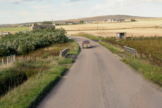
Ness Head is a popular destination for outdoor enthusiasts, offering numerous opportunities for hiking and exploration. There are well-maintained trails that wind along the headland, allowing visitors to fully immerse themselves in the natural beauty of the area. The coastal path provides stunning views of the sea and the chance to observe the wildlife in their natural habitat.

Overall, Ness Head is a must-visit destination for nature lovers and those seeking a tranquil escape. Its striking cliffs, diverse wildlife, and scenic trails make it an ideal spot to appreciate the raw beauty of the Caithness coastline.

If you have any feedback on the listing, please let us know in the comments section below.
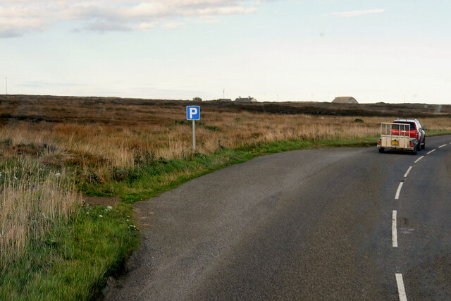
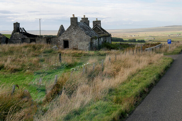
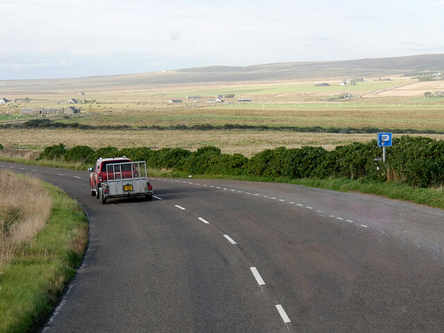
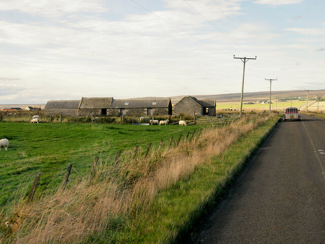
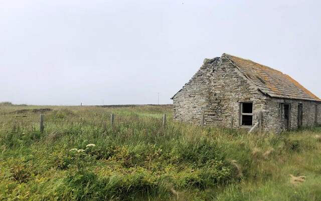
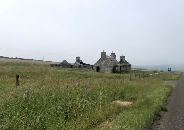
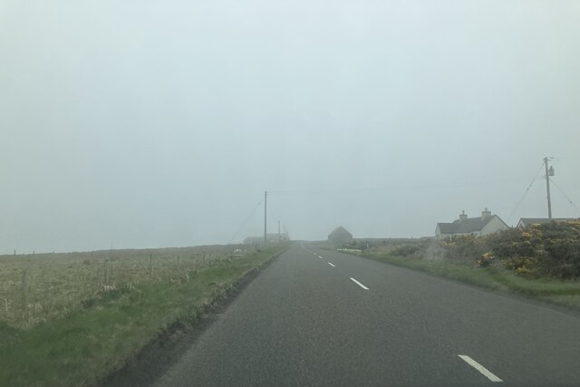
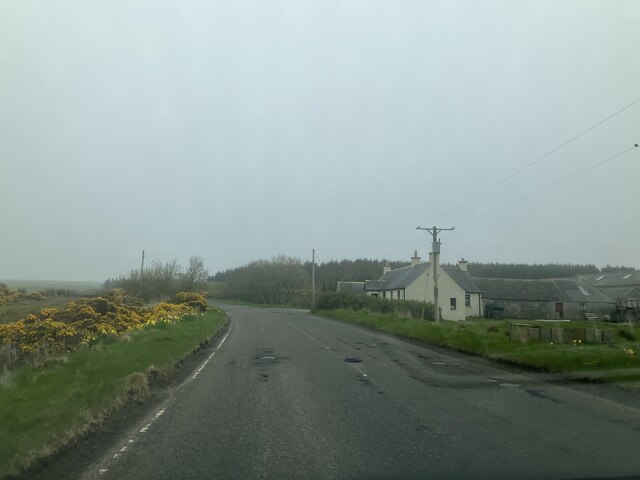
Ness Head Images

Images are sourced within 2km of 58.582401/-3.0616709 or Grid Reference ND3866. Thanks to Geograph Open Source API. All images are credited.

Layby on the A99 near Milltown The A99 follows the east coast of Caithness from Latheron, where it leaves the A9, though the town of Wick to John o' Groats at the north-east corner of the Highlands. The road is a trunk road between Latheron and Wick. It was part of the A9 until 1997, when the A9 was re-routed along what had been the A895-A882 link between Latheron and Thurso.

The A99 forms part of the North Coast 500 (NC500) which was launched in 2015. NC500 is a 516-mile scenic route around the north coast of Scotland, starting and ending at Inverness Castle,
Layby on the A99 near Milltown
The A99 follows the east coast of Caithness from Latheron, where it leaves the A9, though the town of Wick to John o' Groats at the north-east corner of the Highlands. The road is a trunk road between Latheron and Wick. It was part of the A9 until 1997, when the A9 was re-routed along what had been the A895-A882 link between Latheron and Thurso. The A99 forms part of the North Coast 500 (NC500) which was launched in 2015. NC500 is a 516-mile scenic route around the north coast of Scotland, starting and ending at Inverness Castle,
Smithy House (Ruin), Hill of Harley The A99 follows the east coast of Caithness from Latheron, where it leaves the A9, though the town of Wick to John o' Groats at the north-east corner of the Highlands. The road is a trunk road between Latheron and Wick. It was part of the A9 until 1997, when the A9 was re-routed along what had been the A895-A882 link between Latheron and Thurso.

The A99 forms part of the North Coast 500 (NC500) which was launched in 2015. NC500 is a 516-mile scenic route around the north coast of Scotland, starting and ending at Inverness Castle,
Smithy House (Ruin), Hill of Harley
The A99 follows the east coast of Caithness from Latheron, where it leaves the A9, though the town of Wick to John o' Groats at the north-east corner of the Highlands. The road is a trunk road between Latheron and Wick. It was part of the A9 until 1997, when the A9 was re-routed along what had been the A895-A882 link between Latheron and Thurso. The A99 forms part of the North Coast 500 (NC500) which was launched in 2015. NC500 is a 516-mile scenic route around the north coast of Scotland, starting and ending at Inverness Castle,
Layby on the A99 near Harley The A99 follows the east coast of Caithness from Latheron, where it leaves the A9, though the town of Wick to John o' Groats at the north-east corner of the Highlands. The road is a trunk road between Latheron and Wick. It was part of the A9 until 1997, when the A9 was re-routed along what had been the A895-A882 link between Latheron and Thurso.

The A99 forms part of the North Coast 500 (NC500) which was launched in 2015. NC500 is a 516-mile scenic route around the north coast of Scotland, starting and ending at Inverness Castle,
Layby on the A99 near Harley
The A99 follows the east coast of Caithness from Latheron, where it leaves the A9, though the town of Wick to John o' Groats at the north-east corner of the Highlands. The road is a trunk road between Latheron and Wick. It was part of the A9 until 1997, when the A9 was re-routed along what had been the A895-A882 link between Latheron and Thurso. The A99 forms part of the North Coast 500 (NC500) which was launched in 2015. NC500 is a 516-mile scenic route around the north coast of Scotland, starting and ending at Inverness Castle,
A99, Farm Buildings near Freswick The A99 follows the east coast of Caithness from Latheron, where it leaves the A9, though the town of Wick to John o' Groats at the north-east corner of the Highlands. The road is a trunk road between Latheron and Wick. It was part of the A9 until 1997, when the A9 was re-routed along what had been the A895-A882 link between Latheron and Thurso.

The A99 forms part of the North Coast 500 (NC500) which was launched in 2015. NC500 is a 516-mile scenic route around the north coast of Scotland, starting and ending at Inverness Castle,
A99, Farm Buildings near Freswick
The A99 follows the east coast of Caithness from Latheron, where it leaves the A9, though the town of Wick to John o' Groats at the north-east corner of the Highlands. The road is a trunk road between Latheron and Wick. It was part of the A9 until 1997, when the A9 was re-routed along what had been the A895-A882 link between Latheron and Thurso. The A99 forms part of the North Coast 500 (NC500) which was launched in 2015. NC500 is a 516-mile scenic route around the north coast of Scotland, starting and ending at Inverness Castle,
A99, Bridge over Little Gill Burn The A99 follows the east coast of Caithness from Latheron, where it leaves the A9, though the town of Wick to John o' Groats at the north-east corner of the Highlands. The road is a trunk road between Latheron and Wick. It was part of the A9 until 1997, when the A9 was re-routed along what had been the A895-A882 link between Latheron and Thurso.

The A99 forms part of the North Coast 500 (NC500) which was launched in 2015. NC500 is a 516-mile scenic route around the north coast of Scotland, starting and ending at Inverness Castle,
A99, Bridge over Little Gill Burn
The A99 follows the east coast of Caithness from Latheron, where it leaves the A9, though the town of Wick to John o' Groats at the north-east corner of the Highlands. The road is a trunk road between Latheron and Wick. It was part of the A9 until 1997, when the A9 was re-routed along what had been the A895-A882 link between Latheron and Thurso. The A99 forms part of the North Coast 500 (NC500) which was launched in 2015. NC500 is a 516-mile scenic route around the north coast of Scotland, starting and ending at Inverness Castle,
Overhanging Cliff near Freswick Beyond, across Freswick Bay, is Skirza Head.
Overhanging Cliff near Freswick
Beyond, across Freswick Bay, is Skirza Head.
Sea Stack at Freswick This stack shows the layered sedimentary rocks of the area.
Sea Stack at Freswick
This stack shows the layered sedimentary rocks of the area.
At Freswick Mains Within the buildings at Freswick Mains.
At Freswick Mains
Within the buildings at Freswick Mains.
Coast near Auckengill It seems like the roof of a sea cave has collapsed forming a gloup.
Coast near Auckengill
It seems like the roof of a sea cave has collapsed forming a gloup.
Coast at The Kilns The area in the foreground is within the grid square.
Coast at The Kilns
The area in the foreground is within the grid square.
The Kilns A small area of coastline is within this grid square.
The Kilns
A small area of coastline is within this grid square.
Freswick Bay Waves catching the afternoon sunlight.
Freswick Bay
Waves catching the afternoon sunlight.
Derelict old barn by the A99
Croft in ruins by the A99
Approaching Hilltop Cottage
Approaching Westlands
Anti-invasion defences, Freswick Bay, Caithness The photo shows a double row of "Dragon's Teeth" and a row of "Cubes".
Anti-invasion defences, Freswick Bay, Caithness
The photo shows a double row of "Dragon's Teeth" and a row of "Cubes".
Skirza Harbour, Caithness
Show me another place!

Ness Head is located at Grid Ref: ND3866 (Lat: 58.582401, Lng: -3.0616709)

Unitary Authority: Highland

Police Authority: Highlands and Islands

What 3 Words

///fussy.loft.illogical. Near John o' Groats, Highland

Related Wikis

Skirza

Skirza or Skirsa, is a small remote linear fishing village, overlooking Freswick Bay to the south and Skirza Head to the southeast, in eastern Caithness...

Freswick

Freswick ( FREZZ-ik) or Skirsa, is a small remote hamlet, overlooking Freswick Bay to the east, in eastern Caithness, Scottish Highlands and is in the...

Auckengill

Auckengill is a settlement, 6 miles (10 kilometres) south of John o' Groats, on the east coast of Caithness, within the Scottish council area of Highland...

Nybster

Nybster is a scattered rural and crofting township, situated in Caithness and is in the Scottish council area of Highland. It is located along the A9 road...

Keiss Castle

Keiss Castle is a partially ruined castle in Scotland, which stands on sheer cliffs overlooking Sinclair's Bay less than one mile north of Keiss village...

Keiss

Keiss (Scottish Gaelic: Cèis) is a fishing village at the northern end of Sinclair's Bay on the east coast of Caithness county in Scotland's Highland...

John o' Groats

John O' Groats (Scottish Gaelic: Taigh Iain Ghròt) is a village 2.5 mi (4 km) northeast of Canisbay, Caithness, in the far north of Scotland. John O' Groats...

Canisbay

Canisbay is a rural hamlet located about one mile (1.5 kilometres) southwest of Huna and two and a half miles (four kilometres) southwest of John o' Groats...

Nearby Amenities

Located within 500m of 58.582401,-3.0616709
Created By: dmgroom_coastlines
Source: PGS
Lat/Long: 58.578165/-3.063642
Source: PGS
Lat/Long: 58.5786342/-3.0636492
Source: PGS
Lat/Long: 58.5788297/-3.0630221
Source: PGS
Lat/Long: 58.5789164/-3.06268
Created By: dmgroom_coastlines
Source: PGS
Lat/Long: 58.578934/-3.062417
Created By: dmgroom_coastlines
Source: PGS
Lat/Long: 58.579958/-3.062175
Created By: dmgroom_coastlines
Source: PGS
Lat/Long: 58.580086/-3.061929
Source: PGS
Lat/Long: 58.5800518/-3.0616743
Source: PGS
Lat/Long: 58.5800204/-3.0613917
Source: PGS
Lat/Long: 58.5800813/-3.061078
Source: PGS
Lat/Long: 58.5802456/-3.0606925
Source: PGS
Lat/Long: 58.5806095/-3.0605182
Source: PGS
Lat/Long: 58.5812785/-3.0599631
Source: PGS
Lat/Long: 58.5812585/-3.060421
Source: PGS
Lat/Long: 58.5809354/-3.0613444
Source: PGS
Lat/Long: 58.5813443/-3.0616199
Source: PGS
Lat/Long: 58.5816577/-3.0611488
Source: PGS
Lat/Long: 58.581598/-3.0632761
Source: PGS
Lat/Long: 58.5820525/-3.0632789
Source: PGS
Lat/Long: 58.5820933/-3.0631966
Source: PGS
Lat/Long: 58.5822016/-3.0626995
Source: PGS
Lat/Long: 58.5821479/-3.062375
Source: PGS
Lat/Long: 58.5822255/-3.06185
Source: PGS
Lat/Long: 58.5822818/-3.0618582
Source: PGS
Lat/Long: 58.5826944/-3.0615048
Created By: dmgroom_coastlines
Source: PGS
Lat/Long: 58.583156/-3.063895
Source: PGS
Lat/Long: 58.5838304/-3.0645721
Source: PGS
Lat/Long: 58.5834701/-3.0657926
Source: PGS
Lat/Long: 58.5837764/-3.0657336
Source: PGS
Lat/Long: 58.5837848/-3.0662717
Source: PGS
Lat/Long: 58.5839485/-3.0663361
Created By: dmgroom_coastlines
Source: PGS
Lat/Long: 58.584051/-3.066838
Source: PGS
Lat/Long: 58.5843393/-3.0675142
Source: PGS
Lat/Long: 58.5847687/-3.0679827
Source: PGS
Lat/Long: 58.5851175/-3.0681636
The data included in this document is from www.openstreetmap.org. The data is made available under ODbL.

Have you been to Ness Head?

Leave your review of Ness Head below (or comments, questions and feedback).