Byke Yards

Coastal Feature, Headland, Point in Caithness

Scotland

Byke Yards

Layby on the A99 near Milltown The A99 follows the east coast of Caithness from Latheron, where it leaves the A9, though the town of Wick to John o' Groats at the north-east corner of the Highlands. The road is a trunk road between Latheron and Wick. It was part of the A9 until 1997, when the A9 was re-routed along what had been the A895-A882 link between Latheron and Thurso.

The A99 forms part of the North Coast 500 (NC500) which was launched in 2015. NC500 is a 516-mile scenic route around the north coast of Scotland, starting and ending at Inverness Castle,
Layby on the A99 near Milltown Credit: David Dixon

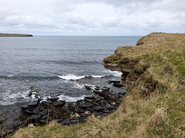
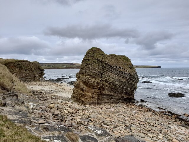
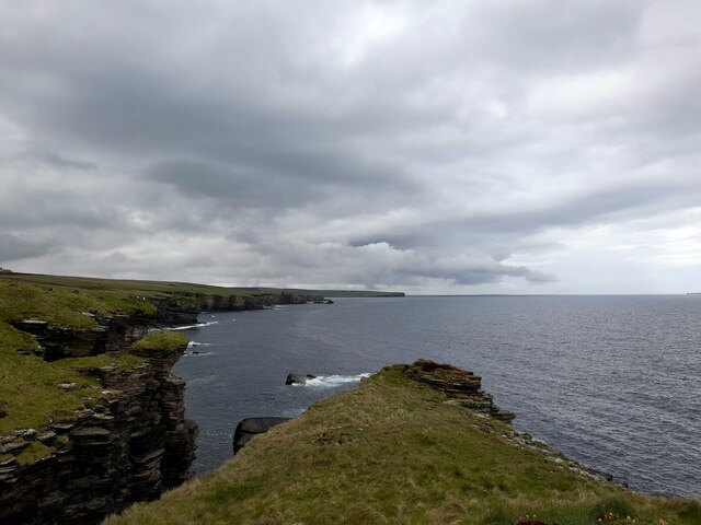
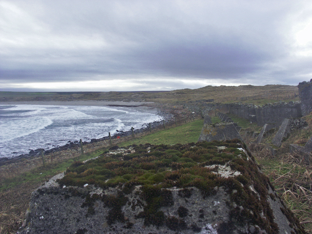
Byke Yards is a prominent coastal feature located in Caithness, Scotland. It is specifically classified as a headland or point, jutting out into the North Sea. The name "Byke Yards" is believed to have derived from the Old Norse words "bik" meaning a point or headland, and "gardr" meaning an enclosed space or yard.

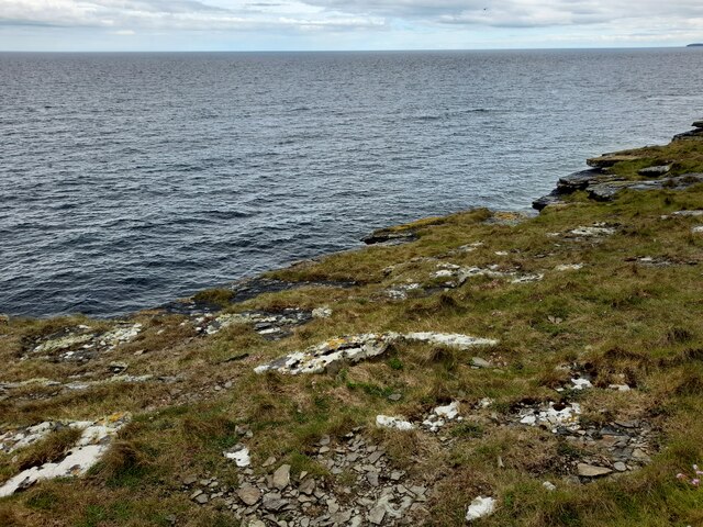
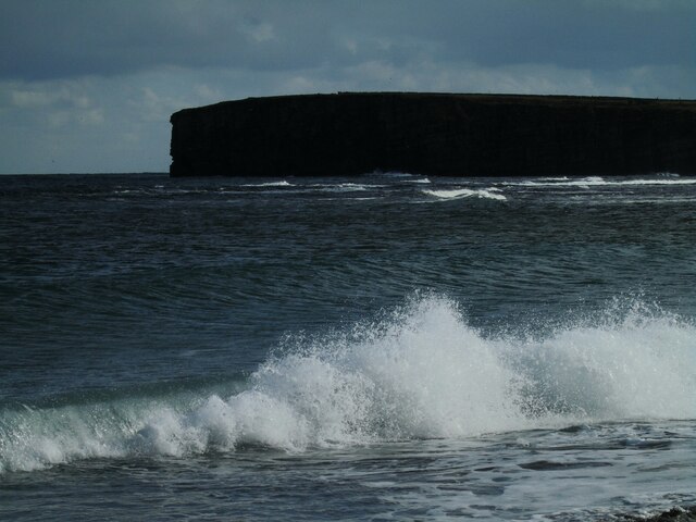
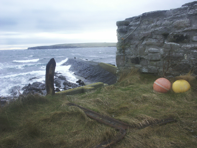
This coastal formation is characterized by its rugged and rocky terrain, with cliffs rising steeply from the sea. The headland is composed of layers of sedimentary rocks, including sandstone and shale, which have been carved by the relentless forces of wind and waves over centuries.

Byke Yards offers breathtaking views of the surrounding coastline, with its elevated position providing a panoramic vantage point. On a clear day, visitors can observe the vast expanse of the North Sea, as well as catch glimpses of nearby islands such as Stroma and the Orkney Islands.

The headland is also home to a diverse range of flora and fauna. Its exposed location and nutrient-rich waters attract a variety of seabirds, including gulls, fulmars, and kittiwakes. In addition, seals can often be spotted basking on the rocks below.

Byke Yards is a popular destination for nature enthusiasts, hikers, and photographers. Its dramatic cliffs, stunning vistas, and abundant wildlife make it a must-visit location for anyone exploring the Caithness coastline.

If you have any feedback on the listing, please let us know in the comments section below.
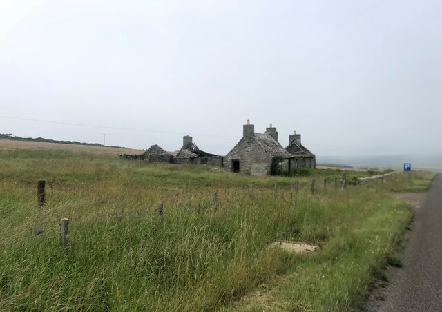
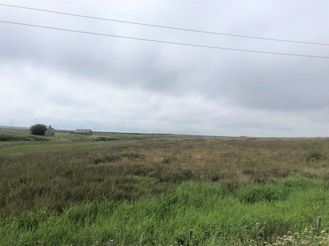
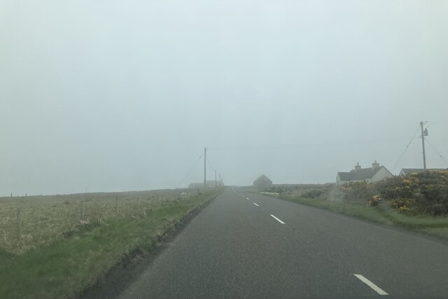
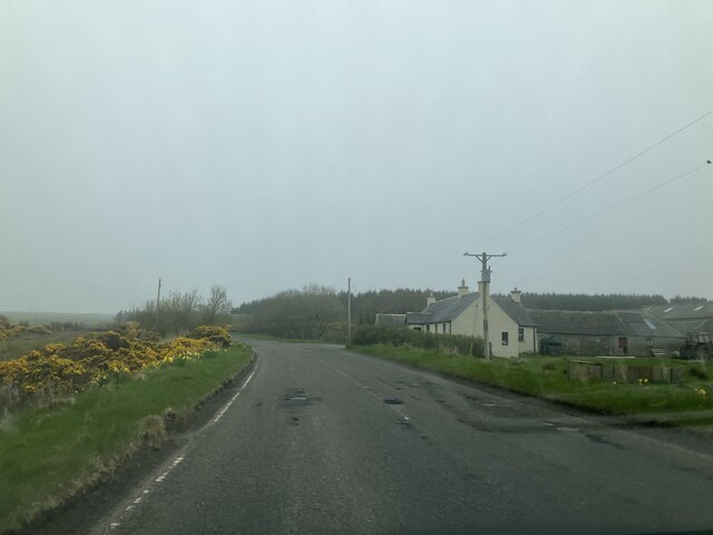
Byke Yards Images

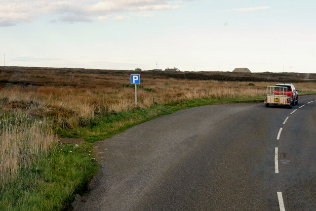
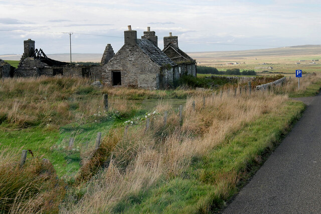
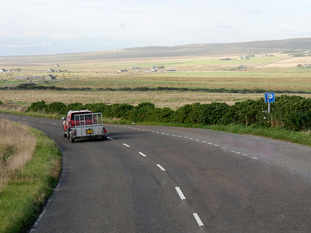
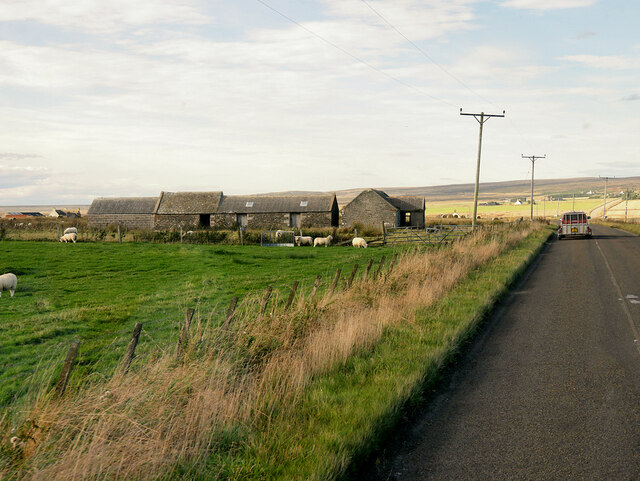
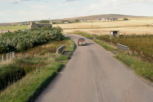
Images are sourced within 2km of 58.583752/-3.0644982 or Grid Reference ND3866. Thanks to Geograph Open Source API. All images are credited.

Layby on the A99 near Milltown The A99 follows the east coast of Caithness from Latheron, where it leaves the A9, though the town of Wick to John o' Groats at the north-east corner of the Highlands. The road is a trunk road between Latheron and Wick. It was part of the A9 until 1997, when the A9 was re-routed along what had been the A895-A882 link between Latheron and Thurso.

The A99 forms part of the North Coast 500 (NC500) which was launched in 2015. NC500 is a 516-mile scenic route around the north coast of Scotland, starting and ending at Inverness Castle,
Layby on the A99 near Milltown
The A99 follows the east coast of Caithness from Latheron, where it leaves the A9, though the town of Wick to John o' Groats at the north-east corner of the Highlands. The road is a trunk road between Latheron and Wick. It was part of the A9 until 1997, when the A9 was re-routed along what had been the A895-A882 link between Latheron and Thurso. The A99 forms part of the North Coast 500 (NC500) which was launched in 2015. NC500 is a 516-mile scenic route around the north coast of Scotland, starting and ending at Inverness Castle,
Smithy House (Ruin), Hill of Harley The A99 follows the east coast of Caithness from Latheron, where it leaves the A9, though the town of Wick to John o' Groats at the north-east corner of the Highlands. The road is a trunk road between Latheron and Wick. It was part of the A9 until 1997, when the A9 was re-routed along what had been the A895-A882 link between Latheron and Thurso.

The A99 forms part of the North Coast 500 (NC500) which was launched in 2015. NC500 is a 516-mile scenic route around the north coast of Scotland, starting and ending at Inverness Castle,
Smithy House (Ruin), Hill of Harley
The A99 follows the east coast of Caithness from Latheron, where it leaves the A9, though the town of Wick to John o' Groats at the north-east corner of the Highlands. The road is a trunk road between Latheron and Wick. It was part of the A9 until 1997, when the A9 was re-routed along what had been the A895-A882 link between Latheron and Thurso. The A99 forms part of the North Coast 500 (NC500) which was launched in 2015. NC500 is a 516-mile scenic route around the north coast of Scotland, starting and ending at Inverness Castle,
Layby on the A99 near Harley The A99 follows the east coast of Caithness from Latheron, where it leaves the A9, though the town of Wick to John o' Groats at the north-east corner of the Highlands. The road is a trunk road between Latheron and Wick. It was part of the A9 until 1997, when the A9 was re-routed along what had been the A895-A882 link between Latheron and Thurso.

The A99 forms part of the North Coast 500 (NC500) which was launched in 2015. NC500 is a 516-mile scenic route around the north coast of Scotland, starting and ending at Inverness Castle,
Layby on the A99 near Harley
The A99 follows the east coast of Caithness from Latheron, where it leaves the A9, though the town of Wick to John o' Groats at the north-east corner of the Highlands. The road is a trunk road between Latheron and Wick. It was part of the A9 until 1997, when the A9 was re-routed along what had been the A895-A882 link between Latheron and Thurso. The A99 forms part of the North Coast 500 (NC500) which was launched in 2015. NC500 is a 516-mile scenic route around the north coast of Scotland, starting and ending at Inverness Castle,
A99, Farm Buildings near Freswick The A99 follows the east coast of Caithness from Latheron, where it leaves the A9, though the town of Wick to John o' Groats at the north-east corner of the Highlands. The road is a trunk road between Latheron and Wick. It was part of the A9 until 1997, when the A9 was re-routed along what had been the A895-A882 link between Latheron and Thurso.

The A99 forms part of the North Coast 500 (NC500) which was launched in 2015. NC500 is a 516-mile scenic route around the north coast of Scotland, starting and ending at Inverness Castle,
A99, Farm Buildings near Freswick
The A99 follows the east coast of Caithness from Latheron, where it leaves the A9, though the town of Wick to John o' Groats at the north-east corner of the Highlands. The road is a trunk road between Latheron and Wick. It was part of the A9 until 1997, when the A9 was re-routed along what had been the A895-A882 link between Latheron and Thurso. The A99 forms part of the North Coast 500 (NC500) which was launched in 2015. NC500 is a 516-mile scenic route around the north coast of Scotland, starting and ending at Inverness Castle,
A99, Bridge over Little Gill Burn The A99 follows the east coast of Caithness from Latheron, where it leaves the A9, though the town of Wick to John o' Groats at the north-east corner of the Highlands. The road is a trunk road between Latheron and Wick. It was part of the A9 until 1997, when the A9 was re-routed along what had been the A895-A882 link between Latheron and Thurso.

The A99 forms part of the North Coast 500 (NC500) which was launched in 2015. NC500 is a 516-mile scenic route around the north coast of Scotland, starting and ending at Inverness Castle,
A99, Bridge over Little Gill Burn
The A99 follows the east coast of Caithness from Latheron, where it leaves the A9, though the town of Wick to John o' Groats at the north-east corner of the Highlands. The road is a trunk road between Latheron and Wick. It was part of the A9 until 1997, when the A9 was re-routed along what had been the A895-A882 link between Latheron and Thurso. The A99 forms part of the North Coast 500 (NC500) which was launched in 2015. NC500 is a 516-mile scenic route around the north coast of Scotland, starting and ending at Inverness Castle,
Overhanging Cliff near Freswick Beyond, across Freswick Bay, is Skirza Head.
Overhanging Cliff near Freswick
Beyond, across Freswick Bay, is Skirza Head.
Sea Stack at Freswick This stack shows the layered sedimentary rocks of the area.
Sea Stack at Freswick
This stack shows the layered sedimentary rocks of the area.
At Freswick Mains Within the buildings at Freswick Mains.
At Freswick Mains
Within the buildings at Freswick Mains.
Coast at The Kilns The area in the foreground is within the grid square.
Coast at The Kilns
The area in the foreground is within the grid square.
The Kilns A small area of coastline is within this grid square.
The Kilns
A small area of coastline is within this grid square.
Freswick Bay Waves catching the afternoon sunlight.
Freswick Bay
Waves catching the afternoon sunlight.
Derelict old barn by the A99
Croft in ruins by the A99
Boggy land at Freswick
Approaching Hilltop Cottage
Approaching Westlands
Anti-invasion defences, Freswick Bay, Caithness The photo shows a double row of "Dragon's Teeth" and a row of "Cubes".
Anti-invasion defences, Freswick Bay, Caithness
The photo shows a double row of "Dragon's Teeth" and a row of "Cubes".
Skirza Harbour, Caithness
Show me another place!

Byke Yards is located at Grid Ref: ND3866 (Lat: 58.583752, Lng: -3.0644982)

Unitary Authority: Highland

Police Authority: Highlands and Islands

What 3 Words

///freezers.crouch.haystack. Near John o' Groats, Highland

Related Wikis

Skirza

Skirza or Skirsa, is a small remote linear fishing village, overlooking Freswick Bay to the south and Skirza Head to the southeast, in eastern Caithness...

Freswick

Freswick ( FREZZ-ik) or Skirsa, is a small remote hamlet, overlooking Freswick Bay to the east, in eastern Caithness, Scottish Highlands and is in the...

Auckengill

Auckengill is a settlement, 6 miles (10 kilometres) south of John o' Groats, on the east coast of Caithness, within the Scottish council area of Highland...

Nybster

Nybster is a scattered rural and crofting township, situated in Caithness and is in the Scottish council area of Highland. It is located along the A9 road...

Nearby Amenities

Located within 500m of 58.583752,-3.0644982
Created By: dmgroom_coastlines
Source: PGS
Lat/Long: 58.579958/-3.062175
Created By: dmgroom_coastlines
Source: PGS
Lat/Long: 58.580086/-3.061929
Source: PGS
Lat/Long: 58.5800518/-3.0616743
Source: PGS
Lat/Long: 58.5800204/-3.0613917
Source: PGS
Lat/Long: 58.5800813/-3.061078
Source: PGS
Lat/Long: 58.5802456/-3.0606925
Source: PGS
Lat/Long: 58.5806095/-3.0605182
Source: PGS
Lat/Long: 58.5812785/-3.0599631
Source: PGS
Lat/Long: 58.5812585/-3.060421
Source: PGS
Lat/Long: 58.5809354/-3.0613444
Source: PGS
Lat/Long: 58.5813443/-3.0616199
Source: PGS
Lat/Long: 58.5816577/-3.0611488
Source: PGS
Lat/Long: 58.581598/-3.0632761
Source: PGS
Lat/Long: 58.5820525/-3.0632789
Source: PGS
Lat/Long: 58.5820933/-3.0631966
Source: PGS
Lat/Long: 58.5822016/-3.0626995
Source: PGS
Lat/Long: 58.5821479/-3.062375
Source: PGS
Lat/Long: 58.5822255/-3.06185
Source: PGS
Lat/Long: 58.5822818/-3.0618582
Source: PGS
Lat/Long: 58.5826944/-3.0615048
Created By: dmgroom_coastlines
Source: PGS
Lat/Long: 58.583156/-3.063895
Source: PGS
Lat/Long: 58.5838304/-3.0645721
Source: PGS
Lat/Long: 58.5834701/-3.0657926
Source: PGS
Lat/Long: 58.5837764/-3.0657336
Source: PGS
Lat/Long: 58.5837848/-3.0662717
Source: PGS
Lat/Long: 58.5839485/-3.0663361
Created By: dmgroom_coastlines
Source: PGS
Lat/Long: 58.584051/-3.066838
Source: PGS
Lat/Long: 58.5843393/-3.0675142
Source: PGS
Lat/Long: 58.5847687/-3.0679827
Source: PGS
Lat/Long: 58.5851175/-3.0681636
Source: PGS
Lat/Long: 58.5862018/-3.0690311
The data included in this document is from www.openstreetmap.org. The data is made available under ODbL.

Have you been to Byke Yards?

Leave your review of Byke Yards below (or comments, questions and feedback).