Small Geos

Coastal Feature, Headland, Point in Caithness

Scotland

Small Geos

Layby on the A99 near Milltown The A99 follows the east coast of Caithness from Latheron, where it leaves the A9, though the town of Wick to John o' Groats at the north-east corner of the Highlands. The road is a trunk road between Latheron and Wick. It was part of the A9 until 1997, when the A9 was re-routed along what had been the A895-A882 link between Latheron and Thurso.

The A99 forms part of the North Coast 500 (NC500) which was launched in 2015. NC500 is a 516-mile scenic route around the north coast of Scotland, starting and ending at Inverness Castle,
Layby on the A99 near Milltown Credit: David Dixon

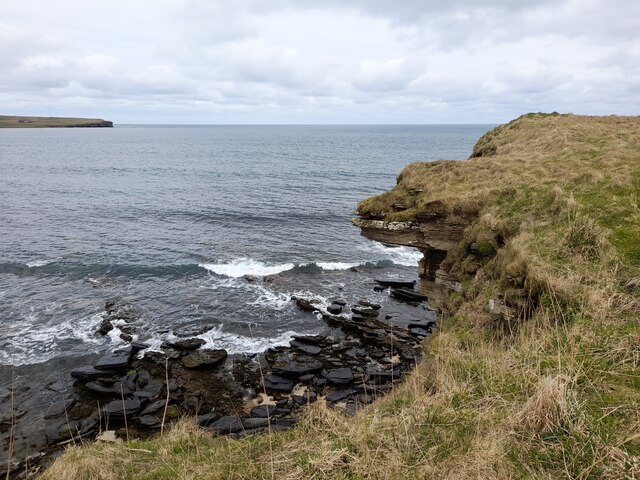
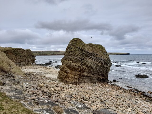
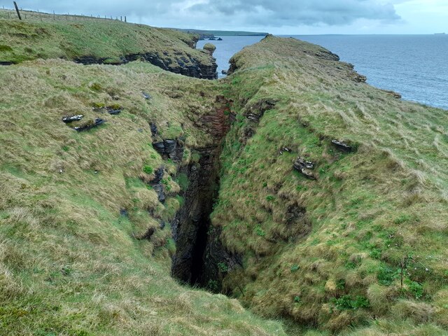
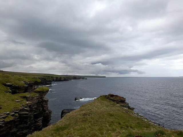
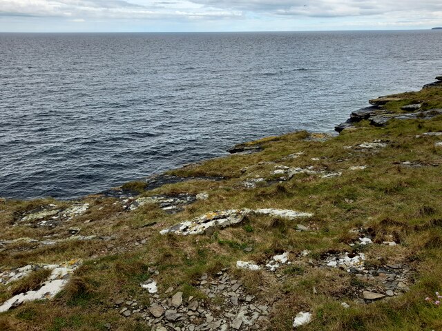
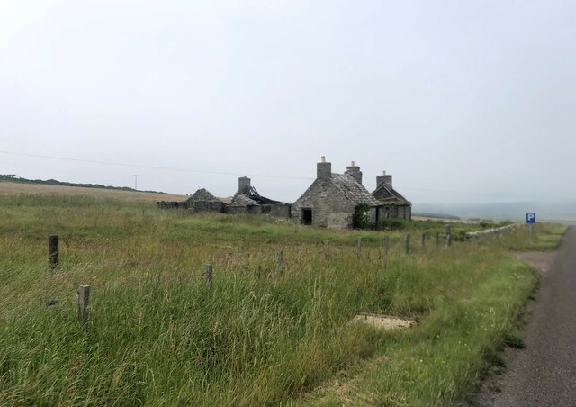
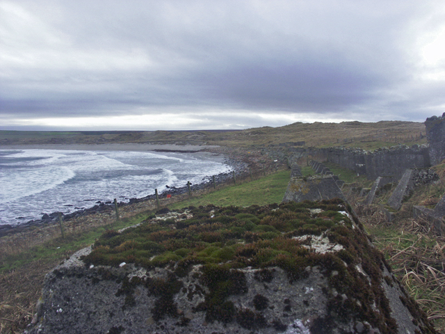
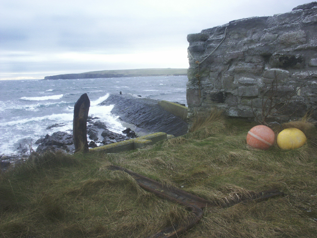
Small Geos is a prominent coastal feature located in Caithness, a county in the northeastern part of Scotland. It is specifically classified as a headland, which refers to a narrow stretch of land that extends out into the sea. Situated along the rugged coastline, Small Geos is characterized by its steep cliffs and rocky terrain, making it a striking and picturesque landmark in the region.

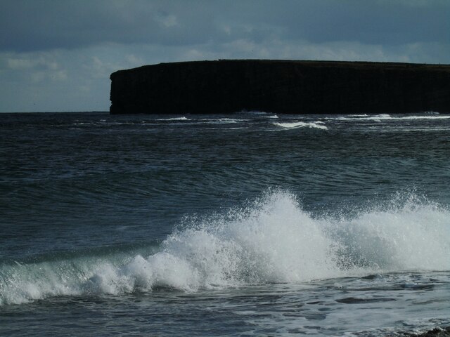
The headland is formed by the erosive forces of the North Sea, which have shaped the coastline over thousands of years. The relentless pounding of waves against the cliffs has created deep, narrow clefts known as geos, giving rise to the name of the feature. These geos are a distinguishing characteristic of Small Geos, adding to its visual appeal and providing a habitat for various marine species.

Small Geos is an important site for wildlife and serves as a nesting ground for seabirds such as fulmars, guillemots, and razorbills. The towering cliffs provide excellent vantage points for these birds to build their nests and rear their young. Additionally, the surrounding waters are home to a diverse range of marine life, including seals, dolphins, and various species of fish.

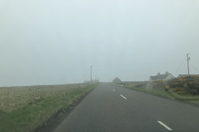
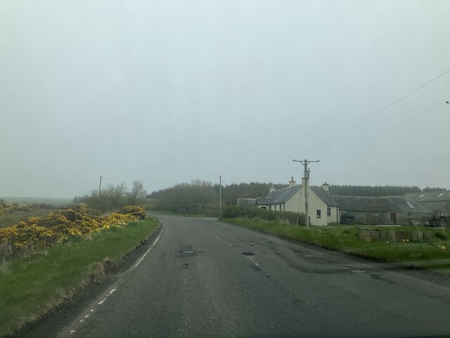
The headland is accessible to visitors, who can explore its dramatic landscape and enjoy breathtaking views of the North Sea. However, caution must be exercised as the cliffs can be unstable and dangerous. Small Geos is popular among hikers and nature enthusiasts, offering opportunities for coastal walks and birdwatching.

Overall, Small Geos in Caithness is a captivating and ecologically significant headland, showcasing the power of natural forces and providing a haven for wildlife in the region.

If you have any feedback on the listing, please let us know in the comments section below.

Small Geos Images

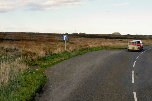
Images are sourced within 2km of 58.57986/-3.0616283 or Grid Reference ND3866. Thanks to Geograph Open Source API. All images are credited.

Layby on the A99 near Milltown The A99 follows the east coast of Caithness from Latheron, where it leaves the A9, though the town of Wick to John o' Groats at the north-east corner of the Highlands. The road is a trunk road between Latheron and Wick. It was part of the A9 until 1997, when the A9 was re-routed along what had been the A895-A882 link between Latheron and Thurso.

The A99 forms part of the North Coast 500 (NC500) which was launched in 2015. NC500 is a 516-mile scenic route around the north coast of Scotland, starting and ending at Inverness Castle,
Layby on the A99 near Milltown
The A99 follows the east coast of Caithness from Latheron, where it leaves the A9, though the town of Wick to John o' Groats at the north-east corner of the Highlands. The road is a trunk road between Latheron and Wick. It was part of the A9 until 1997, when the A9 was re-routed along what had been the A895-A882 link between Latheron and Thurso. The A99 forms part of the North Coast 500 (NC500) which was launched in 2015. NC500 is a 516-mile scenic route around the north coast of Scotland, starting and ending at Inverness Castle,
Smithy House (Ruin), Hill of Harley The A99 follows the east coast of Caithness from Latheron, where it leaves the A9, though the town of Wick to John o' Groats at the north-east corner of the Highlands. The road is a trunk road between Latheron and Wick. It was part of the A9 until 1997, when the A9 was re-routed along what had been the A895-A882 link between Latheron and Thurso.

The A99 forms part of the North Coast 500 (NC500) which was launched in 2015. NC500 is a 516-mile scenic route around the north coast of Scotland, starting and ending at Inverness Castle,
Smithy House (Ruin), Hill of Harley
The A99 follows the east coast of Caithness from Latheron, where it leaves the A9, though the town of Wick to John o' Groats at the north-east corner of the Highlands. The road is a trunk road between Latheron and Wick. It was part of the A9 until 1997, when the A9 was re-routed along what had been the A895-A882 link between Latheron and Thurso. The A99 forms part of the North Coast 500 (NC500) which was launched in 2015. NC500 is a 516-mile scenic route around the north coast of Scotland, starting and ending at Inverness Castle,
Layby on the A99 near Harley The A99 follows the east coast of Caithness from Latheron, where it leaves the A9, though the town of Wick to John o' Groats at the north-east corner of the Highlands. The road is a trunk road between Latheron and Wick. It was part of the A9 until 1997, when the A9 was re-routed along what had been the A895-A882 link between Latheron and Thurso.

The A99 forms part of the North Coast 500 (NC500) which was launched in 2015. NC500 is a 516-mile scenic route around the north coast of Scotland, starting and ending at Inverness Castle,
Layby on the A99 near Harley
The A99 follows the east coast of Caithness from Latheron, where it leaves the A9, though the town of Wick to John o' Groats at the north-east corner of the Highlands. The road is a trunk road between Latheron and Wick. It was part of the A9 until 1997, when the A9 was re-routed along what had been the A895-A882 link between Latheron and Thurso. The A99 forms part of the North Coast 500 (NC500) which was launched in 2015. NC500 is a 516-mile scenic route around the north coast of Scotland, starting and ending at Inverness Castle,
A99, Farm Buildings near Freswick The A99 follows the east coast of Caithness from Latheron, where it leaves the A9, though the town of Wick to John o' Groats at the north-east corner of the Highlands. The road is a trunk road between Latheron and Wick. It was part of the A9 until 1997, when the A9 was re-routed along what had been the A895-A882 link between Latheron and Thurso.

The A99 forms part of the North Coast 500 (NC500) which was launched in 2015. NC500 is a 516-mile scenic route around the north coast of Scotland, starting and ending at Inverness Castle,
A99, Farm Buildings near Freswick
The A99 follows the east coast of Caithness from Latheron, where it leaves the A9, though the town of Wick to John o' Groats at the north-east corner of the Highlands. The road is a trunk road between Latheron and Wick. It was part of the A9 until 1997, when the A9 was re-routed along what had been the A895-A882 link between Latheron and Thurso. The A99 forms part of the North Coast 500 (NC500) which was launched in 2015. NC500 is a 516-mile scenic route around the north coast of Scotland, starting and ending at Inverness Castle,
Overhanging Cliff near Freswick Beyond, across Freswick Bay, is Skirza Head.
Overhanging Cliff near Freswick
Beyond, across Freswick Bay, is Skirza Head.
Sea Stack at Freswick This stack shows the layered sedimentary rocks of the area.
Sea Stack at Freswick
This stack shows the layered sedimentary rocks of the area.
At Freswick Mains Within the buildings at Freswick Mains.
At Freswick Mains
Within the buildings at Freswick Mains.
Coast near Auckengill It seems like the roof of a sea cave has collapsed forming a gloup.
Coast near Auckengill
It seems like the roof of a sea cave has collapsed forming a gloup.
Coast at The Kilns The area in the foreground is within the grid square.
Coast at The Kilns
The area in the foreground is within the grid square.
The Kilns A small area of coastline is within this grid square.
The Kilns
A small area of coastline is within this grid square.
Freswick Bay Waves catching the afternoon sunlight.
Freswick Bay
Waves catching the afternoon sunlight.
Derelict old barn by the A99
Croft in ruins by the A99
Approaching Hilltop Cottage
Approaching Westlands
Cottage on A9 southbound
Anti-invasion defences, Freswick Bay, Caithness The photo shows a double row of "Dragon's Teeth" and a row of "Cubes".
Anti-invasion defences, Freswick Bay, Caithness
The photo shows a double row of "Dragon's Teeth" and a row of "Cubes".
Skirza Harbour, Caithness
Show me another place!

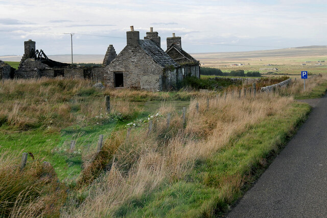
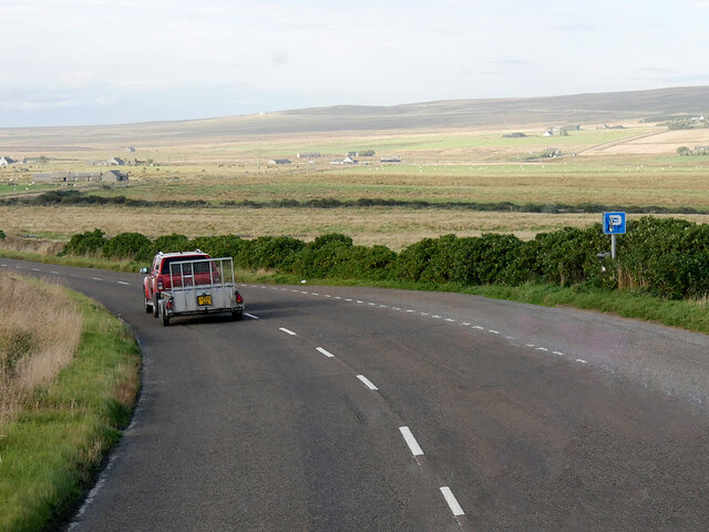
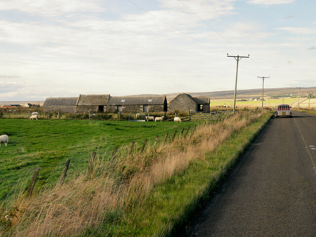
Small Geos is located at Grid Ref: ND3866 (Lat: 58.57986, Lng: -3.0616283)

Unitary Authority: Highland

Police Authority: Highlands and Islands

What 3 Words

///stags.porridge.skims. Near John o' Groats, Highland

Related Wikis

Skirza

Skirza or Skirsa, is a small remote linear fishing village, overlooking Freswick Bay to the south and Skirza Head to the southeast, in eastern Caithness...

Freswick

Freswick ( FREZZ-ik) or Skirsa, is a small remote hamlet, overlooking Freswick Bay to the east, in eastern Caithness, Scottish Highlands and is in the...

Auckengill

Auckengill is a settlement, 6 miles (10 kilometres) south of John o' Groats, on the east coast of Caithness, within the Scottish council area of Highland...

Nybster

Nybster is a scattered rural and crofting township, situated in Caithness and is in the Scottish council area of Highland. It is located along the A9 road...

Nearby Amenities

Located within 500m of 58.57986,-3.0616283
Source: PGS
Lat/Long: 58.5757855/-3.0650158
Created By: dmgroom_coastlines
Source: PGS
Lat/Long: 58.575989/-3.064372
Source: PGS
Lat/Long: 58.5761992/-3.0637672
Source: PGS
Lat/Long: 58.5762817/-3.0639611
Source: PGS
Lat/Long: 58.576344/-3.0649235
Created By: dmgroom_coastlines
Source: PGS
Lat/Long: 58.576629/-3.064864
Created By: dmgroom_coastlines
Source: PGS
Lat/Long: 58.577141/-3.06462
Created By: dmgroom_coastlines
Source: PGS
Lat/Long: 58.577269/-3.064375
Source: PGS
Lat/Long: 58.5773948/-3.0632656
Created By: dmgroom_coastlines
Source: PGS
Lat/Long: 58.578165/-3.063642
Source: PGS
Lat/Long: 58.5786342/-3.0636492
Source: PGS
Lat/Long: 58.5788297/-3.0630221
Source: PGS
Lat/Long: 58.5789164/-3.06268
Created By: dmgroom_coastlines
Source: PGS
Lat/Long: 58.578934/-3.062417
Created By: dmgroom_coastlines
Source: PGS
Lat/Long: 58.579958/-3.062175
Created By: dmgroom_coastlines
Source: PGS
Lat/Long: 58.580086/-3.061929
Source: PGS
Lat/Long: 58.5800518/-3.0616743
Source: PGS
Lat/Long: 58.5800204/-3.0613917
Source: PGS
Lat/Long: 58.5800813/-3.061078
Source: PGS
Lat/Long: 58.5802456/-3.0606925
Source: PGS
Lat/Long: 58.5806095/-3.0605182
Source: PGS
Lat/Long: 58.5812785/-3.0599631
Source: PGS
Lat/Long: 58.5812585/-3.060421
Source: PGS
Lat/Long: 58.5809354/-3.0613444
Source: PGS
Lat/Long: 58.5813443/-3.0616199
Source: PGS
Lat/Long: 58.5816577/-3.0611488
Source: PGS
Lat/Long: 58.581598/-3.0632761
Source: PGS
Lat/Long: 58.5820525/-3.0632789
Source: PGS
Lat/Long: 58.5820933/-3.0631966
Source: PGS
Lat/Long: 58.5822016/-3.0626995
Source: PGS
Lat/Long: 58.5821479/-3.062375
Source: PGS
Lat/Long: 58.5822255/-3.06185
Source: PGS
Lat/Long: 58.5822818/-3.0618582
Source: PGS
Lat/Long: 58.5826944/-3.0615048
Created By: dmgroom_coastlines
Source: PGS
Lat/Long: 58.583156/-3.063895
Source: PGS
Lat/Long: 58.5838304/-3.0645721
Source: PGS
Lat/Long: 58.5834701/-3.0657926
Source: PGS
Lat/Long: 58.5837764/-3.0657336
Ele: 50
Lat/Long: 58.5781262/-3.0685841
Ele: 50
Lat/Long: 58.5770439/-3.0681389
The data included in this document is from www.openstreetmap.org. The data is made available under ODbL.

Have you been to Small Geos?

Leave your review of Small Geos below (or comments, questions and feedback).