Kirni Geo
Coastal Feature, Headland, Point in Orkney
Scotland
Kirni Geo
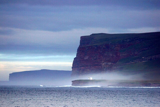
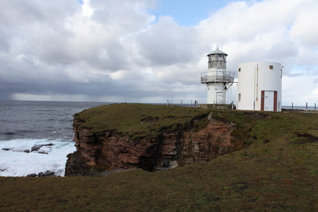
Kirni Geo is a prominent coastal feature located in Orkney, an archipelago in northern Scotland. Situated on the mainland of Orkney, Kirni Geo is a headland that juts out into the North Sea, forming a distinctive point along the rugged coastline.
The geo is characterized by its steep cliffs that rise dramatically from the sea, creating a majestic and dramatic landscape. These cliffs are composed of sandstone and shale, displaying layers of sedimentary rock that have been shaped by years of erosion from the powerful waves crashing against them. The height of the cliffs varies, with some sections reaching up to 70 meters above sea level.
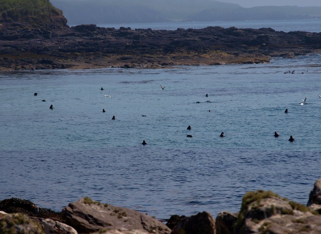
Kirni Geo offers breathtaking panoramic views of the surrounding area, including the North Sea and the neighboring islands of Orkney. The headland provides an excellent vantage point for observing seabird colonies, with species such as puffins, guillemots, and razorbills nesting on the cliffs during the breeding season.
The area around Kirni Geo is also rich in archaeological significance, with several prehistoric sites located nearby. These include ancient burial mounds and standing stones, offering a glimpse into the history and heritage of the region.
Access to Kirni Geo is possible via a coastal path that leads visitors along the cliff tops, providing a safe and enjoyable way to explore the area. The rugged beauty and natural grandeur of Kirni Geo make it a popular destination for nature enthusiasts, hikers, and those seeking a tranquil escape amidst Orkney's stunning coastal scenery.
If you have any feedback on the listing, please let us know in the comments section below.
Kirni Geo Images
Images are sourced within 2km of 58.777102/-3.2867217 or Grid Reference ND2588. Thanks to Geograph Open Source API. All images are credited.
![Melsetter Postbox Victorian Postbos at Melsetter on Hoy [KW16 46]](https://s1.geograph.org.uk/geophotos/04/63/86/4638625_d40a729a.jpg)


Kirni Geo is located at Grid Ref: ND2588 (Lat: 58.777102, Lng: -3.2867217)
Unitary Authority: Orkney Islands
Police Authority: Highlands and Islands
What 3 Words
///tennis.strictest.type. Near Lyness, Orkney Islands
Nearby Locations
Related Wikis

The Needle, Orkney
The Needle is a 70-metre-high (230 ft) sea stack on the island of Hoy, in Orkney, Scotland. It is located on the southwest coast of Hoy at ND243902. There...

Hoglinns Water
Hoglinns Water is a small freshwater loch in the south of the island of Hoy, Orkney. It drains in to Heldale Water via Hoglinns Burn. The loch was surveyed...

Brims, Orkney
Brims is a village at the southern point of the island of Hoy, in Orkney, Scotland. The settlement is within the parish of Walls and Flotta. The RNLI lifeboat...

RNLB Thomas McCunn (ON 759)
RNLB Thomas McCunn (ON 759) is a 45ft 6in Watson-class lifeboat stationed at Longhope in Orkney, Scotland, from January 1933 until April 1962. During...
Nearby Amenities
Located within 500m of 58.777102,-3.2867217Have you been to Kirni Geo?
Leave your review of Kirni Geo below (or comments, questions and feedback).