Fully Geo

Coastal Feature, Headland, Point in Caithness

Scotland

Fully Geo

Geo at Scarfskerry
Geo at Scarfskerry Credit: sylvia duckworth

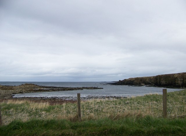
Fully Geo is a prominent coastal feature located in Caithness, Scotland. It is classified as a headland, also known as a point, due to its distinct geographical formation. Fully Geo is situated along the rugged coastline of Caithness and offers breathtaking views of the North Sea.

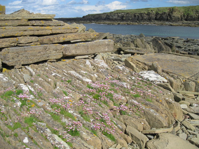
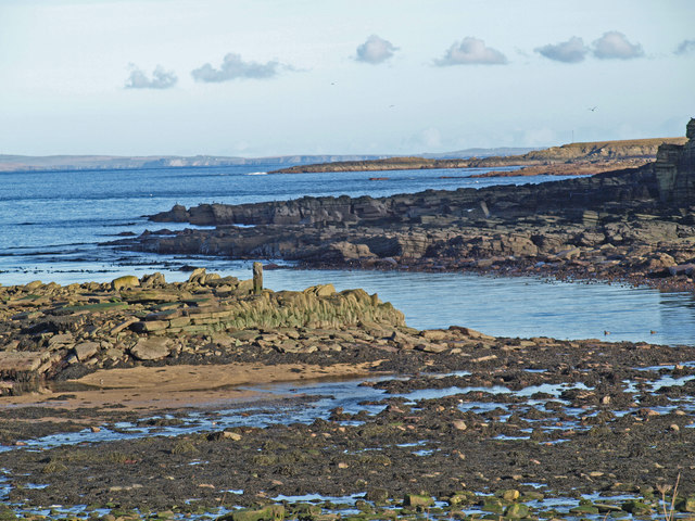
The headland is characterized by its steep cliffs that rise dramatically from the sea, creating a striking visual spectacle. These cliffs are composed of layers of sedimentary rock, showcasing the geological history of the region. Erosion from the relentless crashing waves has sculpted the cliffs, resulting in unique formations and caves within Fully Geo.

The headland is also home to a diverse range of flora and fauna. The exposed cliffs provide nesting sites for various seabirds, including fulmars and kittiwakes. Visitors to Fully Geo may have the opportunity to observe these birds in their natural habitat.

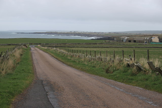
The coastal location of Fully Geo makes it an ideal spot for recreational activities such as hiking and birdwatching. There are several walking trails in the area that offer stunning views of the headland and its surroundings. The rugged terrain and dramatic cliffs add an element of adventure to any visit.

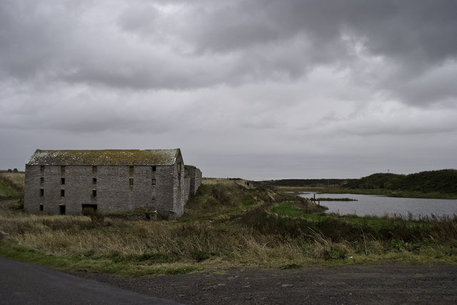
Fully Geo is not only a natural wonder but also a site of historical significance. It is believed that the headland was once home to a settlement during the Iron Age, although there are no visible remains today. However, the rich history of the area adds an extra layer of intrigue to Fully Geo.

In conclusion, Fully Geo is a captivating headland located in Caithness, Scotland. Its steep cliffs, diverse wildlife, and historical significance make it a must-visit destination for nature enthusiasts and history buffs alike.

If you have any feedback on the listing, please let us know in the comments section below.

Fully Geo Images

Images are sourced within 2km of 58.648073/-3.2862944 or Grid Reference ND2574. Thanks to Geograph Open Source API. All images are credited.

Geo at Scarfskerry
Geo at Scarfskerry
Ebbs Geo at Scarfskerry
Scarfskerry - 1987 Scarfskerry, Ebbs Geo, Pentland Firth, Orkney Isle of Hoy and South Walls visible in the distance.
Scarfskerry - 1987
Scarfskerry, Ebbs Geo, Pentland Firth, Orkney Isle of Hoy and South Walls visible in the distance.
Bluebells at Ebbs Geo This geo is close to the road at Scarfskerry. It's mid-May and the bluebells are in full bloom.
Bluebells at Ebbs Geo
This geo is close to the road at Scarfskerry. It's mid-May and the bluebells are in full bloom.
Scarfskerry jetty This narrow jetty is still used occasionally by small fishing vessels, but the winch is no longer in service.
Scarfskerry jetty
This narrow jetty is still used occasionally by small fishing vessels, but the winch is no longer in service.
Ham Harbour Ham harbour has not been used or maintained for many years. The details of its construction have been revealed in the sections of wall which still stand. Compare with <a href="https://www.geograph.org.uk/photo/24555">ND2473 : Ham Harbour</a> taken nearly eight years ago.
Ham Harbour
Ham harbour has not been used or maintained for many years. The details of its construction have been revealed in the sections of wall which still stand. Compare with ND2473 : Ham Harbour taken nearly eight years ago.
Detail of old harbour wall at Ham Part of the remaining wall of the derelict harbour at Ham.
Detail of old harbour wall at Ham
Part of the remaining wall of the derelict harbour at Ham.
Scarfskerry Baptist church
The scenic road to Dunnet Head Dunnet Head can just be seen in the distance 5 miles distant.
The scenic road to Dunnet Head
Dunnet Head can just be seen in the distance 5 miles distant.
A typical Caithness lane near Ham
Ham old mill
Ham old mill
Ham Harbour from the road One of the advantages of having to stop for oncoming cars on a single-track road is being able to grab a quick photo
Ham Harbour from the road
One of the advantages of having to stop for oncoming cars on a single-track road is being able to grab a quick photo
Ham Harbour Low Tide
Ham Harbour
Low Tide
Ham pond
Ham pond
Wind Turbine
Wind Turbine
Farmland near Greenvale There is a track on the right, but completely overgrown and no longer used.
Farmland near Greenvale
There is a track on the right, but completely overgrown and no longer used.
Farmland north of Barrock Seemingly not in good condition, but still used, I assume.
Farmland north of Barrock
Seemingly not in good condition, but still used, I assume.
Disused Mill at Ham
Disused Mill at Ham
Show me another place!

Fully Geo is located at Grid Ref: ND2574 (Lat: 58.648073, Lng: -3.2862944)

Unitary Authority: Highland

Police Authority: Highlands and Islands

What 3 Words

///slips.palm.tadpoles. Near John o' Groats, Highland

Related Wikis

Skarfskerry

Skarfskerry (or Scarfskerry; Scottish Gaelic: Sgarbh Sgeir) is a settlement located in the far northern county Caithness on a small peninsula northeast...

Ham, Caithness

Ham is a village in the Caithness region in the Scottish council area of Highland. It has a very short river running from a mill pond to the sea - a total...

Loch of Mey

Loch of Mey is a loch near the north coast of Caithness, Scotland, and one of the most northern water features of mainland Britain. It lies just to the...

Brough Castle (Caithness)

Brough Castle is a ruined castle near Brough, Caithness. It is believed to date from the 12th to 14th centuries. == Description == The foundations of...

Nearby Amenities

Located within 500m of 58.648073,-3.2862944
Source: PGS
Lat/Long: 58.6512997/-3.2804787
Source: PGS
Lat/Long: 58.6513586/-3.281042
Source: PGS
Lat/Long: 58.6513737/-3.281318
Created By: almien_coastlines
Source: PGS
Lat/Long: 58.651078/-3.281825
Created By: almien_coastlines
Source: PGS
Lat/Long: 58.650821/-3.282314
Source: PGS
Lat/Long: 58.6496042/-3.2830203
Created By: almien_coastlines
Source: PGS
Lat/Long: 58.649283/-3.283284
Created By: almien_coastlines
Source: PGS
Lat/Long: 58.649027/-3.283527
Created By: almien_coastlines
Source: PGS
Lat/Long: 58.649024/-3.285
Created By: almien_coastlines
Source: PGS
Lat/Long: 58.648256/-3.284994
Created By: almien_coastlines
Source: PGS
Lat/Long: 58.648125/-3.285975
Created By: almien_coastlines
Source: PGS
Lat/Long: 58.648122/-3.287448
Created By: almien_coastlines
Source: PGS
Lat/Long: 58.648377/-3.287941
Created By: almien_coastlines
Source: PGS
Lat/Long: 58.648632/-3.288434
Created By: almien_coastlines
Source: PGS
Lat/Long: 58.648885/-3.289419
Source: PGS
Lat/Long: 58.6487069/-3.2903873
Source: PGS
Lat/Long: 58.6480246/-3.2903939
Source: PGS
Lat/Long: 58.6475875/-3.2909595
Created By: almien_coastlines
Source: PGS
Lat/Long: 58.64709/-3.290877
Source: PGS
Lat/Long: 58.6468958/-3.2923023
Source: PGS
Lat/Long: 58.6468163/-3.2934845
Source: PGS
Lat/Long: 58.6464476/-3.2933133
Source: PGS
Lat/Long: 58.6461498/-3.2937599
Passing Place
Lat/Long: 58.6438433/-3.2848148
The data included in this document is from www.openstreetmap.org. The data is made available under ODbL.

Have you been to Fully Geo?

Leave your review of Fully Geo below (or comments, questions and feedback).