Ruthy Geo

Coastal Feature, Headland, Point in Caithness

Scotland

Ruthy Geo

Geo at Scarfskerry
Geo at Scarfskerry Credit: sylvia duckworth

Ruthy Geo is a prominent coastal feature located in the county of Caithness, Scotland. It is classified as a headland or point, jutting out into the North Sea. The geographical coordinates of Ruthy Geo are [58.6294° N, 3.1241° W].

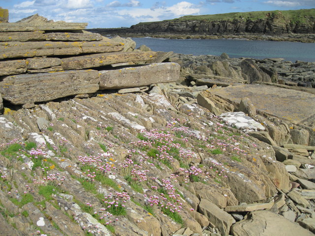
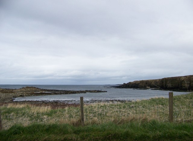
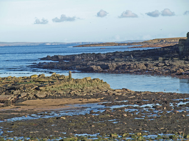
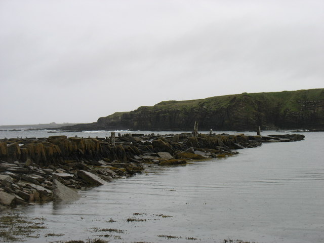
This natural formation stands tall and imposing, offering breathtaking views of the surrounding landscape. The rugged cliffs that make up Ruthy Geo rise up to an impressive height, providing a striking contrast against the deep blue waters of the sea. The cliffs are composed of layers of sedimentary rocks, showcasing the area's rich geological history.

Visitors to Ruthy Geo are treated to a diverse range of flora and fauna that thrive in this coastal environment. Seabirds can often be spotted nesting on the cliffs, including species such as fulmars, kittiwakes, and guillemots. The area is also home to various marine life, with seals sometimes seen basking on nearby rocks.

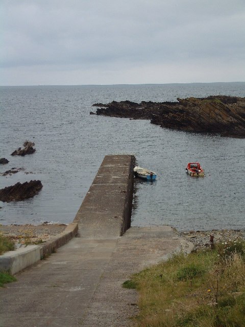
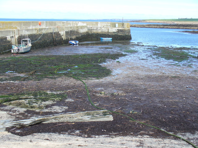
The coastal path that leads to Ruthy Geo offers a picturesque and invigorating walk, allowing visitors to fully appreciate the beauty of this natural wonder. Along the way, one can enjoy the sound of crashing waves and the fresh sea breeze, enhancing the overall experience.

Due to its unique geological and ecological characteristics, Ruthy Geo is protected as a designated Site of Special Scientific Interest. This ensures the preservation of its natural heritage and allows for ongoing research and conservation efforts.

Overall, Ruthy Geo in Caithness is a captivating coastal feature that showcases the raw beauty and diverse ecosystems of the Scottish coastline.

If you have any feedback on the listing, please let us know in the comments section below.

Ruthy Geo Images

Images are sourced within 2km of 58.650564/-3.2824397 or Grid Reference ND2574. Thanks to Geograph Open Source API. All images are credited.

Geo at Scarfskerry
Geo at Scarfskerry
Public birdwatching hide at Loch of Mey
Ebbs Geo at Scarfskerry
Scarfskerry - 1987 Scarfskerry, Ebbs Geo, Pentland Firth, Orkney Isle of Hoy and South Walls visible in the distance.
Scarfskerry - 1987
Scarfskerry, Ebbs Geo, Pentland Firth, Orkney Isle of Hoy and South Walls visible in the distance.
Bluebells at Ebbs Geo This geo is close to the road at Scarfskerry. It's mid-May and the bluebells are in full bloom.
Bluebells at Ebbs Geo
This geo is close to the road at Scarfskerry. It's mid-May and the bluebells are in full bloom.
Scarfskerry jetty This narrow jetty is still used occasionally by small fishing vessels, but the winch is no longer in service.
Scarfskerry jetty
This narrow jetty is still used occasionally by small fishing vessels, but the winch is no longer in service.
Ham Harbour Ham harbour has not been used or maintained for many years. The details of its construction have been revealed in the sections of wall which still stand. Compare with <a href="https://www.geograph.org.uk/photo/24555">ND2473 : Ham Harbour</a> taken nearly eight years ago.
Ham Harbour
Ham harbour has not been used or maintained for many years. The details of its construction have been revealed in the sections of wall which still stand. Compare with ND2473 : Ham Harbour taken nearly eight years ago.
Detail of old harbour wall at Ham Part of the remaining wall of the derelict harbour at Ham.
Detail of old harbour wall at Ham
Part of the remaining wall of the derelict harbour at Ham.
Scarfskerry Baptist church
Ham old mill
Ham old mill
Ham Harbour from the road One of the advantages of having to stop for oncoming cars on a single-track road is being able to grab a quick photo
Ham Harbour from the road
One of the advantages of having to stop for oncoming cars on a single-track road is being able to grab a quick photo
Ham Harbour Low Tide
Ham Harbour
Low Tide
Wind Turbine
Wind Turbine
Disused Mill at Ham
Disused Mill at Ham
Disused pier at Ham
Disused pier at Ham
Swan and cygnets on the Burn of Ham I was surprised (but perhaps I should not have been) to find this swan and her brood below the High Water level.
Swan and cygnets on the Burn of Ham
I was surprised (but perhaps I should not have been) to find this swan and her brood below the High Water level.
The Burn of Ham Here flowing under a bridge carrying a minor road, with a disused mill on the left. It was raining gently when I took this photo, which explains the dappled effect on the water.
The Burn of Ham
Here flowing under a bridge carrying a minor road, with a disused mill on the left. It was raining gently when I took this photo, which explains the dappled effect on the water.
Scarfskerry Pier In Scarfskerry Haven, with Scarfskerry Point behind.
Scarfskerry Pier
In Scarfskerry Haven, with Scarfskerry Point behind.
Show me another place!

Ruthy Geo is located at Grid Ref: ND2574 (Lat: 58.650564, Lng: -3.2824397)

Unitary Authority: Highland

Police Authority: Highlands and Islands

What 3 Words

///lights.mint.indicates. Near John o' Groats, Highland

Related Wikis

Skarfskerry

Skarfskerry (or Scarfskerry; Scottish Gaelic: Sgarbh Sgeir) is a settlement located in the far northern county Caithness on a small peninsula northeast...

Loch of Mey

Loch of Mey is a loch near the north coast of Caithness, Scotland, and one of the most northern water features of mainland Britain. It lies just to the...

Ham, Caithness

Ham is a village in the Caithness region in the Scottish council area of Highland. It has a very short river running from a mill pond to the sea - a total...

Harrow, Caithness

Harrow is a hamlet on the north coast of Caithness, Scotland. It lies just to the west of the Castle of Mey and northeast of the Loch of Mey. Harrow Harbour...

Nearby Amenities

Located within 500m of 58.650564,-3.2824397
Source: PGS
Lat/Long: 58.6531875/-3.2755904
Source: PGS
Lat/Long: 58.6531363/-3.276479
Source: PGS
Lat/Long: 58.6530647/-3.2773526
Source: PGS
Lat/Long: 58.6528653/-3.2775519
Source: PGS
Lat/Long: 58.6525991/-3.2773333
Source: PGS
Lat/Long: 58.6522116/-3.2768392
Source: PGS
Lat/Long: 58.6516325/-3.2768969
Source: PGS
Lat/Long: 58.6516176/-3.278293
Created By: almien_coastlines
Source: PGS
Lat/Long: 58.651724/-3.279129
Source: PGS
Lat/Long: 58.6512997/-3.2804787
Source: PGS
Lat/Long: 58.6513586/-3.281042
Source: PGS
Lat/Long: 58.6513737/-3.281318
Created By: almien_coastlines
Source: PGS
Lat/Long: 58.651078/-3.281825
Created By: almien_coastlines
Source: PGS
Lat/Long: 58.650821/-3.282314
Source: PGS
Lat/Long: 58.6496042/-3.2830203
Created By: almien_coastlines
Source: PGS
Lat/Long: 58.649283/-3.283284
Created By: almien_coastlines
Source: PGS
Lat/Long: 58.649027/-3.283527
Created By: almien_coastlines
Source: PGS
Lat/Long: 58.649024/-3.285
Created By: almien_coastlines
Source: PGS
Lat/Long: 58.648256/-3.284994
Created By: almien_coastlines
Source: PGS
Lat/Long: 58.648125/-3.285975
Created By: almien_coastlines
Source: PGS
Lat/Long: 58.648122/-3.287448
Created By: almien_coastlines
Source: PGS
Lat/Long: 58.648377/-3.287941
Created By: almien_coastlines
Source: PGS
Lat/Long: 58.648632/-3.288434
Created By: almien_coastlines
Source: PGS
Lat/Long: 58.648885/-3.289419
Post Box
Ref: KW14 22
Lat/Long: 58.6479654/-3.2758489
The Haven
Natural: bay
Lat/Long: 58.652416/-3.27832
Power: pole
Lat/Long: 58.6506353/-3.2744976
Power: pole
Lat/Long: 58.6510536/-3.2755189
The data included in this document is from www.openstreetmap.org. The data is made available under ODbL.

Have you been to Ruthy Geo?

Leave your review of Ruthy Geo below (or comments, questions and feedback).