Skaysan

Coastal Feature, Headland, Point in Orkney

Scotland

Skaysan

Mar Wick bay, Orkney
Mar Wick bay, Orkney Credit: John Ferguson

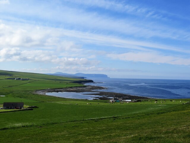
Skaysan is a prominent headland located on the northern coast of the Orkney Islands in Scotland. With its stunning natural beauty and rich history, Skaysan attracts visitors from all over the world.

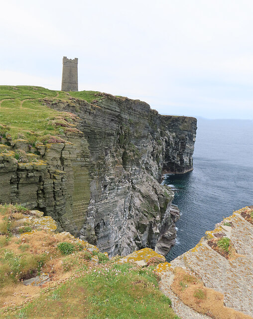
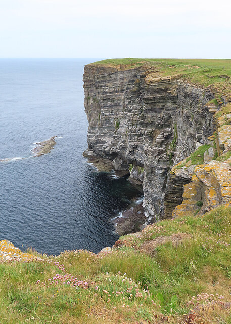
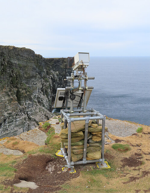
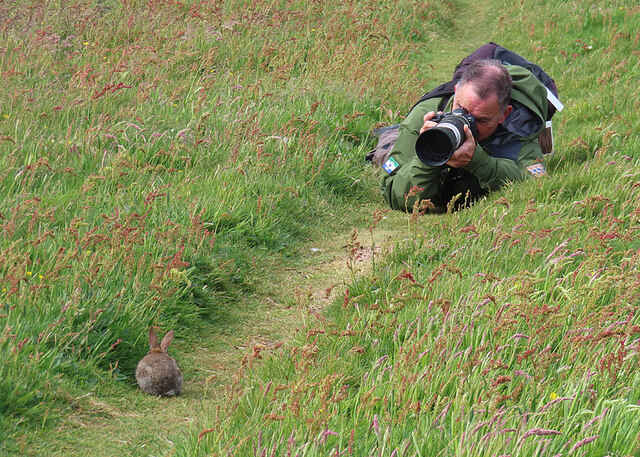
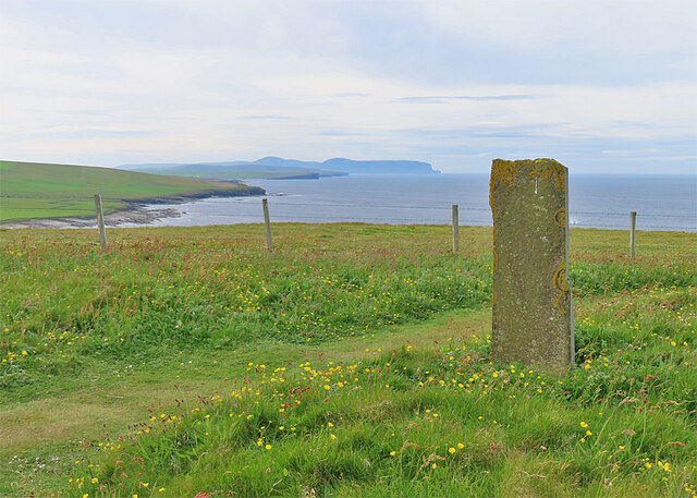
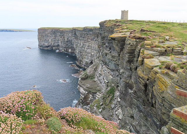
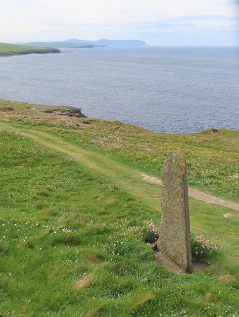
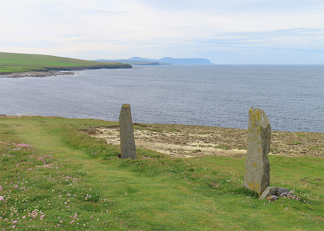
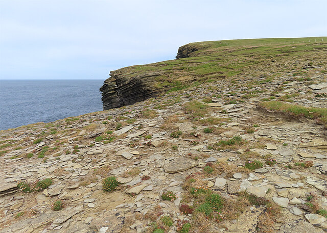
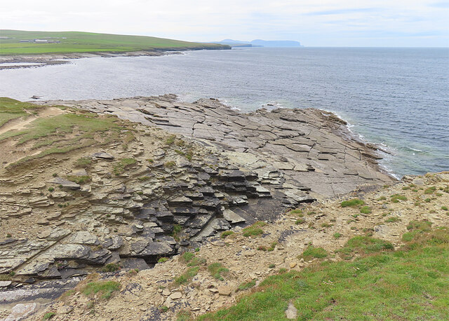
Rising majestically from the North Sea, Skaysan is characterized by its rugged cliffs, which stand tall against the crashing waves below. The headland offers breathtaking panoramic views of the surrounding coastline and the vast expanse of the ocean, making it a popular spot for nature enthusiasts and photographers alike.

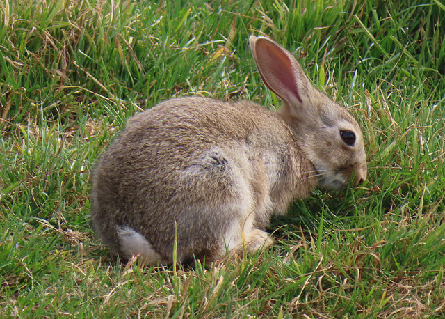
Skaysan is also known for its diverse wildlife. The headland serves as a nesting ground for several seabird species, including puffins, guillemots, and kittiwakes. Visitors often marvel at the sight of these graceful creatures soaring above the cliffs and diving into the sea in search of food.

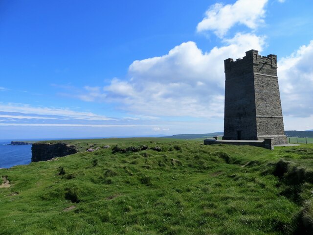
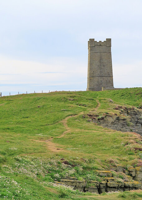
In addition to its natural wonders, Skaysan holds historical significance. The headland was once home to an ancient settlement dating back to the Neolithic period, with remains of stone structures and artifacts providing insights into the lives of its inhabitants. Nearby, there are also traces of Viking presence, including a burial mound known as a "broch."

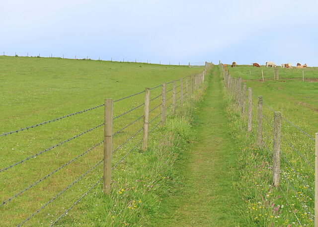
Access to Skaysan is relatively easy, with a well-maintained path leading visitors to the headland. However, caution is advised as the cliffs can be unstable, and it is important to stay within designated areas for safety.

Skaysan is a captivating coastal feature that combines stunning landscapes, abundant wildlife, and a rich cultural heritage. Whether one is exploring its natural wonders or delving into its history, Skaysan offers an unforgettable experience for those who venture to this remote corner of Orkney.

If you have any feedback on the listing, please let us know in the comments section below.

Skaysan Images

Images are sourced within 2km of 59.099696/-3.3525069 or Grid Reference HY2224. Thanks to Geograph Open Source API. All images are credited.

Mar Wick bay, Orkney
Kitchener Memorial, Orkney
Cliffs at Marwick Head The cliffs here are a Royal Society for the Protection of Birds reserve, being used for nesting by birds of many species. The tower is the Kitchener Monument.
Cliffs at Marwick Head
The cliffs here are a Royal Society for the Protection of Birds reserve, being used for nesting by birds of many species. The tower is the Kitchener Monument.
Path to Marwick Head The path leads from the car park at Mid Comloquoy to the cliff edge north of Marwick Head.
Path to Marwick Head
The path leads from the car park at Mid Comloquoy to the cliff edge north of Marwick Head.
Rabbit There's no shortage of rabbits here, and plenty of evidence of burrows on the cliff tops.
Rabbit
There's no shortage of rabbits here, and plenty of evidence of burrows on the cliff tops.
Cattle at Comloquoy A herd apparently of mixed breeds of cattle.
Cattle at Comloquoy
A herd apparently of mixed breeds of cattle.
Cliffs at Marwick Head The cliffs here are getting on for 100 metres in height.
Cliffs at Marwick Head
The cliffs here are getting on for 100 metres in height.
Kitchener Memorial The memorial is a prominent feature on Marwick Head.
Kitchener Memorial
The memorial is a prominent feature on Marwick Head.
Bird Monitoring Camera The camera is aimed at the nesting seabirds on the cliffs at Marwick Head. Notice how it is weighed down with stones against westerly gales.
Bird Monitoring Camera
The camera is aimed at the nesting seabirds on the cliffs at Marwick Head. Notice how it is weighed down with stones against westerly gales.
Plaque on Kitchener Memorial The plaque on <a href="https://www.geograph.org.uk/photo/7585917">HY2225 : Kitchener Memorial</a> is self-explanatory.
Plaque on Kitchener Memorial
The plaque on HY2225 : Kitchener Memorial is self-explanatory.
Memorial Wall The <a href="https://www.geograph.org.uk/photo/7585917">HY2225 : Kitchener Memorial</a> on Marwick Head originally mentioned only Field Marshal Earl Kitchener by name. This wall, erected only as recently as 2016, finally commemorates 737 other officers and men lost when HMS 'Hampshire' was sunk by a mine on 5 June 1916. Only twelve men survived.
Memorial Wall
The HY2225 : Kitchener Memorial on Marwick Head originally mentioned only Field Marshal Earl Kitchener by name. This wall, erected only as recently as 2016, finally commemorates 737 other officers and men lost when HMS 'Hampshire' was sunk by a mine on 5 June 1916. Only twelve men survived.
Photographer and Rabbit The photographer was hoping for photographs of birds, but was, for the moment, targeting a rabbit. We managed to avoid spooking it and I hope he got a good image.
Photographer and Rabbit
The photographer was hoping for photographs of birds, but was, for the moment, targeting a rabbit. We managed to avoid spooking it and I hope he got a good image.
Boundary Marker I assume that the stone is a boundary marker between two properties. In the distance are the cliffs around Yesnaby and, further away, the hills on the island of Hoy.
Boundary Marker
I assume that the stone is a boundary marker between two properties. In the distance are the cliffs around Yesnaby and, further away, the hills on the island of Hoy.
Cliffs at Marwick Head A long line of cliffs makes up Marwick Head, on top of which stands the Kitchener Monument.
Cliffs at Marwick Head
A long line of cliffs makes up Marwick Head, on top of which stands the Kitchener Monument.
Standing Stone by the Path The path starts to descend here from Marwick head to sea level, and the stone is one of several that stand beside it. I don't think they are ancient.
Standing Stone by the Path
The path starts to descend here from Marwick head to sea level, and the stone is one of several that stand beside it. I don't think they are ancient.
Standing Stones I don't think these stones are ancient monuments. They are beside the path down from Marwick Head to the beach.
Standing Stones
I don't think these stones are ancient monuments. They are beside the path down from Marwick Head to the beach.
Storm Beach The rock strata on the cliff top have been progressively stripped away by winter storms.
Storm Beach
The rock strata on the cliff top have been progressively stripped away by winter storms.
Dipping Strata On the south side of Marwick Head, with a view south to Yesnaby and the island of Hoy.
Dipping Strata
On the south side of Marwick Head, with a view south to Yesnaby and the island of Hoy.
Show me another place!

Skaysan is located at Grid Ref: HY2224 (Lat: 59.099696, Lng: -3.3525069)

Unitary Authority: Orkney Islands

Police Authority: Highlands and Islands

What 3 Words

///exact.perfected.miracle. Near Birsay, Orkney Islands

Related Wikis

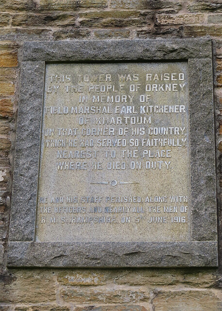
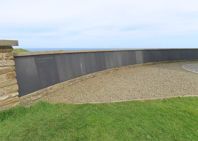
HMS Hampshire (1903)

HMS Hampshire was one of six Devonshire-class armoured cruisers built for the Royal Navy in the first decade of the 20th century. She was assigned to the...

St Magnus Church, Birsay

St Magnus Church, Birsay is a 17th century church located in the parish of Birsay on Mainland, Orkney in Scotland. Built in 1664 on the site of an earlier...

Earl's Palace, Birsay

The Earl's Palace in Birsay, Orkney, Scotland, is a ruined 16th-century castle. It was built by Robert Stewart, 1st Earl of Orkney (1533–1593), illegitimate...

RNAS Twatt (HMS Tern)

Royal Naval Air Station Twatt, (RNAS Twatt; or HMS Tern) is a former Royal Navy Air Station located near Twatt, Orkney, Scotland. It was built by the Admiralty...

Buckquoy spindle-whorl

The Buckquoy spindle-whorl is an Ogham-inscribed spindle-whorl dating from the Early Middle Ages, probably the 8th century, which was found in 1970 in...

Brough of Birsay Lighthouse

The unmanned Brough of Birsay Lighthouse lighthouse was built in 1925 by David A Stevenson. It is located on the Brough of Birsay, an uninhabited tidal...

Brough of Birsay

The Brough of Birsay is an uninhabited tidal island off the north-west coast of The Mainland of Orkney, Scotland, in the parish of Birsay. It is located...

Twatt, Orkney

Twatt is a settlement in the parish of Birsay on the Mainland of Orkney, Scotland. It was previously the location of RNAS Twatt (HMS Tern), 1940–1949....

Nearby Amenities

Located within 500m of 59.099696,-3.3525069
Parking
Capacity: 3
Parking: surface
Surface: unpaved
Lat/Long: 59.1002617/-3.3488642
Marwick Head
Addr City: Orkney
Addr Postcode: KW17 2NB
Leisure: nature_reserve
Operator: RSPB
Lat/Long: 59.0988345/-3.3469738
Leisure: picnic_table
Lat/Long: 59.0967108/-3.3469544
Power: pole
Lat/Long: 59.1018065/-3.3490934
Power: pole
Lat/Long: 59.101954/-3.3479886
Power: pole
Lat/Long: 59.1021002/-3.3469555
The data included in this document is from www.openstreetmap.org. The data is made available under ODbL.

Have you been to Skaysan?

Leave your review of Skaysan below (or comments, questions and feedback).