Streama Tainga

Coastal Feature, Headland, Point in Orkney

Scotland

Streama Tainga

Mar Wick bay, Orkney
Mar Wick bay, Orkney Credit: John Ferguson

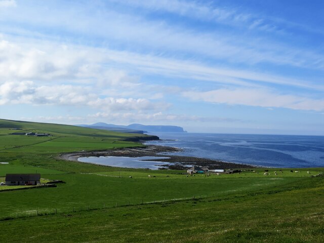
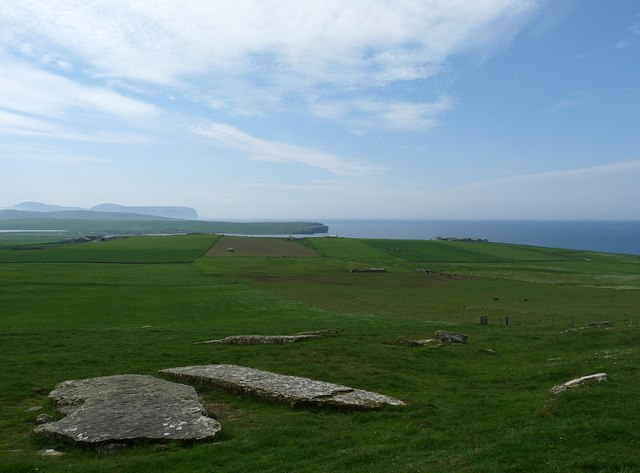
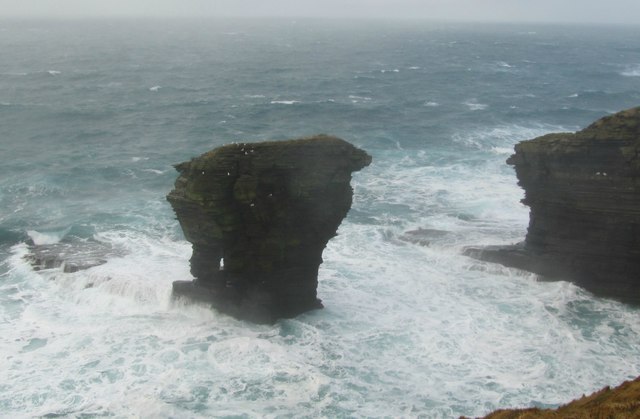
Streama Tainga is a prominent coastal feature located in Orkney, Scotland. It is a headland that extends into the North Sea, forming a distinct point that juts out into the water. The name "Streama Tainga" is derived from the Old Norse language and translates to "strong tongue," likely referring to the headland's robust and prominent nature.

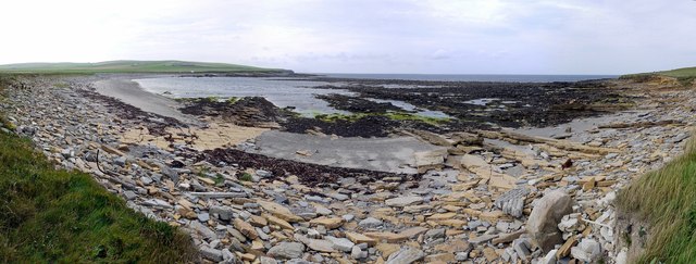
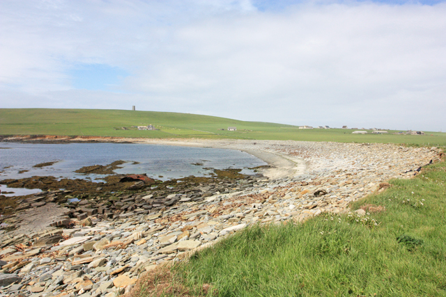
This coastal feature is characterized by its rugged and steep cliffs that rise dramatically from the sea, creating a striking and picturesque landscape. The cliffs are composed of layers of sedimentary rock, showcasing various geological formations and providing valuable insights into the region's geological history.

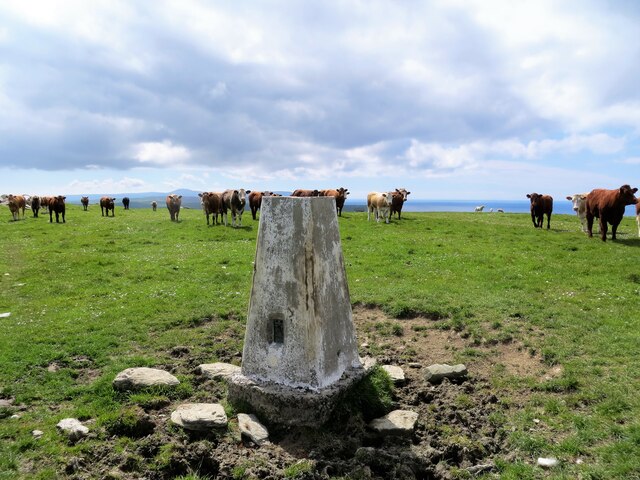
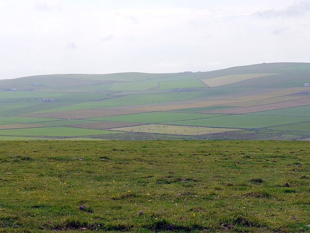
Streama Tainga serves as an important landmark in the area, offering stunning panoramic views of the surrounding coastline and the vast expanse of the North Sea. Its strategic location also makes it an ideal spot for birdwatching, as it serves as a nesting site for various seabird species, including puffins, guillemots, and kittiwakes.

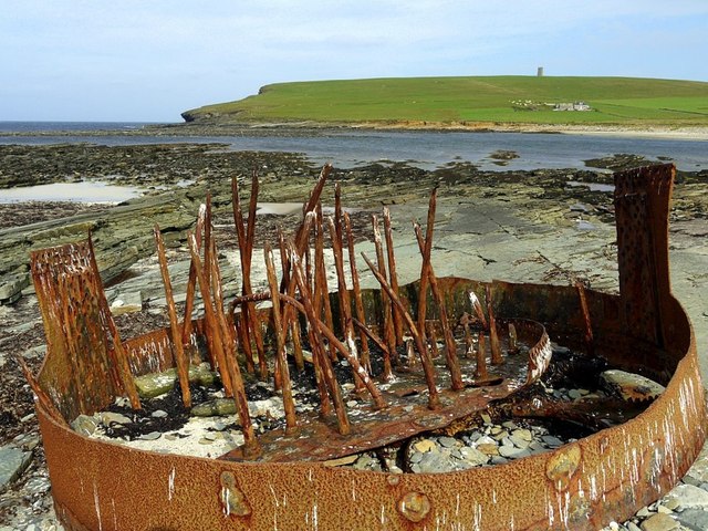
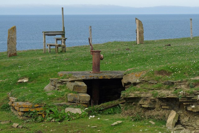
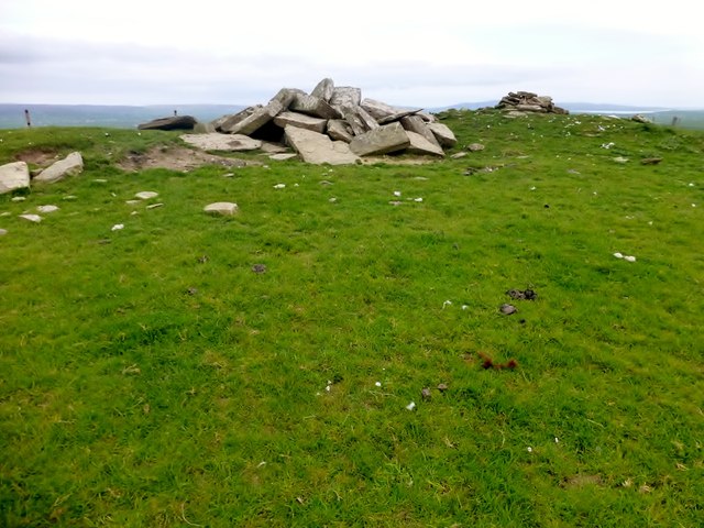
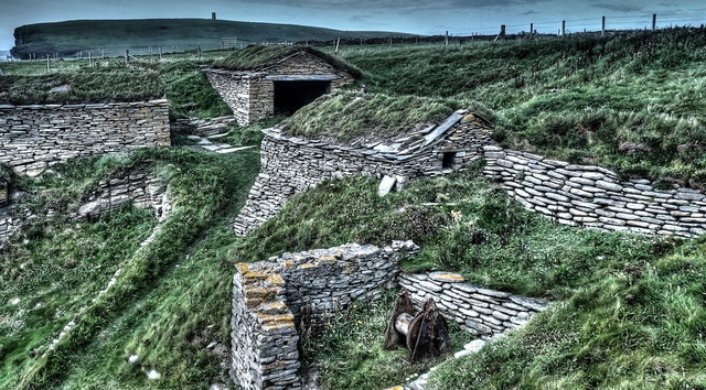
The headland is also significant from a historical perspective. Archaeological evidence suggests that it has been inhabited for thousands of years, with ancient structures and artifacts discovered in the vicinity. These findings provide valuable insights into the lives and cultures of the people who once called this area home.

Overall, Streama Tainga is a captivating and historically rich coastal feature. Its rugged cliffs, breathtaking views, and archaeological significance make it a popular destination for nature enthusiasts, historians, and those seeking to immerse themselves in the natural beauty and cultural heritage of Orkney.

If you have any feedback on the listing, please let us know in the comments section below.

Streama Tainga Images

Images are sourced within 2km of 59.08216/-3.3554635 or Grid Reference HY2222. Thanks to Geograph Open Source API. All images are credited.

Mar Wick bay, Orkney
Vestra Fiold trig pillar
Cleft in the Rock I suspect that this might be the line of an igneous dyke that has been preferentially eroded out.
Cleft in the Rock
I suspect that this might be the line of an igneous dyke that has been preferentially eroded out.
Rusty metal at Mar Wick Remains of a ship's boiler. The same subject as <a href="https://www.geograph.org.uk/photo/2052112">HY2224 : Mar Wick, Orkney</a>
Rusty metal at Mar Wick
Remains of a ship's boiler. The same subject as HY2224 : Mar Wick, Orkney
Road east of Mar Wick
Mar Wick panorama
Mar Wick panorama
Rocky shore at Mar Wick
Orkney landscape from the Kitchener Memorial
Mar Wick Mar Wick is the rocky area exposed at low tide.  The cleft in the cliff face, near to the horizon, (indistinct on the photograph), is named Minna Geo.
Mar Wick
Mar Wick is the rocky area exposed at low tide. The cleft in the cliff face, near to the horizon, (indistinct on the photograph), is named Minna Geo.
Towards the Kitchener Memorial The memorial is seen on the skyline.  Directly beneath is the farmstead or hamlet of Gridgar, with Steadquoy a little to the right.  The water is labelled "Choin (Tidal Pond)" on OS Maps.
Towards the Kitchener Memorial
The memorial is seen on the skyline. Directly beneath is the farmstead or hamlet of Gridgar, with Steadquoy a little to the right. The water is labelled "Choin (Tidal Pond)" on OS Maps.
Marwick Bay A generally stony beach, with Mar Wick out in the bay to the right.
Marwick Bay
A generally stony beach, with Mar Wick out in the bay to the right.
Well on farmland, Northdyke, Orkney The well is shown on the OS 1:25,000 map.

The stile is on the coastal footpath which runs the length of mainland Orkney's west coast.
Well on farmland, Northdyke, Orkney
The well is shown on the OS 1:25,000 map. The stile is on the coastal footpath which runs the length of mainland Orkney's west coast.
Quarried slabs below Vestra Fiold, Orkney From <span class="nowrap"><a title="http://canmore.rcahms.gov.uk/en/site/1923/details/vestrafiold" rel="nofollow ugc noopener" href="http://canmore.rcahms.gov.uk/en/site/1923/details/vestrafiold">Link</a><img style="margin-left:2px;" alt="External link" title="External link - shift click to open in new window" src="https://s1.geograph.org.uk/img/external.png" width="10" height="10"/></span> : "What is believed to be an ancient quarry from which slabs have been taken for circles and standing stones lies on the S slope of Vestra Fiold; a quarter of a mile N of the farm-house of Breck. Across the shoulder of the hill, in two groups, a large number of massive slabs are still to be seen. In the upper group typical slabs measure 4ft 6in by 3ft 6in and 5ft by 3ft, but in the lower group some are much bigger, three in particular measuring 14ft 9in by 5ft 3in by 6in thick; 18ft 6in by 5ft 6in; 16ft by 6ft. The last mentioned stone appears to have been roughly wedged up as if in readiness for removal."
Quarried slabs below Vestra Fiold, Orkney
From LinkExternal link : "What is believed to be an ancient quarry from which slabs have been taken for circles and standing stones lies on the S slope of Vestra Fiold; a quarter of a mile N of the farm-house of Breck. Across the shoulder of the hill, in two groups, a large number of massive slabs are still to be seen. In the upper group typical slabs measure 4ft 6in by 3ft 6in and 5ft by 3ft, but in the lower group some are much bigger, three in particular measuring 14ft 9in by 5ft 3in by 6in thick; 18ft 6in by 5ft 6in; 16ft by 6ft. The last mentioned stone appears to have been roughly wedged up as if in readiness for removal."
Vestra Fiold Thirteenth TuMP of the day with Jim Bloomer and Tricky Speirs on a sunny afternoon.
Name: Vestra Fiold
Hill number: 4928
Height: 129m / 423ft
Parent (Ma/M): 1555  Milldoe - Mid Tooin
Area:23: Orkney Islands
Class: Hu,1
Grid ref: HY 24157 22106
Summit feature:most southerly of two cairns 60m S of trig point
Drop: 110m
Col: 19m  HY274243
Vestra Fiold
Thirteenth TuMP of the day with Jim Bloomer and Tricky Speirs on a sunny afternoon. Name: Vestra Fiold Hill number: 4928 Height: 129m / 423ft Parent (Ma/M): 1555 Milldoe - Mid Tooin Area:23: Orkney Islands Class: Hu,1 Grid ref: HY 24157 22106 Summit feature:most southerly of two cairns 60m S of trig point Drop: 110m Col: 19m HY274243
The Spord sea stack A stormy sea and stack just off West mainland
The Spord sea stack
A stormy sea and stack just off West mainland
Restored Fishermen's Huts The restored Fishermen's Huts at Sand Geo, Marwick.
Restored Fishermen's Huts
The restored Fishermen's Huts at Sand Geo, Marwick.
The Smaa Geo And small it is - but it still gets a name!

The Orkney layers of sandstone sedimentary rock show clearly here.
The Smaa Geo
And small it is - but it still gets a name! The Orkney layers of sandstone sedimentary rock show clearly here.
Fishermen's Huts These fishermen's huts at Sand Geo were built in the 1800s to provide shelter and storage for local fishermen.
Fishermen's Huts
These fishermen's huts at Sand Geo were built in the 1800s to provide shelter and storage for local fishermen.
Show me another place!

Streama Tainga is located at Grid Ref: HY2222 (Lat: 59.08216, Lng: -3.3554635)

Unitary Authority: Orkney Islands

Police Authority: Highlands and Islands

What 3 Words

///steady.atomic.give. Near Sandwick, Orkney Islands

Related Wikis

Bay of Skaill

The Bay of Skaill (from Old Norse Bugr Skála) is a small bay on the west coast of the Orkney Mainland, Scotland. == Visitor attractions == Bay of Skaill...

Skara Brae

Skara Brae is a stone-built Neolithic settlement, located on the Bay of Skaill on the west coast of Mainland, the largest island in the Orkney archipelago...
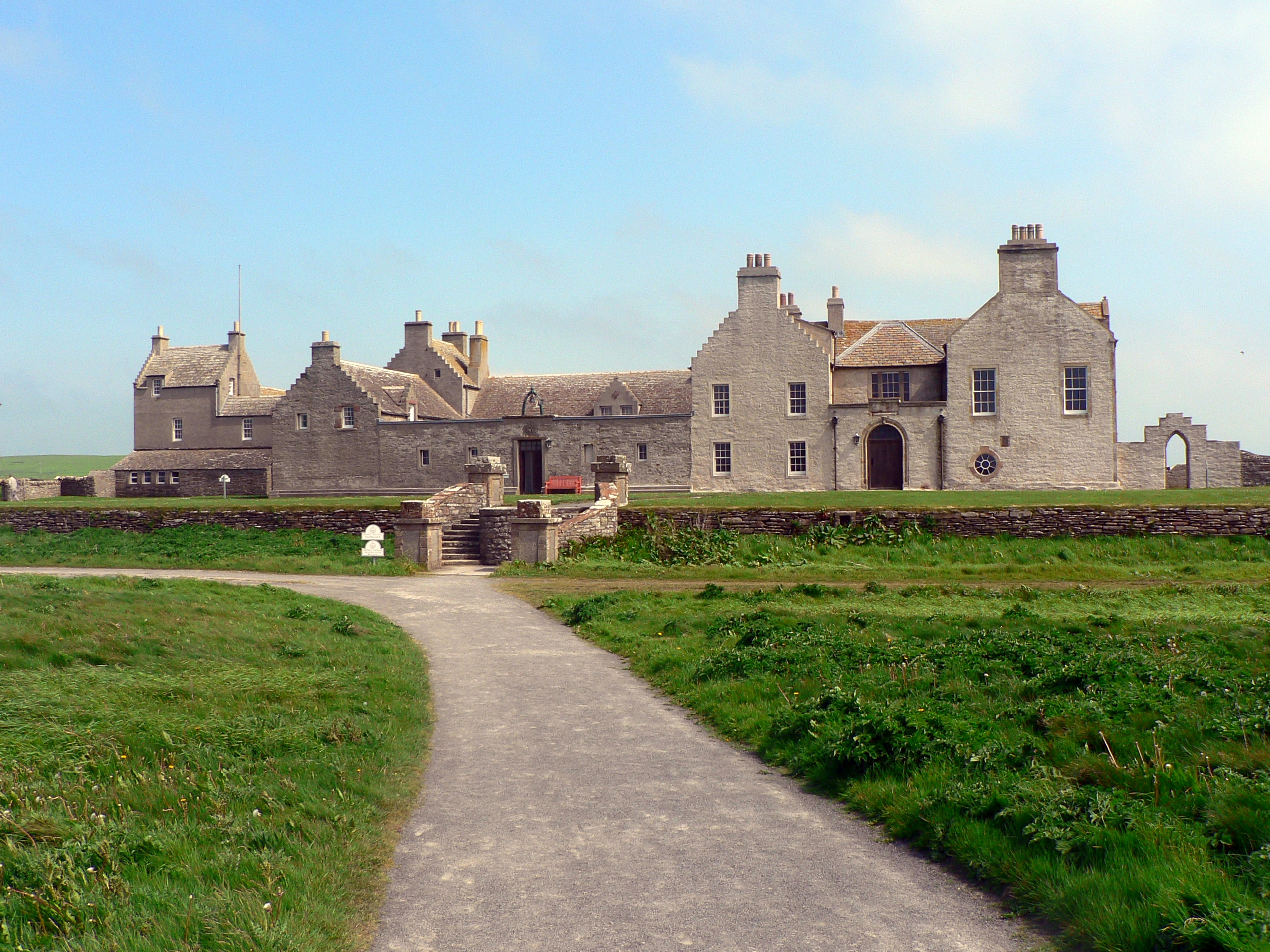
Skaill House

Skaill House is a historic manor house in Sandwick parish on Mainland, the largest of the Orkney Islands, Scotland. The house overlooks the neolithic site...

RNAS Twatt (HMS Tern)

Royal Naval Air Station Twatt, (RNAS Twatt; or HMS Tern) is a former Royal Navy Air Station located near Twatt, Orkney, Scotland. It was built by the Admiralty...

Sandwick, Orkney

Sandwick (Old Norse: Sandvík; Norn: Sandvik) is a parish on the west coast of Mainland, Orkney, Scotland, 4 miles (6.4 km) north of Stromness.The parish...

HMS Hampshire (1903)

HMS Hampshire was one of six Devonshire-class armoured cruisers built for the Royal Navy in the first decade of the 20th century. She was assigned to the...

Loch of Skaill

The Loch of Skaill is a small somewhat triangular, freshwater loch in the parish of Sandwick, Orkney on Mainland Orkney, Scotland. It lies 0.5 mi (0.80...

Twatt, Orkney

Twatt is a settlement in the parish of Birsay on the Mainland of Orkney, Scotland. It was previously the location of RNAS Twatt (HMS Tern), 1940–1949....

Nearby Amenities

Located within 500m of 59.08216,-3.3554635
Outshore Point
Place: locality
Lat/Long: 59.083627/-3.3514799
The data included in this document is from www.openstreetmap.org. The data is made available under ODbL.

Have you been to Streama Tainga?

Leave your review of Streama Tainga below (or comments, questions and feedback).