Vesker

Bay in Orkney

Scotland

Vesker

Mar Wick bay, Orkney
Mar Wick bay, Orkney Credit: John Ferguson

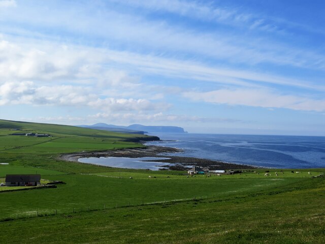
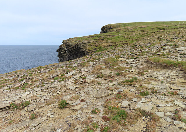
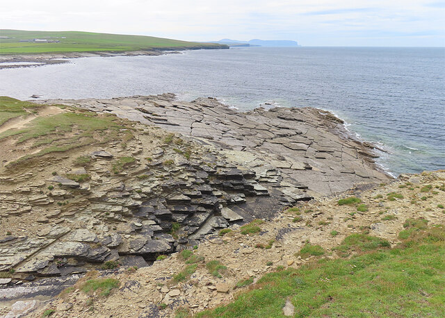
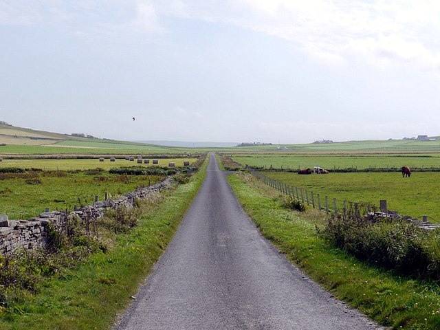
Vesker, Orkney, is a picturesque bay located on the east coast of the Orkney Mainland in Scotland. Situated about 7 miles northeast of Kirkwall, the capital of Orkney, Vesker Bay offers stunning views of the North Sea and its rugged coastline.

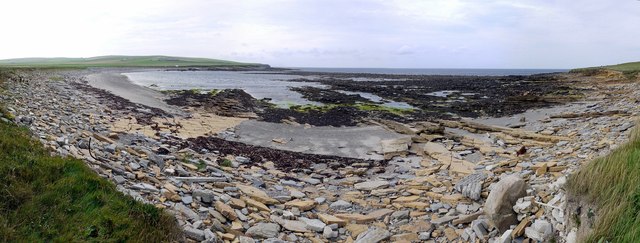
The bay is characterized by its sandy beach, which stretches over 2 miles in length and is perfect for leisurely walks or sunbathing during the summer months. The clear turquoise waters of Vesker Bay are also popular among swimmers and water sports enthusiasts, making it a great spot for a refreshing dip or some kayaking.

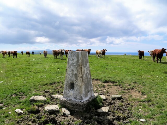
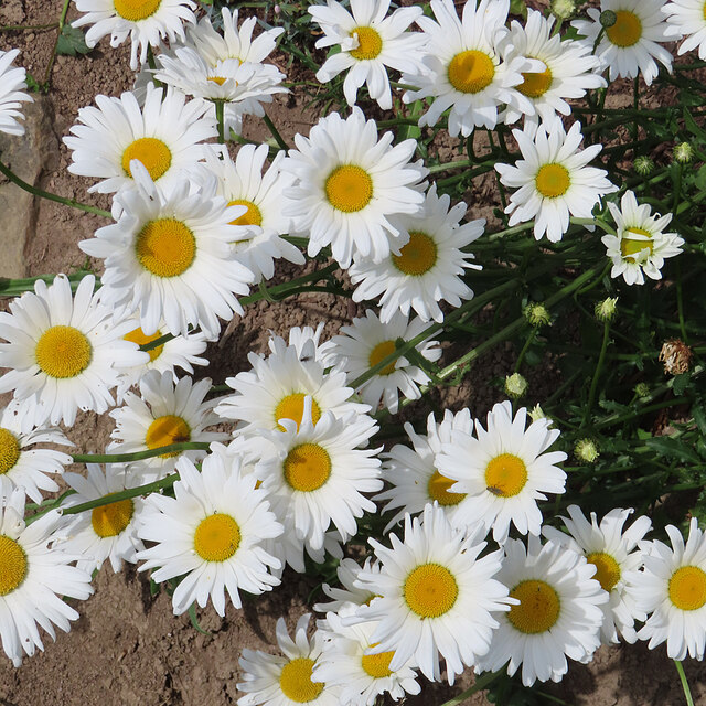
Surrounding the bay, visitors can find a diverse range of flora and fauna, including various seabirds, seals, and even occasional sightings of dolphins and whales. The bay's natural beauty and tranquility make it an ideal location for birdwatchers and nature lovers.

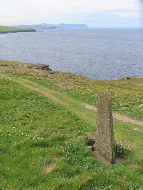
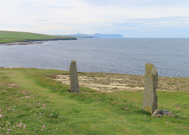
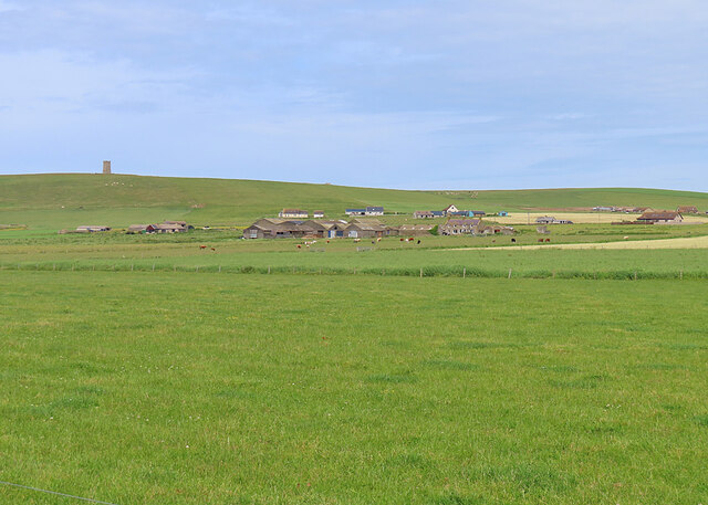
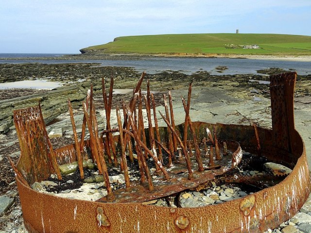
Despite its remote location, Vesker Bay has a rich historical background. The remains of a Norse broch, an ancient circular stone tower, can be found close to the bay, indicating a long history of human habitation in the area. The broch offers a glimpse into the lives of the inhabitants who lived there centuries ago.

Overall, Vesker Bay is a hidden gem in Orkney, offering a combination of natural beauty, recreational activities, and historical significance. Whether one is seeking relaxation, adventure, or a connection to the past, Vesker Bay has something to offer for everyone.

If you have any feedback on the listing, please let us know in the comments section below.

Vesker Images

Images are sourced within 2km of 59.086833/-3.3534839 or Grid Reference HY2222. Thanks to Geograph Open Source API. All images are credited.

Mar Wick bay, Orkney
Vestra Fiold trig pillar
Standing Stone by the Path The path starts to descend here from Marwick head to sea level, and the stone is one of several that stand beside it. I don't think they are ancient.
Standing Stone by the Path
The path starts to descend here from Marwick head to sea level, and the stone is one of several that stand beside it. I don't think they are ancient.
Standing Stones I don't think these stones are ancient monuments. They are beside the path down from Marwick Head to the beach.
Standing Stones
I don't think these stones are ancient monuments. They are beside the path down from Marwick Head to the beach.
Storm Beach The rock strata on the cliff top have been progressively stripped away by winter storms.
Storm Beach
The rock strata on the cliff top have been progressively stripped away by winter storms.
Dipping Strata On the south side of Marwick Head, with a view south to Yesnaby and the island of Hoy.
Dipping Strata
On the south side of Marwick Head, with a view south to Yesnaby and the island of Hoy.
Gunnagairn Gunnagairn is a geo on the south side of Marwick Head.
Gunnagairn
Gunnagairn is a geo on the south side of Marwick Head.
Cleft in the Rock I suspect that this might be the line of an igneous dyke that has been preferentially eroded out.
Cleft in the Rock
I suspect that this might be the line of an igneous dyke that has been preferentially eroded out.
Mar Wick The tidal lagoon at the head of the bay is Choin.
Mar Wick
The tidal lagoon at the head of the bay is Choin.
Gruidgar The flat building in front of the house is a gallery of local art and craft works.
Gruidgar
The flat building in front of the house is a gallery of local art and craft works.
Ox-eye Daisies (Leucanthemum vulgare) One of several flourishing clumps.
Ox-eye Daisies (Leucanthemum vulgare)
One of several flourishing clumps.
Netherskaill Netherskaill is the nearest farm. In the distance is the Kitchener Memorial.
Netherskaill
Netherskaill is the nearest farm. In the distance is the Kitchener Memorial.
Gunnagairn cliff, Marwick, Orkney Taken during a shoreline survey for the International Centre for Island Technology (ICIT).
Gunnagairn cliff, Marwick, Orkney
Taken during a shoreline survey for the International Centre for Island Technology (ICIT).
Across Choin The Kitchener Memorial is on the horizon
Across Choin
The Kitchener Memorial is on the horizon
Rusty metal at Mar Wick Remains of a ship's boiler. The same subject as <a href="https://www.geograph.org.uk/photo/2052112">HY2224 : Mar Wick, Orkney</a>
Rusty metal at Mar Wick
Remains of a ship's boiler. The same subject as HY2224 : Mar Wick, Orkney
Road east of Mar Wick
Mar Wick panorama
Mar Wick panorama
Rocky shore at Mar Wick
Show me another place!

Vesker is located at Grid Ref: HY2222 (Lat: 59.086833, Lng: -3.3534839)

Unitary Authority: Orkney Islands

Police Authority: Highlands and Islands

What 3 Words

///hogs.elevated.playroom. Near Sandwick, Orkney Islands

Related Wikis

Bay of Skaill

The Bay of Skaill (from Old Norse Bugr Skála) is a small bay on the west coast of the Orkney Mainland, Scotland. == Visitor attractions == Bay of Skaill...

RNAS Twatt (HMS Tern)

Royal Naval Air Station Twatt, (RNAS Twatt; or HMS Tern) is a former Royal Navy Air Station located near Twatt, Orkney, Scotland. It was built by the Admiralty...

HMS Hampshire (1903)

HMS Hampshire was one of six Devonshire-class armoured cruisers built for the Royal Navy in the first decade of the 20th century. She was assigned to the...

Skara Brae

Skara Brae is a stone-built Neolithic settlement, located on the Bay of Skaill on the west coast of Mainland, the largest island in the Orkney archipelago...

Nearby Amenities

Located within 500m of 59.086833,-3.3534839
Outshore Point
Place: locality
Lat/Long: 59.083627/-3.3514799
The Stramp
Place: locality
Lat/Long: 59.0872127/-3.3484314
The data included in this document is from www.openstreetmap.org. The data is made available under ODbL.

Have you been to Vesker?

Leave your review of Vesker below (or comments, questions and feedback).