Jackdaw Point
Coastal Feature, Headland, Point in Glamorgan
Wales
Jackdaw Point

Jackdaw Point is a prominent coastal feature located in Glamorgan, Wales. Situated on the southern coast, it is a striking headland that juts out into the Bristol Channel. The point is named after the large number of jackdaw birds that inhabit the area, adding to its natural charm.
The headland is characterized by its rugged and dramatic cliffs, which are predominantly composed of limestone. These cliffs create a stunning backdrop against the crashing waves of the channel, making it a popular spot for photographers and nature enthusiasts. The point offers panoramic views of the surrounding coastline, with its elevated position providing a vantage point for observing the ever-changing tides and marine life.
Jackdaw Point is also known for its rich biodiversity. The rocky shoreline and nearby sea caves are home to a variety of marine species, including seals, dolphins, and a wide array of seabirds. The point itself is covered in lush vegetation, with patches of grasses, heather, and wildflowers scattered across the landscape.
Access to Jackdaw Point is relatively easy, with a well-maintained footpath leading visitors to the headland. There are also designated viewing points and benches along the route, allowing visitors to rest and take in the breathtaking scenery. The area is managed by local conservation organizations, ensuring the preservation of its natural beauty and wildlife.
Whether it be for a leisurely stroll, bird-watching, or simply enjoying the peaceful ambiance of the coast, Jackdaw Point offers a captivating experience for all nature enthusiasts and visitors to Glamorgan.
If you have any feedback on the listing, please let us know in the comments section below.
Jackdaw Point Images
Images are sourced within 2km of 51.377705/-3.1168854 or Grid Reference ST2264. Thanks to Geograph Open Source API. All images are credited.


Jackdaw Point is located at Grid Ref: ST2264 (Lat: 51.377705, Lng: -3.1168854)
Unitary Authority: Cardiff
Police Authority: South Wales
What 3 Words
///entitles.flipper.coping. Near Penarth, Vale of Glamorgan
Nearby Locations
Related Wikis
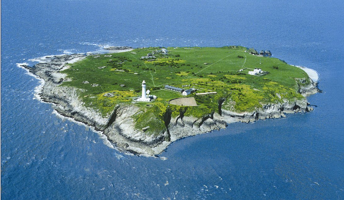
Flat Holm
Flat Holm (Welsh: Ynys Echni) is a Welsh island lying in the Bristol Channel approximately 6 km (4 mi) from Lavernock Point in the Vale of Glamorgan. It...

The Wolves (Bristol Channel)
The Wolves are three small rocky islets just over a mile northwest of the island of Flat Holm in the Bristol Channel. They measure approximately 25 metres...
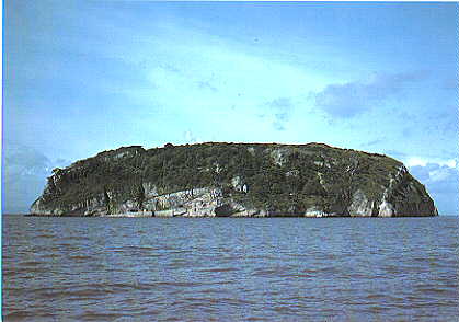
Steep Holm
Steep Holm (Welsh: Ynys Rhonech, Old English: Ronech and later Steopanreolice) is an English island lying in the Bristol Channel. The island covers 48...

Lavernock Battery
Lavernock Battery was built at Lavernock Point, Wales on the recommendations of the 1860 Royal Commission during the late 1860s to protect the ports of...
Nearby Amenities
Located within 500m of 51.377705,-3.1168854Have you been to Jackdaw Point?
Leave your review of Jackdaw Point below (or comments, questions and feedback).