Bogle Hole

Coastal Feature, Headland, Point in Kirkcudbrightshire

Scotland

Bogle Hole

Shell beach Lines of stranded seaweed make a contrast with the brightly-coloured shells on the east side of Rough Island.
Shell beach Credit: Jonathan Wilkins

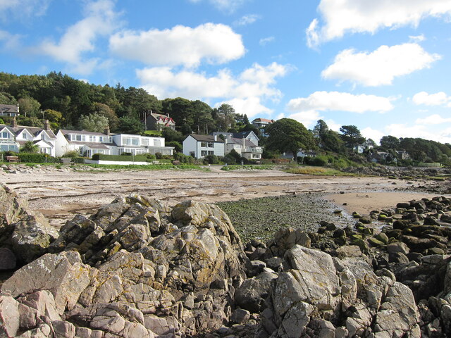
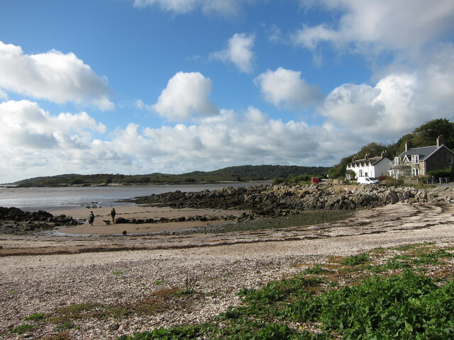
Bogle Hole is a prominent coastal feature located in Kirkcudbrightshire, Scotland. It is a headland or point that juts out into the sea, offering stunning views of the surrounding coastline. The name "Bogle Hole" is derived from the Scottish word "bogle," meaning ghost or spirit, which adds an element of intrigue to this natural wonder.

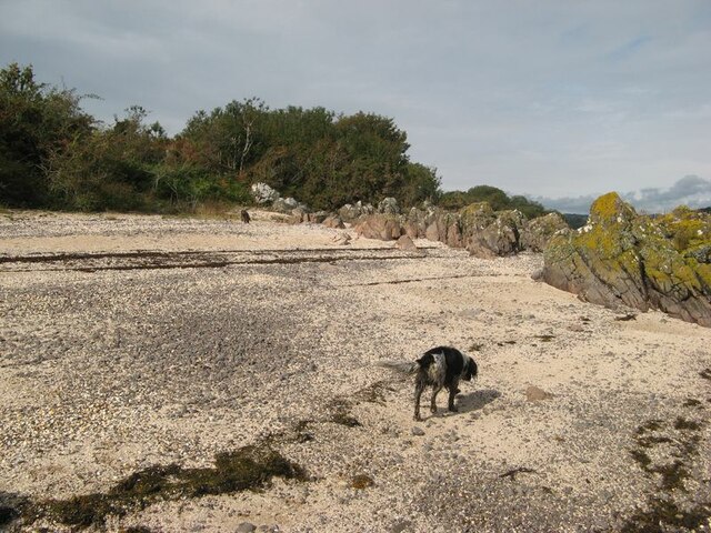
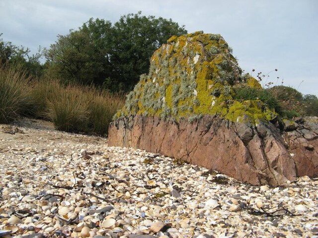
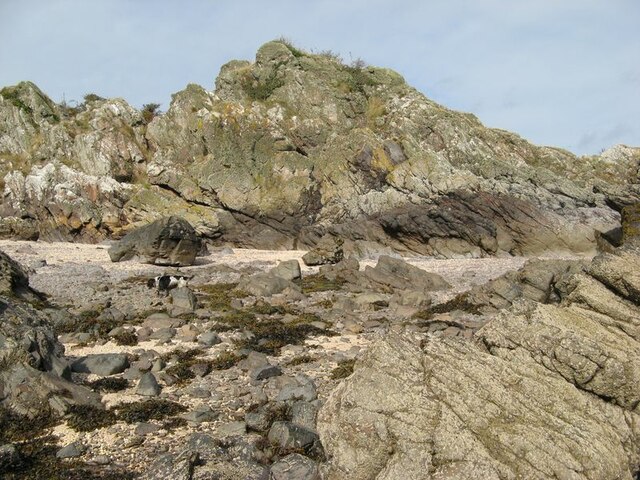
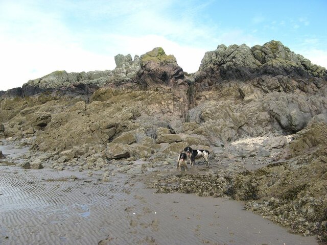
Situated on the Solway Firth, Bogle Hole boasts rugged cliffs and rocky outcrops that have been shaped by the relentless power of the ocean over time. The headland is known for its dramatic landscape, with towering cliffs that provide nesting sites for seabirds like puffins, guillemots, and razorbills. The area is also home to a diverse range of marine life, making it a popular spot for wildlife enthusiasts and birdwatchers.

Visitors to Bogle Hole can enjoy breathtaking panoramic views of the sea, with the Isle of Man visible on clear days. The headland is easily accessible by foot, with a well-maintained coastal path that leads to the site. It is a perfect location for hiking and exploring the rugged beauty of the Scottish coastline.

Additionally, Bogle Hole holds a place in local folklore, with tales of mysterious sightings and ghostly apparitions adding to its allure. Legends and stories of supernatural occurrences have been passed down through generations, further enhancing the intrigue surrounding this coastal feature.

Overall, Bogle Hole in Kirkcudbrightshire is a captivating and picturesque coastal point, offering stunning views, diverse wildlife, and a touch of mystique that adds to its appeal.

If you have any feedback on the listing, please let us know in the comments section below.

Bogle Hole Images

Images are sourced within 2km of 54.856331/-3.7714209 or Grid Reference NX8652. Thanks to Geograph Open Source API. All images are credited.

Shell beach Lines of stranded seaweed make a contrast with the brightly-coloured shells on the east side of Rough Island.
Shell beach
Lines of stranded seaweed make a contrast with the brightly-coloured shells on the east side of Rough Island.
Granite outcrop An isolated rock outcrop on the shell beach is a fine example of a pink, granitic vein. Many such veins appear to be associated with the intrusion of the nearby Criffel-Dalbeattie pluton, with fingers reaching out into the greywackes of Silurian age. Prominent exposures of such rocks can also be found nearby on the mainland at Rockcliffe. Wave action and abrasion has kept the lower part clear of encrustation, but the top has a delightfully thick growth of lichens.
Granite outcrop
An isolated rock outcrop on the shell beach is a fine example of a pink, granitic vein. Many such veins appear to be associated with the intrusion of the nearby Criffel-Dalbeattie pluton, with fingers reaching out into the greywackes of Silurian age. Prominent exposures of such rocks can also be found nearby on the mainland at Rockcliffe. Wave action and abrasion has kept the lower part clear of encrustation, but the top has a delightfully thick growth of lichens.
Rough Island shore This is rough terrain, with chaotic exposures of fractured and deformed rock. Is it the origin of the name Rough Island?
Rough Island shore
This is rough terrain, with chaotic exposures of fractured and deformed rock. Is it the origin of the name Rough Island?
Intertidal rocks Rocks exposed in the intertidal zone at the south end of Rough Island.
Intertidal rocks
Rocks exposed in the intertidal zone at the south end of Rough Island.
Island mudscape A view against the light of the expanse of water, mud and sand that makes up the outer end of Rough Firth. The Spring Stones are to the left, while Hestan Island is on the right of the river running out to clear water.
Island mudscape
A view against the light of the expanse of water, mud and sand that makes up the outer end of Rough Firth. The Spring Stones are to the left, while Hestan Island is on the right of the river running out to clear water.
Drainage channel Water draining from the area to the east of the causeway runs across the sand, but swings in to the southern end of Rough Island before dispersing towards the river channel. My assistants were encouraged to splash around in the relatively clean water after their muddy trek around the west side of the island.
Drainage channel
Water draining from the area to the east of the causeway runs across the sand, but swings in to the southern end of Rough Island before dispersing towards the river channel. My assistants were encouraged to splash around in the relatively clean water after their muddy trek around the west side of the island.
Looking across the bay at Rockcliffe To the houses at Port Donnel.
Looking across the bay at Rockcliffe
To the houses at Port Donnel.
Challenging site with development potential! Solid foundations and close to the sea.
Challenging site with development potential!
Solid foundations and close to the sea.
View from Rockcliffe Past Rough Island to Hestan Island on the horizon.
View from Rockcliffe
Past Rough Island to Hestan Island on the horizon.
In Rockliffe Heading for Castlehill Point.
In Rockliffe
Heading for Castlehill Point.
Colvend Parish Church An Early Christian church by P MacGregor Chalmers 1911, of granite with red sandstone dressings and set on a rise overlooking the Solway Firth. Its bell-tower is topped by a steep pyramid roof.
Colvend Parish Church
An Early Christian church by P MacGregor Chalmers 1911, of granite with red sandstone dressings and set on a rise overlooking the Solway Firth. Its bell-tower is topped by a steep pyramid roof.
Colvend House Just to the left of the house, through a gap between the trees, is White Loch.
Colvend House
Just to the left of the house, through a gap between the trees, is White Loch.
Whinney Knowe, Rockcliffe A smart sea front house on the shore road, overlooking Port Donnell. I stayed there about 40+ years ago, with another family; it is the daughter of that family who took this photo and remembered it well! Apparently it is still available to let, according to an undated website, but with no details.
Whinney Knowe, Rockcliffe
A smart sea front house on the shore road, overlooking Port Donnell. I stayed there about 40+ years ago, with another family; it is the daughter of that family who took this photo and remembered it well! Apparently it is still available to let, according to an undated website, but with no details.
Beach at Rockcliffe A fine August day and not a soul on the beach or the benches overlooking the bay.
Beach at Rockcliffe
A fine August day and not a soul on the beach or the benches overlooking the bay.
Castlehill Point, viewpoint
Rough Firth
Rough Firth
Low tide at Rockcliffe
View from Rockcliffe
Show me another place!

Bogle Hole is located at Grid Ref: NX8652 (Lat: 54.856331, Lng: -3.7714209)

Unitary Authority: Dumfries and Galloway

Police Authority: Dumfries and Galloway

What 3 Words

///continued.metro.divisions. Near Dalbeattie, Dumfries & Galloway

Related Wikis

Colvend and Southwick

Colvend and Southwick is a community council area and civil parish within the Stewartry area of Dumfries and Galloway, Scotland. It is also part of the...

Rough Island, Scotland

"Rough Island" is also used as a translation of "Garbh Eilean", a common Scottish name for islandsRough Island is a 20-acre (8 ha) uninhabited tidal island...

Rough Firth

Rough Firth is an inlet on the northern coast of the Solway Firth in the Stewartry area of Dumfries and Galloway, Scotland. The firth lies between Almorness...

Rockcliffe, Dumfries and Galloway

Rockcliffe is a small, coastal village in Kirkcudbrightshire, Dumfries and Galloway in Scotland, with a view of Rough Island, Hestan Island, the Solway...

Nearby Amenities

Located within 500m of 54.856331,-3.7714209
Source: PGS
Lat/Long: 54.854686/-3.7779322
Source: PGS
Lat/Long: 54.8549447/-3.777429
Source: PGS
Lat/Long: 54.8550077/-3.7772316
Source: PGS
Lat/Long: 54.8551807/-3.7767542
Source: PGS
Lat/Long: 54.8552455/-3.77606
Source: PGS
Lat/Long: 54.8552622/-3.7754989
Source: PGS
Lat/Long: 54.855366/-3.7748519
Source: PGS
Lat/Long: 54.8554333/-3.7739808
Source: PGS
Lat/Long: 54.8554487/-3.7734551
Source: PGS
Lat/Long: 54.8556235/-3.7730291
Source: PGS
Lat/Long: 54.8557384/-3.7728424
Source: PGS
Lat/Long: 54.8557316/-3.7726171
Source: PGS
Lat/Long: 54.8561543/-3.7713203
Source: PGS
Lat/Long: 54.8560013/-3.7709269
Source: PGS
Lat/Long: 54.8564982/-3.7693669
Source: PGS
Lat/Long: 54.8565815/-3.7686744
Source: PGS
Lat/Long: 54.8567322/-3.768271
Source: PGS
Lat/Long: 54.8565436/-3.7680119
Source: PGS
Lat/Long: 54.8565414/-3.767638
Source: PGS
Lat/Long: 54.8567585/-3.7669969
Source: PGS
Lat/Long: 54.8567545/-3.7665388
Source: PGS
Lat/Long: 54.8569076/-3.7663275
Source: PGS
Lat/Long: 54.85697/-3.7656006
Source: PGS
Lat/Long: 54.8568842/-3.7651854
Source: PGS
Lat/Long: 54.8568971/-3.7647289
Bogle Hole
Place: locality
Lat/Long: 54.8562297/-3.7716963
Gutcher's Isle
Place: locality
Lat/Long: 54.856376/-3.7714161
Bells Isle
Place: locality
Lat/Long: 54.8568068/-3.7655908
Historic: memorial
Lat/Long: 54.85688/-3.7641705
The data included in this document is from www.openstreetmap.org. The data is made available under ODbL.

Have you been to Bogle Hole?

Leave your review of Bogle Hole below (or comments, questions and feedback).