A' Chleit Mhòr

Coastal Feature, Headland, Point in Sutherland

Scotland

A' Chleit Mhòr

Net-drying poles, Portskerra During the fishing season bag-nets have to be taken from the water every seven days or so and the accumulated weed and other detritus removed.   After cleaning they are dried on the poles which are set out to correspond to the shape of the bag-net.
Net-drying poles, Portskerra Credit: Iain A Robertson

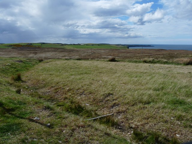
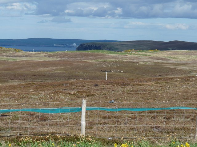
A' Chleit Mhòr is a prominent coastal feature located in Sutherland, Scotland. It is classified as a headland or point, jutting out into the North Atlantic Ocean. The name A' Chleit Mhòr is of Gaelic origin and translates to "the big rock."

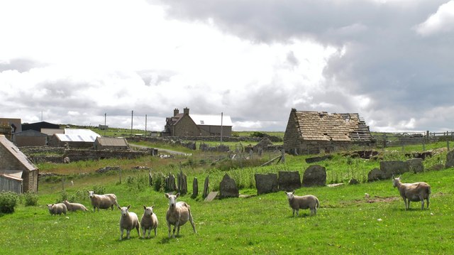
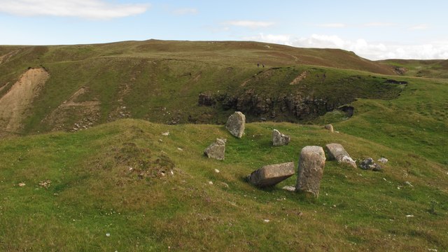
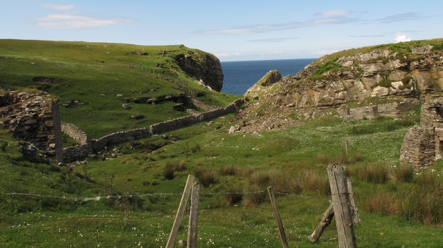
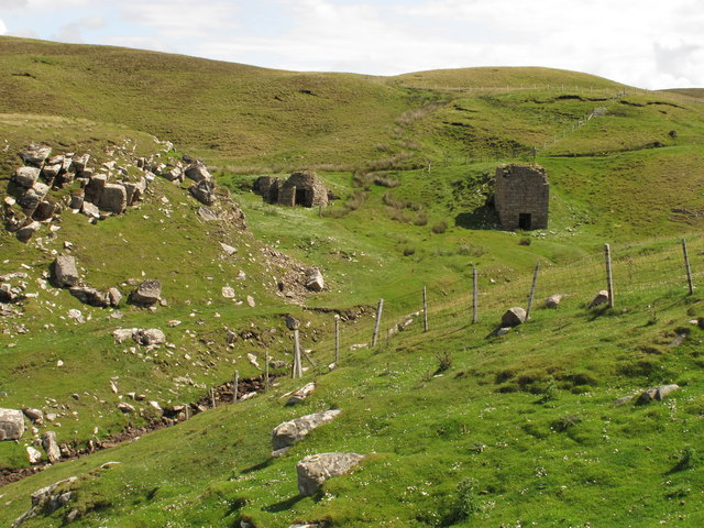
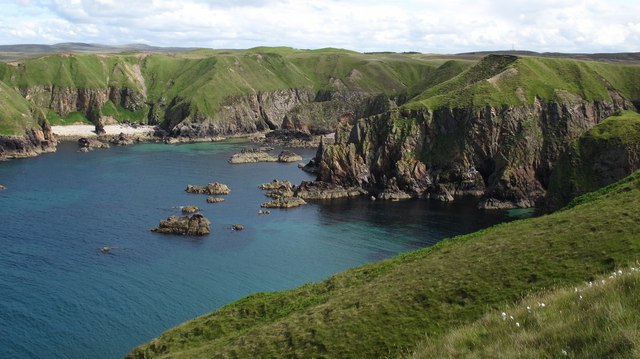
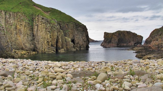
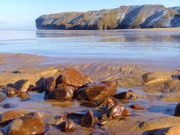
The headland is characterized by its rugged and rocky terrain, with steep cliffs dropping down to the sea below. The cliffs are composed of layers of sedimentary rocks, which have been eroded over time by the relentless force of the ocean waves. This erosion has created fascinating geological formations, such as sea caves, stacks, and arches.

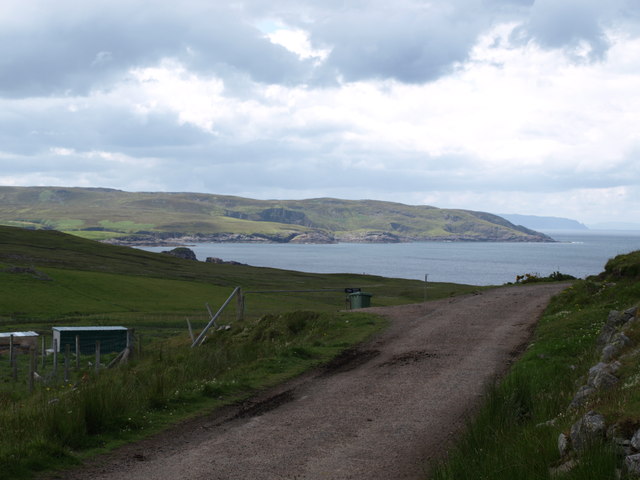
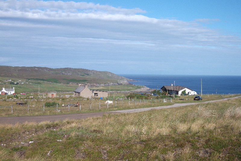
A' Chleit Mhòr offers breathtaking panoramic views of the surrounding coastline and the vast expanse of the Atlantic Ocean. On clear days, visitors can see the distant outline of the Outer Hebrides islands to the northwest.

The headland is also home to a diverse range of flora and fauna. The exposed cliffs provide nesting sites for seabirds such as puffins, guillemots, and razorbills. Visitors may also spot seals basking on the rocks or swimming in the surrounding waters.

Due to its remote location, A' Chleit Mhòr is an ideal spot for solitude and reflection. It attracts nature enthusiasts, photographers, and hikers looking to explore the stunning coastal landscape. However, visitors are advised to take caution as the cliffs can be dangerous and slippery, and the weather conditions can change rapidly.

In conclusion, A' Chleit Mhòr is a captivating and rugged headland in Sutherland, offering stunning views, diverse wildlife, and a sense of tranquility for those who venture to its remote location.

If you have any feedback on the listing, please let us know in the comments section below.

A' Chleit Mhòr Images

Images are sourced within 2km of 58.573622/-3.9549581 or Grid Reference NC8666. Thanks to Geograph Open Source API. All images are credited.

Net-drying poles, Portskerra During the fishing season bag-nets have to be taken from the water every seven days or so and the accumulated weed and other detritus removed.   After cleaning they are dried on the poles which are set out to correspond to the shape of the bag-net.
Net-drying poles, Portskerra
During the fishing season bag-nets have to be taken from the water every seven days or so and the accumulated weed and other detritus removed. After cleaning they are dried on the poles which are set out to correspond to the shape of the bag-net.
Salmon coble at Portskerra These traditionally-shaped cobles fish the bag-nets around the Scottish coasts.   Traditionally they were constructed with wood, but this one is made from glass-reinforced plastic (GRP).
Salmon coble at Portskerra
These traditionally-shaped cobles fish the bag-nets around the Scottish coasts. Traditionally they were constructed with wood, but this one is made from glass-reinforced plastic (GRP).
Shorn sheep and slabstones at Baligill The slabstones are frequently used as 'hedges' in Sutherland but these would not keep in the livestock!
Shorn sheep and slabstones at Baligill
The slabstones are frequently used as 'hedges' in Sutherland but these would not keep in the livestock!
An Dun fort at Baligill There are several ancient forts along the sea cliffs between Strathy and Portskerra and this one is close to the limekilns near Baligill.
An Dun fort at Baligill
There are several ancient forts along the sea cliffs between Strathy and Portskerra and this one is close to the limekilns near Baligill.
Limekilns at Baligill Burn Two limekilns are situated in the lower end of the Baligill Burn where it enters the sea. One is circular (at right) and the other, more recent one is rectangular (at left of photo).
Limekilns at Baligill Burn
Two limekilns are situated in the lower end of the Baligill Burn where it enters the sea. One is circular (at right) and the other, more recent one is rectangular (at left of photo).
Limekilns in Baligill Burn The circular kiln was built c.1820 and the rectangular kiln c.1850.
Limekilns in Baligill Burn
The circular kiln was built c.1820 and the rectangular kiln c.1850.
Cliff scenery at Portskerra Two small burns, the Alltan Domhaich and the Allt na Cleite, plunge down spectacular ravines to the sea at this large cove. An ancient fort is situated on one of these narrow headlands and a Peregrine was devouring its kill there during my visit.
Cliff scenery at Portskerra
Two small burns, the Alltan Domhaich and the Allt na Cleite, plunge down spectacular ravines to the sea at this large cove. An ancient fort is situated on one of these narrow headlands and a Peregrine was devouring its kill there during my visit.
Melvich: postbox № KW14 45 This small postbox stands outside the village store which is also Melvich Post Office, probably a recent relocation for the post office since the 1:50,000 shows it to the southeast.
Melvich: postbox № KW14 45
This small postbox stands outside the village store which is also Melvich Post Office, probably a recent relocation for the post office since the 1:50,000 shows it to the southeast.
Portskerra: postbox № KW14 49 A small postbox, emptied daily except Sunday at 12:30pm.
Portskerra: postbox № KW14 49
A small postbox, emptied daily except Sunday at 12:30pm.
Portskerra: rocks below Sgeir Ruadh Rocks and waves below the cliffs of modest height.
Portskerra: rocks below Sgeir Ruadh
Rocks and waves below the cliffs of modest height.
View to the north-east  from the A836 near Portskerra The coastline of the Orkney Islands can be seen on the horizon.
View to the north-east from the A836 near Portskerra
The coastline of the Orkney Islands can be seen on the horizon.
The A836 approaching Portskerra from the west
View towards Baligill Green fields and the hamlet of Baligall on the horizon are in contrast to the bleak acid moorland in the foreground.
View towards Baligill
Green fields and the hamlet of Baligall on the horizon are in contrast to the bleak acid moorland in the foreground.
View near Portskerra The area of acid moorland in the foreground has been fenced off to protect the habitat. The now closed Dounreay nuclear power station can be seen in the distance.
View near Portskerra
The area of acid moorland in the foreground has been fenced off to protect the habitat. The now closed Dounreay nuclear power station can be seen in the distance.
Berry Geo near Portskerra This small cove lies immediately to the west of the Ruhba Ghoiridh headland. The boulder beach is accessible on foot with care down a steep, grassy bank.
Berry Geo near Portskerra
This small cove lies immediately to the west of the Ruhba Ghoiridh headland. The boulder beach is accessible on foot with care down a steep, grassy bank.
Portskerra Slipway
Portskerra Slipway
Boat and flowers, Portskerra beside the road to the slipway
Boat and flowers, Portskerra
beside the road to the slipway
The road to Balligill Single track road from the A836 to Baligill
The road to Balligill
Single track road from the A836 to Baligill
Show me another place!

A' Chleit Mhòr is located at Grid Ref: NC8666 (Lat: 58.573622, Lng: -3.9549581)

Unitary Authority: Highland

Police Authority: Highlands and Islands

What 3 Words

///trickles.bills.camper. Near Reay, Highland

Related Wikis

Portskerra

Portskerra (from Scottish Gaelic Port Sgeire 'skerry harbour') is a hamlet that overlooks Melvich Bay in Sutherland, Highland, Scotland. The village of...

Melvich

Melvich (from Norse Mel Vik – "sand dune bay" – rendered into Scottish Gaelic: A' Mhealbhaich) is a village in the county of Sutherland on the north coast...

Strathy

Strathy (from Scottish Gaelic Srathaidh 'place of the strath') is a scattered community in Sutherland in the Scottish Highlands. The settlement emerged...

Totegan

Totegan is a hamlet in Sutherland, Scotland and is one of the most northerly settlements in mainland Scotland. The nearest main road to the hamlet is the...

Aultiphurst

Aultiphurst (Scottish Gaelic: Allt a' Phuirt), in Strathy, Sutherland, is a village in the Scottish HighlandsThe name Aultiphurst is a misspelling of Allt...

Lednagullin

Lednagullin is a village on the south east shore of Armadale Bay in Sutherland, Scottish Highlands and is in the Scottish council area of Highland....

Armadale, Sutherland

Armadale (Scottish Gaelic: Armadal, Scots: Airmadale) is a small village on the north coast of Scotland, in the council area of Highland. The village is...

Achiemore, Strath Halladale

Achiemore is a hamlet in Strath Halladale in Sutherland, in the Highland council area of Scotland. Achiemore is situated to the north of Smigel Burn on...

Related Videos

(some of) Scotland’s North Coast 500

Seeing as we are all having to travel closer to home this year (thank you, Covid) my friend & I decided to road trip around some of ...

Portskerra

Portskerra never disappoints, class day with good viz and flat water. So much more caves to explore here. Will be back up there ...

NC500 || North Coast (pt4) Another day in Paradise

NC500 #NORTHCOAST #SCOTLAND IF YOU WOULD LIKE TO SUPPORT THE CHANNEL You can do so by joining our Patreon ...

Nearby Amenities

Located within 500m of 58.573622,-3.9549581
Source: PGS
Lat/Long: 58.5700251/-3.9501091
Source: PGS
Lat/Long: 58.5703497/-3.9497731
Source: PGS
Lat/Long: 58.5710563/-3.9495878
Source: PGS
Lat/Long: 58.5714721/-3.949807
Created By: almien_coastlines
Source: PGS
Lat/Long: 58.571599/-3.950044
Source: PGS
Lat/Long: 58.5716296/-3.9503228
Source: PGS
Lat/Long: 58.5730032/-3.950946
Source: PGS
Lat/Long: 58.5735028/-3.951168
Created By: almien_coastlines
Source: PGS
Lat/Long: 58.573888/-3.952066
Source: PGS
Lat/Long: 58.5743757/-3.9524526
Source: PGS
Lat/Long: 58.5745131/-3.9531785
Source: PGS
Lat/Long: 58.573545/-3.9531092
Source: PGS
Lat/Long: 58.5727206/-3.9523174
Source: PGS
Lat/Long: 58.5726881/-3.9530444
Source: PGS
Lat/Long: 58.5729879/-3.9531115
Source: PGS
Lat/Long: 58.5739884/-3.9551122
Source: PGS
Lat/Long: 58.5728769/-3.9555994
Created By: almien_coastlines
Source: PGS
Lat/Long: 58.572964/-3.955715
Source: PGS
Lat/Long: 58.5732765/-3.9558257
Source: PGS
Lat/Long: 58.5741759/-3.9568127
Source: PGS
Lat/Long: 58.573707/-3.9576006
Created By: almien_coastlines
Source: PGS
Lat/Long: 58.573202/-3.958172
Source: PGS
Lat/Long: 58.5735414/-3.958999
Source: PGS
Lat/Long: 58.5729792/-3.9590065
Source: PGS
Lat/Long: 58.571904/-3.9591272
Source: PGS
Lat/Long: 58.5721589/-3.960255
Source: PGS
Lat/Long: 58.5731597/-3.9610473
Source: PGS
Lat/Long: 58.5731188/-3.9616848
Source: PGS
Lat/Long: 58.5722719/-3.9615871
The data included in this document is from www.openstreetmap.org. The data is made available under ODbL.

Have you been to A' Chleit Mhòr?

Leave your review of A' Chleit Mhòr below (or comments, questions and feedback).