Scoble Point

Coastal Feature, Headland, Point in Devon South Hams

England

Scoble Point

Salcombe : Bay Scenery Looking out into the bay.
Salcombe : Bay Scenery Credit: Lewis Clarke

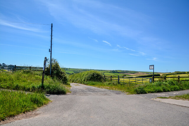
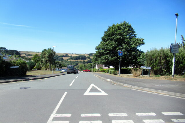
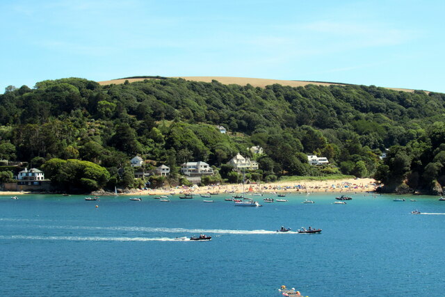
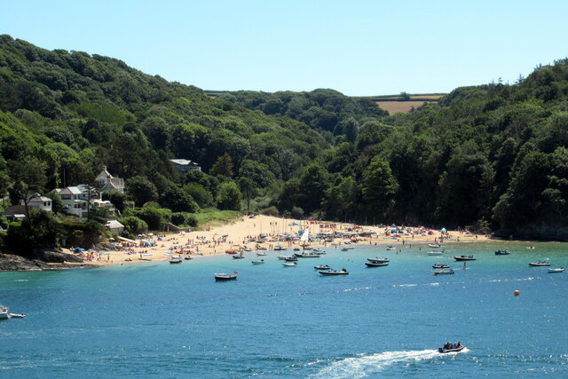
Scoble Point is a prominent coastal feature located in Devon, England. Situated on the south coast of the county, it is classified as a headland or point due to its protrusion into the English Channel. The point is positioned between two popular coastal towns, Sidmouth to the west and Branscombe to the east.

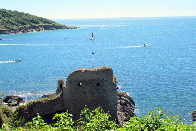
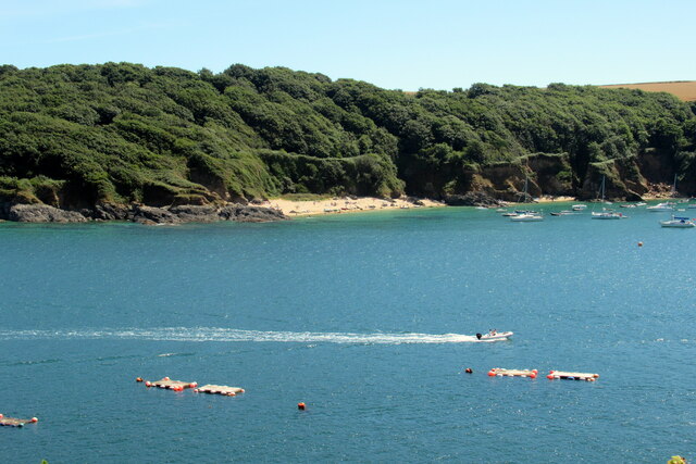
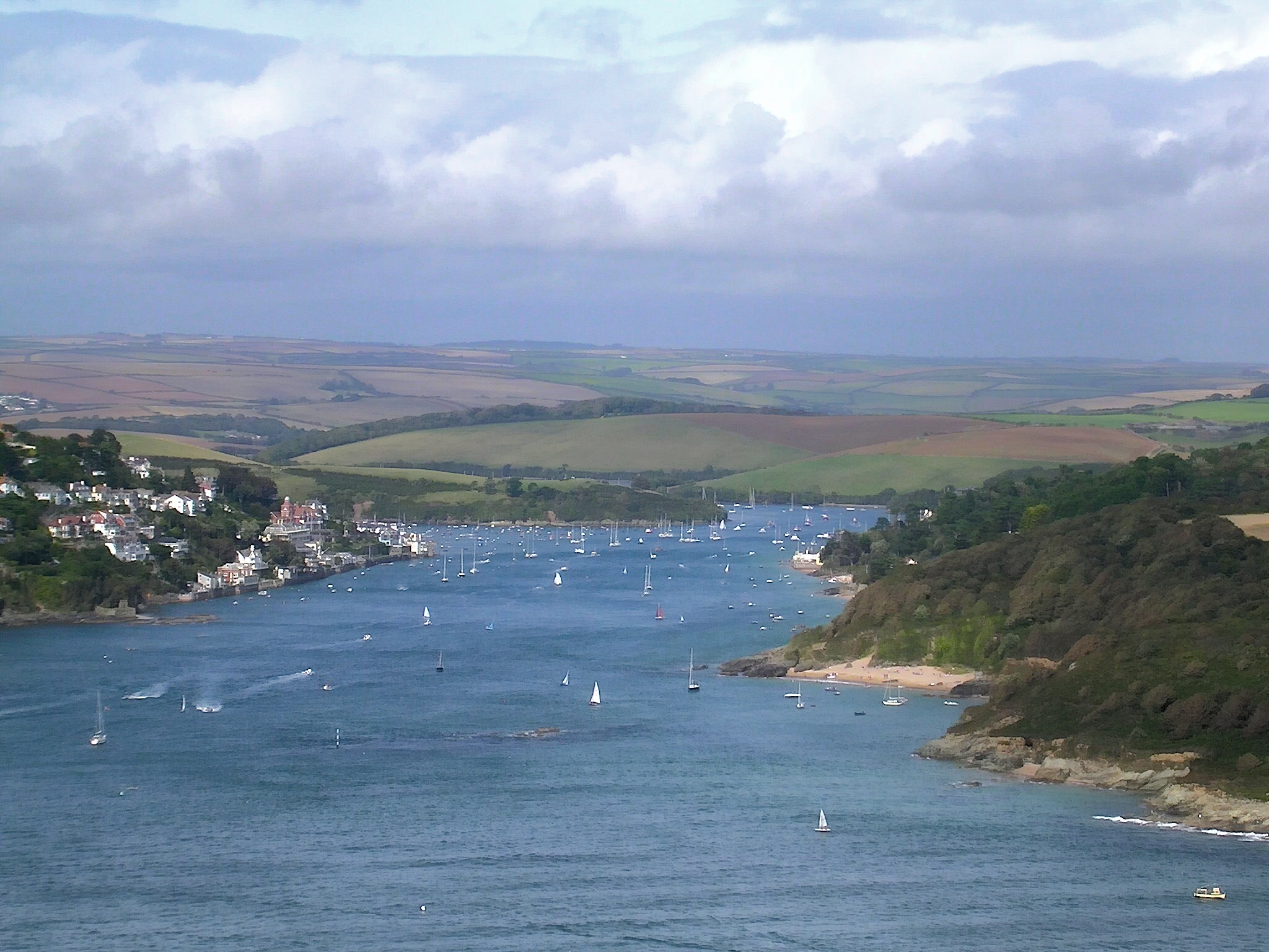
Scoble Point is known for its rugged beauty and dramatic cliffs, which rise steeply from the sea. The area is characterized by its striking geological formations, including layers of red sandstone and white chalk, which have been shaped by erosion and weathering over millions of years.

The headland offers breathtaking panoramic views of the surrounding coastline, making it a popular destination for tourists and nature enthusiasts. Visitors can enjoy watching the crashing waves and observing the diverse marine life that inhabits the waters off the point. Seabird colonies, including gulls and cormorants, can often be spotted nesting on the cliff faces.

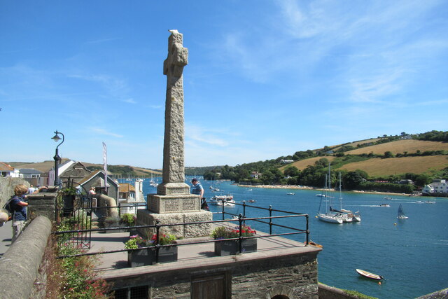
In addition to its natural beauty, Scoble Point also has a rich history. The area has been occupied by humans for thousands of years, and evidence of ancient settlements can be found nearby. The headland is also associated with maritime activity, with tales of smugglers and shipwrecks adding to its allure.

Overall, Scoble Point is a captivating coastal feature that combines stunning natural scenery with historical significance. Whether for its geological wonders, wildlife, or cultural heritage, this headland attracts visitors seeking to immerse themselves in the beauty and history of the Devon coastline.

If you have any feedback on the listing, please let us know in the comments section below.
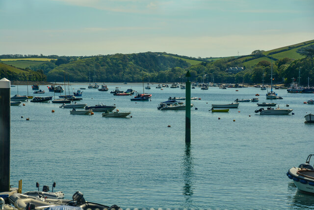
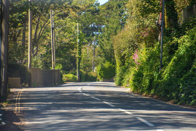
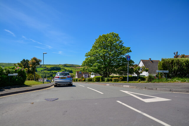
Scoble Point Images

Images are sourced within 2km of 50.240221/-3.7558011 or Grid Reference SX7439. Thanks to Geograph Open Source API. All images are credited.

Salcombe : Bay Scenery Looking out into the bay.
Salcombe : Bay Scenery
Looking out into the bay.
East Portlemouth : Sunny Cove Looking towards a beach and cove.
East Portlemouth : Sunny Cove
Looking towards a beach and cove.
Salcombe : A381 Looking along the A381.
Salcombe : A381
Looking along the A381.
Salcombe : Beadon Road Beadon Road off Main Road.
Salcombe : Beadon Road
Beadon Road off Main Road.
Salcombe : Gulf Petrol Station A Gulf garage off Main Road.
Salcombe : Gulf Petrol Station
A Gulf garage off Main Road.
Salcombe : Track A track to Motherhill Farm.
Salcombe : Track
A track to Motherhill Farm.
Beadon Road Salcombe
The 164 bus to Salcombe leaving the Devon Road stop
Fort Charles, Salcombe
Salcombe estuary looking towards Sunny Cove
Salcombe estuary looking towards Mill Bay
Footbridge over Cliff Road, Salcombe
Mill Bay Salcombe
Mill Bay Salcombe
Fork left for car and boat park, Salcombe
Salcombe war memorial
Steps down to the Ferry Inn and passenger ferry, Salcombe
Fore Street Salcombe
Salcombe slip-way
Salcombe slip-way
Show me another place!

Scoble Point is located at Grid Ref: SX7439 (Lat: 50.240221, Lng: -3.7558011)

Administrative County: Devon

District: South Hams

Police Authority: Devon and Cornwall

What 3 Words

///newsstand.claps.lives. Near Salcombe, Devon

Related Wikis

Hallowe'en (clipper)

Hallowe’en was a 920-ton iron clipper ship. She was built in 1870 by Maudslay, Son & Field at Greenwich, England, for Jock Willis & Sons (commissioned...

Salcombe Lifeboat Station

Salcombe Lifeboat Station is the base for Royal National Lifeboat Institution (RNLI) search and rescue operations at Salcombe, Devon in England. The first...

East Portlemouth

East Portlemouth is a village and civil parish in the South Hams district, in the county of Devon, England, situated at the southern end of the Kingsbridge...

Kingsbridge Estuary

The Kingsbridge Estuary (also, erroneously, known as the 'Salcombe Estuary') in the South Hams area of Devon, England runs from Kingsbridge in the north...

Nearby Amenities

Located within 500m of 50.240221,-3.7558011
Source: PGS
Lat/Long: 50.2411281/-3.7553281
Source: PGS
Lat/Long: 50.2408203/-3.7563901
Source: PGS
Lat/Long: 50.240469/-3.7588727
Source: PGS
Lat/Long: 50.2401102/-3.7551005
Source: PGS
Lat/Long: 50.2398689/-3.7540461
Source: PGS
Lat/Long: 50.2398/-3.7530328
Source: PGS
Lat/Long: 50.2398065/-3.7522044
Source: PGS
Lat/Long: 50.2398827/-3.7518482
Source: PGS
Lat/Long: 50.2399787/-3.7511793
Source: PGS
Lat/Long: 50.240181/-3.750397
Source: PGS
Lat/Long: 50.2402956/-3.7489196
Source: PGS
Lat/Long: 50.2367906/-3.7570416
Source: PGS
Lat/Long: 50.2364631/-3.7573413
Source: PGS
Lat/Long: 50.2364939/-3.7587803
Seamark Light Category: lower
Seamark Light Character: Q
Seamark Light Colour: white
Seamark Light Height: 5
Seamark Light Range: 8
Seamark Light Reference: A 0222
Seamark Type: light_minor
Source: US NGA Pub. 114. 2011-05-26.
Lat/Long: 50.2425938/-3.7552128
Seamark Light Category: upper
Seamark Light Character: Q
Seamark Light Colour: white
Seamark Light Height: 45
Seamark Light Range: 8
Seamark Light Reference: A 0222.1
Seamark Type: light_minor
Source: US NGA Pub. 114. 2011-05-26.
Lat/Long: 50.2430548/-3.7545604
Seamark Mooring Category: buoy
Seamark Mooring Colour: yellow
Seamark Mooring Shape: can
Seamark Type: mooring
Lat/Long: 50.2378085/-3.7615924
Seamark Mooring Category: buoy
Seamark Mooring Colour: yellow
Seamark Mooring Shape: can
Seamark Type: mooring
Lat/Long: 50.2373437/-3.7612039
Ditch End
Place: locality
Lat/Long: 50.2365434/-3.7594746
Snapes Point
Place: locality
Lat/Long: 50.2401622/-3.7608505
Scoble Point
Place: locality
Lat/Long: 50.2408469/-3.7560194
Horsepool Cove
Place: locality
Lat/Long: 50.2375512/-3.7501846
Fuel Barge
Seamark Small Craft Facility Category: fuel_station
Seamark Type: small_craft_facility
Waterway: fuel
Lat/Long: 50.2376241/-3.7604302
Crossways
Place: locality
Lat/Long: 50.2382761/-3.7585687
Ditchend Cove
Place: locality
Lat/Long: 50.2367533/-3.7575365
Ox Point
Place: locality
Lat/Long: 50.2435647/-3.7566948
Source: PGS
Lat/Long: 50.2372144/-3.7509421
Source: PGS
Lat/Long: 50.2375652/-3.7516348
Source: PGS
Lat/Long: 50.2375671/-3.7536449
Source: PGS
Lat/Long: 50.2376284/-3.7552257
Source: PGS
Lat/Long: 50.237498/-3.75594
Source: PGS
Lat/Long: 50.2372926/-3.7565925
Source: PGS
Lat/Long: 50.2371115/-3.756851
Source: PGS
Lat/Long: 50.2396695/-3.7625838
Source: PGS
Lat/Long: 50.2396729/-3.7622793
Source: PGS
Lat/Long: 50.2393435/-3.7613363
Source: PGS
Lat/Long: 50.2393994/-3.7604821
Source: PGS
Lat/Long: 50.2395331/-3.7598804
Source: PGS
Lat/Long: 50.239714/-3.7595787
Source: PGS
Lat/Long: 50.2399513/-3.7593697
Source: PGS
Lat/Long: 50.2402752/-3.7593468
Ilbertstowe Point
Place: locality
Lat/Long: 50.2406741/-3.7593881
Fire Hydrant
Emergency: fire_hydrant
Fire Hydrant Type: underground
Survey Date: 2022-03-19
Lat/Long: 50.2370835/-3.7545534
Fire Hydrant
Emergency: fire_hydrant
Fire Hydrant Type: underground
Survey Date: 2022-03-19
Lat/Long: 50.2363335/-3.7572391
The data included in this document is from www.openstreetmap.org. The data is made available under ODbL.

Have you been to Scoble Point?

Leave your review of Scoble Point below (or comments, questions and feedback).