Batson Creek

Sea, Estuary, Creek in Devon South Hams

England

Batson Creek

Boats at Southpool Creek, East Portlemouth
Boats at Southpool Creek, East Portlemouth Credit: Colin Park

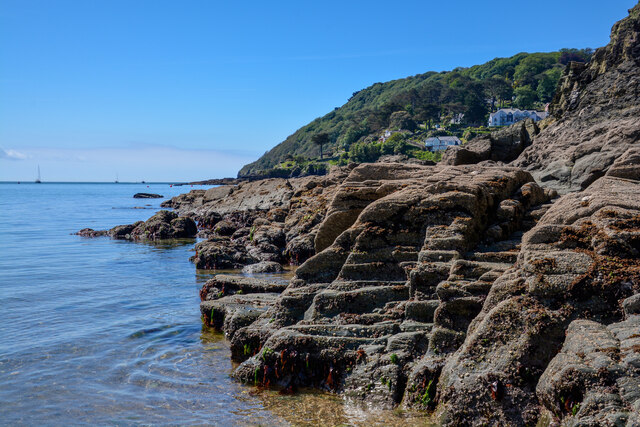
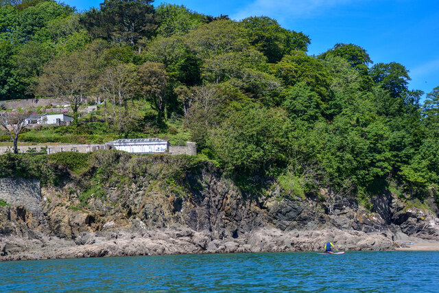
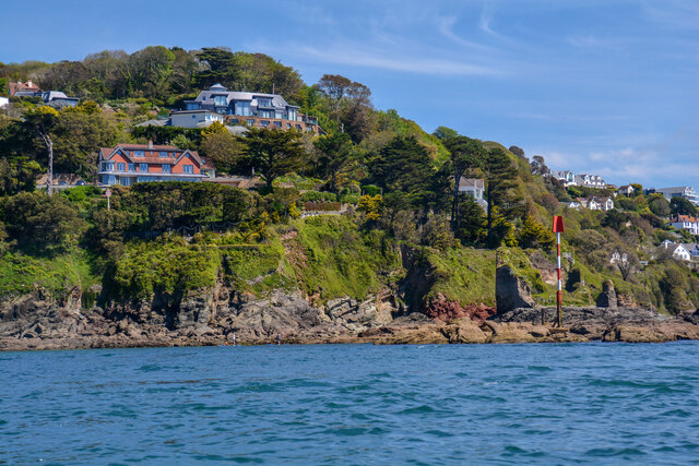
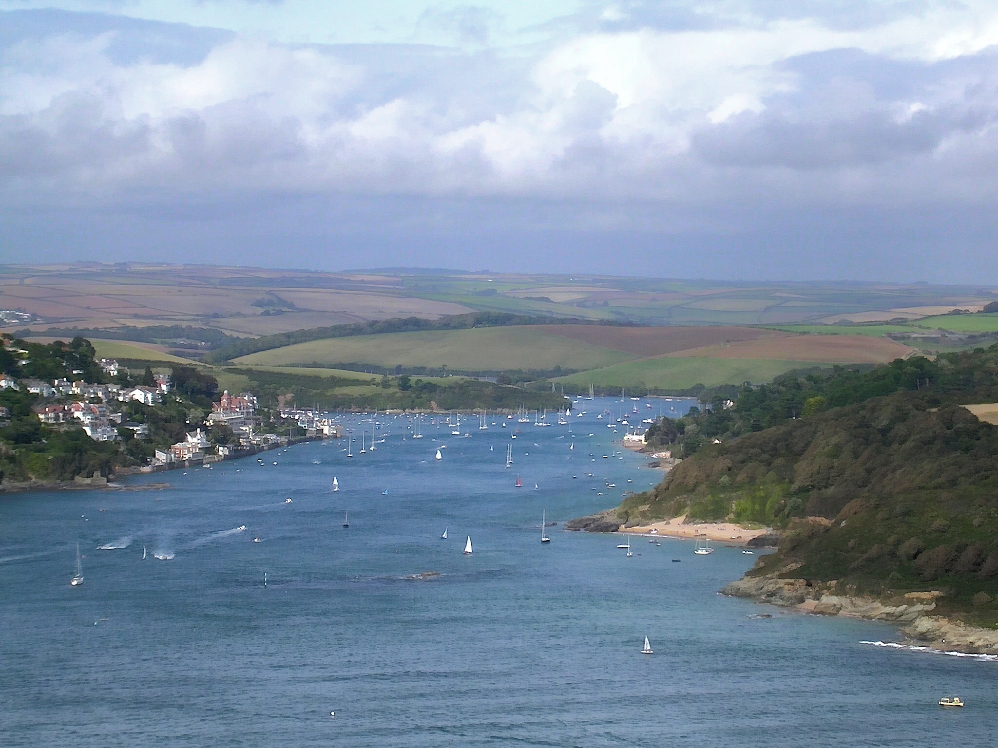
Batson Creek is a picturesque waterway located in the beautiful county of Devon, England. It is situated in the South Hams district, near the charming village of Salcombe. This idyllic creek is part of the Salcombe Estuary, a designated Area of Outstanding Natural Beauty.

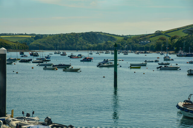
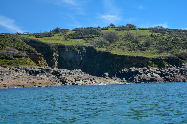
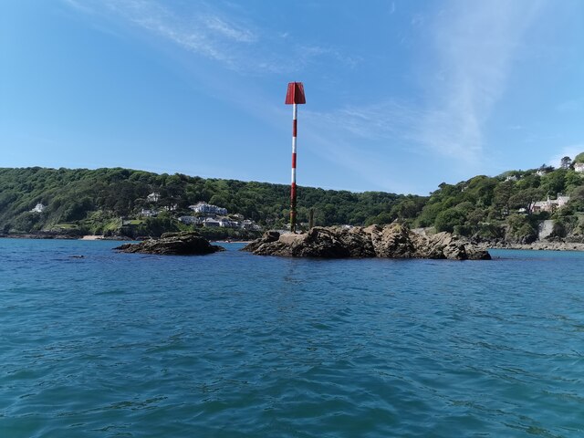
As its name suggests, Batson Creek is primarily a creek, a narrow and winding inlet of the sea. It stretches for approximately 1.5 miles, meandering through lush marshlands and rolling hills. The creek is fed by freshwater streams and tides from the adjacent Salcombe Estuary, creating a unique ecosystem teeming with a diverse range of flora and fauna.

The creek is a haven for wildlife enthusiasts, offering ample opportunities for birdwatching and nature exploration. Visitors can spot a variety of bird species, including herons, oystercatchers, and kingfishers, among others. The surrounding marshes and mudflats provide a rich feeding ground for wading birds and waterfowl.

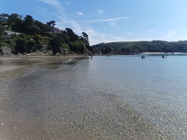
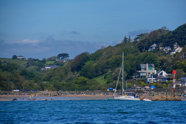
Batson Creek is also a popular destination for boating and water activities. The calm and sheltered waters make it an ideal spot for kayaking, paddleboarding, and sailing. Many visitors also enjoy leisurely walks along the creek, admiring the scenic views and enjoying the tranquility of the area.

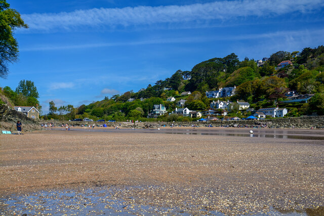
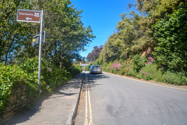
The creek is easily accessible from Salcombe, with several footpaths and trails leading to its banks. The nearby town offers various amenities, including shops, cafes, and accommodations, making it a convenient base for exploring the creek and its surrounding attractions.

Overall, Batson Creek in Devon is a natural gem, offering a peaceful and picturesque setting for nature lovers and outdoor enthusiasts alike.

If you have any feedback on the listing, please let us know in the comments section below.
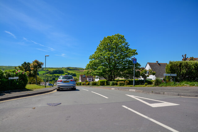
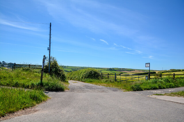
Batson Creek Images

Images are sourced within 2km of 50.240641/-3.7660263 or Grid Reference SX7439. Thanks to Geograph Open Source API. All images are credited.

Boats at Southpool Creek, East Portlemouth
Salcombe : Bay Scenery Looking out into the bay.
Salcombe : Bay Scenery
Looking out into the bay.
Salcombe : Coastal Scenery Looking across the coastline.
Salcombe : Coastal Scenery
Looking across the coastline.
Salcombe : North Sands Looking across the beach.
Salcombe : North Sands
Looking across the beach.
Salcombe : North Sands Looking across the beach.
Salcombe : North Sands
Looking across the beach.
Salcombe : Coastal Scenery Looking towards the rocky shore.
Salcombe : Coastal Scenery
Looking towards the rocky shore.
Salcombe : Coastal Scenery Looking across the coast with Poundstone in view.
Salcombe : Coastal Scenery
Looking across the coast with Poundstone in view.
East Portlemouth : Sunny Cove Looking towards a beach and cove.
East Portlemouth : Sunny Cove
Looking towards a beach and cove.
East Portlemouth : Coastal Scenery A view towards the rocks.
East Portlemouth : Coastal Scenery
A view towards the rocks.
East Portlemouth : Coastal Scenery A view along the coastline.
East Portlemouth : Coastal Scenery
A view along the coastline.
Salcombe : Pound Stone A beacon on the stones.
Salcombe : Pound Stone
A beacon on the stones.
Salcombe : Beadon Road Looking along Beadon Road.
Salcombe : Beadon Road
Looking along Beadon Road.
Salcombe : Beadon Road A road with no entry to vehicles from here.
Salcombe : Beadon Road
A road with no entry to vehicles from here.
Salcombe : A381 Looking along the A381.
Salcombe : A381
Looking along the A381.
Salcombe : Tarmac A tarmac area off Main Road.
Salcombe : Tarmac
A tarmac area off Main Road.
Salcombe : Beadon Road Beadon Road off Main Road.
Salcombe : Beadon Road
Beadon Road off Main Road.
Salcombe : Gulf Petrol Station A Gulf garage off Main Road.
Salcombe : Gulf Petrol Station
A Gulf garage off Main Road.
Salcombe : Track A track to Motherhill Farm.
Salcombe : Track
A track to Motherhill Farm.
Show me another place!

Batson Creek is located at Grid Ref: SX7439 (Lat: 50.240641, Lng: -3.7660263)

Administrative County: Devon

District: South Hams

Police Authority: Devon and Cornwall

What 3 Words

///trails.enlarge.carriage. Near Salcombe, Devon

Related Wikis

Salcombe Lifeboat Station

Salcombe Lifeboat Station is the base for Royal National Lifeboat Institution (RNLI) search and rescue operations at Salcombe, Devon in England. The first...

Hallowe'en (clipper)

Hallowe’en was a 920-ton iron clipper ship. She was built in 1870 by Maudslay, Son & Field at Greenwich, England, for Jock Willis & Sons (commissioned...

Salcombe

Salcombe is a resort town in the South Hams district of Devon, south west England. The town is close to the mouth of the Kingsbridge Estuary, mostly built...

East Portlemouth

East Portlemouth is a small Devon village situated at the southern end of the Kingsbridge Estuary, on the south Devon Coast. The population of this parish...

Kingsbridge Estuary

The Kingsbridge Estuary (also, erroneously, known as the 'Salcombe Estuary') in the South Hams area of Devon, England runs from Kingsbridge in the north...

Salcombe Castle

Salcombe Castle or Fort Charles is a ruined fortification just off the beach of North Sands in Salcombe, Devon, England, within the South Devon Area of...

Overbeck's

Overbeck's Museum and Garden is an Edwardian house and 2.75 hectare (7 acre) garden at Sharpitor, Salcombe, Devon, England. It is named after its last...

RAF Hope Cove

Royal Air Force Hope Cove or more simply RAF Hope Cove is a former Royal Air Force radar station. It is located about 1 mile (1.6 km) south west of Salcombe...

Related Videos

SALCOMBE | Full tour of holiday seaside town of Salcombe in Devon England

Salcombe is a seaside holiday town located between Dartmouth and Plymouth in Devon in South West England. Escape to ...

THE PERFECT HOLIDAY

Hello everyone, welcome to the channel! I hope that I find you well in the New Year. I'm adding this one to the personal travel ...

📍Taking you home 🤗 #travel #uk #sandybeach #morningvibes

Thanks for watching today's video! If you enjoyed, hit the like button and drop a comment below! If are you curious to find more, ...

Shore Fishing Uk | Plaice Fishing | Travel to Salcombe

Join Andy as he travels down to salcombe in Devon for a spot of Plaice fishing from the rocks with great success #fishing ...

Nearby Amenities

Located within 500m of 50.240641,-3.7660263
Coleman's Corner
Place: locality
Lat/Long: 50.2384533/-3.7674134
Source: PGS
Lat/Long: 50.2367307/-3.7661836
Source: PGS
Lat/Long: 50.2394634/-3.7661952
Source: PGS
Lat/Long: 50.2399252/-3.7684797
Source: PGS
Lat/Long: 50.2396685/-3.7692601
Source: PGS
Lat/Long: 50.2400436/-3.7700275
Source: PGS
Lat/Long: 50.2431023/-3.7702088
Source: PGS
Lat/Long: 50.2440603/-3.7702175
Source: PGS
Lat/Long: 50.2436543/-3.7673221
Source: PGS
Lat/Long: 50.2430966/-3.7661308
Source: PGS
Lat/Long: 50.2429831/-3.7659881
Source: PGS
Lat/Long: 50.2427301/-3.7656031
Source: PGS
Lat/Long: 50.2425087/-3.7655312
Source: PGS
Lat/Long: 50.2422814/-3.7652039
Source: PGS
Lat/Long: 50.2419307/-3.7648191
Source: PGS
Lat/Long: 50.2405139/-3.7636472
Pub
The Victoria Inn
Addr City: Salcombe
Addr Postcode: TQ8 8BU
Addr Street: Fore Street
Fhrs Id: 1428641
Source: GPS
Source Addr: FHRS Open Data
Lat/Long: 50.2377682/-3.7674276
Pub
Kings Arms
Addr City: Salcombe
Addr Housenumber: 18
Addr Postcode: TQ8 8BU
Addr Street: Fore Street
Fhrs Id: 1428354
Lat/Long: 50.238001/-3.7672776
Atm
Brand: Cashzone
Brand Wikidata: Q110738461
Cash In: no
Network: Allpoint
Network Wikidata: Q4733264
Operator: Cash Zone
Lat/Long: 50.2378588/-3.7672839
Fire Station
Salcombe Community Fire Station
Addr Postcode: TQ8 8DU
Source: OS OpenData StreetView
Source Postcode: ONS_OpenData_Postcodes
Lat/Long: 50.240252/-3.7699408
Source: PGS
Lat/Long: 50.2405198/-3.7659237
Place Of Worship
Catholic Church
Denomination: catholic
Religion: christian
Source: OS OpenData StreetView
Lat/Long: 50.2365493/-3.7684808
Salcombe Town Museum
Source: OS OpenData StreetView
Tourism: museum
Lat/Long: 50.2383109/-3.7679468
Source: PGS
Lat/Long: 50.2377268/-3.7666792
Pharmacy
Boots
Addr Housenumber: 25-26
Addr Postcode: TQ8 8ET
Addr Street: Fore Street
Brand: Boots
Brand Wikidata: Q6123139
Dispensing: yes
Healthcare: pharmacy
Website: https://www.boots.com/stores/5515-salcombe-fore-street-tq8-8et
Lat/Long: 50.237415/-3.7670915
Fat Face
Brand: Fat Face
Brand Wikidata: Q5437186
Shop: clothes
Lat/Long: 50.2381853/-3.767286
Pub
Dick & Wills
Addr City: Salcombe
Addr Postcode: TQ8 8JG
Addr Street: Fore Street
Fhrs Id: 1428741
Lat/Long: 50.2365573/-3.7665578
Pub
The Fortescue
Addr Postcode: TQ8 8BZ
Addr Street: Union Street
Wikidata: Q26508176
Lat/Long: 50.2388663/-3.7670272
Salcombe Tourist Information
Addr City: Salcombe
Addr Postcode: TQ8 8DE
Addr Street: Market Street
Information: office
Phone: +44 1548 843927
Tourism: information
Lat/Long: 50.2383349/-3.7677868
Salcombe Dairy
Addr City: Salcombe
Addr Postcode: TQ8 8DX
Addr Street: Shadycombe Road
Shop: ice_cream
Lat/Long: 50.2395898/-3.770081
Post Box
Brand: Royal Mail
Brand Wikidata: Q638098
Brand Wikipedia: en:Royal Mail
Collection Times: Mo-Fr 09:00, Sa 07:00
Operator: Royal Mail
Operator Wikidata: Q638098
Post Box Design: type_a
Post Box Type: pillar
Ref: TQ8 24D
Royal Cypher: EIIR
Royal Cypher Wikidata: Q33102113
Source: survey;streetlevel imagery;aerial imagery
Survey Date: 2024-03-02
Lat/Long: 50.2377486/-3.7672698
Post Box
Brand: Royal Mail
Brand Wikidata: Q638098
Brand Wikipedia: en:Royal Mail
Collection Times: Mo-Fr 09:00, Sa 07:00
Operator: Royal Mail
Operator Wikidata: Q638098
Post Box Design: type_b
Post Box Mounting: building
Post Box Type: wall
Ref: TQ8 43D
Royal Cypher: EIIR
Royal Cypher Wikidata: Q33102113
Source: survey;streetlevel imagery;aerial imagery
Survey Date: 2024-03-02
Lat/Long: 50.2384423/-3.7680144
Post Box
Brand: Royal Mail
Brand Wikidata: Q638098
Brand Wikipedia: en:Royal Mail
Collection Times: Mo-Fr 12:00; Sa 11:30; Su off
Operator: Royal Mail
Operator Wikidata: Q638098
Post Box Design: type_b
Post Box Mounting: building
Post Box Type: wall
Ref: TQ8 6
Royal Cypher: GR
Royal Cypher Wikidata: Q33102273
Source: survey;streetlevel imagery;aerial imagery
Lat/Long: 50.2395443/-3.7713484
Pub
Ferry Inn
Addr City: Salcombe
Addr Postcode: TQ8 8JE
Addr Street: Fore Street
Fhrs Id: 1428638
Wikidata: Q26507967
Lat/Long: 50.2362603/-3.766509
Seamark Mooring Category: buoy
Seamark Mooring Colour: yellow
Seamark Mooring Shape: can
Seamark Type: mooring
Lat/Long: 50.2367423/-3.7641083
Seamark Mooring Category: buoy
Seamark Mooring Colour: yellow
Seamark Mooring Shape: can
Seamark Type: mooring
Lat/Long: 50.2369432/-3.7634287
Seamark Mooring Category: buoy
Seamark Mooring Colour: red
Seamark Mooring Shape: can
Seamark Type: mooring
Lat/Long: 50.2369906/-3.7643637
Seamark Mooring Category: buoy
Seamark Mooring Colour: yellow
Seamark Mooring Shape: can
Seamark Type: mooring
Lat/Long: 50.2372026/-3.7627934
Seamark Mooring Category: buoy
Seamark Mooring Colour: red
Seamark Mooring Shape: can
Seamark Type: mooring
Lat/Long: 50.2372556/-3.7635078
Seamark Mooring Category: buoy
Seamark Mooring Colour: yellow
Seamark Mooring Shape: can
Seamark Type: mooring
Lat/Long: 50.237388/-3.7624259
Seamark Mooring Category: buoy
Seamark Mooring Colour: red
Seamark Mooring Shape: can
Seamark Type: mooring
Lat/Long: 50.2374012/-3.7632283
Seamark Mooring Category: buoy
Seamark Mooring Colour: red
Seamark Mooring Shape: can
Seamark Type: mooring
Lat/Long: 50.2375469/-3.762897
Seamark Mooring Category: buoy
Seamark Mooring Colour: red
Seamark Mooring Shape: can
Seamark Type: mooring
Lat/Long: 50.2377522/-3.7624466
Seamark Mooring Category: buoy
Seamark Mooring Colour: yellow
Seamark Mooring Shape: can
Seamark Type: mooring
Lat/Long: 50.2378085/-3.7615924
Seamark Mooring Category: buoy
Seamark Mooring Colour: red
Seamark Mooring Shape: can
Seamark Type: mooring
Lat/Long: 50.2379409/-3.7620066
Seamark Mooring Category: buoy
Seamark Mooring Colour: yellow
Seamark Mooring Shape: can
Seamark Type: mooring
Lat/Long: 50.2367794/-3.7625473
Seamark Mooring Category: buoy
Seamark Mooring Colour: yellow
Seamark Mooring Shape: can
Seamark Type: mooring
Lat/Long: 50.2370791/-3.7618957
Seamark Beacon Lateral Category: port
Seamark Beacon Lateral Colour: red
Seamark Beacon Lateral System: iala-a
Seamark Light Character: Q
Seamark Light Colour: red
Seamark Topmark Colour: red
Seamark Topmark Shape: cylinder
Seamark Type: beacon_lateral
Lat/Long: 50.2371583/-3.7655217
Seamark Beacon Lateral Category: starboard
Seamark Beacon Lateral Colour: green
Seamark Beacon Lateral System: iala-a
Seamark Light Character: Q
Seamark Light Colour: green
Seamark Topmark Colour: green
Seamark Topmark Shape: cone, point up
Seamark Type: beacon_lateral
Lat/Long: 50.2371397/-3.7649247
Seamark Beacon Lateral Category: starboard
Seamark Beacon Lateral Colour: green
Seamark Beacon Lateral System: iala-a
Seamark Light Character: Q
Seamark Light Colour: green
Seamark Topmark Colour: green
Seamark Topmark Shape: cone, point up
Seamark Type: beacon_lateral
Lat/Long: 50.2374865/-3.7652837
Seamark Beacon Lateral Category: starboard
Seamark Beacon Lateral Colour: green
Seamark Beacon Lateral System: iala-a
Seamark Light Character: Q
Seamark Light Colour: green
Seamark Topmark Colour: green
Seamark Topmark Shape: cone, point up
Seamark Type: beacon_lateral
Lat/Long: 50.2378279/-3.7656198
Seamark Beacon Lateral Category: starboard
Seamark Beacon Lateral Colour: green
Seamark Beacon Lateral System: iala-a
Seamark Light Character: Q
Seamark Light Colour: green
Seamark Topmark Colour: green
Seamark Topmark Shape: cone, point up
Seamark Type: beacon_lateral
Lat/Long: 50.2382169/-3.7657276
Batson Slipway
Leisure: slipway
Lat/Long: 50.2418975/-3.7674745
Customs Quay
Place: locality
Lat/Long: 50.2387018/-3.7666006
Victoria Quay
Place: locality
Lat/Long: 50.239079/-3.7665689
Source: PGS
Lat/Long: 50.2405007/-3.7665884
Source: PGS
Lat/Long: 50.2405115/-3.7663053
Snapes Point
Place: locality
Lat/Long: 50.2401622/-3.7608505
Shadycombe Creek
Place: locality
Lat/Long: 50.2404967/-3.7676734
Historic: lime_Kiln
Man Made: kiln
Product: quicklime
Lat/Long: 50.2440272/-3.7706242
Batson Creek
Place: locality
Lat/Long: 50.2423187/-3.7666277
Ferry Terminal
Ferry: yes
Public Transport: station
Seamark Light Character: F
Seamark Light Colour: red
Seamark Light Height: 4
Seamark Light Range: 3
Seamark Light Reference: A 0224
Seamark Type: light_minor
Source: US NGA Pub. 114. 2011-05-26.
Lat/Long: 50.2363453/-3.7660957
Leisure: playground
Lat/Long: 50.2377049/-3.7689235
Tappers Quay
Place: locality
Lat/Long: 50.2404633/-3.7662128
Brewery Quay
Place: locality
Lat/Long: 50.2403035/-3.7671579
Fishermans Quay
Place: locality
Lat/Long: 50.2411687/-3.7669249
Toilets
Fee: no
Wheelchair: yes
Lat/Long: 50.2403789/-3.7697621
Man Made: water_works
Lat/Long: 50.2409687/-3.7688267
Whitestrand
Leisure: slipway
Lat/Long: 50.2377655/-3.7665865
Bench
Backrest: yes
Survey Date: 2022-08-20
Lat/Long: 50.2377602/-3.7667848
Bus Stop
Courtenay Park
Bench: no
Bus: yes
Covered: no
Operator: Tally Ho!
Public Transport: platform
Shelter: no
Lat/Long: 50.2375794/-3.7697046
Bus Stop
Shadycombe Road
Bench: no
Bin: yes
Bus: yes
Covered: no
Lit: yes
Naptan AtcoCode: 1100DEA10153
Naptan NaptanCode: dvnawjwt
Operator: Tally Ho!
Public Transport: platform
Shelter: yes
Tactile Paving: no
Lat/Long: 50.2390213/-3.77016
Source: PGS
Lat/Long: 50.2437352/-3.7690179
Source: PGS
Lat/Long: 50.2436626/-3.7687236
Source: PGS
Lat/Long: 50.2434673/-3.7670027
Source: PGS
Lat/Long: 50.2433438/-3.766638
Source: PGS
Lat/Long: 50.2411138/-3.7644738
Source: PGS
Lat/Long: 50.2409158/-3.7641254
Source: PGS
Lat/Long: 50.2400836/-3.7632791
Source: PGS
Lat/Long: 50.239928/-3.763028
Source: PGS
Lat/Long: 50.2396695/-3.7625838
Source: PGS
Lat/Long: 50.2396729/-3.7622793
Source: PGS
Lat/Long: 50.2393435/-3.7613363
Source: PGS
Lat/Long: 50.2393994/-3.7604821
Source: PGS
Lat/Long: 50.2395331/-3.7598804
Source: PGS
Lat/Long: 50.239714/-3.7595787
Source: PGS
Lat/Long: 50.2399513/-3.7593697
Source: PGS
Lat/Long: 50.2402752/-3.7593468
Defibrillator
Defibrillator Location: On outside wall of toilet building next to ferry landing pontoon
Emergency: defibrillator
Ref GB The Circuit: EB752460-67C4-4987-B938-ADB300F7E532
Survey Date: 2024-03-02
Lat/Long: 50.2380095/-3.7669248
Ilbertstowe Point
Place: locality
Lat/Long: 50.2406741/-3.7593881
Salcombe Holiday Homes
Addr Housenumber: 1-2
Addr Postcode: TQ8 8QE
Addr Street: Island Street
Phone: +44 1548 843485
Shop: travel_agency
Lat/Long: 50.2395952/-3.7699409
Restaurant
Captain Flint’s
Addr Housenumber: 82
Addr Postcode: TQ8 8BY
Addr Street: Fore Street
Cuisine: burger;chicken;fish;ice_cream;pasta;pizza;seafood;steak_house
Diet Vegan: yes
Email: captainflints@captainflints.co.uk
Opening Hours: Th-Sa 18:00-21:15
Operator: Andy&Jane
Phone: +44 1548 842357
Website: http://www.captainflints.co.uk
Lat/Long: 50.2387112/-3.7674514
Shadycombe
Place: locality
Lat/Long: 50.2407827/-3.7709606
Leisure: slipway
Lat/Long: 50.2413866/-3.7668729
Direction: 165
Generator Method: photovoltaic
Generator Output Electricity: yes
Generator Solar Modules: 12
Generator Source: solar
Generator Type: solar_photovoltaic_panel
Location: roof
Power: generator
Lat/Long: 50.2390551/-3.7718886
Direction: S
Generator Method: photovoltaic
Generator Output Electricity: yes
Generator Solar Modules: 47
Generator Source: solar
Generator Type: solar_photovoltaic_panel
Location: roof
Power: generator
Lat/Long: 50.2400893/-3.7678848
Direction: WSW
Generator Method: photovoltaic
Generator Output Electricity: yes
Generator Solar Modules: 6
Generator Source: solar
Generator Type: solar_photovoltaic_panel
Location: roof
Power: generator
Lat/Long: 50.2402422/-3.7700075
The Baltic Exchange III
Water Rescue
Emergency: water_rescue
Operator: Royal National Lifeboat Institution
Operator Short: RNLI
Operator Wikidata: Q2166873
Ref: 16-09
Seamark Name: The Baltic Exchange III
Seamark Radio Station Category: ais
Seamark Radio Station Mmsi: 235050655
Seamark Rescue Station Category: lifeboat_on_mooring
Seamark Source: Bing; https://rnli.org/find-my-nearest
Seamark Type: rescue_station
Website: https://rnli.org/find-my-nearest/lifeboat-stations/salcombe-lifeboat-station/salcombe-lifeboats
Lat/Long: 50.238966/-3.7658758
Post Box
Brand: Royal Mail
Brand Wikidata: Q638098
Brand Wikipedia: en:Royal Mail
Collection Times: Mo-Fr 10:00; Sa 10:00; Su off
Operator: Royal Mail
Operator Wikidata: Q638098
Post Box Design: type_b
Post Box Mounting: stone_wall
Post Box Type: wall
Ref: TQ8 17
Royal Cypher: GR
Royal Cypher Wikidata: Q33102273
Source: survey;streetlevel imagery;aerial imagery
Lat/Long: 50.2370629/-3.7688641
Bench
Backrest: yes
Lat/Long: 50.2403065/-3.7693469
Source: PGS
Lat/Long: 50.2430401/-3.7695791
Source: PGS
Lat/Long: 50.2427827/-3.76853
Source: PGS
Lat/Long: 50.2423514/-3.7680348
Source: PGS
Lat/Long: 50.2414376/-3.7668902
Source: PGS
Lat/Long: 50.2411127/-3.7664944
Source: PGS
Lat/Long: 50.2409436/-3.7670869
Source: PGS
Lat/Long: 50.240811/-3.767983
Source: PGS
Lat/Long: 50.240811/-3.767983
Source: PGS
Lat/Long: 50.240811/-3.767983
Source: PGS
Lat/Long: 50.2402983/-3.767965
Source: PGS
Lat/Long: 50.2402983/-3.767965
Source: PGS
Lat/Long: 50.2402983/-3.767965
Source: PGS
Lat/Long: 50.24025/-3.7684656
Source: PGS
Lat/Long: 50.24025/-3.7684656
Co-op Food
Brand: Co-op Food
Brand Wikidata: Q3277439
Operator: The Co-operative Group
Operator Wikidata: Q117202
Shop: convenience
Website: https://www.coop.co.uk/store-finder/TQ8-8FN/gould-road
Lat/Long: 50.2399377/-3.770365
Bench
Survey Date: 2022-08-20
Lat/Long: 50.2404234/-3.7692422
Bench
Backrest: yes
Survey Date: 2022-08-20
Lat/Long: 50.2403244/-3.7693066
Bench
Backrest: yes
Survey Date: 2022-08-20
Lat/Long: 50.240366/-3.7693732
Life Ring
Emergency: life_ring
Survey Date: 2022-08-20
Lat/Long: 50.2389554/-3.7659721
Life Ring
Emergency: life_ring
Survey Date: 2022-08-20
Lat/Long: 50.237963/-3.766619
Bench
Backrest: yes
Survey Date: 2022-08-20
Lat/Long: 50.2376962/-3.7665813
Life Ring
Emergency: life_ring
Survey Date: 2022-08-20
Lat/Long: 50.2363467/-3.7663265
Bench
Survey Date: 2022-08-20
Lat/Long: 50.2403404/-3.7694311
Life Ring
Emergency: life_ring
Survey Date: 2022-08-20
Lat/Long: 50.2401603/-3.7696793
Bench
Backrest: yes
Survey Date: 2022-08-20
Lat/Long: 50.2395672/-3.7663489
Waste Basket
Survey Date: 2022-08-20
Lat/Long: 50.2384925/-3.7671424
Waste Basket
Survey Date: 2022-08-20
Lat/Long: 50.2379938/-3.7669063
Bench
Backrest: yes
Survey Date: 2022-08-20
Lat/Long: 50.2380034/-3.7667963
Bench
Backrest: yes
Survey Date: 2022-08-20
Lat/Long: 50.2379245/-3.7667809
Bench
Backrest: yes
Survey Date: 2022-08-20
Lat/Long: 50.237902/-3.7667472
Fire Hydrant
Emergency: fire_hydrant
Fire Hydrant Type: underground
Survey Date: 2022-08-20
Lat/Long: 50.2378289/-3.7699035
Fire Hydrant
Emergency: fire_hydrant
Fire Hydrant Type: underground
Survey Date: 2022-08-20
Lat/Long: 50.2384253/-3.7696317
Waste Basket
Survey Date: 2022-08-20
Lat/Long: 50.2390443/-3.7701202
Waste Basket
Survey Date: 2022-08-20
Lat/Long: 50.2397723/-3.7702086
Fire Hydrant
Emergency: fire_hydrant
Fire Hydrant Diameter: 110
Fire Hydrant Position: lane
Fire Hydrant Type: underground
Survey Date: 2022-08-20
Lat/Long: 50.2399164/-3.7667213
Waste Basket
Survey Date: 2022-08-20
Lat/Long: 50.2397104/-3.7665845
Bench
Backrest: yes
Survey Date: 2022-08-20
Lat/Long: 50.2396301/-3.7663492
Bench
Backrest: yes
Survey Date: 2022-08-20
Lat/Long: 50.2391434/-3.7664922
Life Ring
Emergency: life_ring
Survey Date: 2022-08-20
Lat/Long: 50.2385865/-3.7666856
Bench
Backrest: yes
Survey Date: 2022-08-20
Lat/Long: 50.2378786/-3.7667652
Bench
Backrest: yes
Survey Date: 2022-08-20
Lat/Long: 50.2378218/-3.766793
Waste Basket
Survey Date: 2022-08-20
Lat/Long: 50.2377314/-3.766922
Waste Basket
Survey Date: 2022-08-20
Lat/Long: 50.2363958/-3.766549
Fire Hydrant
Emergency: fire_hydrant
Fire Hydrant Diameter: 110
Fire Hydrant Position: lane
Fire Hydrant Type: underground
Survey Date: 2022-08-20
Lat/Long: 50.2397293/-3.7690591
Life Ring
Emergency: life_ring
Survey Date: 2022-08-20
Lat/Long: 50.2403115/-3.7677583
Bench
Backrest: yes
Survey Date: 2022-08-20
Lat/Long: 50.2396662/-3.7663466
Bench
Backrest: yes
Survey Date: 2022-08-20
Lat/Long: 50.2396054/-3.7663527
Bench
Backrest: yes
Survey Date: 2022-08-20
Lat/Long: 50.2395881/-3.7663511
Bench
Backrest: yes
Survey Date: 2022-08-20
Lat/Long: 50.2391694/-3.7664741
Bench
Backrest: yes
Survey Date: 2022-08-20
Lat/Long: 50.2390668/-3.7665721
Life Ring
Emergency: life_ring
Survey Date: 2022-08-20
Lat/Long: 50.239041/-3.7666111
Waste Basket
Survey Date: 2022-08-20
Lat/Long: 50.2390156/-3.766617
Waste Basket
Survey Date: 2022-08-20
Lat/Long: 50.2387508/-3.7668236
Waste Basket
Survey Date: 2022-08-20
Lat/Long: 50.2384901/-3.7674515
Waste Basket
Survey Date: 2022-08-20
Lat/Long: 50.2378034/-3.7672173
Waste Basket
Survey Date: 2022-08-20
Lat/Long: 50.2377406/-3.7672242
Bench
Backrest: yes
Survey Date: 2022-08-20
Lat/Long: 50.2379761/-3.7667684
Bench
Backrest: yes
Survey Date: 2022-08-20
Lat/Long: 50.2378388/-3.7667962
Bench
Backrest: yes
Survey Date: 2022-08-20
Lat/Long: 50.2378031/-3.7667894
Bench
Backrest: yes
Survey Date: 2022-08-20
Lat/Long: 50.2377839/-3.7667884
Fire Hydrant
Emergency: fire_hydrant
Fire Hydrant Type: underground
Survey Date: 2022-08-20
Lat/Long: 50.2376931/-3.7666223
Bench
Backrest: yes
Survey Date: 2022-08-20
Lat/Long: 50.236396/-3.7663768
Fire Hydrant
Emergency: fire_hydrant
Fire Hydrant Position: lane
Fire Hydrant Type: underground
Survey Date: 2022-08-20
Lat/Long: 50.2362051/-3.7668611
Recycling
Recycling Clothes: no
Recycling Glass Bottles: yes
Recycling Paper: no
Recycling Plastic: no
Recycling Type: container
Survey Date: 2022-08-20
Lat/Long: 50.239379/-3.7705798
Bench
Backrest: yes
Survey Date: 2022-08-20
Lat/Long: 50.238478/-3.7670343
Waste Basket
Survey Date: 2022-08-20
Lat/Long: 50.2378784/-3.7670063
Bench
Backrest: yes
Survey Date: 2022-08-20
Lat/Long: 50.2376951/-3.766556
Life Ring
Emergency: life_ring
Survey Date: 2022-08-20
Lat/Long: 50.2377274/-3.76654
Waste Basket
Survey Date: 2022-08-20
Lat/Long: 50.2399545/-3.7702875
Bench
Backrest: yes
Survey Date: 2022-08-20
Lat/Long: 50.2379501/-3.7667556
Bench
Survey Date: 2022-08-20
Lat/Long: 50.2402886/-3.7698066
Shelter
Lat/Long: 50.2363598/-3.7663214
Ferry Terminal
Ferry: yes
Public Transport: station
Source: PGS
Lat/Long: 50.2379655/-3.7662413
Bicycle Parking
Survey Date: 2024-03-02
Lat/Long: 50.237999/-3.7669068
Telephone
Booth: KXCash
Survey Date: 2024-03-02
Lat/Long: 50.2378644/-3.7672508
Fire Hydrant
Emergency: fire_hydrant
Fire Hydrant Type: underground
Survey Date: 2024-03-02
Lat/Long: 50.2384749/-3.7674475
Fire Hydrant
Emergency: fire_hydrant
Survey Date: 2024-03-02
Lat/Long: 50.2385702/-3.7680224
Defibrillator
Defibrillator Location: On outside wall of church building, facing cemetary
Emergency: defibrillator
Indoor: no
Survey Date: 2024-03-02
Lat/Long: 50.2392316/-3.7683945
Fire Hydrant
Emergency: fire_hydrant
Survey Date: 2024-03-02
Lat/Long: 50.2387044/-3.7667289
Charging Station
Survey Date: 2024-03-02
Lat/Long: 50.2405812/-3.7689894
Bench
Survey Date: 2024-03-02
Lat/Long: 50.240625/-3.7690735
Bench
Survey Date: 2024-03-02
Lat/Long: 50.2406587/-3.7690384
Bench
Survey Date: 2024-03-02
Lat/Long: 50.2406886/-3.7689936
Bench
Backrest: yes
Survey Date: 2024-03-02
Lat/Long: 50.2407519/-3.7688894
Bench
Backrest: yes
Survey Date: 2024-03-02
Lat/Long: 50.2430059/-3.7695927
Waste Basket
Survey Date: 2024-03-02
Waste: dog_excrement
Lat/Long: 50.2429803/-3.7698619
Bench
Survey Date: 2024-03-02
Waste: dog_excrement
Lat/Long: 50.2430219/-3.7702747
Bench
Backrest: yes
Survey Date: 2024-03-02
Lat/Long: 50.2430752/-3.7709076
The data included in this document is from www.openstreetmap.org. The data is made available under ODbL.

Have you been to Batson Creek?

Leave your review of Batson Creek below (or comments, questions and feedback).