Snapes Point

Coastal Feature, Headland, Point in Devon South Hams

England

Snapes Point

Salcombe : Bay Scenery Looking out into the bay.
Salcombe : Bay Scenery Credit: Lewis Clarke

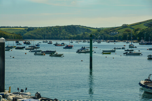
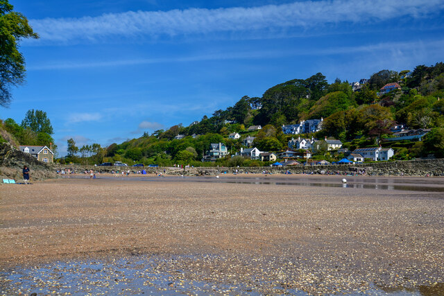
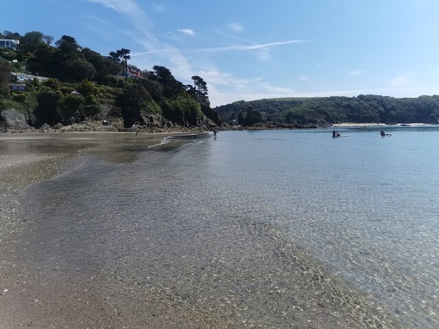
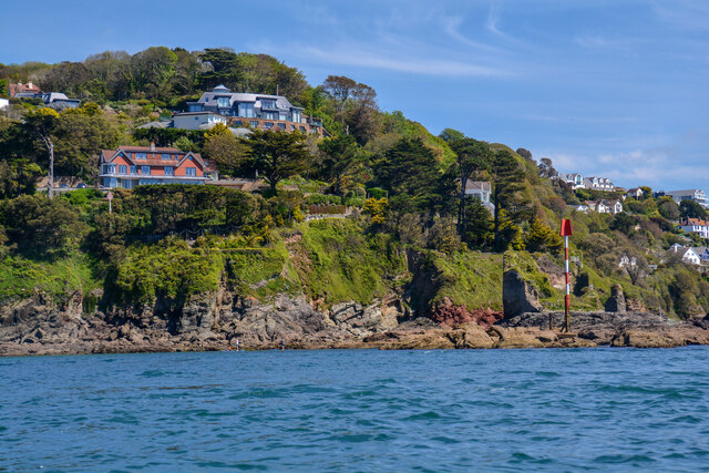
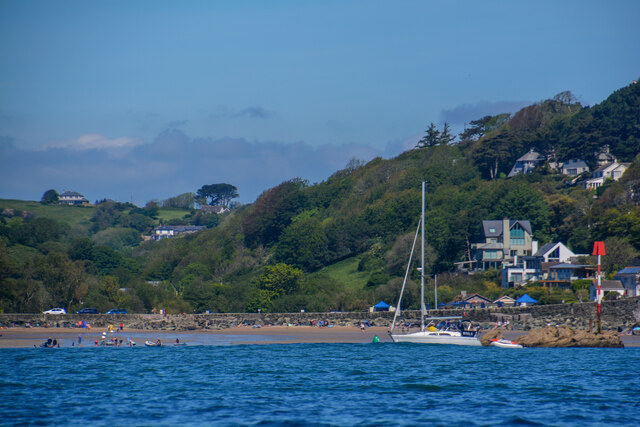
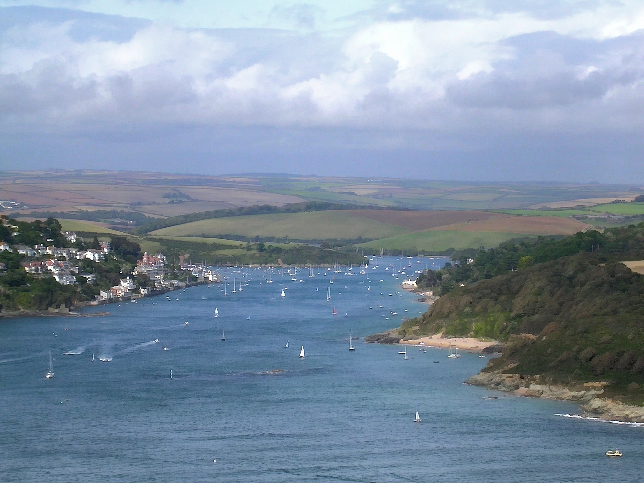
Snapes Point is a prominent coastal feature located in Devon, England. Situated on the southern coast of the county, it is a picturesque headland that stretches out into the English Channel. This point boasts stunning panoramic views of the surrounding landscape, making it a popular destination for locals and tourists alike.

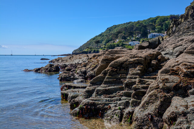
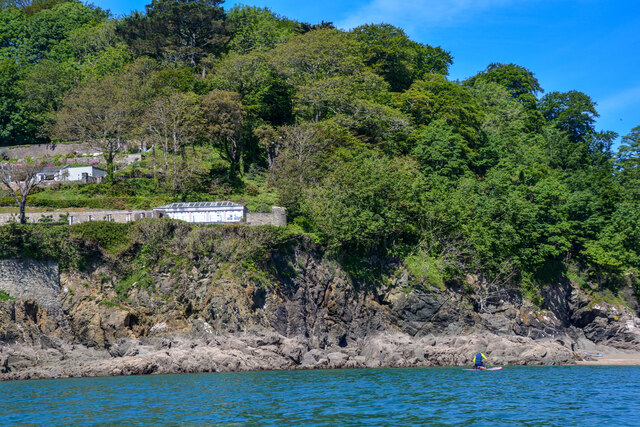
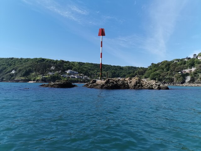
The headland itself is characterized by rugged cliffs that offer a dramatic backdrop to the vibrant blue waters below. The cliffs are composed of various sedimentary rock formations, displaying layers that provide a glimpse into the geological history of the region. Visitors can observe the effects of erosion on the cliffs, as well as the presence of fossils embedded within the rocks.

Snapes Point is also known for its diverse wildlife. The surrounding area is home to a variety of seabirds, including gulls, cormorants, and even the occasional sighting of a peregrine falcon. The nearby waters are teeming with marine life, with seals often spotted basking on the rocks or swimming in the shallows.

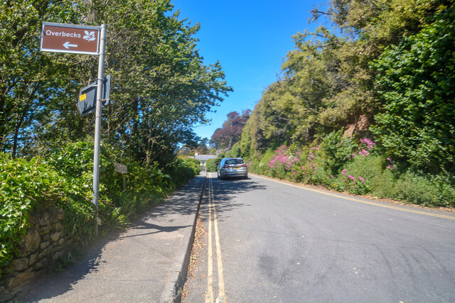
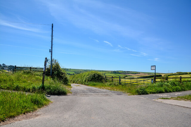
Access to Snapes Point is provided by a footpath that leads from the nearby coastal village of Salcombe. This path takes visitors through a beautiful coastal landscape, featuring heathland, grassy slopes, and wildflowers. The journey to the point is a pleasant experience in itself, allowing visitors to immerse themselves in the natural beauty of the area.

Overall, Snapes Point offers a captivating coastal experience, combining stunning views, geological interest, and abundant wildlife. Whether for a leisurely stroll, birdwatching, or simply enjoying the peaceful atmosphere, this headland is a must-visit destination for nature enthusiasts and those seeking a tranquil escape in Devon.

If you have any feedback on the listing, please let us know in the comments section below.
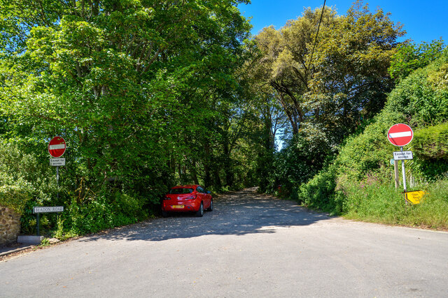
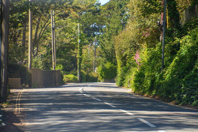
Snapes Point Images

Images are sourced within 2km of 50.240336/-3.7612328 or Grid Reference SX7439. Thanks to Geograph Open Source API. All images are credited.

Salcombe : Bay Scenery Looking out into the bay.
Salcombe : Bay Scenery
Looking out into the bay.
Salcombe : Coastal Scenery Looking across the coastline.
Salcombe : Coastal Scenery
Looking across the coastline.
Salcombe : North Sands Looking across the beach.
Salcombe : North Sands
Looking across the beach.
Salcombe : North Sands Looking across the beach.
Salcombe : North Sands
Looking across the beach.
Salcombe : Coastal Scenery Looking towards the rocky shore.
Salcombe : Coastal Scenery
Looking towards the rocky shore.
Salcombe : Coastal Scenery Looking across the coast with Poundstone in view.
Salcombe : Coastal Scenery
Looking across the coast with Poundstone in view.
East Portlemouth : Sunny Cove Looking towards a beach and cove.
East Portlemouth : Sunny Cove
Looking towards a beach and cove.
East Portlemouth : Coastal Scenery A view along the coastline.
East Portlemouth : Coastal Scenery
A view along the coastline.
Salcombe : Pound Stone A beacon on the stones.
Salcombe : Pound Stone
A beacon on the stones.
Salcombe : Beadon Road Looking along Beadon Road.
Salcombe : Beadon Road
Looking along Beadon Road.
Salcombe : Beadon Road A road with no entry to vehicles from here.
Salcombe : Beadon Road
A road with no entry to vehicles from here.
Salcombe : A381 Looking along the A381.
Salcombe : A381
Looking along the A381.
Salcombe : Tarmac A tarmac area off Main Road.
Salcombe : Tarmac
A tarmac area off Main Road.
Salcombe : Beadon Road Beadon Road off Main Road.
Salcombe : Beadon Road
Beadon Road off Main Road.
Salcombe : Gulf Petrol Station A Gulf garage off Main Road.
Salcombe : Gulf Petrol Station
A Gulf garage off Main Road.
Salcombe : Track A track to Motherhill Farm.
Salcombe : Track
A track to Motherhill Farm.
Beadon Road Salcombe
The 164 bus to Salcombe leaving the Devon Road stop
Show me another place!

Snapes Point is located at Grid Ref: SX7439 (Lat: 50.240336, Lng: -3.7612328)

Administrative County: Devon

District: South Hams

Police Authority: Devon and Cornwall

What 3 Words

///weedy.trail.character. Near Salcombe, Devon

Related Wikis

Hallowe'en (clipper)

Hallowe’en was a 920-ton iron clipper ship. She was built in 1870 by Maudslay, Son & Field at Greenwich, England, for Jock Willis & Sons (commissioned...

Salcombe Lifeboat Station

Salcombe Lifeboat Station is the base for Royal National Lifeboat Institution (RNLI) search and rescue operations at Salcombe, Devon in England. The first...

East Portlemouth

East Portlemouth is a village and civil parish in the South Hams district, in the county of Devon, England, situated at the southern end of the Kingsbridge...

Kingsbridge Estuary

The Kingsbridge Estuary (also, erroneously, known as the 'Salcombe Estuary') in the South Hams area of Devon, England runs from Kingsbridge in the north...

Nearby Amenities

Located within 500m of 50.240336,-3.7612328
Coleman's Corner
Place: locality
Lat/Long: 50.2384533/-3.7674134
Source: PGS
Lat/Long: 50.2411281/-3.7553281
Source: PGS
Lat/Long: 50.2408203/-3.7563901
Source: PGS
Lat/Long: 50.2394634/-3.7661952
Source: PGS
Lat/Long: 50.2430966/-3.7661308
Source: PGS
Lat/Long: 50.2429831/-3.7659881
Source: PGS
Lat/Long: 50.2427301/-3.7656031
Source: PGS
Lat/Long: 50.2425087/-3.7655312
Source: PGS
Lat/Long: 50.2422814/-3.7652039
Source: PGS
Lat/Long: 50.2419307/-3.7648191
Source: PGS
Lat/Long: 50.2405139/-3.7636472
Source: PGS
Lat/Long: 50.240469/-3.7588727
Source: PGS
Lat/Long: 50.2401102/-3.7551005
Source: PGS
Lat/Long: 50.2367906/-3.7570416
Source: PGS
Lat/Long: 50.2364939/-3.7587803
Source: PGS
Lat/Long: 50.2363488/-3.7607831
Source: PGS
Lat/Long: 50.2405198/-3.7659237
Source: PGS
Lat/Long: 50.2377268/-3.7666792
Seamark Light Category: lower
Seamark Light Character: Q
Seamark Light Colour: white
Seamark Light Height: 5
Seamark Light Range: 8
Seamark Light Reference: A 0222
Seamark Type: light_minor
Source: US NGA Pub. 114. 2011-05-26.
Lat/Long: 50.2425938/-3.7552128
Kerb: no
Lat/Long: 50.23625/-3.7595
Fat Face
Brand: Fat Face
Brand Wikidata: Q5437186
Shop: clothes
Lat/Long: 50.2381853/-3.767286
Pub
The Fortescue
Addr Postcode: TQ8 8BZ
Addr Street: Union Street
Wikidata: Q26508176
Lat/Long: 50.2388663/-3.7670272
Seamark Mooring Category: buoy
Seamark Mooring Colour: yellow
Seamark Mooring Shape: can
Seamark Type: mooring
Lat/Long: 50.2367423/-3.7641083
Seamark Mooring Category: buoy
Seamark Mooring Colour: yellow
Seamark Mooring Shape: can
Seamark Type: mooring
Lat/Long: 50.2369432/-3.7634287
Seamark Mooring Category: buoy
Seamark Mooring Colour: red
Seamark Mooring Shape: can
Seamark Type: mooring
Lat/Long: 50.2369906/-3.7643637
Seamark Mooring Category: buoy
Seamark Mooring Colour: yellow
Seamark Mooring Shape: can
Seamark Type: mooring
Lat/Long: 50.2372026/-3.7627934
Seamark Mooring Category: buoy
Seamark Mooring Colour: red
Seamark Mooring Shape: can
Seamark Type: mooring
Lat/Long: 50.2372556/-3.7635078
Seamark Mooring Category: buoy
Seamark Mooring Colour: yellow
Seamark Mooring Shape: can
Seamark Type: mooring
Lat/Long: 50.237388/-3.7624259
Seamark Mooring Category: buoy
Seamark Mooring Colour: red
Seamark Mooring Shape: can
Seamark Type: mooring
Lat/Long: 50.2374012/-3.7632283
Seamark Mooring Category: buoy
Seamark Mooring Colour: red
Seamark Mooring Shape: can
Seamark Type: mooring
Lat/Long: 50.2375469/-3.762897
Seamark Mooring Category: buoy
Seamark Mooring Colour: red
Seamark Mooring Shape: can
Seamark Type: mooring
Lat/Long: 50.2377522/-3.7624466
Seamark Mooring Category: buoy
Seamark Mooring Colour: yellow
Seamark Mooring Shape: can
Seamark Type: mooring
Lat/Long: 50.2378085/-3.7615924
Seamark Mooring Category: buoy
Seamark Mooring Colour: red
Seamark Mooring Shape: can
Seamark Type: mooring
Lat/Long: 50.2379409/-3.7620066
Seamark Mooring Category: buoy
Seamark Mooring Colour: yellow
Seamark Mooring Shape: can
Seamark Type: mooring
Lat/Long: 50.2367794/-3.7625473
Seamark Mooring Category: buoy
Seamark Mooring Colour: yellow
Seamark Mooring Shape: can
Seamark Type: mooring
Lat/Long: 50.2370791/-3.7618957
Seamark Beacon Lateral Category: port
Seamark Beacon Lateral Colour: red
Seamark Beacon Lateral System: iala-a
Seamark Light Character: Q
Seamark Light Colour: red
Seamark Topmark Colour: red
Seamark Topmark Shape: cylinder
Seamark Type: beacon_lateral
Lat/Long: 50.2371583/-3.7655217
Seamark Beacon Lateral Category: starboard
Seamark Beacon Lateral Colour: green
Seamark Beacon Lateral System: iala-a
Seamark Light Character: Q
Seamark Light Colour: green
Seamark Topmark Colour: green
Seamark Topmark Shape: cone, point up
Seamark Type: beacon_lateral
Lat/Long: 50.2371397/-3.7649247
Seamark Mooring Category: buoy
Seamark Mooring Colour: yellow
Seamark Mooring Shape: can
Seamark Type: mooring
Lat/Long: 50.2373437/-3.7612039
Seamark Beacon Lateral Category: starboard
Seamark Beacon Lateral Colour: green
Seamark Beacon Lateral System: iala-a
Seamark Light Character: Q
Seamark Light Colour: green
Seamark Topmark Colour: green
Seamark Topmark Shape: cone, point up
Seamark Type: beacon_lateral
Lat/Long: 50.2374865/-3.7652837
Seamark Beacon Lateral Category: starboard
Seamark Beacon Lateral Colour: green
Seamark Beacon Lateral System: iala-a
Seamark Light Character: Q
Seamark Light Colour: green
Seamark Topmark Colour: green
Seamark Topmark Shape: cone, point up
Seamark Type: beacon_lateral
Lat/Long: 50.2378279/-3.7656198
Seamark Beacon Lateral Category: starboard
Seamark Beacon Lateral Colour: green
Seamark Beacon Lateral System: iala-a
Seamark Light Character: Q
Seamark Light Colour: green
Seamark Topmark Colour: green
Seamark Topmark Shape: cone, point up
Seamark Type: beacon_lateral
Lat/Long: 50.2382169/-3.7657276
Batson Slipway
Leisure: slipway
Lat/Long: 50.2418975/-3.7674745
Ditch End
Place: locality
Lat/Long: 50.2365434/-3.7594746
Customs Quay
Place: locality
Lat/Long: 50.2387018/-3.7666006
Victoria Quay
Place: locality
Lat/Long: 50.239079/-3.7665689
Source: PGS
Lat/Long: 50.2405007/-3.7665884
Source: PGS
Lat/Long: 50.2405115/-3.7663053
Snapes Point
Place: locality
Lat/Long: 50.2401622/-3.7608505
Scoble Point
Place: locality
Lat/Long: 50.2408469/-3.7560194
Shadycombe Creek
Place: locality
Lat/Long: 50.2404967/-3.7676734
Batson Creek
Place: locality
Lat/Long: 50.2423187/-3.7666277
Fuel Barge
Seamark Small Craft Facility Category: fuel_station
Seamark Type: small_craft_facility
Waterway: fuel
Lat/Long: 50.2376241/-3.7604302
Crossways
Place: locality
Lat/Long: 50.2382761/-3.7585687
Ditchend Cove
Place: locality
Lat/Long: 50.2367533/-3.7575365
Tappers Quay
Place: locality
Lat/Long: 50.2404633/-3.7662128
Brewery Quay
Place: locality
Lat/Long: 50.2403035/-3.7671579
Fishermans Quay
Place: locality
Lat/Long: 50.2411687/-3.7669249
Black Knob Point
Place: locality
Lat/Long: 50.2446459/-3.7604964
Ox Point
Place: locality
Lat/Long: 50.2435647/-3.7566948
Whitestrand
Leisure: slipway
Lat/Long: 50.2377655/-3.7665865
Bench
Backrest: yes
Survey Date: 2022-08-20
Lat/Long: 50.2377602/-3.7667848
Source: PGS
Lat/Long: 50.237498/-3.75594
Source: PGS
Lat/Long: 50.2372926/-3.7565925
Source: PGS
Lat/Long: 50.2371115/-3.756851
Source: PGS
Lat/Long: 50.2411138/-3.7644738
Source: PGS
Lat/Long: 50.2409158/-3.7641254
Source: PGS
Lat/Long: 50.2400836/-3.7632791
Source: PGS
Lat/Long: 50.239928/-3.763028
Source: PGS
Lat/Long: 50.2396695/-3.7625838
Source: PGS
Lat/Long: 50.2396729/-3.7622793
Source: PGS
Lat/Long: 50.2393435/-3.7613363
Source: PGS
Lat/Long: 50.2393994/-3.7604821
Source: PGS
Lat/Long: 50.2395331/-3.7598804
Source: PGS
Lat/Long: 50.239714/-3.7595787
Source: PGS
Lat/Long: 50.2399513/-3.7593697
Source: PGS
Lat/Long: 50.2402752/-3.7593468
Defibrillator
Defibrillator Location: On outside wall of toilet building next to ferry landing pontoon
Emergency: defibrillator
Ref GB The Circuit: EB752460-67C4-4987-B938-ADB300F7E532
Survey Date: 2024-03-02
Lat/Long: 50.2380095/-3.7669248
Ilbertstowe Point
Place: locality
Lat/Long: 50.2406741/-3.7593881
Restaurant
Captain Flint’s
Addr Housenumber: 82
Addr Postcode: TQ8 8BY
Addr Street: Fore Street
Cuisine: burger;chicken;fish;ice_cream;pasta;pizza;seafood;steak_house
Diet Vegan: yes
Email: captainflints@captainflints.co.uk
Opening Hours: Th-Sa 18:00-21:15
Operator: Andy&Jane
Phone: +44 1548 842357
Website: http://www.captainflints.co.uk
Lat/Long: 50.2387112/-3.7674514
Leisure: slipway
Lat/Long: 50.2413866/-3.7668729
Direction: SSE
Generator Method: photovoltaic
Generator Output Electricity: yes
Generator Solar Modules: 12
Generator Source: solar
Generator Type: solar_photovoltaic_panel
Location: roof
Power: generator
Lat/Long: 50.2361302/-3.7610424
Direction: S
Generator Method: photovoltaic
Generator Output Electricity: yes
Generator Solar Modules: 47
Generator Source: solar
Generator Type: solar_photovoltaic_panel
Location: roof
Power: generator
Lat/Long: 50.2400893/-3.7678848
The Baltic Exchange III
Water Rescue
Emergency: water_rescue
Operator: Royal National Lifeboat Institution
Operator Short: RNLI
Operator Wikidata: Q2166873
Ref: 16-09
Seamark Name: The Baltic Exchange III
Seamark Radio Station Category: ais
Seamark Radio Station Mmsi: 235050655
Seamark Rescue Station Category: lifeboat_on_mooring
Seamark Source: Bing; https://rnli.org/find-my-nearest
Seamark Type: rescue_station
Website: https://rnli.org/find-my-nearest/lifeboat-stations/salcombe-lifeboat-station/salcombe-lifeboats
Lat/Long: 50.238966/-3.7658758
Waste Basket
Survey Date: 2022-03-19
Lat/Long: 50.2362812/-3.7593914
Source: PGS
Lat/Long: 50.2414376/-3.7668902
Source: PGS
Lat/Long: 50.2411127/-3.7664944
Source: PGS
Lat/Long: 50.2409436/-3.7670869
Source: PGS
Lat/Long: 50.240811/-3.767983
Source: PGS
Lat/Long: 50.240811/-3.767983
Source: PGS
Lat/Long: 50.240811/-3.767983
Source: PGS
Lat/Long: 50.2402983/-3.767965
Source: PGS
Lat/Long: 50.2402983/-3.767965
Source: PGS
Lat/Long: 50.2402983/-3.767965
Life Ring
Emergency: life_ring
Survey Date: 2022-08-20
Lat/Long: 50.2389554/-3.7659721
Life Ring
Emergency: life_ring
Survey Date: 2022-08-20
Lat/Long: 50.237963/-3.766619
Bench
Backrest: yes
Survey Date: 2022-08-20
Lat/Long: 50.2376962/-3.7665813
Bench
Backrest: yes
Survey Date: 2022-08-20
Lat/Long: 50.2395672/-3.7663489
Waste Basket
Survey Date: 2022-08-20
Lat/Long: 50.2384925/-3.7671424
Waste Basket
Survey Date: 2022-08-20
Lat/Long: 50.2379938/-3.7669063
Bench
Backrest: yes
Survey Date: 2022-08-20
Lat/Long: 50.2380034/-3.7667963
Bench
Backrest: yes
Survey Date: 2022-08-20
Lat/Long: 50.2379245/-3.7667809
Bench
Backrest: yes
Survey Date: 2022-08-20
Lat/Long: 50.237902/-3.7667472
Fire Hydrant
Emergency: fire_hydrant
Fire Hydrant Diameter: 110
Fire Hydrant Position: lane
Fire Hydrant Type: underground
Survey Date: 2022-08-20
Lat/Long: 50.2399164/-3.7667213
Waste Basket
Survey Date: 2022-08-20
Lat/Long: 50.2397104/-3.7665845
Bench
Backrest: yes
Survey Date: 2022-08-20
Lat/Long: 50.2396301/-3.7663492
Bench
Backrest: yes
Survey Date: 2022-08-20
Lat/Long: 50.2391434/-3.7664922
Life Ring
Emergency: life_ring
Survey Date: 2022-08-20
Lat/Long: 50.2385865/-3.7666856
Bench
Backrest: yes
Survey Date: 2022-08-20
Lat/Long: 50.2378786/-3.7667652
Bench
Backrest: yes
Survey Date: 2022-08-20
Lat/Long: 50.2378218/-3.766793
Waste Basket
Survey Date: 2022-08-20
Lat/Long: 50.2377314/-3.766922
Life Ring
Emergency: life_ring
Survey Date: 2022-08-20
Lat/Long: 50.2403115/-3.7677583
Bench
Backrest: yes
Survey Date: 2022-08-20
Lat/Long: 50.2396662/-3.7663466
Bench
Backrest: yes
Survey Date: 2022-08-20
Lat/Long: 50.2396054/-3.7663527
Bench
Backrest: yes
Survey Date: 2022-08-20
Lat/Long: 50.2395881/-3.7663511
Bench
Backrest: yes
Survey Date: 2022-08-20
Lat/Long: 50.2391694/-3.7664741
Bench
Backrest: yes
Survey Date: 2022-08-20
Lat/Long: 50.2390668/-3.7665721
Life Ring
Emergency: life_ring
Survey Date: 2022-08-20
Lat/Long: 50.239041/-3.7666111
Waste Basket
Survey Date: 2022-08-20
Lat/Long: 50.2390156/-3.766617
Waste Basket
Survey Date: 2022-08-20
Lat/Long: 50.2387508/-3.7668236
Waste Basket
Survey Date: 2022-08-20
Lat/Long: 50.2384901/-3.7674515
Bench
Backrest: yes
Survey Date: 2022-08-20
Lat/Long: 50.2379761/-3.7667684
Bench
Backrest: yes
Survey Date: 2022-08-20
Lat/Long: 50.2378388/-3.7667962
Bench
Backrest: yes
Survey Date: 2022-08-20
Lat/Long: 50.2378031/-3.7667894
Bench
Backrest: yes
Survey Date: 2022-08-20
Lat/Long: 50.2377839/-3.7667884
Fire Hydrant
Emergency: fire_hydrant
Fire Hydrant Type: underground
Survey Date: 2022-08-20
Lat/Long: 50.2376931/-3.7666223
Bench
Backrest: yes
Survey Date: 2022-08-20
Lat/Long: 50.238478/-3.7670343
Waste Basket
Survey Date: 2022-08-20
Lat/Long: 50.2378784/-3.7670063
Bench
Backrest: yes
Survey Date: 2022-08-20
Lat/Long: 50.2376951/-3.766556
Life Ring
Emergency: life_ring
Survey Date: 2022-08-20
Lat/Long: 50.2377274/-3.76654
Bench
Backrest: yes
Survey Date: 2022-08-20
Lat/Long: 50.2379501/-3.7667556
Ferry Terminal
Ferry: yes
Public Transport: station
Source: PGS
Lat/Long: 50.2379655/-3.7662413
Bicycle Parking
Survey Date: 2024-03-02
Lat/Long: 50.237999/-3.7669068
Fire Hydrant
Emergency: fire_hydrant
Fire Hydrant Type: underground
Survey Date: 2024-03-02
Lat/Long: 50.2384749/-3.7674475
Fire Hydrant
Emergency: fire_hydrant
Survey Date: 2024-03-02
Lat/Long: 50.2387044/-3.7667289
The data included in this document is from www.openstreetmap.org. The data is made available under ODbL.

Have you been to Snapes Point?

Leave your review of Snapes Point below (or comments, questions and feedback).