Bellhouse Rock

Coastal Feature, Headland, Point in Devon South Hams

England

Bellhouse Rock

Salcombe : Coastal Scenery Looking across the coastline.
Salcombe : Coastal Scenery Credit: Lewis Clarke

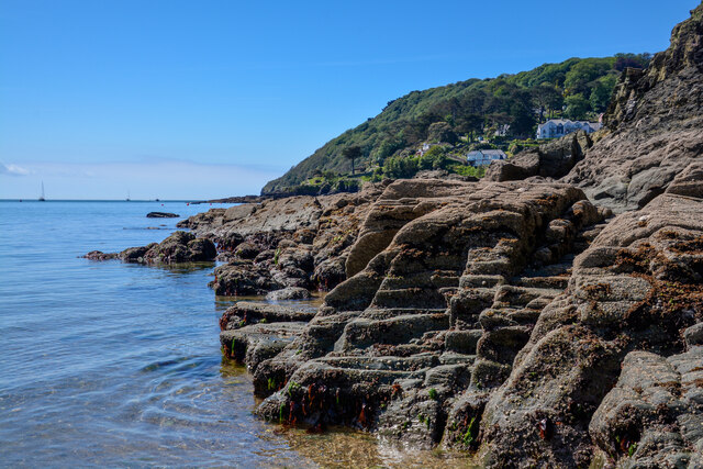
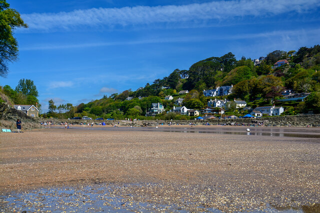
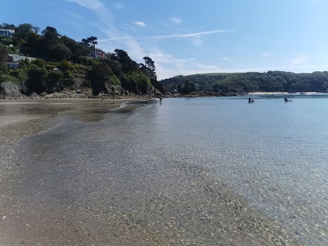
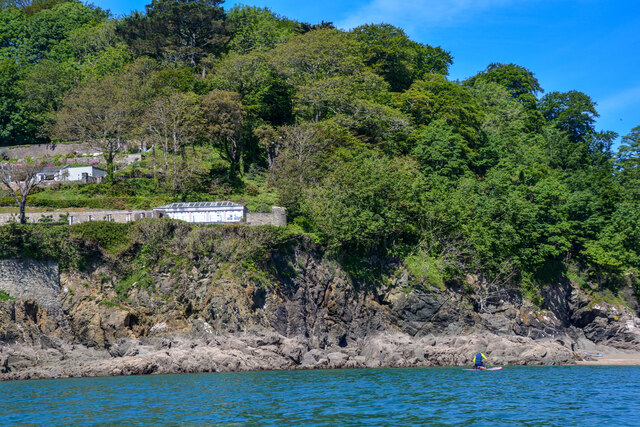
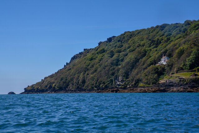
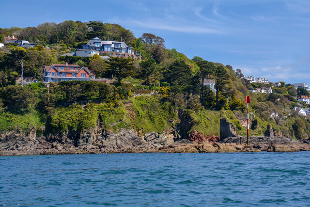
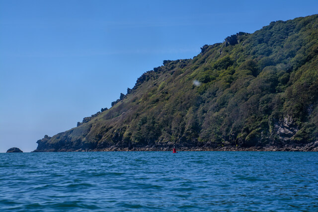
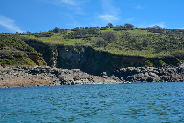
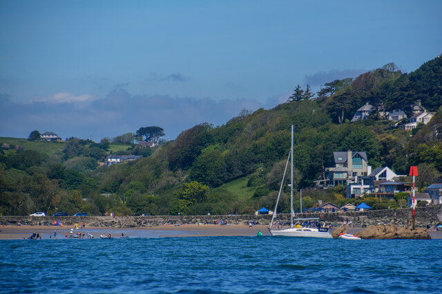
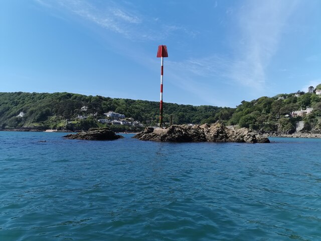
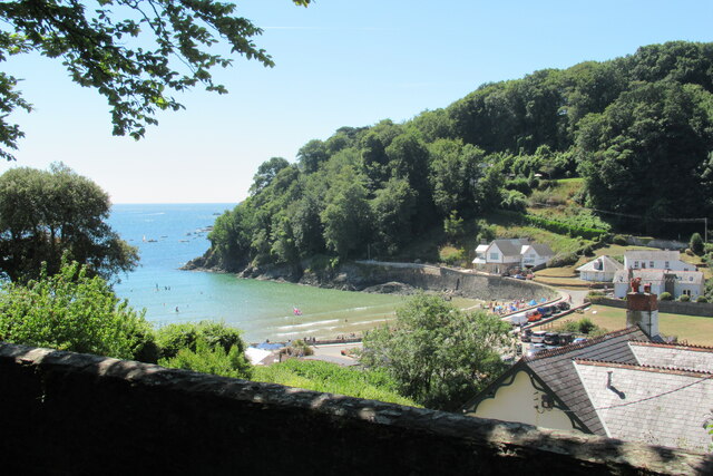
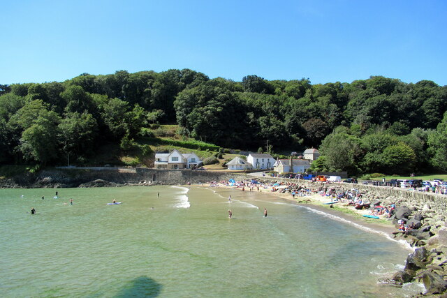
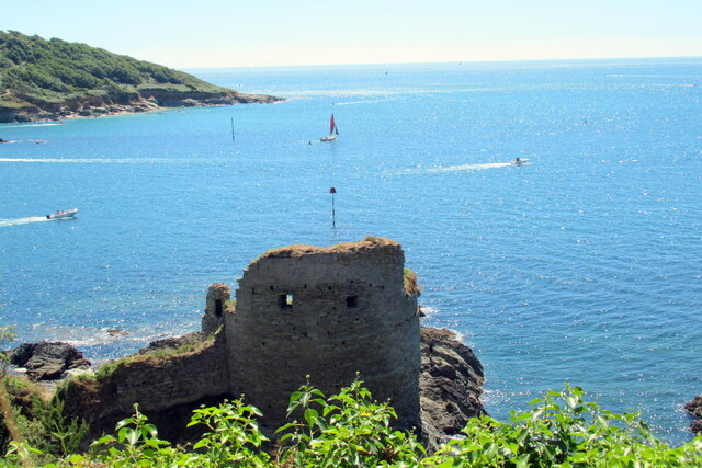
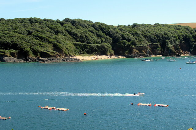
Bellhouse Rock is a prominent coastal feature located in Devon, England. This headland juts out into the sea, offering stunning views of the surrounding coastline and the open ocean. The rock is made of rugged cliffs that rise dramatically from the water, creating a striking and picturesque landscape.

At low tide, Bellhouse Rock is accessible by foot, allowing visitors to explore the rock pools and caves that are revealed along the shoreline. The area is popular with hikers and nature enthusiasts, who come to enjoy the rugged beauty of the coastline and observe the diverse wildlife that calls this area home.

Bellhouse Rock is also a popular spot for birdwatching, with a variety of seabirds nesting on the cliffs and offshore islands. The headland is a designated Site of Special Scientific Interest, due to its important geological and ecological features.

Overall, Bellhouse Rock is a must-visit destination for anyone looking to experience the beauty and tranquility of the Devon coastline. Its rugged cliffs, stunning views, and diverse wildlife make it a truly special place to explore and enjoy.

If you have any feedback on the listing, please let us know in the comments section below.

Bellhouse Rock Images

Images are sourced within 2km of 50.214307/-3.7859384 or Grid Reference SX7236. Thanks to Geograph Open Source API. All images are credited.

Salcombe : Coastal Scenery Looking across the coastline.
Salcombe : Coastal Scenery
Looking across the coastline.
Salcombe : North Sands Looking across the beach.
Salcombe : North Sands
Looking across the beach.
Salcombe : North Sands Looking across the beach.
Salcombe : North Sands
Looking across the beach.
Salcombe : Coastal Scenery Looking towards the rocky shore.
Salcombe : Coastal Scenery
Looking towards the rocky shore.
Salcombe : Bolt Head Looking across the coastline.
Salcombe : Bolt Head
Looking across the coastline.
Salcombe : Coastal Scenery Looking across the coast with Poundstone in view.
Salcombe : Coastal Scenery
Looking across the coast with Poundstone in view.
Salcombe : Bolt Head A view towards Bolt Head.
Salcombe : Bolt Head
A view towards Bolt Head.
East Portlemouth : Sunny Cove Looking towards a beach and cove.
East Portlemouth : Sunny Cove
Looking towards a beach and cove.
East Portlemouth : Coastal Scenery A view towards the rocks.
East Portlemouth : Coastal Scenery
A view towards the rocks.
East Portlemouth : Coastal Scenery A view along the coastline.
East Portlemouth : Coastal Scenery
A view along the coastline.
East Portlemouth : Coastal Scenery A house with a view overlooking the bay.
East Portlemouth : Coastal Scenery
A house with a view overlooking the bay.
Salcombe : Pound Stone A beacon on the stones.
Salcombe : Pound Stone
A beacon on the stones.
Salcombe : Beadon Road Looking along Beadon Road.
Salcombe : Beadon Road
Looking along Beadon Road.
Salcombe North Beach from Sandhills Road
Salcombe North Beach
Fort Charles, Salcombe
Salcombe estuary looking towards Sunny Cove
Overbecks An Edwardian house owned by the National Trust. It is named after its last private owner Otto Christop Joseph Gerhardt Ludwig Overbeck (1860–1937).  The house is currently closed to the public but the 7 acre gardens are open.
Overbecks
An Edwardian house owned by the National Trust. It is named after its last private owner Otto Christop Joseph Gerhardt Ludwig Overbeck (1860–1937). The house is currently closed to the public but the 7 acre gardens are open.
Show me another place!

Bellhouse Rock is located at Grid Ref: SX7236 (Lat: 50.214307, Lng: -3.7859384)

Administrative County: Devon

District: South Hams

Police Authority: Devon and Cornwall

What 3 Words

///miracles.theory.apple. Near Salcombe, Devon

Related Wikis

Bolt Head

Bolt Head is a National Trust headland on the South Coast of Devon, England, United Kingdom, situated west of the Kingsbridge Estuary. It is a popular...

Overbeck's

Overbeck's Museum and Garden is an Edwardian house and 2.75 hectare (7 acre) garden at Sharpitor, Salcombe, Devon, England. It is named after its last...

RAF Hope Cove

Royal Air Force Hope Cove or more simply RAF Hope Cove is a former Royal Air Force radar station. It is located about 1 mile (1.6 km) south west of Salcombe...

RAF Bolt Head

Royal Air Force Bolt Head or more simply RAF Bolt Head is a former Royal Air Force satellite airfield 1 mile (1.6 km) south west of Salcombe on the south...

Nearby Amenities

Located within 500m of 50.214307,-3.7859384
Source: PGS
Lat/Long: 50.2106517/-3.7848464
Source: PGS
Lat/Long: 50.2106776/-3.7847526
Source: PGS
Lat/Long: 50.2110111/-3.7846957
Source: PGS
Lat/Long: 50.2117391/-3.7850685
Source: PGS
Lat/Long: 50.2122226/-3.7855813
Source: PGS
Lat/Long: 50.2148748/-3.7861843
Bolt Head
Place: locality
Source: NPE
Lat/Long: 50.2110959/-3.7878884
Bench
Backrest: yes
Lat/Long: 50.2167306/-3.7838495
Tourism: viewpoint
Lat/Long: 50.2159024/-3.7822851
Starehole Bay
Alt Name: Starhole Bay
Place: locality
Source: npe
Lat/Long: 50.2134427/-3.7840775
Sharp Tor Toposcope
Description: In memory of W Newton Drew
Information: map
Map Type: toposcope
Tourism: information
Lat/Long: 50.216631/-3.7836228
Tourism: viewpoint
Lat/Long: 50.2165905/-3.783493
Seamark Buoy Lateral Category: port
Seamark Buoy Lateral Colour: red
Seamark Buoy Lateral Shape: can
Seamark Buoy Lateral System: iala-a
Seamark Type: buoy_lateral
Lat/Long: 50.2141604/-3.7841423
Starehole Cove
Place: locality
Lat/Long: 50.2147294/-3.7852992
Bellhouse Rock
Place: locality
Lat/Long: 50.214334/-3.7860346
Sharp Tor
Place: locality
Lat/Long: 50.216034/-3.7828267
Herzogin Cecilie
Historic: wreck
Seamark Type: wreck
Wikidata: Q1463082
Wikipedia: en:Herzogin Cecilie
Wreck Date Sunk: 1936
Wreck Visible At High Tide: no
Wreck Visible At Low Tide: yes
Lat/Long: 50.2144256/-3.7850299
Great Eelstone
Place: locality
Lat/Long: 50.2157777/-3.781218
Little Eelstone
Place: locality
Lat/Long: 50.2163802/-3.780593
Cadmus Rocks
Place: locality
Lat/Long: 50.215048/-3.7813454
Bench
Backrest: no
Lat/Long: 50.2158358/-3.7852811
Bench
Backrest: no
Lat/Long: 50.2158742/-3.7849698
Bench
Backrest: no
Lat/Long: 50.2171365/-3.7824978
Bench
Backrest: no
Lat/Long: 50.2117248/-3.787907
Bench
Backrest: no
Lat/Long: 50.2117224/-3.788731
Old Gamp
Place: locality
Lat/Long: 50.2141461/-3.7868652
Middle Gamp
Place: locality
Lat/Long: 50.2150249/-3.7862375
New Gamp
Place: locality
Lat/Long: 50.2153853/-3.7851057
Archaeological Site: settlement
Historic: archaeological_site
Inscription: Danish settlement
Lat/Long: 50.2155146/-3.7889994
The data included in this document is from www.openstreetmap.org. The data is made available under ODbL.

Have you been to Bellhouse Rock?

Leave your review of Bellhouse Rock below (or comments, questions and feedback).