Starehole Cove

Sea, Estuary, Creek in Devon

England

Starehole Cove

Salcombe : Coastal Scenery Looking across the coastline.
Salcombe : Coastal Scenery Credit: Lewis Clarke

Starehole Cove is a picturesque coastal location nestled in the county of Devon, England. Situated just south of the charming village of Salcombe, this idyllic cove offers visitors a serene and captivating experience.

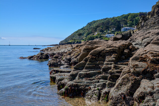
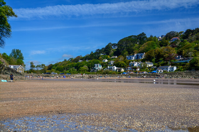
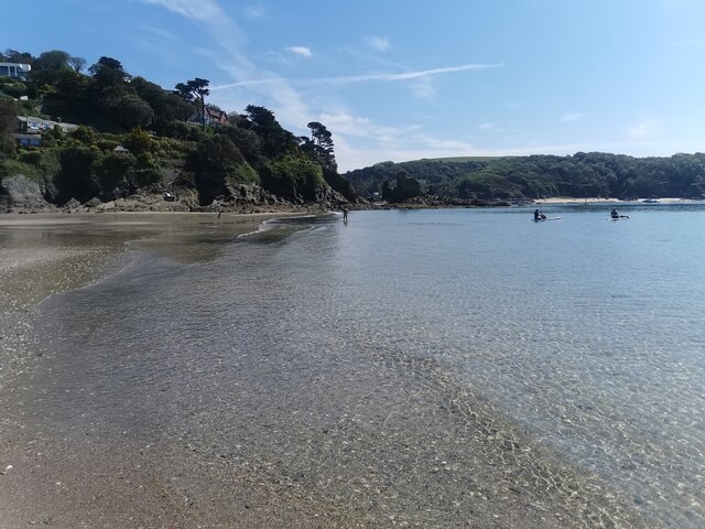
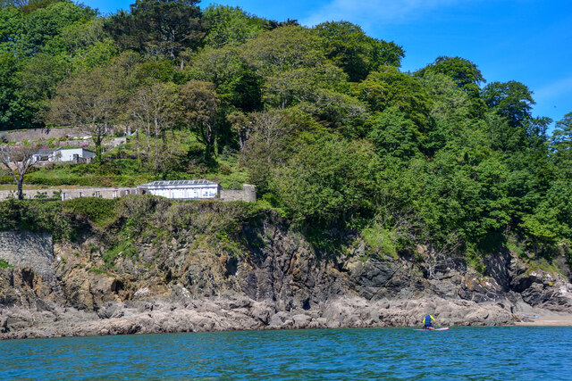
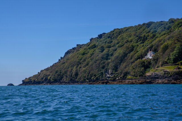
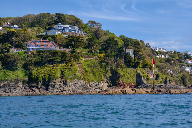
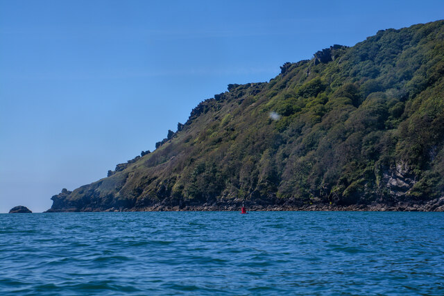
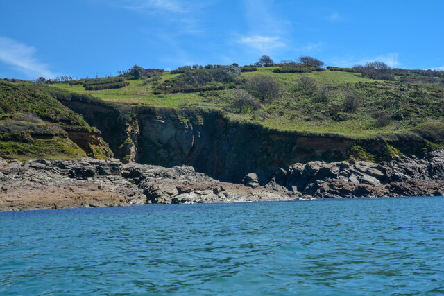
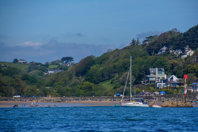
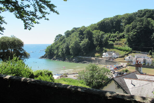
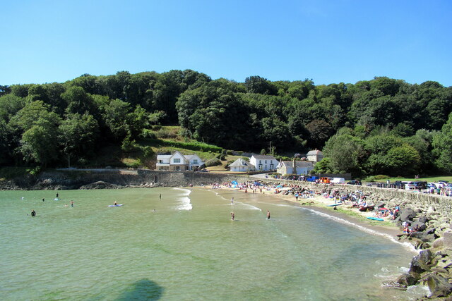
The cove is defined by its stunning natural beauty, with a combination of rugged cliffs, golden sandy beaches, and crystal-clear turquoise waters. It is a popular spot for beachgoers, sunbathers, and water sports enthusiasts alike. The cove is surrounded by lush greenery and rolling hills, providing a dramatic backdrop to the coastal scenery.

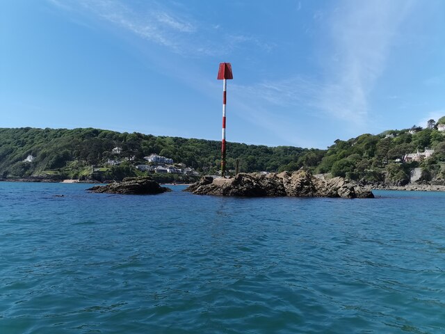
Starehole Cove is unique in that it is not only a seafront destination but also an estuary and creek. The Salcombe Estuary, renowned for its breathtaking views and wildlife diversity, meets the sea at this location. This convergence creates a fascinating ecosystem and an abundance of marine life. Visitors can witness a variety of bird species, such as cormorants and gulls, as well as occasional sightings of seals and dolphins.

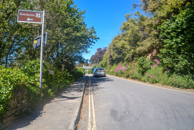
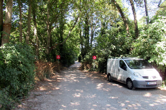
The cove is accessible via a footpath, which winds its way through the countryside and offers breathtaking panoramic views along the way. It is a popular starting point for coastal walks, where visitors can explore the surrounding cliffs, enjoy the fresh sea breeze, and take in the panoramic vistas.

Starehole Cove is a hidden gem in Devon, offering a peaceful and unspoiled coastal experience. Whether you are seeking relaxation on the beach, exploration of the estuary, or simply a retreat into nature, Starehole Cove is a destination that promises to captivate and rejuvenate.

If you have any feedback on the listing, please let us know in the comments section below.

Starehole Cove Images

Images are sourced within 2km of 50.214767/-3.7858995 or Grid Reference SX7236. Thanks to Geograph Open Source API. All images are credited.

Salcombe : Coastal Scenery Looking across the coastline.
Salcombe : Coastal Scenery
Looking across the coastline.
Salcombe : North Sands Looking across the beach.
Salcombe : North Sands
Looking across the beach.
Salcombe : North Sands Looking across the beach.
Salcombe : North Sands
Looking across the beach.
Salcombe : Coastal Scenery Looking towards the rocky shore.
Salcombe : Coastal Scenery
Looking towards the rocky shore.
Salcombe : Bolt Head Looking across the coastline.
Salcombe : Bolt Head
Looking across the coastline.
Salcombe : Coastal Scenery Looking across the coast with Poundstone in view.
Salcombe : Coastal Scenery
Looking across the coast with Poundstone in view.
Salcombe : Bolt Head A view towards Bolt Head.
Salcombe : Bolt Head
A view towards Bolt Head.
East Portlemouth : Sunny Cove Looking towards a beach and cove.
East Portlemouth : Sunny Cove
Looking towards a beach and cove.
East Portlemouth : Coastal Scenery A view towards the rocks.
East Portlemouth : Coastal Scenery
A view towards the rocks.
East Portlemouth : Coastal Scenery A view along the coastline.
East Portlemouth : Coastal Scenery
A view along the coastline.
East Portlemouth : Coastal Scenery A house with a view overlooking the bay.
East Portlemouth : Coastal Scenery
A house with a view overlooking the bay.
Salcombe : Pound Stone A beacon on the stones.
Salcombe : Pound Stone
A beacon on the stones.
Salcombe : Beadon Road Looking along Beadon Road.
Salcombe : Beadon Road
Looking along Beadon Road.
Salcombe : Beadon Road A road with no entry to vehicles from here.
Salcombe : Beadon Road
A road with no entry to vehicles from here.
Track and path from Beadon Road, Salcombe
Salcombe North Beach from Sandhills Road
Salcombe North Beach
Fort Charles, Salcombe
Show me another place!

Starehole Cove is located at Grid Ref: SX7236 (Lat: 50.214767, Lng: -3.7858995)

Administrative County: Devon

Police Authority: Devon and Cornwall

What 3 Words

///snug.extremely.stack. Near Salcombe, Devon

Related Wikis

Bolt Head

Bolt Head is a National Trust headland on the South Coast of Devon, England, United Kingdom, situated west of the Kingsbridge Estuary. It is a popular...

Overbeck's

Overbeck's Museum and Garden is an Edwardian house and 2.75 hectare (7 acre) garden at Sharpitor, Salcombe, Devon, England. It is named after its last...

RAF Hope Cove

Royal Air Force Hope Cove or more simply RAF Hope Cove is a former Royal Air Force radar station. It is located about 1 mile (1.6 km) south west of Salcombe...
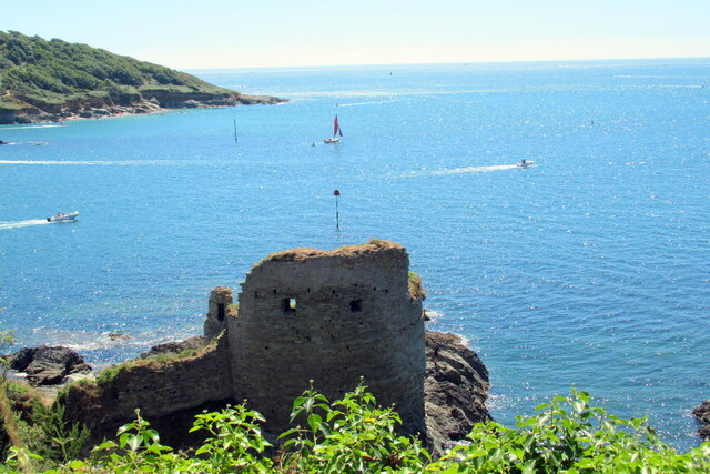
Salcombe Castle

Salcombe Castle or Fort Charles is a ruined fortification just off the beach of North Sands in Salcombe, Devon, England, within the South Devon Area of...

Nearby Amenities

Located within 500m of 50.214767,-3.7858995
Source: PGS
Lat/Long: 50.2106517/-3.7848464
Source: PGS
Lat/Long: 50.2106776/-3.7847526
Source: PGS
Lat/Long: 50.2110111/-3.7846957
Source: PGS
Lat/Long: 50.2117391/-3.7850685
Source: PGS
Lat/Long: 50.2122226/-3.7855813
Source: PGS
Lat/Long: 50.2148748/-3.7861843
Bolt Head
Place: locality
Source: NPE
Lat/Long: 50.2110959/-3.7878884
Bench
Backrest: yes
Lat/Long: 50.2167306/-3.7838495
Tourism: viewpoint
Lat/Long: 50.2159024/-3.7822851
Starehole Bay
Alt Name: Starhole Bay
Place: locality
Source: npe
Lat/Long: 50.2134427/-3.7840775
Sharp Tor Toposcope
Description: In memory of W Newton Drew
Information: map
Map Type: toposcope
Tourism: information
Lat/Long: 50.216631/-3.7836228
Tourism: viewpoint
Lat/Long: 50.2165905/-3.783493
Seamark Buoy Lateral Category: port
Seamark Buoy Lateral Colour: red
Seamark Buoy Lateral Shape: can
Seamark Buoy Lateral System: iala-a
Seamark Type: buoy_lateral
Lat/Long: 50.2141604/-3.7841423
Starehole Cove
Place: locality
Lat/Long: 50.2147294/-3.7852992
Bellhouse Rock
Place: locality
Lat/Long: 50.214334/-3.7860346
Sharp Tor
Place: locality
Lat/Long: 50.216034/-3.7828267
Herzogin Cecilie
Historic: wreck
Seamark Type: wreck
Wikidata: Q1463082
Wikipedia: en:Herzogin Cecilie
Wreck Date Sunk: 1936
Wreck Visible At High Tide: no
Wreck Visible At Low Tide: yes
Lat/Long: 50.2144256/-3.7850299
Great Eelstone
Place: locality
Lat/Long: 50.2157777/-3.781218
Little Eelstone
Place: locality
Lat/Long: 50.2163802/-3.780593
Cadmus Rocks
Place: locality
Lat/Long: 50.215048/-3.7813454
Bench
Backrest: no
Lat/Long: 50.2158358/-3.7852811
Bench
Backrest: no
Lat/Long: 50.2158742/-3.7849698
Bench
Backrest: no
Lat/Long: 50.2171365/-3.7824978
Bench
Backrest: no
Lat/Long: 50.2117248/-3.787907
Bench
Backrest: no
Lat/Long: 50.2117224/-3.788731
Old Gamp
Place: locality
Lat/Long: 50.2141461/-3.7868652
Middle Gamp
Place: locality
Lat/Long: 50.2150249/-3.7862375
New Gamp
Place: locality
Lat/Long: 50.2153853/-3.7851057
Archaeological Site: settlement
Historic: archaeological_site
Inscription: Danish settlement
Lat/Long: 50.2155146/-3.7889994
The data included in this document is from www.openstreetmap.org. The data is made available under ODbL.

Have you been to Starehole Cove?

Leave your review of Starehole Cove below (or comments, questions and feedback).