Paul Jones's Point

Coastal Feature, Headland, Point in Kirkcudbrightshire

Scotland

Paul Jones's Point

The River Dee Viewed from the B727 near Fish House Wood.
The River Dee Credit: Billy McCrorie

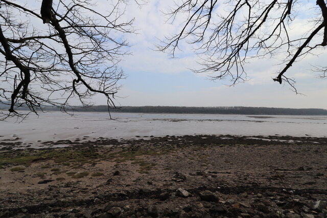
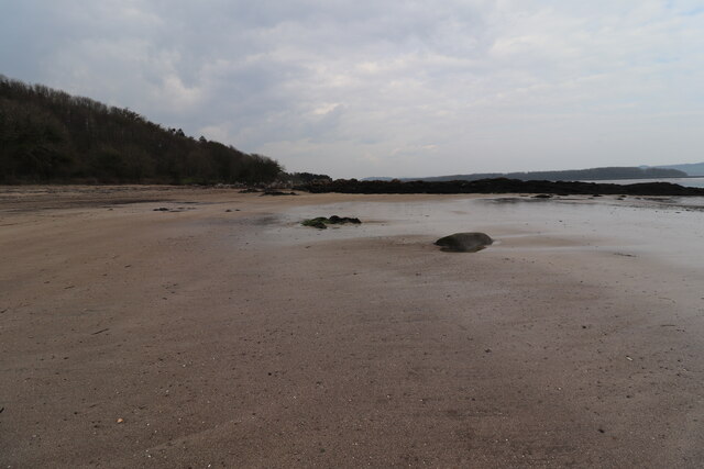
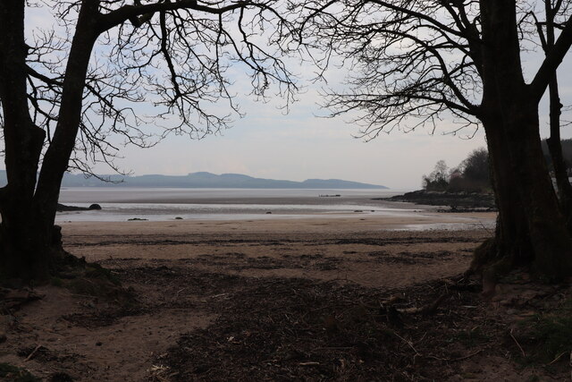
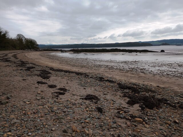
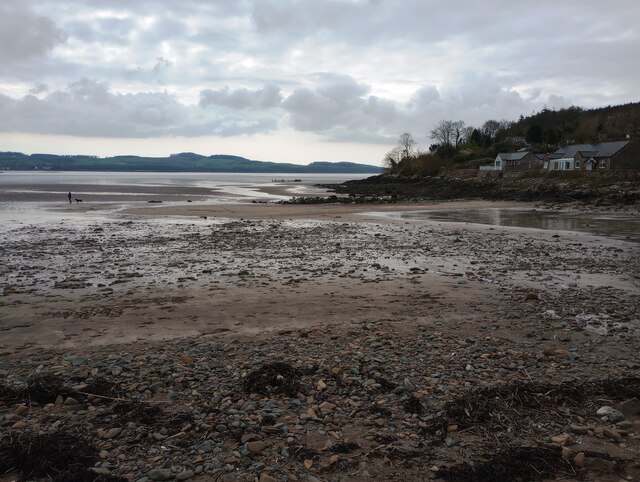
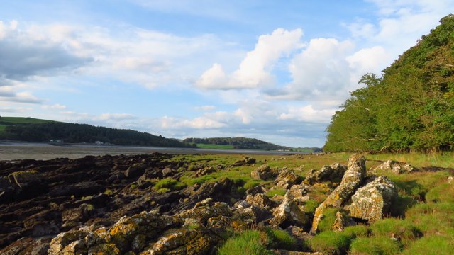
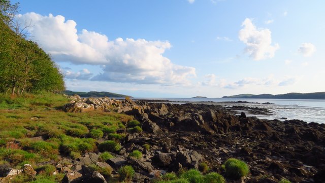
Paul Jones's Point is a prominent coastal feature located in Kirkcudbrightshire, Scotland. It is a headland that extends into the Irish Sea, offering stunning views and natural beauty. The point is named after John Paul Jones, a renowned Scottish-American naval officer, who was born in nearby Kirkbean.

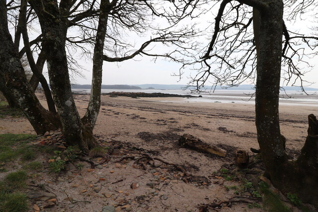
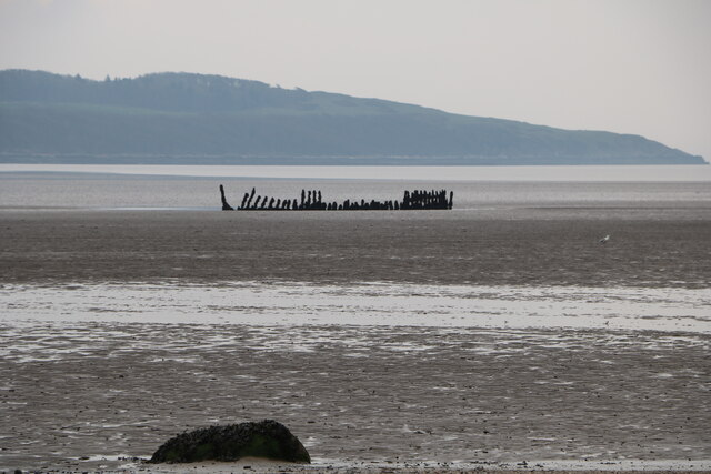
This headland is characterized by its rugged, rocky cliffs that drop dramatically into the sea. The cliffs are composed of sedimentary rocks, formed over millions of years, creating a visually striking landscape. The area is also home to a variety of wildlife, including seabirds, seals, and occasionally dolphins, making it a popular spot for nature enthusiasts and birdwatchers.

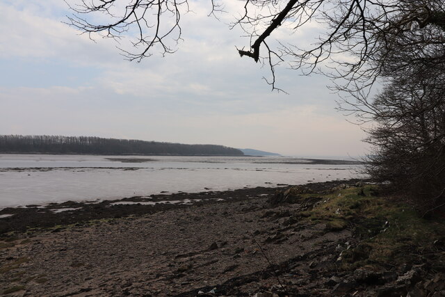
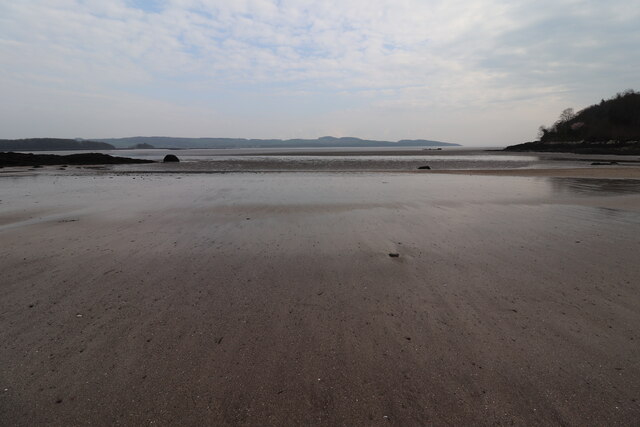
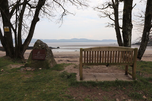
Atop the headland, there is a viewing platform that provides visitors with a panoramic vista of the surrounding coastline and the vast expanse of the sea. The view from Paul Jones's Point is particularly spectacular during sunrise and sunset, with the changing colors of the sky reflecting off the water.

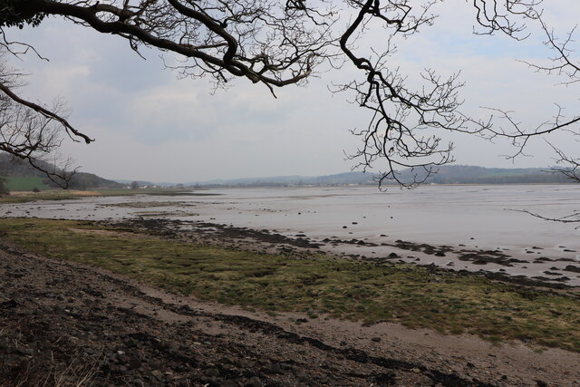
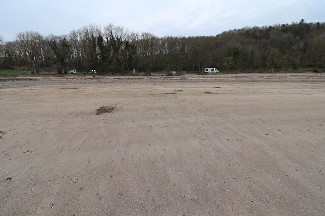
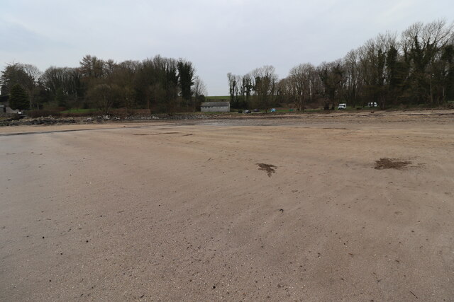
Access to Paul Jones's Point is relatively easy, with a well-maintained path leading from the nearby coastal road. There are also designated parking areas for visitors. The headland is a great place for leisurely walks, picnics, or simply enjoying the tranquility of the coastal environment.

In addition to its natural beauty, Paul Jones's Point holds historical significance due to its association with John Paul Jones. The point serves as a reminder of his Scottish roots and his contributions to naval history.

If you have any feedback on the listing, please let us know in the comments section below.

Paul Jones's Point Images

Images are sourced within 2km of 54.814089/-4.0652583 or Grid Reference NX6748. Thanks to Geograph Open Source API. All images are credited.

The River Dee Viewed from the B727 near Fish House Wood.
The River Dee
Viewed from the B727 near Fish House Wood.
The River Dee Heading for Kirkcudbright Bay. Viewed from the B727 near Fish House Wood.
The River Dee
Heading for Kirkcudbright Bay. Viewed from the B727 near Fish House Wood.
The River Dee Looking back towards Kirkcudbright. Viewed from the B727 near Fish House Wood.
The River Dee
Looking back towards Kirkcudbright. Viewed from the B727 near Fish House Wood.
Dhoon Beach At Nun Mill Bay just off the B727.
Dhoon Beach
At Nun Mill Bay just off the B727.
Rocks at Dhoon Beach At Nun Mill Bay just off the B727.
Rocks at Dhoon Beach
At Nun Mill Bay just off the B727.
Dhoon Beach At Nun Mill Bay.
Dhoon Beach
At Nun Mill Bay.
Dhoon Beach At Nun Mill Bay just off the B727. In the centre is the toilet block at Dhoon Beach.
Dhoon Beach
At Nun Mill Bay just off the B727. In the centre is the toilet block at Dhoon Beach.
Warning Signs at Dhoon Beach Mainly about Dead Man's Fingers which has been washed up at the shore and is Poisonous.
Warning Signs at Dhoon Beach
Mainly about Dead Man's Fingers which has been washed up at the shore and is Poisonous.
Dhoon Beach At Nun Mill Bay just off the B727.
Dhoon Beach
At Nun Mill Bay just off the B727.
Dhoon Beach At Nun Mill Bay just off the B727.
Dhoon Beach
At Nun Mill Bay just off the B727.
Memorial Stone and Seat, Dhoon Beach Stone is about the Schooner "Monreith" wrecked here in 1900.
Memorial Stone and Seat, Dhoon Beach
Stone is about the Schooner "Monreith" wrecked here in 1900.
History of the Schooner "Monreith" Wrecked here on 12th November 1900. It's timbers are still visible at low tide.
History of the Schooner "Monreith"
Wrecked here on 12th November 1900. It's timbers are still visible at low tide.
Wreck at Nun Mill Bay Timbers of the Schooner "Monreith" wrecked on the 12th November 1900.
Wreck at Nun Mill Bay
Timbers of the Schooner "Monreith" wrecked on the 12th November 1900.
Beach at Nun Mill Bay Mixture of pebbles, sand and seaweed
Beach at Nun Mill Bay
Mixture of pebbles, sand and seaweed
Low tide at Nun Mill Bay With wreck in distance
Low tide at Nun Mill Bay
With wreck in distance
Western foreshore of St Mary's Isle with view up River Dee
Western foreshore of St Mary's Isle with view towards Kirkcudbright Bay
Trees lining the road near Grange Farm, Muthill One of the few bits of this area of the countryside that wasn't flying a red flag that day - most of this peninsula (if you can call it that) is MOD training area and I didn't want to get shot as a spy/terrorist, so this is as exciting as the photos got!
Trees lining the road near Grange Farm, Muthill
One of the few bits of this area of the countryside that wasn't flying a red flag that day - most of this peninsula (if you can call it that) is MOD training area and I didn't want to get shot as a spy/terrorist, so this is as exciting as the photos got!
Show me another place!

Paul Jones's Point is located at Grid Ref: NX6748 (Lat: 54.814089, Lng: -4.0652583)

Unitary Authority: Dumfries and Galloway

Police Authority: Dumfries and Galloway

What 3 Words

///topmost.pillow.ironic. Near Kirkcudbright, Dumfries & Galloway

Related Wikis

River Dee, Galloway

The River Dee (Scottish Gaelic: Dè / Uisge Dhè), in south-west Scotland, flows from its source in Loch Dee amongst the Galloway Hills, firstly to Clatteringshaws...

St Cuthbert Wanderers F.C.

Saint Cuthbert Wanderers Football Club are a football club from the town of Kirkcudbright in the Stewartry in Galloway, Scotland. They play in the South...

Kirkcudbright

Kirkcudbright ( kur-KOO-bree; Scots: Kirkcoubrie; Scottish Gaelic: Cille Chùithbeirt) is a town, parish and a royal burgh from 1455 in Kirkcudbrightshire...

Kirkcudbright Castle

Kirkcudbright Castle, was a castle that was located on the banks of the River Dee, in Kirkcudbright, Scotland. A motte and bailey castle was built in...

Nearby Amenities

Located within 500m of 54.814089,-4.0652583
Source: PGS
Lat/Long: 54.8114056/-4.0702779
Source: PGS
Lat/Long: 54.8115914/-4.0704227
Source: PGS
Lat/Long: 54.8115967/-4.0708995
Source: PGS
Lat/Long: 54.81198/-4.0718532
Source: PGS
Lat/Long: 54.8124815/-4.0695567
Source: PGS
Lat/Long: 54.8126109/-4.0693325
Source: PGS
Lat/Long: 54.8123473/-4.0690616
Source: PGS
Lat/Long: 54.8121532/-4.0691229
Source: PGS
Lat/Long: 54.811516/-4.0691751
Source: PGS
Lat/Long: 54.8111845/-4.0697252
Source: PGS
Lat/Long: 54.8129656/-4.072715
Source: PGS
Lat/Long: 54.8129285/-4.0721987
Source: PGS
Lat/Long: 54.8126805/-4.0712519
Source: PGS
Lat/Long: 54.8129662/-4.0703442
Source: PGS
Lat/Long: 54.813421/-4.0698542
Source: PGS
Lat/Long: 54.8136461/-4.0693021
Source: PGS
Lat/Long: 54.8135265/-4.0680015
Source: PGS
Lat/Long: 54.8138248/-4.067546
Source: PGS
Lat/Long: 54.8142344/-4.067459
Source: PGS
Lat/Long: 54.8150672/-4.0669833
Source: PGS
Lat/Long: 54.8154616/-4.0664477
Source: PGS
Lat/Long: 54.8159261/-4.0664134
Source: PGS
Lat/Long: 54.8163906/-4.06617
Source: PGS
Lat/Long: 54.8167698/-4.0655817
Source: PGS
Lat/Long: 54.8172554/-4.06531
Source: PGS
Lat/Long: 54.8175281/-4.0648273
Source: PGS
Lat/Long: 54.8178253/-4.0642124
Source: PGS
Lat/Long: 54.8180883/-4.0635963
Source: PGS
Lat/Long: 54.8184018/-4.0632991
Power: pole
Lat/Long: 54.8185358/-4.0650805
Power: pole
Lat/Long: 54.8179275/-4.065926
The data included in this document is from www.openstreetmap.org. The data is made available under ODbL.

Have you been to Paul Jones's Point?

Leave your review of Paul Jones's Point below (or comments, questions and feedback).