Raven's Nest

Coastal Feature, Headland, Point in Kirkcudbrightshire

Scotland

Raven's Nest

Military training area, access point No red flag and no sentry on duty at the little hut, so one could venture into the danger area.
Military training area, access point Credit: Gordon Hatton

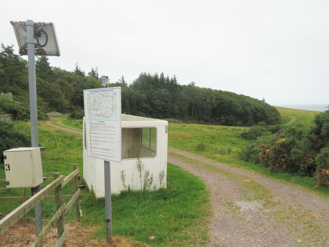
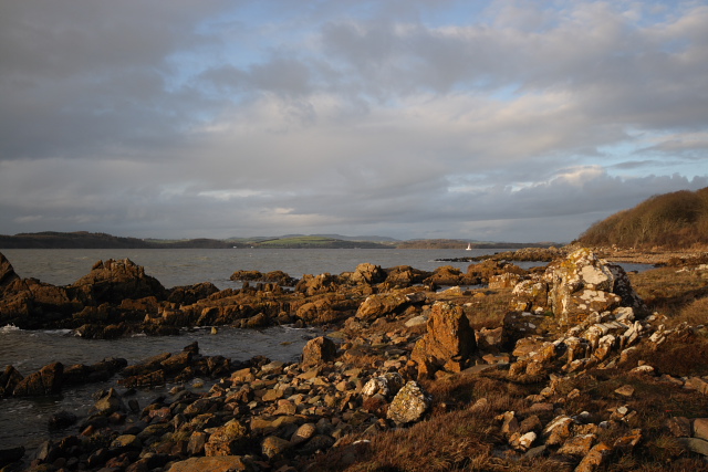
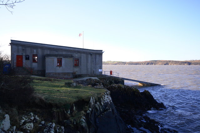
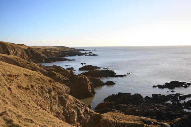
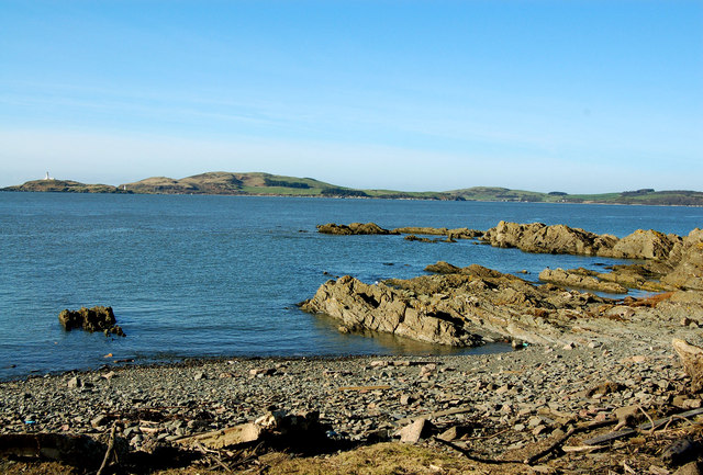
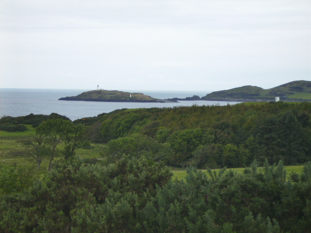
Raven's Nest is a prominent coastal feature located in Kirkcudbrightshire, Scotland. It is a captivating headland that extends out into the sea, forming a striking point that commands breathtaking views of the surrounding area. Situated on the southern coast of Scotland, Raven's Nest is nestled between the towns of Kirkcudbright and Gatehouse of Fleet.

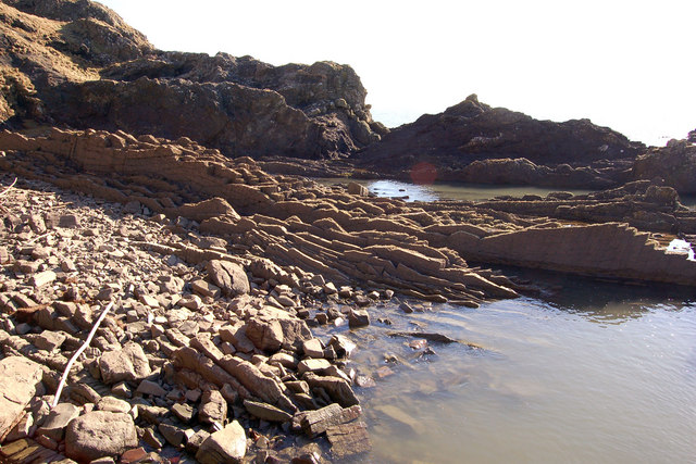
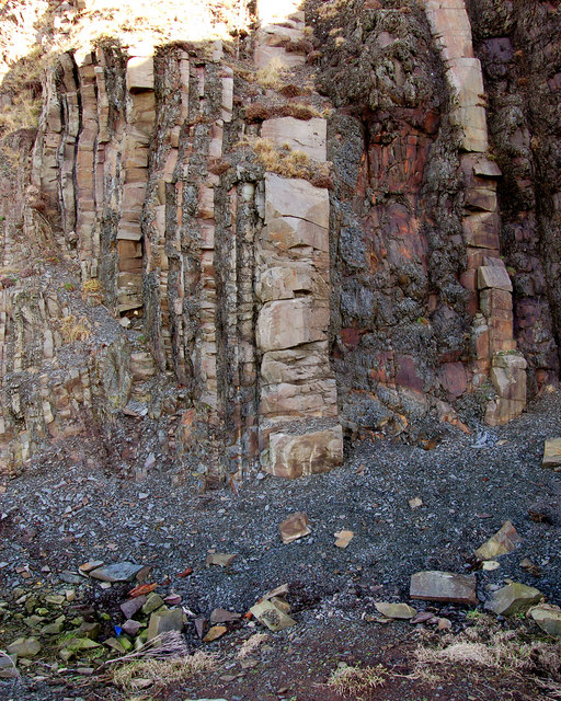
The headland derives its name from the abundance of ravens that inhabit the area, adding an air of mystique and intrigue to this already captivating site. Its rugged cliffs, standing tall against the crashing waves, create a dramatic and awe-inspiring landscape that attracts both locals and visitors alike.

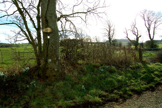
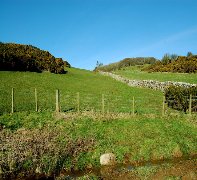
Raven's Nest offers a variety of activities for nature enthusiasts and outdoor lovers. It boasts an array of walking trails that meander along the coastline, providing opportunities for exploration and discovery. These trails offer panoramic vistas of the sea, with breathtaking views of the nearby beaches and the surrounding countryside.

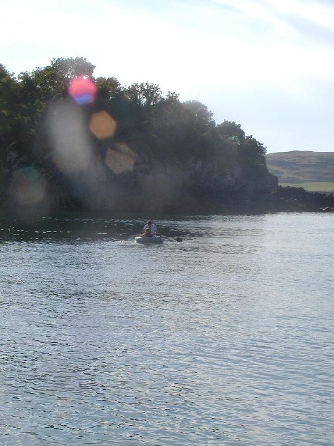
The headland is also a haven for birdwatchers, as it acts as a natural habitat for a diverse range of avian species. Visitors can often spot a variety of seabirds soaring above the cliffs or nesting in the crevices. In addition, the surrounding waters are home to seals and dolphins, providing further opportunities for wildlife observation.

For those seeking tranquility and natural beauty, Raven's Nest is an ideal destination. Its rugged cliffs, abundant wildlife, and panoramic views make it a truly captivating coastal feature in Kirkcudbrightshire, Scotland.

If you have any feedback on the listing, please let us know in the comments section below.

Raven's Nest Images

Images are sourced within 2km of 54.783265/-4.0643397 or Grid Reference NX6745. Thanks to Geograph Open Source API. All images are credited.
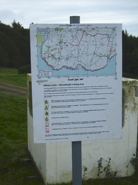
Military training area, access point No red flag and no sentry on duty at the little hut, so one could venture into the danger area.
Military training area, access point
No red flag and no sentry on duty at the little hut, so one could venture into the danger area.
Edge of the danger area A short stroll down the track from the road [no red flag flying] and one could photograph the track that leads towards the coast near Torrs Point.
Edge of the danger area
A short stroll down the track from the road [no red flag flying] and one could photograph the track that leads towards the coast near Torrs Point.
Farmland near Torrs Green pastures between the coast and Castle Hill.
Farmland near Torrs
Green pastures between the coast and Castle Hill.
Manor Hole Manor hole, in Ross Bay, is one of the few reasonable sheltered all-tide anchorages on the Solway.
Manor Hole
Manor hole, in Ross Bay, is one of the few reasonable sheltered all-tide anchorages on the Solway.
Long Robin, Dee Estuary Rocky foreshore at Long Robin on the River Dee Estuary, looking NNW towards St Mary's Isle and Kirkcudbright.
Long Robin, Dee Estuary
Rocky foreshore at Long Robin on the River Dee Estuary, looking NNW towards St Mary's Isle and Kirkcudbright.
Kirkcudbright Lifeboat Station Looking SW across the Dee Estuary.
Kirkcudbright Lifeboat Station
Looking SW across the Dee Estuary.
Coastline at Balmae Ha'en The view over the Solway Firth, southwest of Torrs Point on the coastal path.
Coastline at Balmae Ha'en
The view over the Solway Firth, southwest of Torrs Point on the coastal path.
Gypsy Point Byron wrote about a wild and breaker beaten coast.Perhaps this is it.
Gypsy Point
Byron wrote about a wild and breaker beaten coast.Perhaps this is it.
Balmae Gardens The Head Gardener's cottage, hence its being situated in the wall of the walled gardens.
This house in its beautiful location, now owned by the MOD was built in the eighteenth century by people with vision and style. It now stands open to the elements and its huge walled garden is  overgrown with mature trees. To let a fine building like this to rot should be a crime.
Balmae Gardens
The Head Gardener's cottage, hence its being situated in the wall of the walled gardens. This house in its beautiful location, now owned by the MOD was built in the eighteenth century by people with vision and style. It now stands open to the elements and its huge walled garden is overgrown with mature trees. To let a fine building like this to rot should be a crime.
Torrs Moor, Galloway The house nearby is also named Torrs Moor
Torrs Moor, Galloway
The house nearby is also named Torrs Moor
Gypsy point Interesting rock formation in vertical layers
Gypsy point
Interesting rock formation in vertical layers
Gypsy point Looking over to Little Ross,a tiny island with two lighthouses
Gypsy point
Looking over to Little Ross,a tiny island with two lighthouses
Verdant Galloway in February No wonder the Galloway steaks are good what with cattle feeding on grass like this all day and every day.
Verdant Galloway in February
No wonder the Galloway steaks are good what with cattle feeding on grass like this all day and every day.
Little Ross - both lighthouses can be seen Viewed from Balmae.
The larger lighthouse is in grid square <a href="https://www.geograph.org.uk/gridref/NX6543">NX6543</a>.
<span class="nowrap"><a title="http://www.scottishradiance.com/light/light204.htm" rel="nofollow ugc noopener" href="http://www.scottishradiance.com/light/light204.htm">Link</a><img style="margin-left:2px;" alt="External link" title="External link - shift click to open in new window" src="https://s1.geograph.org.uk/img/external.png" width="10" height="10"/></span>
The smaller lighthouse sits in grid square <a href="https://www.geograph.org.uk/gridref/NX6643">NX6643</a>.
Little Ross - both lighthouses can be seen
Viewed from Balmae. The larger lighthouse is in grid square NX6543. LinkExternal link The smaller lighthouse sits in grid square NX6643.
Rights of access notice board Some parts of the MoD ranges around the Kirkcudbright Training Area are open access for walkers when the red flags are not flying. This is for the majority of the time.
Rights of access notice board
Some parts of the MoD ranges around the Kirkcudbright Training Area are open access for walkers when the red flags are not flying. This is for the majority of the time.
Access road to part of the Kirkcudbright Training Area (MoD)
The Duck Pond The duck pond at Torrs Farm.
The Duck Pond
The duck pond at Torrs Farm.
Torrs Lochan The un-named lochan near Torrs Farm.
Torrs Lochan
The un-named lochan near Torrs Farm.
Show me another place!

Raven's Nest is located at Grid Ref: NX6745 (Lat: 54.783265, Lng: -4.0643397)

Unitary Authority: Dumfries and Galloway

Police Authority: Dumfries and Galloway

What 3 Words

///clip.amused.irritable. Near Kirkcudbright, Dumfries & Galloway

Related Wikis

Kirkcudbright Bay

Kirkcudbright Bay is an inlet of the Irish Sea on the coast of Galloway in southwest Scotland. Its coastline falls entirely within the modern administrative...

River Dee, Galloway

The River Dee (Scottish Gaelic: Dè / Uisge Dhè), in south-west Scotland, flows from its source in Loch Dee amongst the Galloway Hills, firstly to Clatteringshaws...

Little Ross

Little Ross is a 29-acre (12-hectare) island with a lighthouse on the Solway Coast south of the town of Kirkcudbright in Galloway, Scotland. It is next...

Dundrennan Range

Dundrennan Range is a weapons testing range on the Solway Firth, near Kirkcudbright in Dumfries and Galloway, in south west Scotland, it is part of the...

Nearby Amenities

Located within 500m of 54.783265,-4.0643397
Source: PGS
Lat/Long: 54.7875124/-4.0650168
Source: PGS
Lat/Long: 54.78687/-4.0654257
Source: PGS
Lat/Long: 54.7861119/-4.0650602
Source: PGS
Lat/Long: 54.7855889/-4.0649576
Source: PGS
Lat/Long: 54.7851138/-4.065047
Source: PGS
Lat/Long: 54.7845367/-4.0650773
Source: PGS
Lat/Long: 54.7839485/-4.0649166
Source: PGS
Lat/Long: 54.7837479/-4.0646673
Source: PGS
Lat/Long: 54.7834355/-4.0647673
Source: PGS
Lat/Long: 54.7829603/-4.0645743
Source: PGS
Lat/Long: 54.7818734/-4.0649142
Source: PGS
Lat/Long: 54.7810212/-4.0648592
Source: PGS
Lat/Long: 54.7808519/-4.0646443
Source: PGS
Lat/Long: 54.7803678/-4.0639238
Source: PGS
Lat/Long: 54.7800276/-4.0637006
Source: PGS
Lat/Long: 54.7794783/-4.0629461
Source: PGS
Lat/Long: 54.7796722/-4.0622619
Source: PGS
Lat/Long: 54.7793448/-4.0621263
Torrs Point
Place: locality
Lat/Long: 54.7814314/-4.06507
Man Made: tower
Seamark Landmark Category: tower
Seamark Name: Lookout Tower
Tower Type: observation
Lat/Long: 54.7800099/-4.0596895
The data included in this document is from www.openstreetmap.org. The data is made available under ODbL.

Have you been to Raven's Nest?

Leave your review of Raven's Nest below (or comments, questions and feedback).