Meggerland Point

Coastal Feature, Headland, Point in Kirkcudbrightshire

Scotland

Meggerland Point

Corseyard Dairy A real oddity, in stile it aspires to appear as a church.
Corseyard Dairy Credit: Chris Andrews

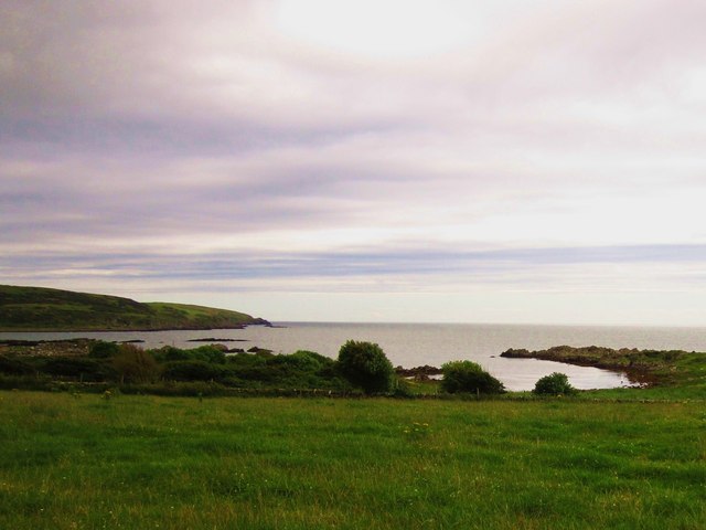
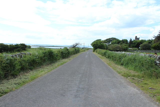
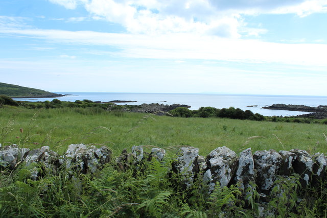
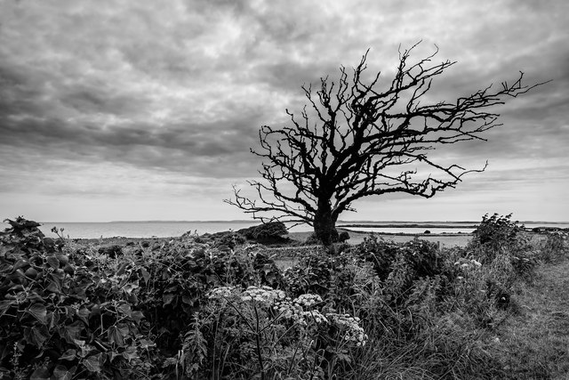
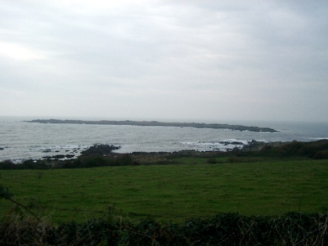
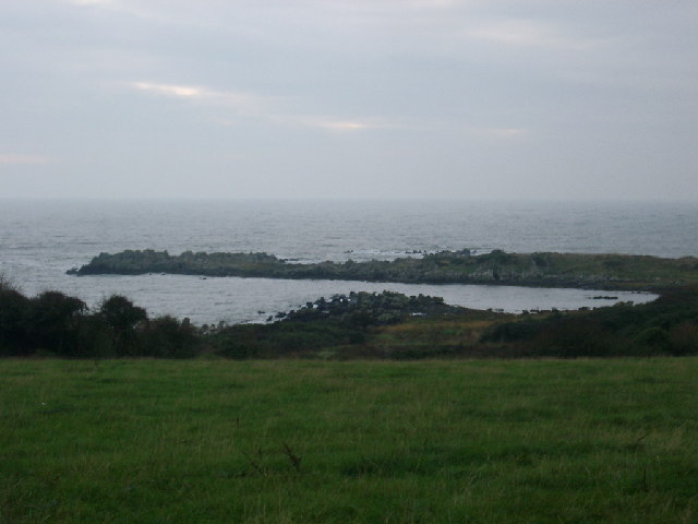
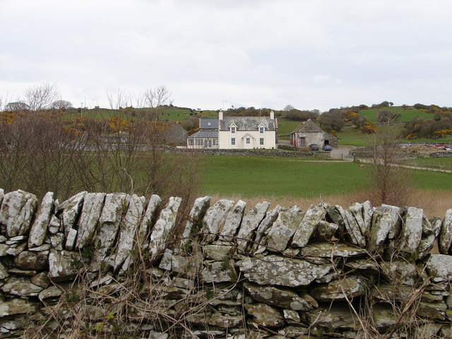
Meggerland Point is a prominent headland located in Kirkcudbrightshire, Scotland. Situated on the southwest coast of the country, it extends into the Irish Sea, offering breathtaking views of the surrounding landscape.

This coastal feature is characterized by its rugged cliffs that rise dramatically from the water, forming a picturesque backdrop against the crashing waves. The cliffs are composed of sedimentary rock formations, which display layers of different colors and textures, adding to the beauty of the area.

The headland is accessible via a narrow footpath that winds its way along the cliff edge, providing visitors with an adventurous and scenic hike. Along the trail, one can spot various species of seabirds nesting in the rock crevices, creating a vibrant and lively atmosphere.

The point also boasts a diverse range of marine life, making it a popular spot for snorkeling and diving enthusiasts. Underneath the clear waters, a vibrant underwater ecosystem thrives, with colorful fish, crustaceans, and even the occasional seal sighting.

In addition to its natural beauty, Meggerland Point has historical significance. It is believed to have been a strategic location during ancient times, with evidence of prehistoric settlements and burial mounds found in the vicinity. These archaeological remains add an extra layer of fascination to the area.

Overall, Meggerland Point offers a unique blend of natural beauty, wildlife, and historical interest. It is a must-visit destination for nature lovers, adventure seekers, and history enthusiasts alike.

If you have any feedback on the listing, please let us know in the comments section below.

Meggerland Point Images

Images are sourced within 2km of 54.803793/-4.1860697 or Grid Reference NX5947. Thanks to Geograph Open Source API. All images are credited.

Corseyard Dairy A real oddity, in stile it aspires to appear as a church.
Corseyard Dairy
A real oddity, in stile it aspires to appear as a church.
Corseyard Dairy Corseyard Dairy, (locally known as Coo Palace) with a water tower designed to look like a medieval Scottish fortified house, constructed for the then laird of nearby Knockbrex estate, James Brown, chairman of Affleck & Brown, a Manchester department store.
<span class="nowrap"><a title="http://www.buildingsatrisk.org.uk/details/900384" rel="nofollow ugc noopener" href="http://www.buildingsatrisk.org.uk/details/900384">Link</a><img style="margin-left:2px;" alt="External link" title="External link - shift click to open in new window" src="https://s1.geograph.org.uk/img/external.png" width="10" height="10"/></span>
Corseyard Dairy
Corseyard Dairy, (locally known as Coo Palace) with a water tower designed to look like a medieval Scottish fortified house, constructed for the then laird of nearby Knockbrex estate, James Brown, chairman of Affleck & Brown, a Manchester department store. LinkExternal link
Boundary Wall A section of Corseyard Dairy, boundary wall.
Boundary Wall
A section of Corseyard Dairy, boundary wall.
Castle Haven Bay
Castle Haven Bay
Corseyard Dairy for sale This Gothic style dairy steading was original built for James Brown of Knockbrex. The site is currently marketed for sale and the foreground sign reads:-
Grade A Listed Edwardian Dairy
with lapsed planning for conversion
to Residential and/or Business use
Available as a whole or in 3 lots
Corseyard Dairy for sale
This Gothic style dairy steading was original built for James Brown of Knockbrex. The site is currently marketed for sale and the foreground sign reads:- Grade A Listed Edwardian Dairy with lapsed planning for conversion to Residential and/or Business use Available as a whole or in 3 lots
Corseyard Dairy Tower The Corseyard Dairy buildings are currently marketed for sale. For a wider view, see <a href="https://www.geograph.org.uk/photo/3507630">NX5948 : Corseyard Dairy for sale</a>.
Corseyard Dairy Tower
The Corseyard Dairy buildings are currently marketed for sale. For a wider view, see NX5948 : Corseyard Dairy for sale.
Corseyard Dairy Tower Known locally as the "Coo Palace".
Corseyard Dairy Tower
Known locally as the "Coo Palace".
Road to Borgue near Corseyard
Road to Gatehouse of Fleet at Corseyard On the mid right you can see Corseyard Tower.
Road to Gatehouse of Fleet at Corseyard
On the mid right you can see Corseyard Tower.
Coastline at Castle Haven Bay
Corseyard Dairy Tower Known locally as the "Coo Palace".
Corseyard Dairy Tower
Known locally as the "Coo Palace".
Kirkandrews - Borgue
Barlocco Isle, nr Borgue Taken at High Tide so only the high ground is shown - if you look at the OS map, there are rocks all round, submerged at High Tide.
Barlocco Isle, nr Borgue
Taken at High Tide so only the high ground is shown - if you look at the OS map, there are rocks all round, submerged at High Tide.
Old Man's Pow, Kirkandrew Bay Taken at high tide
Old Man's Pow, Kirkandrew Bay
Taken at high tide
Tower at Roberton Farm nr Borgue Think this is a doocot. The building it's part of looks like a church but I'm reasonably certain it's build as a farm steading and someone was having a laugh
Tower at Roberton Farm nr Borgue
Think this is a doocot. The building it's part of looks like a church but I'm reasonably certain it's build as a farm steading and someone was having a laugh
Coo Palace, Corseyard allegedly an early C20th dairy; architect unknown.
Coo Palace, Corseyard
allegedly an early C20th dairy; architect unknown.
Barlocco House View from Borgue-Knockbrex road of Barlocco, a converted farmhouse.
Barlocco House
View from Borgue-Knockbrex road of Barlocco, a converted farmhouse.
Barlocco Isle Low Tide at Barlocco Isle
Barlocco Isle
Low Tide at Barlocco Isle
Show me another place!

Meggerland Point is located at Grid Ref: NX5947 (Lat: 54.803793, Lng: -4.1860697)

Unitary Authority: Dumfries and Galloway

Police Authority: Dumfries and Galloway

What 3 Words

///innovate.outfitter.explains. Near Kirkcudbright, Dumfries & Galloway

Related Wikis

Kirkandrews, Dumfries and Galloway

Kirkandrews, sometimes written as Kirkanders in older documents, is a coastal hamlet about 9 kilometres (6 mi) west-southwest of Kirkcudbright in Dumfries...
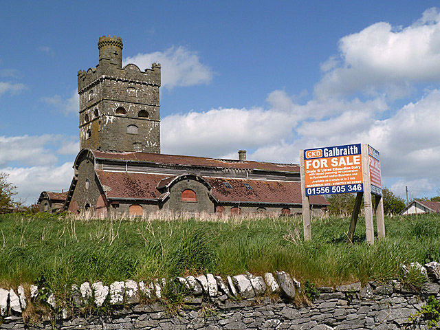
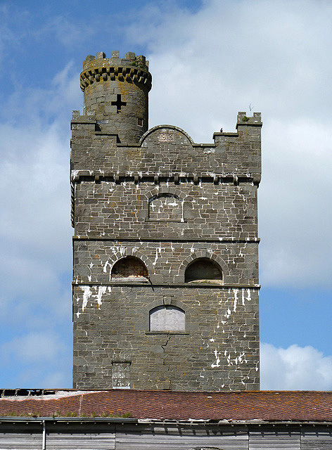
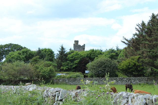
Corseyard Farm

Corseyard Farm, known locally as the Coo Palace and now marketed under that name, is an architecturally unusual dairy farm near Kirkandrews in Scotland...

Islands of Fleet

The Islands of Fleet are a group of small islands in Galloway, Scotland. They are in Fleet Bay, which is part of Wigtown Bay, and is in turn part of the...

Borness

Borness is a farm of around 1550 acres on the coast of Borgue Parish in the Stewartry of Kirkcudbrightshire (now part of Dumfries and Galloway). It is...

Plunton Castle

Plunton Castle is a ruined L-plan tower house between Kirkandrews and Gatehouse of Fleet in Dumfries and Galloway, Scotland. Built around 1575 for the...

Borgue, Dumfries and Galloway

Borgue (pronounced /ˈbɔrɡ/; Scottish Gaelic: Borgh) is a village and parish in the Stewartry of Kirkcudbright in Dumfries and Galloway, Scotland. It lies...

Borgue Old House

Borgue Old House is a ruined Y-plan house, about 300 metres (0.2 mi) east of Borgue in Dumfries and Galloway, Scotland. Built in 1680, but probably incorporating...

Water of Fleet

The Water of Fleet is a river in Scotland flowing into Fleet Bay on the Solway Firth. Its two tributaries are the Big Water of Fleet, which begins around...

Nearby Amenities

Located within 500m of 54.803793,-4.1860697
Source: Landsat photo
Lat/Long: 54.8077402/-4.1872094
Source: Landsat photo
Lat/Long: 54.8078042/-4.1868628
Source: Landsat photo
Lat/Long: 54.807871/-4.1865882
Source: Landsat photo
Lat/Long: 54.8082073/-4.1856408
Source: Landsat photo
Lat/Long: 54.8077102/-4.1855056
Source: Landsat photo
Lat/Long: 54.8067052/-4.1850856
Source: Landsat photo
Lat/Long: 54.8069091/-4.1846768
Source: Landsat photo
Lat/Long: 54.8072341/-4.1837751
Source: Landsat photo
Lat/Long: 54.8070427/-4.1813471
Source: Landsat photo
Lat/Long: 54.80654/-4.1815573
Source: Landsat photo
Lat/Long: 54.8052232/-4.1829578
Source: Landsat photo
Lat/Long: 54.805046/-4.1833477
Source: Landsat photo
Lat/Long: 54.8040552/-4.1853552
Source: Landsat photo
Lat/Long: 54.8033557/-4.1862919
Source: Landsat photo
Lat/Long: 54.8023947/-4.185559
Source: Landsat photo
Lat/Long: 54.8012553/-4.1850604
Barn Heogh
Ele: 60
Natural: peak
Lat/Long: 54.8025395/-4.1803601
Dead Man's Bay
Natural: bay
Lat/Long: 54.8078883/-4.1875296
Cauldforth Bay
Natural: bay
Lat/Long: 54.8063189/-4.1883557
Kirkandrews Bay
Natural: bay
Lat/Long: 54.8064723/-4.18356
The data included in this document is from www.openstreetmap.org. The data is made available under ODbL.

Have you been to Meggerland Point?

Leave your review of Meggerland Point below (or comments, questions and feedback).