Ulfred Point

Coastal Feature, Headland, Point in Devon

England

Ulfred Point

View across the bay at Lee, low tide
View across the bay at Lee, low tide Credit: David Martin

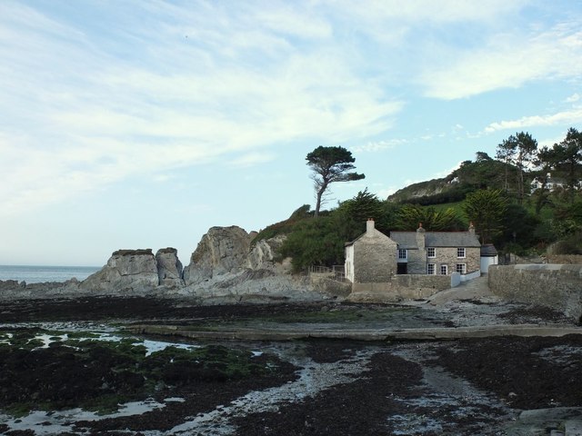
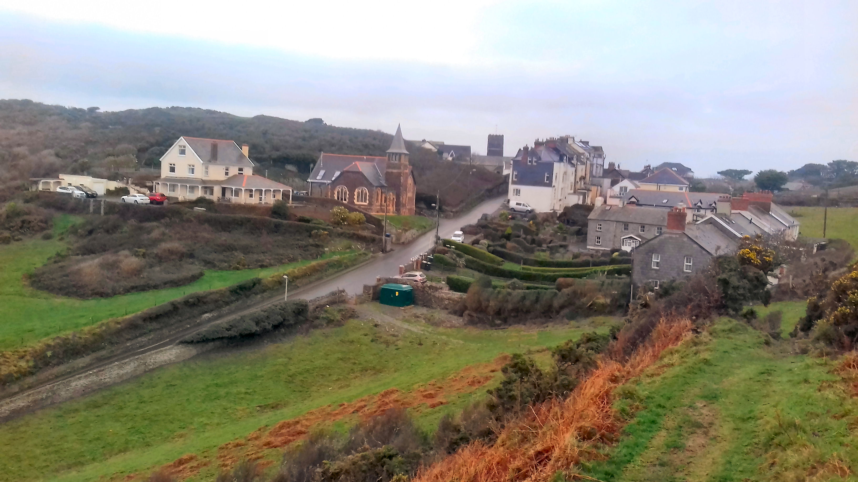
Ulfred Point is a prominent coastal feature located in Devon, England. It is classified as a headland, jutting out into the sea and forming a point along the coastline. The point is situated on the southern coast of Devon, offering picturesque views of the surrounding area.

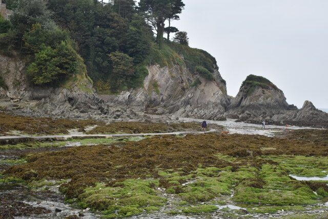
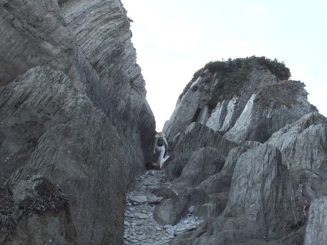
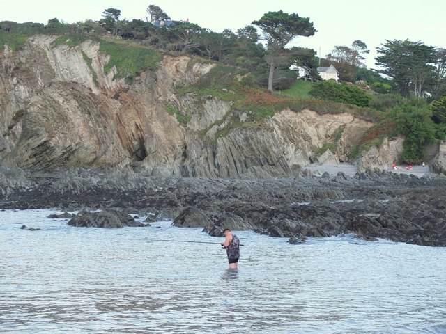
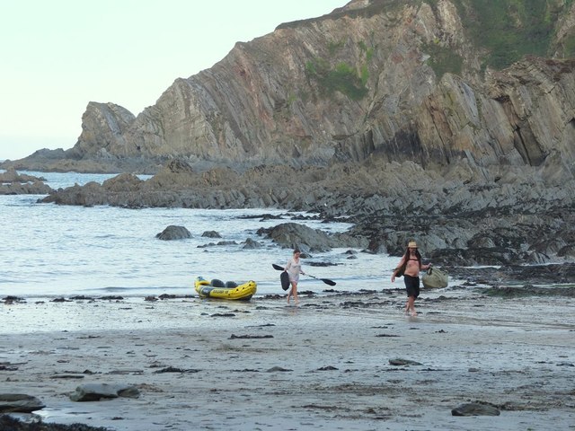
The headland is characterized by rugged cliffs that rise steeply from the sea, providing a dramatic and impressive sight. These cliffs are composed of sedimentary rock, which has been shaped over time by the erosive forces of the sea and weathering. The geology of the area is diverse, with layers of sandstone, limestone, and shale visible in the exposed cliffs.

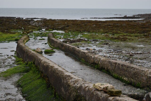
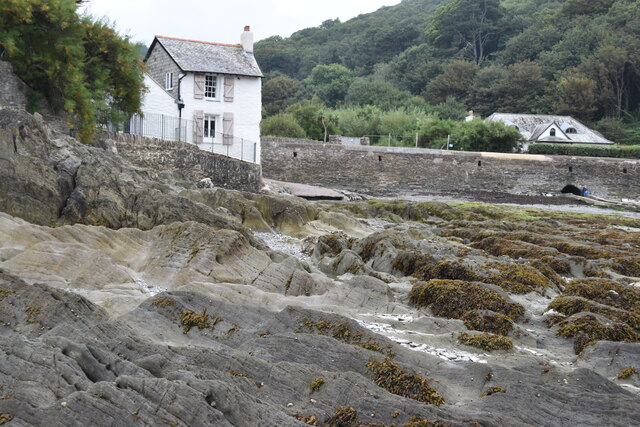
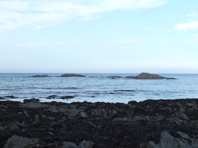
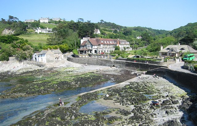
Ulfred Point is a popular destination for nature enthusiasts and hikers due to its outstanding natural beauty. The headland is home to a variety of flora and fauna, including coastal grasses, wildflowers, and seabirds such as gulls and cormorants. The surrounding waters are teeming with marine life, making it an ideal spot for fishing and wildlife spotting.

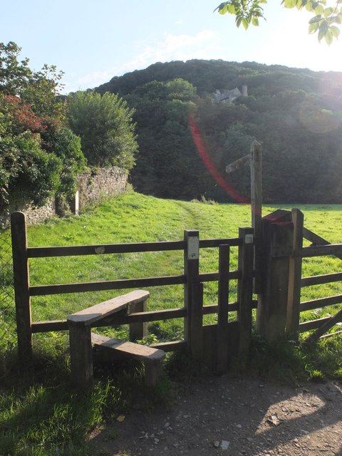
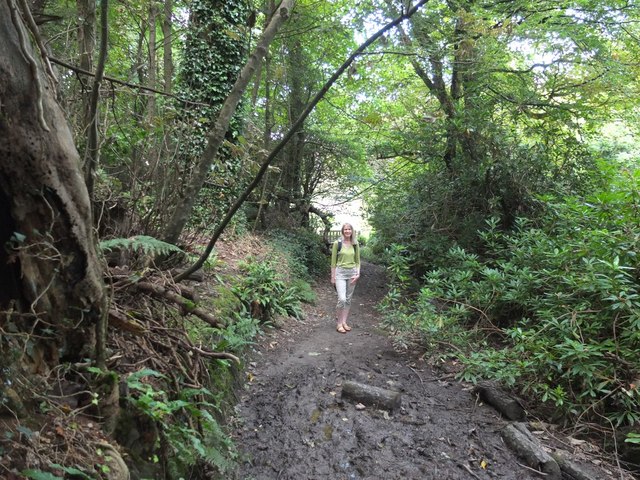
Visitors can enjoy breathtaking views from the top of the headland, taking in the vast expanse of the sea and the rugged coastline. The point also offers access to several walking trails that meander along the cliffs, allowing for leisurely strolls and exploration of the area.

Ulfred Point is a must-visit destination for those seeking to experience the natural beauty and tranquility of the Devon coast. Its striking cliffs, diverse wildlife, and panoramic views make it a perfect spot for nature lovers and outdoor enthusiasts.

If you have any feedback on the listing, please let us know in the comments section below.

Ulfred Point Images

Images are sourced within 2km of 51.201207/-4.1722233 or Grid Reference SS4846. Thanks to Geograph Open Source API. All images are credited.

View across the bay at Lee, low tide
Stream channel onto shore at Lee
House on the shore at Lee
Rocky shore at Lee
Rocky shore at Lee
The South West Coast Path
Sign at Women's Institute Car Park at Lee
Old Maid's Cottage, Lee, North Devon
Junction on Home Lane, Lee, North Devon
Footpath to Wrinkle Wood, Lee, North Devon
Lee Bay, North Devon
Passage from Lee Bay to Sandy Cove
Rocks in Lee Bay, North Devon
Sea fishing in Lee Bay, North Devon
Kayakers coming ashore at Lee Bay, North Devon
Path in Borough Valley near Lee, North Devon
Ordnance Survey Rivet This OS rivet can be found on the concrete base which once had a gatepost standing on it. West side of road. It marks a point 64.191m above mean sea level.
Ordnance Survey Rivet
This OS rivet can be found on the concrete base which once had a gatepost standing on it. West side of road. It marks a point 64.191m above mean sea level.
High scrub south of Bull Point The private road to Bull Point lighthouse runs around the side of this low hill.  My eye was caught by the gates which are aligned above and below that road
High scrub south of Bull Point
The private road to Bull Point lighthouse runs around the side of this low hill. My eye was caught by the gates which are aligned above and below that road
Track to Bull Point lighthouse A section of the track where the road runs through rocky ground
Track to Bull Point lighthouse
A section of the track where the road runs through rocky ground
Show me another place!

Ulfred Point is located at Grid Ref: SS4846 (Lat: 51.201207, Lng: -4.1722233)

Administrative County: Devon

Police Authority: Devon and Cornwall

What 3 Words

///budget.tiredness.exacts. Near Ilfracombe, Devon

Related Wikis

Lee Bay

Lee Bay or just Lee is a small village on the North Devon coast near Woolacombe. Lee is situated on the rugged and inhospitable stretch of coast between...

Bull Point Lighthouse

Bull Point Lighthouse is a lighthouse on Bull Point, about one mile (1.6 km) north of the village of Mortehoe, on the northern coast of Devon, England...

The Torrs

The Torrs are a Local Nature Reserve and one of the four main hills in the North Devon coastal town of Ilfracombe. The Park originally was designed in...

Slade Reservoirs

The Slade Reservoirs are twin reservoirs in the North Devon town of Ilfracombe, England. They are owned by South West Water, and leased to South West Lakes...

Mortehoe

Mortehoe () is a village and former manor on the north coast of Devon, England. It lies 10 miles north-west of Barnstaple, near Woolacombe and Lee Bay...

Morte Point

Morte Point is a peninsula on the north west coast of Devon, England, belonging to the National Trust. To the east is the village of Mortehoe and to the...

Ilfracombe railway station (England)

Ilfracombe railway station was the terminus of the Ilfracombe branch line in north Devon, England. The line was opened as the Barnstaple and Ilfracombe...

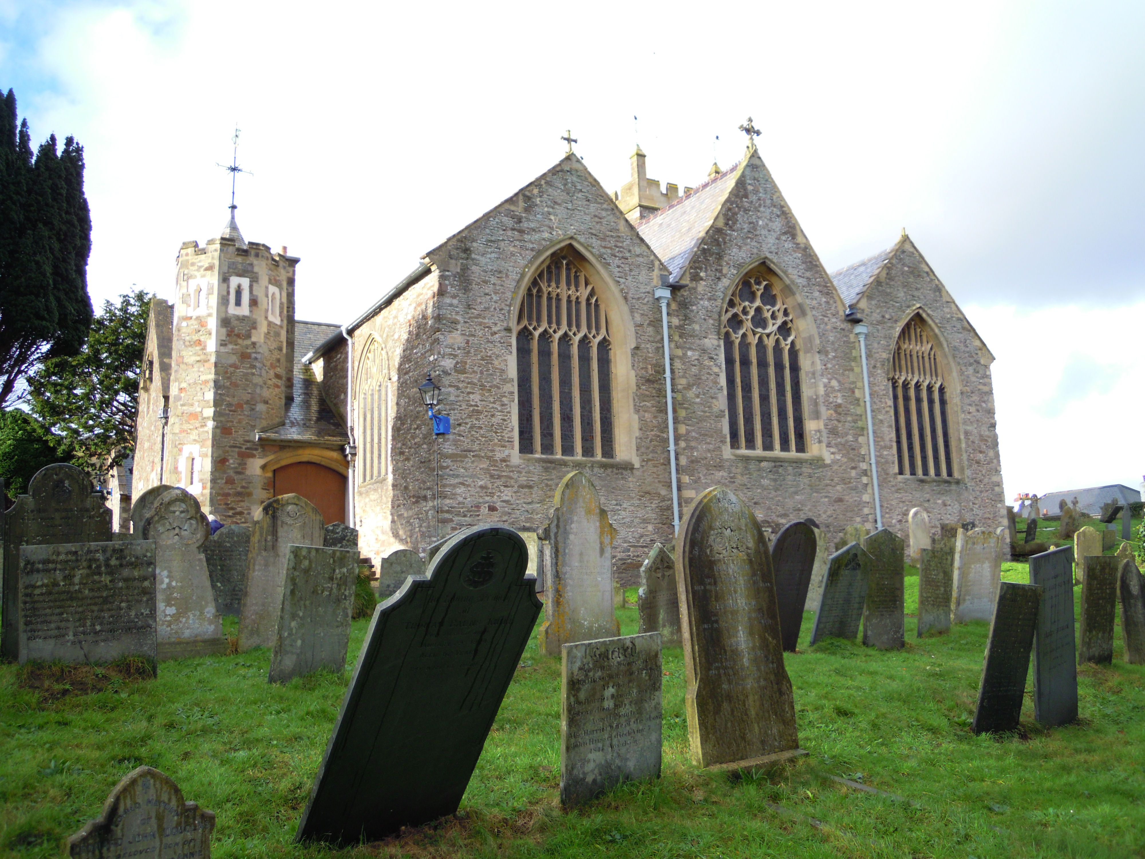
Holy Trinity Church, Ilfracombe

The Church of the Holy Trinity is the Anglican parish church for Ilfracombe in Devon. The building has been a Grade I listed building since 1951 and comes...

Nearby Amenities

Located within 500m of 51.201207,-4.1722233
Source: PGS
Lat/Long: 51.2031481/-4.1667147
Source: PGS
Lat/Long: 51.2028363/-4.1682293
Source: PGS
Lat/Long: 51.2026675/-4.1679129
Source: PGS
Lat/Long: 51.2025477/-4.1678976
Source: PGS
Lat/Long: 51.2024858/-4.1685017
Source: PGS
Lat/Long: 51.2022142/-4.1692398
Source: PGS
Lat/Long: 51.2018908/-4.1711205
Source: PGS
Lat/Long: 51.2017765/-4.1710191
Source: PGS
Lat/Long: 51.2012089/-4.1721585
Source: PGS
Lat/Long: 51.2008018/-4.1730682
Source: PGS
Lat/Long: 51.2006801/-4.1730633
Source: PGS
Lat/Long: 51.2004451/-4.1730733
Source: PGS
Lat/Long: 51.200407/-4.1732334
Source: PGS
Lat/Long: 51.2002314/-4.1731974
Source: PGS
Lat/Long: 51.200081/-4.1732317
Source: PGS
Lat/Long: 51.1999707/-4.1733406
Source: PGS
Lat/Long: 51.1997722/-4.1736466
Source: PGS
Lat/Long: 51.1996358/-4.1740306
Source: PGS
Lat/Long: 51.1995184/-4.1742909
Source: PGS
Lat/Long: 51.1994473/-4.1748429
Source: PGS
Lat/Long: 51.1994409/-4.1751069
Source: PGS
Lat/Long: 51.1994485/-4.1755988
Source: PGS
Lat/Long: 51.1994531/-4.176484
Source: PGS
Lat/Long: 51.1994837/-4.1767629
Source: PGS
Lat/Long: 51.1985532/-4.1767506
Source: PGS
Lat/Long: 51.1993568/-4.1773768
Source: PGS
Lat/Long: 51.1998804/-4.1785071
Source: PGS
Lat/Long: 51.1996237/-4.1787975
Lee Bay
Natural: bay
Place: locality
Source: NPE
Lat/Long: 51.20151/-4.1780698
Shag Point
Place: locality
Lat/Long: 51.2031722/-4.1664591
Outer Appledore Rocks
Place: locality
Lat/Long: 51.1998654/-4.1782433
Ulfred Point
Place: locality
Lat/Long: 51.2018165/-4.1721211
Source: PGS
Lat/Long: 51.1995067/-4.1771107
Barrier: kissing_gate
Lat/Long: 51.1991408/-4.1665986
Generator Method: photovoltaic
Generator Output Electricity: yes
Generator Source: solar
Generator Type: solar_photovoltaic_panel
Location: roof
Power: generator
Lat/Long: 51.1970551/-4.1725428
Generator Method: photovoltaic
Generator Output Electricity: yes
Generator Source: solar
Generator Type: solar_photovoltaic_panel
Location: roof
Power: generator
Lat/Long: 51.1970215/-4.1724382
Street Lamp
Lat/Long: 51.1977048/-4.1766158
The data included in this document is from www.openstreetmap.org. The data is made available under ODbL.

Have you been to Ulfred Point?

Leave your review of Ulfred Point below (or comments, questions and feedback).