Burnfoot

Coastal Feature, Headland, Point in Wigtownshire

Scotland

Burnfoot

Dinnans With its own Port Allen.
Let sleeping bulls lie!
Dinnans Credit: Russel Wills

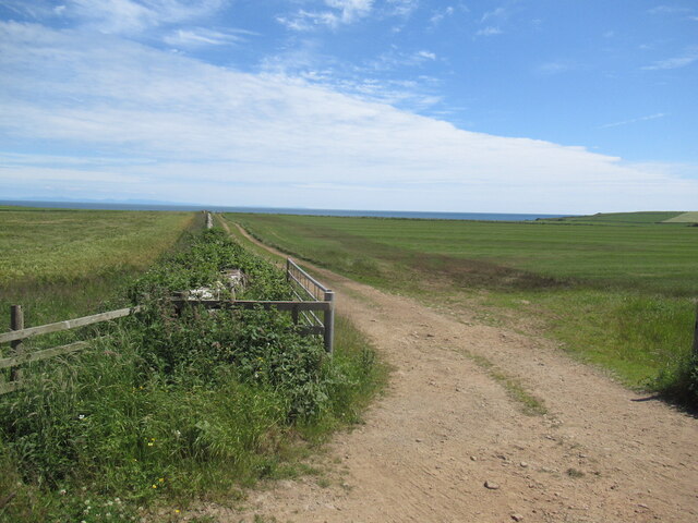
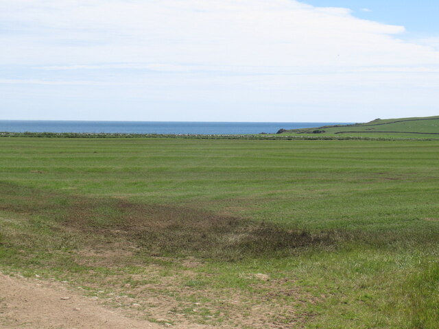
Burnfoot is a picturesque coastal feature located in Wigtownshire, Scotland. Situated on the southwestern coast of the country, it is a prominent headland that juts out into the North Channel of the Irish Sea. This point is known for its stunning views of the sea and surrounding landscape.

The headland of Burnfoot is characterized by its rugged cliffs and rocky shores, which provide a dramatic backdrop against the crashing waves. The area is known for its rich biodiversity, with a variety of seabirds, marine life, and plant species thriving in this unique coastal environment.

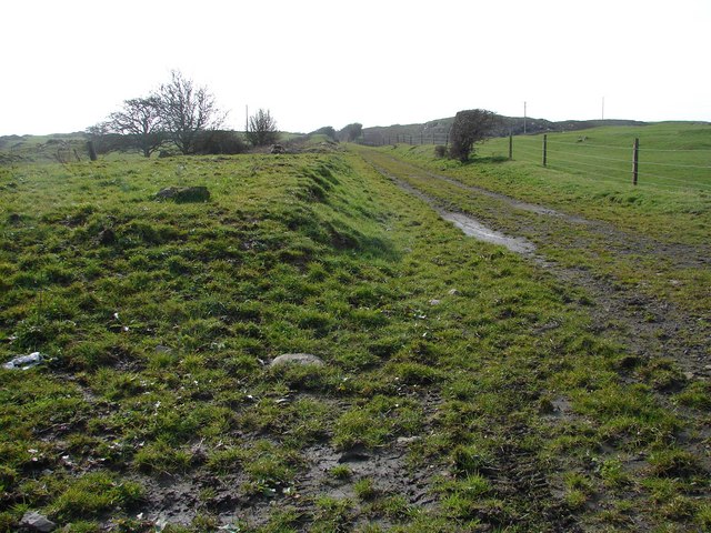
The rocky terrain of Burnfoot is a popular destination for hikers and nature enthusiasts, who come to explore its numerous walking trails and take in the breathtaking vistas. The headland is also home to a small sandy beach, providing a tranquil spot for visitors to relax and enjoy the beauty of the area.

Historically, Burnfoot has been a vital navigational landmark for ships sailing along the North Channel. Its prominent position has made it a point of reference for sailors and a strategic location for the establishment of lighthouses. The most notable of these is the Mull of Galloway Lighthouse, located just a short distance from Burnfoot. This iconic lighthouse has been guiding ships safely along the coast since its construction in 1830.

In summary, Burnfoot is a captivating headland in Wigtownshire, Scotland. With its rugged cliffs, stunning views, and historical significance, it offers a unique coastal experience for visitors seeking natural beauty and tranquility.

If you have any feedback on the listing, please let us know in the comments section below.

Burnfoot Images

Images are sourced within 2km of 54.753288/-4.3585414 or Grid Reference NX4842. Thanks to Geograph Open Source API. All images are credited.

Dinnans With its own Port Allen.
Let sleeping bulls lie!
Dinnans
With its own Port Allen. Let sleeping bulls lie!
Cruggleton Old Church Cruggleton Church, still surrounded by a burial ground, was erected in the second quarter of the 12th. century. It had long been ruinous, when c.1890 it was restored by the Marquess of Bute. Sufficient details and fragments remained for an accurate restoration.
Cruggleton Old Church
Cruggleton Church, still surrounded by a burial ground, was erected in the second quarter of the 12th. century. It had long been ruinous, when c.1890 it was restored by the Marquess of Bute. Sufficient details and fragments remained for an accurate restoration.
Impressive wall enclosing the woodland Beside the road to Garlieston.
Impressive wall enclosing the woodland
Beside the road to Garlieston.
Cruggleton Old Church Viewed from the B7063.
Cruggleton Old Church
Viewed from the B7063.
Name Sign, Cruggleton Old Church Covered in Ivy next to the B7063.
Name Sign, Cruggleton Old Church
Covered in Ivy next to the B7063.
Cruggleton Old Church Zoomed in from the B7063.
Cruggleton Old Church
Zoomed in from the B7063.
Galloway Estate Wall The wall and woodland strip surrounding Galloway House.
Galloway Estate Wall
The wall and woodland strip surrounding Galloway House.
Fields, Cruggleton
Fields, Cruggleton
B7063 passing Cruggleton
On Gallow Hill View over Wigtown Bay. As well as the arable land here, there are grazed fields with lots of rock outcrops.
On Gallow Hill
View over Wigtown Bay. As well as the arable land here, there are grazed fields with lots of rock outcrops.
Summit area, Gallow Hill A hill with rock outcrops, a contrast to the drumlins that are common here.
Summit area, Gallow Hill
A hill with rock outcrops, a contrast to the drumlins that are common here.
West side of Gallow Hill
Cruggleton Church A small wood in a field of barley conceals an medieval chapel, restored in the 1890s.
Cruggleton Church
A small wood in a field of barley conceals an medieval chapel, restored in the 1890s.
Cruggleton Church A small wood in a field of barley conceals an medieval chapel, restored in the 1890s.
Cruggleton Church
A small wood in a field of barley conceals an medieval chapel, restored in the 1890s.
Farmland, Cruggleton Opposite side of the road to the church.
Farmland, Cruggleton
Opposite side of the road to the church.
Near Palmallet A track heading for the sea.
Near Palmallet
A track heading for the sea.
Machars arable Field near Palmallet.
Machars arable
Field near Palmallet.
Cruggleton Old Church Viewed from the B7063.
Cruggleton Old Church
Viewed from the B7063.
Show me another place!

Burnfoot is located at Grid Ref: NX4842 (Lat: 54.753288, Lng: -4.3585414)

Unitary Authority: Dumfries and Galloway

Police Authority: Dumfries and Galloway

What 3 Words

///react.toxic.complies. Near Whithorn, Dumfries & Galloway

Related Wikis

Galloway House

Galloway House is a Category A listed country house in Sorbie, Dumfries and Galloway, Scotland. == History == Adjoining the estate village of Garlieston...

Broughton Skeog railway station

Broughton Skeog (NX4554444071) was a railway station that was located near level crossing gates over a minor road on the Wigtownshire Railway branch line...

Garlieston railway station

Garlieston is the closed terminus of the Garlieston branch of Wigtownshire Railway; running from a junction at Millisle. It served the coastal village...

Whithorn railway station

Whithorn is the closed terminus of the Wigtownshire Railway branch, from Newton Stewart, of the Portpatrick and Wigtownshire Joint Railway. It served...

Garlieston

Garlieston (Scottish Gaelic: Baile Gheàrr Lios, IPA:[ˈpaləʝeaːᵲʎis̪]) is a small planned coastal village in the historical county of Wigtownshire in Dumfries...

Whithorn

Whithorn (Scots pronunciation: [ˈʍɪthorn], Taigh Mhàrtainn in modern Gaelic), is a royal burgh in the historic county of Wigtownshire in Dumfries and Galloway...

Candida Casa

Candida Casa was the name given to the church established by St Ninian in Whithorn, Galloway, southern Scotland, in the mid fifth century AD. The name...

Whithorn Priory

Whithorn Priory was a medieval Scottish monastery that also served as a cathedral, located at 6 Bruce Street in Whithorn, Wigtownshire, Dumfries and Galloway...

Nearby Amenities

Located within 500m of 54.753288,-4.3585414
Source: PGS
Lat/Long: 54.7491/-4.360622
Source: PGS
Lat/Long: 54.749617/-4.360196
Source: PGS
Lat/Long: 54.750387/-4.36
Source: PGS
Lat/Long: 54.750525/-4.359119
Source: PGS
Lat/Long: 54.750656/-4.358902
Source: PGS
Lat/Long: 54.751173/-4.358477
Source: PGS
Lat/Long: 54.751303/-4.358259
Source: PGS
Lat/Long: 54.751441/-4.357378
Source: PGS
Lat/Long: 54.752975/-4.357652
Source: PGS
Lat/Long: 54.753226/-4.358103
Source: PGS
Lat/Long: 54.753477/-4.358554
Source: PGS
Lat/Long: 54.753984/-4.359014
Source: PGS
Lat/Long: 54.75424/-4.359023
Source: PGS
Lat/Long: 54.754758/-4.358597
Source: PGS
Lat/Long: 54.755275/-4.358171
Source: PGS
Lat/Long: 54.755405/-4.357954
Source: PGS
Lat/Long: 54.755536/-4.357737
Source: PGS
Lat/Long: 54.756053/-4.357312
Source: PGS
Lat/Long: 54.757264/-4.3575996
Source: PGS
Lat/Long: 54.7568306/-4.3568121
Source: PGS
Lat/Long: 54.757089/-4.356238
Source: PGS
Lat/Long: 54.7572634/-4.3560847
Source: PGS
Lat/Long: 54.757353/-4.355584
Cruggleton Castle (ruined)
Access: yes
Castle Type: tower
Historic: ruins
Ruins: castle
Lat/Long: 54.7574224/-4.3569958
Generator Method: wind_turbine
Generator Source: wind
Power: generator
Lat/Long: 54.7506164/-4.3624475
Generator Method: wind_turbine
Generator Source: wind
Power: generator
Lat/Long: 54.7511847/-4.3615644
The data included in this document is from www.openstreetmap.org. The data is made available under ODbL.

Have you been to Burnfoot?

Leave your review of Burnfoot below (or comments, questions and feedback).