Mine Cove

Sea, Estuary, Creek in Devon North Devon

England

Mine Cove

View across the bay at Lee, low tide
View across the bay at Lee, low tide Credit: David Martin

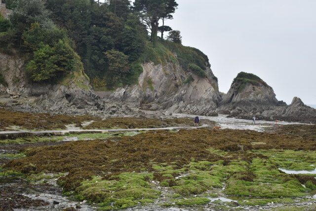
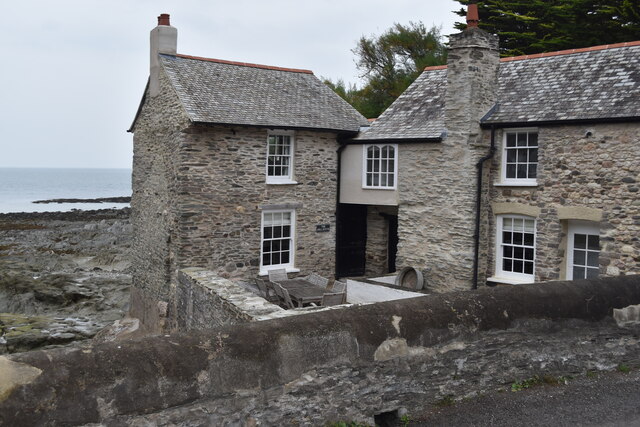
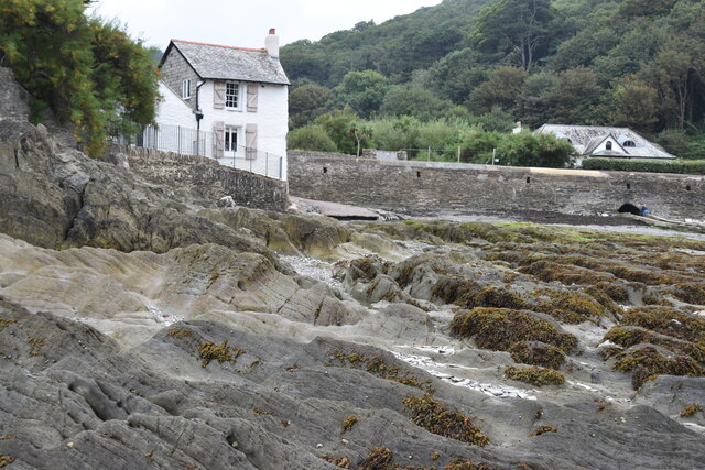
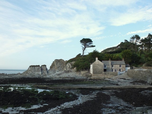
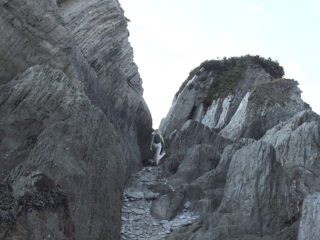
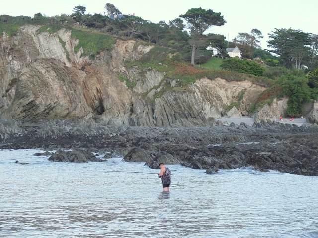
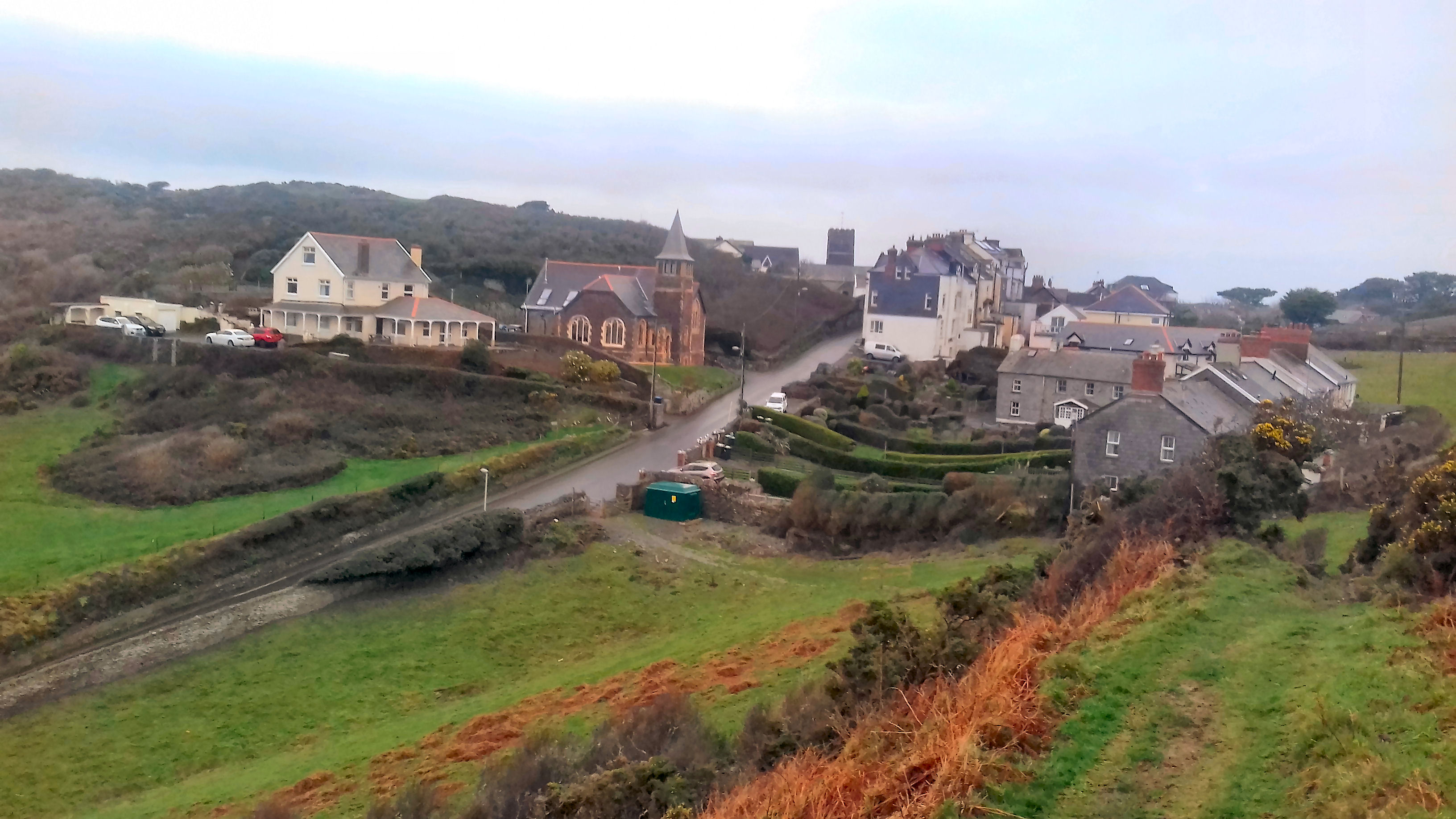
Mine Cove is a picturesque coastal area located in Devon, England. It is nestled between the towns of Salcombe and Hope Cove, offering visitors a serene and idyllic setting. The cove is characterized by its stunning natural beauty, with a combination of sea, estuary, and creek.

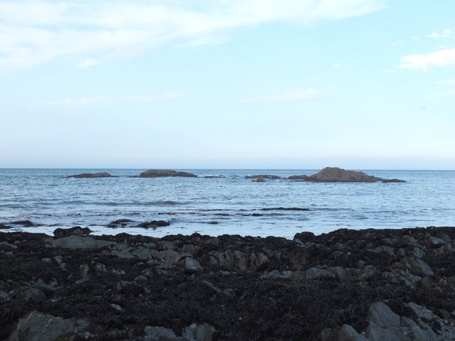
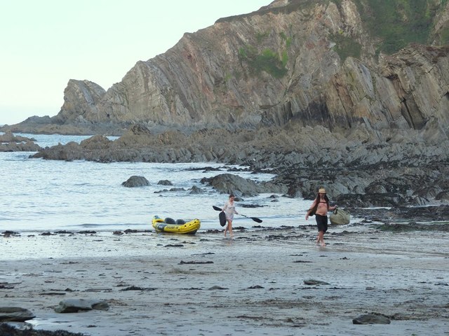
The cove’s main attraction is its pristine sandy beach, which stretches out for a considerable distance. This sandy expanse provides ample space for sunbathing and beach activities, making it a popular spot for families and tourists alike. The crystal-clear waters of the sea offer a refreshing swim during the summer months.

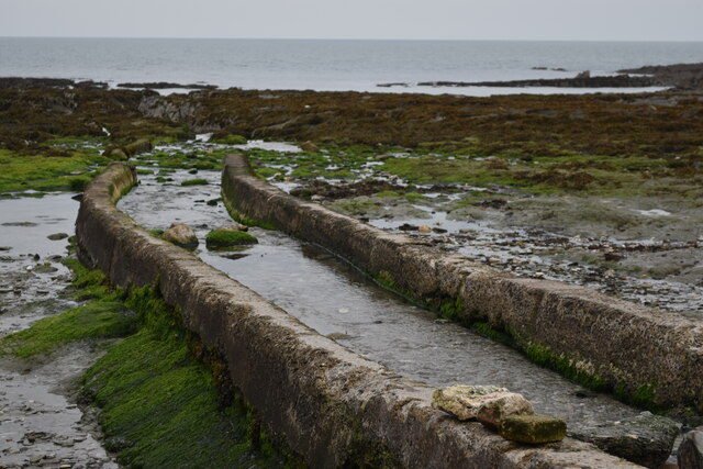
Adjacent to the beach is a small estuary that is formed by the convergence of a creek and the sea. This estuary provides a unique habitat for various marine life and is a haven for birdwatchers. Visitors can observe a range of bird species, including waders and gulls, feeding and nesting in this ecologically rich area.

The creek that flows into the estuary is a charming feature of Mine Cove. It winds its way through the surrounding countryside, creating a tranquil and picturesque environment. Exploring the creek by boat or kayak is a popular activity, allowing visitors to discover hidden coves and admire the beautiful landscape from a different perspective.

Overall, Mine Cove offers a blend of natural beauty and recreational opportunities. Whether one seeks relaxation on the sandy beach, birdwatching in the estuary, or a peaceful kayak journey through the creek, this Devon gem provides a delightful experience for nature enthusiasts and beachgoers alike.

If you have any feedback on the listing, please let us know in the comments section below.
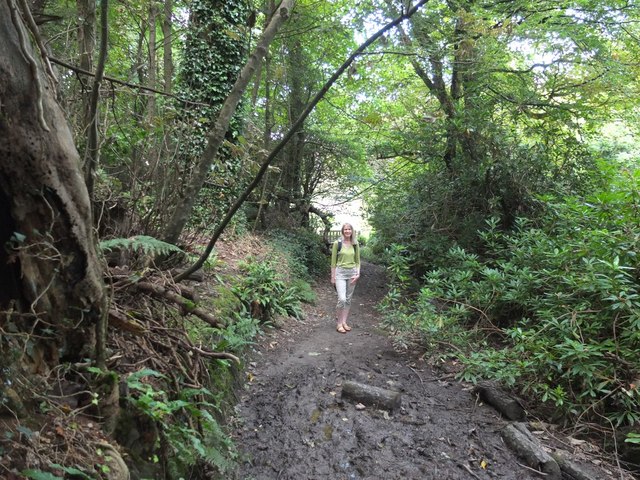
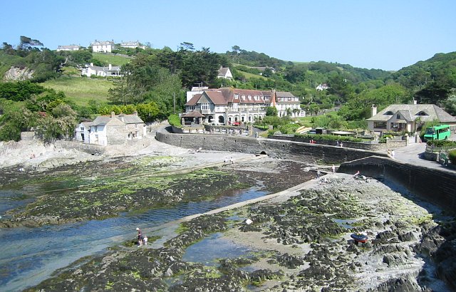
Mine Cove Images

Images are sourced within 2km of 51.198962/-4.1744795 or Grid Reference SS4846. Thanks to Geograph Open Source API. All images are credited.

View across the bay at Lee, low tide
Stream channel onto shore at Lee
House on the shore at Lee
Rocky shore at Lee
Rocky shore at Lee
The South West Coast Path
Sign at Women's Institute Car Park at Lee
Old Maid's Cottage, Lee, North Devon
Junction on Home Lane, Lee, North Devon
Footpath to Wrinkle Wood, Lee, North Devon
Lee Bay, North Devon
Passage from Lee Bay to Sandy Cove
Rocks in Lee Bay, North Devon
Sea fishing in Lee Bay, North Devon
Kayakers coming ashore at Lee Bay, North Devon
Path in Borough Valley near Lee, North Devon
Ordnance Survey Rivet This OS rivet can be found on the concrete base which once had a gatepost standing on it. West side of road. It marks a point 64.191m above mean sea level.
Ordnance Survey Rivet
This OS rivet can be found on the concrete base which once had a gatepost standing on it. West side of road. It marks a point 64.191m above mean sea level.
High scrub south of Bull Point The private road to Bull Point lighthouse runs around the side of this low hill.  My eye was caught by the gates which are aligned above and below that road
High scrub south of Bull Point
The private road to Bull Point lighthouse runs around the side of this low hill. My eye was caught by the gates which are aligned above and below that road
Bull Point The South West Coast Path runs north to the lighthouse
Bull Point
The South West Coast Path runs north to the lighthouse
Show me another place!

Mine Cove is located at Grid Ref: SS4846 (Lat: 51.198962, Lng: -4.1744795)

Administrative County: Devon

District: North Devon

Police Authority: Devon and Cornwall

What 3 Words

///squeaking.splinters.javelin. Near Ilfracombe, Devon

Related Wikis

Lee Bay

Lee Bay or just Lee is a small village on the North Devon coast near Woolacombe. Lee is situated on the rugged and inhospitable stretch of coast between...

Bull Point Lighthouse

Bull Point Lighthouse is a lighthouse on Bull Point, about one mile (1.6 km) north of the village of Mortehoe, on the northern coast of Devon, England...

Mortehoe

Mortehoe () is a village and former manor on the north coast of Devon, England. It lies 10 miles north-west of Barnstaple, near Woolacombe and Lee Bay...

The Torrs

The Torrs are a Local Nature Reserve and one of the four main hills in the North Devon coastal town of Ilfracombe. The Park originally was designed in...

Nearby Amenities

Located within 500m of 51.198962,-4.1744795
Source: PGS
Lat/Long: 51.2018908/-4.1711205
Source: PGS
Lat/Long: 51.2017765/-4.1710191
Source: PGS
Lat/Long: 51.2012089/-4.1721585
Source: PGS
Lat/Long: 51.2008018/-4.1730682
Source: PGS
Lat/Long: 51.2006801/-4.1730633
Source: PGS
Lat/Long: 51.2004451/-4.1730733
Source: PGS
Lat/Long: 51.200407/-4.1732334
Source: PGS
Lat/Long: 51.2002314/-4.1731974
Source: PGS
Lat/Long: 51.200081/-4.1732317
Source: PGS
Lat/Long: 51.1999707/-4.1733406
Source: PGS
Lat/Long: 51.1997722/-4.1736466
Source: PGS
Lat/Long: 51.1996358/-4.1740306
Source: PGS
Lat/Long: 51.1995184/-4.1742909
Source: PGS
Lat/Long: 51.1994473/-4.1748429
Source: PGS
Lat/Long: 51.1994409/-4.1751069
Source: PGS
Lat/Long: 51.1994485/-4.1755988
Source: PGS
Lat/Long: 51.1994531/-4.176484
Source: PGS
Lat/Long: 51.1994837/-4.1767629
Source: PGS
Lat/Long: 51.1985532/-4.1767506
Source: PGS
Lat/Long: 51.1993568/-4.1773768
Source: PGS
Lat/Long: 51.1998804/-4.1785071
Source: PGS
Lat/Long: 51.1996237/-4.1787975
Source: PGS
Lat/Long: 51.1995375/-4.1789293
Source: PGS
Lat/Long: 51.1994266/-4.1791532
Source: PGS
Lat/Long: 51.199393/-4.1794789
Source: PGS
Lat/Long: 51.1993629/-4.1799298
Lee
Is In: Devon, England, UK
Place: village
Lat/Long: 51.1962843/-4.1710719
Lee Bay
Natural: bay
Place: locality
Source: NPE
Lat/Long: 51.20151/-4.1780698
Barrier: kissing_gate
Lat/Long: 51.1954078/-4.17787
Outer Appledore Rocks
Place: locality
Lat/Long: 51.1998654/-4.1782433
Ulfred Point
Place: locality
Lat/Long: 51.2018165/-4.1721211
Source: PGS
Lat/Long: 51.1995067/-4.1771107
Barrier: kissing_gate
Foot: yes
Image: https://archive.org/details/lee-2021-09-06/PXL_20210906_111637270.jpg
Lat/Long: 51.1960203/-4.1725526
Barrier: stile
Lat/Long: 51.1953933/-4.1730653
Generator Method: photovoltaic
Generator Output Electricity: yes
Generator Source: solar
Generator Type: solar_photovoltaic_panel
Location: roof
Power: generator
Lat/Long: 51.1970551/-4.1725428
Generator Method: photovoltaic
Generator Output Electricity: yes
Generator Source: solar
Generator Type: solar_photovoltaic_panel
Location: roof
Power: generator
Lat/Long: 51.1970215/-4.1724382
Generator Method: photovoltaic
Generator Output Electricity: yes
Generator Source: solar
Generator Type: solar_photovoltaic_panel
Location: roof
Power: generator
Lat/Long: 51.1961718/-4.1706196
Generator Method: photovoltaic
Generator Output Electricity: yes
Generator Source: solar
Generator Type: solar_photovoltaic_panel
Location: roof
Power: generator
Lat/Long: 51.1959668/-4.1710944
Generator Method: photovoltaic
Generator Output Electricity: yes
Generator Source: solar
Generator Type: solar_photovoltaic_panel
Location: roof
Power: generator
Lat/Long: 51.1959449/-4.1709536
Generator Method: photovoltaic
Generator Output Electricity: yes
Generator Source: solar
Generator Type: solar_photovoltaic_panel
Location: roof
Power: generator
Lat/Long: 51.195818/-4.1702897
Street Lamp
Lat/Long: 51.1959223/-4.1700914
Street Lamp
Lat/Long: 51.1977048/-4.1766158
Street Lamp
Lamp Mount: straight_mast
Lat/Long: 51.1972363/-4.177566
Fire Hydrant
Emergency: fire_hydrant
Fire Hydrant Position: lane
Fire Hydrant Type: underground
Lat/Long: 51.1972527/-4.1775546
Life Ring
Emergency: life_ring
Image: https://archive.org/details/lee-2021-09-06/PXL_20210906_112341402.jpg
Lat/Long: 51.1972245/-4.1774721
Bus Stop
Lee Bay Sea Wall Bus Stop
Bench: no
Bin: yes
Bus: yes
Lit: yes
Naptan AtcoCode: 1100DEA10997
Naptan NaptanCode: dvnagtmj
Public Transport: platform
Ref: DVNAGTMI
Route Ref: 35
Shelter: no
Tactile Paving: no
Lat/Long: 51.1972376/-4.1775546
Post Box
Collection Times: Mo-Fr 09:00; Sa 07:00
Image: https://archive.org/details/lee-2021-09-06/PXL_20210906_112313236.jpg
Operator: Royal Mail
Operator Wikidata: Q638098
Post Box Manufacturer: Machan, Scotland
Post Box Type: lamp
Ref: EX34 35D
Royal Cypher: EIIR
Royal Cypher Wikidata: Q33102113
Lat/Long: 51.1969678/-4.1772012
Entrance: main
Female: yes
Lat/Long: 51.1963991/-4.1757826
Entrance: main
Male: yes
Lat/Long: 51.1963625/-4.175671
Bench
Backrest: yes
Image: https://archive.org/details/lee-2021-09-06/PXL_20210906_112040237.jpg
Lat/Long: 51.1963619/-4.175718
Post Box
Collection Times: Mo-Fr 16:00; Sa 12:00
Image: https://archive.org/details/lee-2021-09-06/PXL_20210906_111403858.jpg
Operator: Royal Mail
Operator Wikidata: Q638098
Post Box Manufacturer: Derby Castings Limited, Derby
Post Box Type: wall
Ref: EX34 28
Royal Cypher: GR
Royal Cypher Wikidata: Q33102273
Lat/Long: 51.1959885/-4.1708989
Parking
Capacity: 3
Covered: no
Fee: no
Surface: asphalt
Lat/Long: 51.1974829/-4.178611
The data included in this document is from www.openstreetmap.org. The data is made available under ODbL.

Have you been to Mine Cove?

Leave your review of Mine Cove below (or comments, questions and feedback).