Bath Rocks

Coastal Feature, Headland, Point in Ayrshire

Scotland

Bath Rocks

Ardrossan Castle Construction of the castle as we know it began in the 13th century. However little is known of any buildings at the site before the Lands of Ardrossan were gifted to Richard de Barclay by the local feudal lords of the de Morvilles in the 12th century.
The lands passed into the hands of the Eglinton family following the death of the last Barclay Baron of Ardrossan without heirs.
Thereafter it transferred to John de Montgomerie through his marriage to Elizabeth, daughter of Sir Hugh Eglinton sometime after 1736.
The Montgomeries were responsible for a huge programme of reconstruction at Ardrossan Castle, which carried on well into the 15th century. It was the chief seat of the family until the time of Alexander, the first Lord Montgomery, who made Eglinton his principal residence.
Ardrossan remained a stronghold until it was finally destroyed in the 17th century, allegedly at the hands of Oliver Cromwell.
Ardrossan Castle Credit: Raibeart MacAoidh

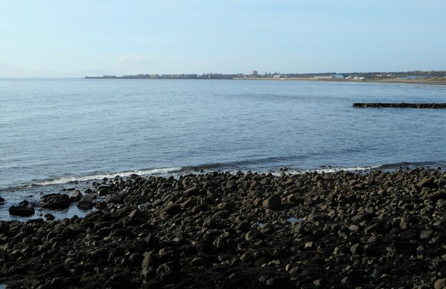
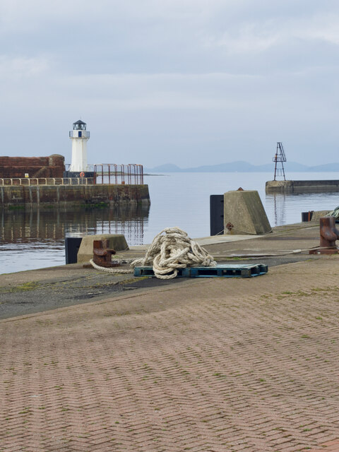
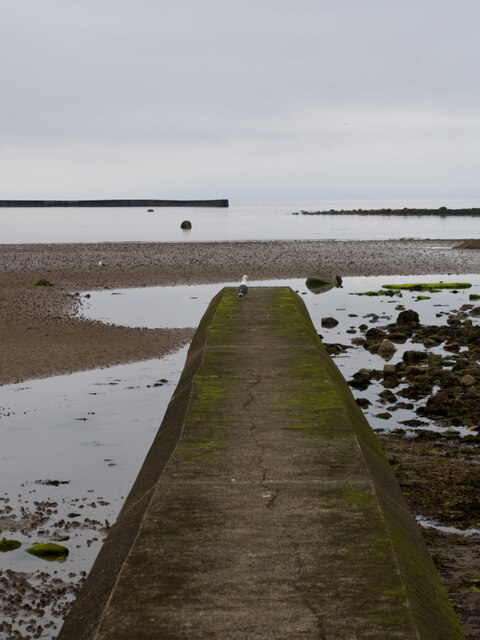
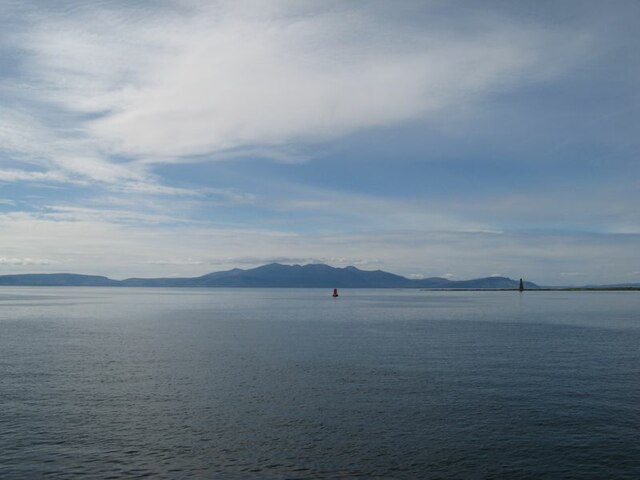
Bath Rocks is a prominent coastal feature located in Ayrshire, Scotland. Situated along the southwestern coast, it is a headland that juts out into the Firth of Clyde, forming a distinctive point that is widely recognized in the area.

The headland at Bath Rocks is characterized by its rugged and rocky terrain, with steep cliffs that overlook the sea. These cliffs are composed mainly of sandstone, which has been shaped over centuries by the powerful waves and weathering processes. The rocks themselves exhibit various colors, ranging from shades of brown to gray, adding to the visual appeal of the area.

As a result of its exposed position, Bath Rocks is often subject to battering waves and strong winds, making it a popular spot for outdoor enthusiasts and nature lovers seeking an exhilarating experience. The headland offers breathtaking panoramic views of the surrounding coastline and the vast expanse of the sea, providing a picturesque backdrop for visitors.

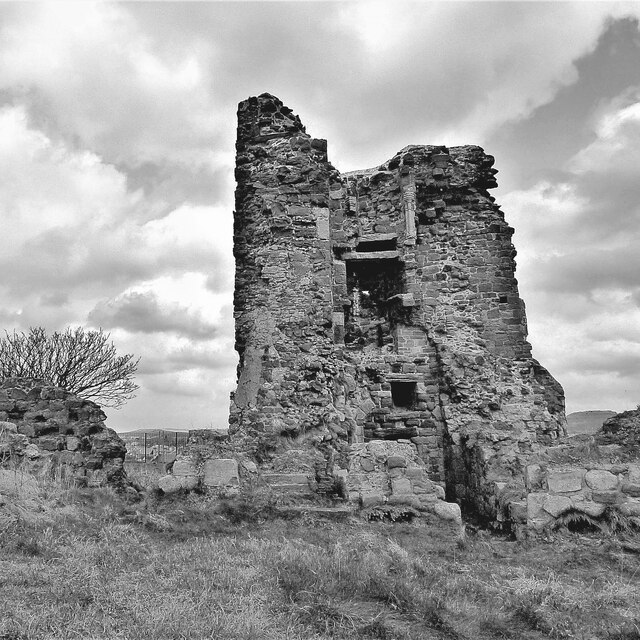
In addition to its natural beauty, Bath Rocks also has historical significance. The area has witnessed human activity dating back thousands of years, with archaeological evidence suggesting that it was once inhabited by early settlers. Today, remnants of ancient settlements can still be found, adding an element of intrigue to the site.

Overall, Bath Rocks in Ayrshire is a captivating coastal feature that offers a unique blend of natural beauty and historical significance. Whether it is exploring the rugged cliffs, enjoying the stunning vistas, or delving into the area's rich history, visitors are sure to be captivated by the charm and allure of Bath Rocks.

If you have any feedback on the listing, please let us know in the comments section below.
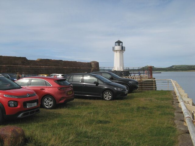
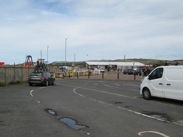
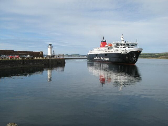
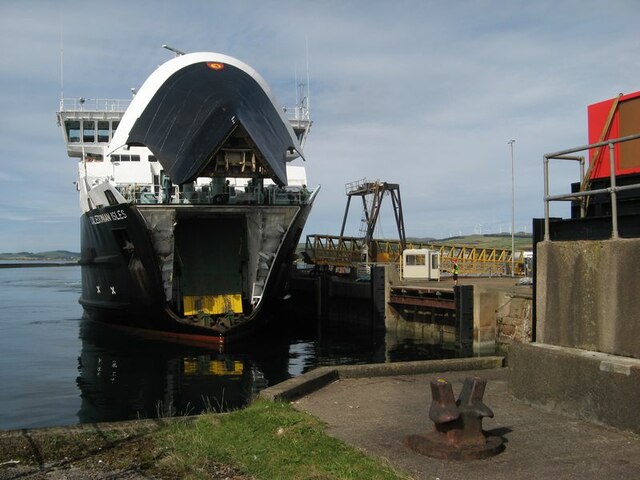
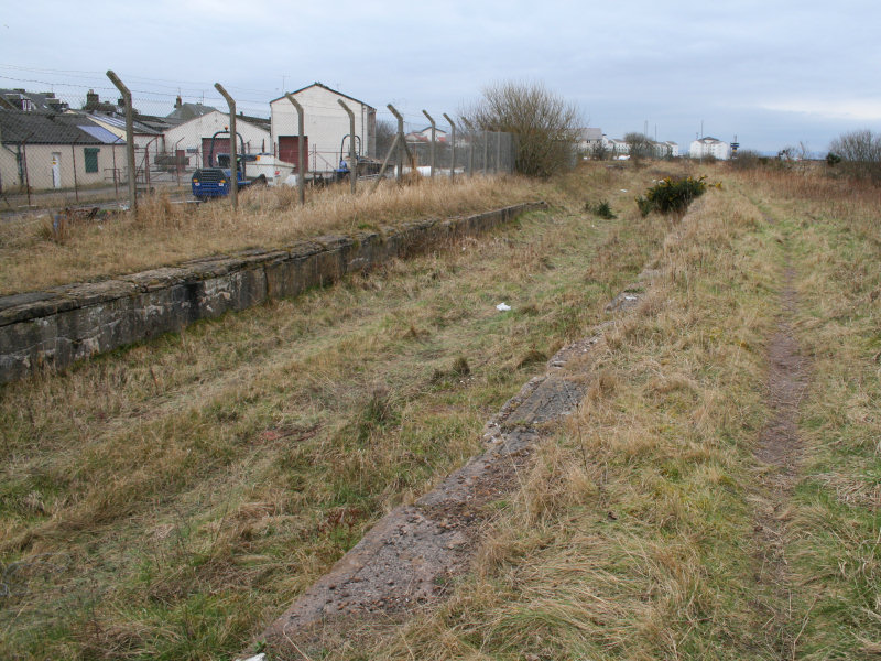
Bath Rocks Images

Images are sourced within 2km of 55.638302/-4.810731 or Grid Reference NS2341. Thanks to Geograph Open Source API. All images are credited.

Ardrossan Castle Construction of the castle as we know it began in the 13th century. However little is known of any buildings at the site before the Lands of Ardrossan were gifted to Richard de Barclay by the local feudal lords of the de Morvilles in the 12th century.
The lands passed into the hands of the Eglinton family following the death of the last Barclay Baron of Ardrossan without heirs.
Thereafter it transferred to John de Montgomerie through his marriage to Elizabeth, daughter of Sir Hugh Eglinton sometime after 1736.
The Montgomeries were responsible for a huge programme of reconstruction at Ardrossan Castle, which carried on well into the 15th century. It was the chief seat of the family until the time of Alexander, the first Lord Montgomery, who made Eglinton his principal residence.
Ardrossan remained a stronghold until it was finally destroyed in the 17th century, allegedly at the hands of Oliver Cromwell.
Ardrossan Castle
Construction of the castle as we know it began in the 13th century. However little is known of any buildings at the site before the Lands of Ardrossan were gifted to Richard de Barclay by the local feudal lords of the de Morvilles in the 12th century. The lands passed into the hands of the Eglinton family following the death of the last Barclay Baron of Ardrossan without heirs. Thereafter it transferred to John de Montgomerie through his marriage to Elizabeth, daughter of Sir Hugh Eglinton sometime after 1736. The Montgomeries were responsible for a huge programme of reconstruction at Ardrossan Castle, which carried on well into the 15th century. It was the chief seat of the family until the time of Alexander, the first Lord Montgomery, who made Eglinton his principal residence. Ardrossan remained a stronghold until it was finally destroyed in the 17th century, allegedly at the hands of Oliver Cromwell.
'The Burning Place' - Saltcoats, North Ayrshire The Burning Place of Sarah Vincent of Saltcoats.
 
 Sarah Vincent was the last witch to be executed in Saltcoats.
The inscription has been worn away, but the word Saltcoats can still be seen.
'The Burning Place' - Saltcoats, North Ayrshire
The Burning Place of Sarah Vincent of Saltcoats. Sarah Vincent was the last witch to be executed in Saltcoats. The inscription has been worn away, but the word Saltcoats can still be seen.
Landsborough and Trinity Church
Countess Street and the Town Hall
View towards Saltcoats From Stevenston Point.
View towards Saltcoats
From Stevenston Point.
Boat yard
Boat yard
Harbour entrance
Harbour entrance
Seagull on Outflow
Seagull on Outflow
Entrance for Arran Ferry at Ardrossan
Caledonian MacBrayne's Ardossan terminal
Lighthouse and long-stay parking A view of the harbour wall and parking area. The condition of the sea wall is a matter of concern, and is expected to form part of the works on upgrading the harbour facilities in readiness for the new vessel.
Lighthouse and long-stay parking
A view of the harbour wall and parking area. The condition of the sea wall is a matter of concern, and is expected to form part of the works on upgrading the harbour facilities in readiness for the new vessel.
Vehicle lanes and ferry terminal building Ferry facilities at Ardrossan harbour. This area is expected to be re-modelled for extra capacity and speed of loading when the new ferry takes up the service.
Vehicle lanes and ferry terminal building
Ferry facilities at Ardrossan harbour. This area is expected to be re-modelled for extra capacity and speed of loading when the new ferry takes up the service.
MV Caledonian Isles The ferry from Brodick on Arran enters the harbour at Ardrossan.
MV Caledonian Isles
The ferry from Brodick on Arran enters the harbour at Ardrossan.
MV Caledonian Isles docking The ferry on approach to the linkspan with bow-visor raised.
MV Caledonian Isles docking
The ferry on approach to the linkspan with bow-visor raised.
Arran view An atmospheric, afternoon view of Arran from the harbour lighthouse. Navigation markers and the Horse Isle Shelves can be seen near to the shore.
Arran view
An atmospheric, afternoon view of Arran from the harbour lighthouse. Navigation markers and the Horse Isle Shelves can be seen near to the shore.
Old milestone This milestone was probably erected for the tollroad from Irvine to Ardrossan and Greenock.  The eroded legend on this face may read Ardrossan/½/Largs/12½.  It is on South Crescent Road at the junction with South Beach Road.
Old milestone
This milestone was probably erected for the tollroad from Irvine to Ardrossan and Greenock. The eroded legend on this face may read Ardrossan/½/Largs/12½. It is on South Crescent Road at the junction with South Beach Road.
Old milestone This is the left face of the milestone on South Crescent Road.   The legend which can just be discerned is Irvine/8½/Kilwinning/4¾/Saltcoats/1.
Old milestone
This is the left face of the milestone on South Crescent Road. The legend which can just be discerned is Irvine/8½/Kilwinning/4¾/Saltcoats/1.
Old milestone On North Bay on Montgomerie Road near the junction of Caledonia Road is this very eroded toll road milestone.   Until 2008 it was sited at the Shell Bridge.   After roadworks it was reset at its current position.   This right-hand face has a very eroded Largs 11/Greenock 25 although the bench mark is clear.   The left face has Irvine/9½/Kilwinning/5½/Saltcoats/2.
Old milestone
On North Bay on Montgomerie Road near the junction of Caledonia Road is this very eroded toll road milestone. Until 2008 it was sited at the Shell Bridge. After roadworks it was reset at its current position. This right-hand face has a very eroded Largs 11/Greenock 25 although the bench mark is clear. The left face has Irvine/9½/Kilwinning/5½/Saltcoats/2.
Show me another place!

Bath Rocks is located at Grid Ref: NS2341 (Lat: 55.638302, Lng: -4.810731)

Unitary Authority: North Ayrshire

Police Authority: Ayrshire

What 3 Words

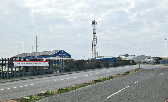
///menu.drill.cloud. Near Ardrossan, North Ayrshire

Related Wikis

Ardrossan Town railway station

Ardrossan Town railway station is one of three remaining in the town of Ardrossan, North Ayrshire, Scotland. It is one of the oldest operational railway...

Ardrossan Civic Centre

Ardrossan Civic Centre is a municipal building in Glasgow Street, Ardrossan, North Ayrshire, Scotland. The building, which is largely used as a community...

Ardrossan

Ardrossan (; from Scottish Gaelic Àird Rosain 'headland of the small promontory') is a town on the North Ayrshire coast in southwestern Scotland. The...

Ardrossan Harbour railway station

Ardrossan Harbour railway station is one of three remaining railway stations in the town of Ardrossan, North Ayrshire, Scotland. The station is managed...

Ardrossan North railway station

Ardrossan North railway station was a railway station serving the town of Ardrossan, North Ayrshire, Scotland as part of the Lanarkshire and Ayrshire Railway...

Ardrossan South Beach railway station

Ardrossan South Beach railway station is one of three in the town of Ardrossan, North Ayrshire, Scotland. The station is managed by ScotRail and is on...

Ardrossan Montgomerie Pier railway station

Ardrossan Montgomerie Pier railway station was a railway station serving the town of Ardrossan, North Ayrshire, Scotland as part of the Lanarkshire and...

Ardrossan Winton Pier railway station

Ardrossan Winton Pier railway station served the town of Ardrossan and its harbour, North Ayrshire, Scotland. The station allowed train passengers to link...

Nearby Amenities

Located within 500m of 55.638302,-4.810731
Created By: almien_coastlines
Lat/Long: 55.639363/-4.809951
Ardrossan
Location: North Ayrshire, Scotland, UK
Name En: Ardrossan
Name Gd: Àird Rosain
Name Sco: Ardrussan
Place: town
Population: 10952
Source: npe
Wikidata: Q640073
Wikipedia: en:Ardrossan
Lat/Long: 55.6400504/-4.8148569
Castlehill Junction
Historic Railway: junction
Railway: site
Lat/Long: 55.6419443/-4.8084448
Ardrossan Town
Naptan AtcoCode: 9100ARDRSTN
Network: National Rail
Network Website: https://www.nationalrail.co.uk/stations/adn/
Network Wikidata: Q26334
Operator: ScotRail
Operator Website: https://www.scotrail.co.uk/plan-your-journey/stations-and-facilities/adn
Operator Wikidata: Q18356161
Public Transport: station
Railway: station
Ref Crs: ADN
Source: landsat/npe
Train: yes
Wikidata: Q2166354
Wikipedia: en:Ardrossan Town railway station
Lat/Long: 55.6398834/-4.8125364
Traffic Signals
Lat/Long: 55.6400798/-4.8149231
Automated: yes
Crossing Barrier: double_half
Railway: level_crossing
Lat/Long: 55.6395103/-4.8129013
Crossing Barrier: half
Railway: level_crossing
Lat/Long: 55.6386715/-4.8181472
Turning Circle
Lat/Long: 55.6420487/-4.8087963
Turning Circle
Lat/Long: 55.6414251/-4.8077449
Turning Circle
Lat/Long: 55.6413168/-4.8086808
Turning Circle
Lat/Long: 55.6390807/-4.8137319
Turning Circle
Lat/Long: 55.6388333/-4.8134795
Turning Circle
Lat/Long: 55.6388375/-4.8111127
Turning Circle
Lat/Long: 55.6387046/-4.8115357
Turning Circle
Lat/Long: 55.6413464/-4.8126694
Turning Circle
Lat/Long: 55.6415462/-4.8052558
Turning Circle
Lat/Long: 55.6399019/-4.8176758
Turning Circle
Lat/Long: 55.6393876/-4.8147682
Turning Circle
Lat/Long: 55.6420567/-4.8136773
Turning Circle
Lat/Long: 55.6418477/-4.8143671
Turning Circle
Lat/Long: 55.6422916/-4.8131778
Post Office
Ardrossan Post Office
Addr Country: GB
Addr Postcode: KA22 8EP
Brand: Post Office
Brand Wikidata: Q1783168
Contact Website: https://www.postoffice.co.uk/branch-finder/2548437/ardrossan
Ref Pol Id: 147392
Lat/Long: 55.6409812/-4.8143563
Restaurant
Ceccini's
Lat/Long: 55.6395617/-4.8178166
Bus Stop
Bus: yes
Naptan AtcoCode: 6170415
Naptan NaptanCode: 62923452
Public Transport: platform
Shelter: yes
Lat/Long: 55.6397148/-4.81343
Bicycle Parking
Bicycle Parking: stands
Capacity: 6
Check Date: 2023-06-18
Covered: no
Lat/Long: 55.640057/-4.8151635
Bicycle Parking
Bicycle Parking: stands
Capacity: 6
Check Date: 2023-06-18
Covered: no
Lat/Long: 55.6401873/-4.8150699
Ardrossan Castle
Castle: ruins
Castle Type: defensive
Historic: castle
Ruins: yes
Wikidata: Q4788264
Wikimedia Commons: Category:Ardrossan Castle
Wikipedia: en:Ardrossan Castle
Lat/Long: 55.6418813/-4.8100968
Historic: monument
Lat/Long: 55.641303/-4.8117491
Barrier: bollard
Lat/Long: 55.6401495/-4.804723
Turning Circle
Lat/Long: 55.6399213/-4.8159783
Turning Circle
Lat/Long: 55.6394045/-4.8165257
Turning Circle
Lat/Long: 55.6396186/-4.8168259
Turning Circle
Lat/Long: 55.6397627/-4.8174537
Turning Circle
Lat/Long: 55.6407419/-4.8172111
Turning Circle
Lat/Long: 55.6410333/-4.8168533
Ardrossan War Memorial
Historic: memorial
Memorial: war_memorial
Lat/Long: 55.6400956/-4.8083391
Post Box
Post Box Design: type_k
Post Box Type: pillar
Ref: KA22 119
Royal Cypher: scottish_crown
Lat/Long: 55.6410172/-4.8141832
Post Box
Operator: Royal Mail
Operator Wikidata: Q638098
Post Box Design: type_b
Post Box Type: pillar
Ref: KA22 88D
Royal Cypher: GR
Royal Cypher Wikidata: Q33102273
Lat/Long: 55.6400317/-4.8145131
Fuel
Asda
Brand: Asda
Brand Wikidata: Q297410
Brand Wikipedia: en:Asda
Compressed Air: no
Contact Facebook: https://www.facebook.com/asda/
Contact Twitter: asda
Contact Website: https://storelocator.asda.com/scotland/adrossan/harbour-road
Operator: Asda Stores Ltd
Lat/Long: 55.6387878/-4.8173216
Entrance: yes
Lat/Long: 55.6390905/-4.8155169
Crossing
Lat/Long: 55.6405689/-4.8058061
Cafe
Asda Café
Addr City: Ardrossan
Addr Country: GB
Addr Postcode: KA22 8BZ
Addr Street: Harbour Road
Brand: Asda
Brand Wikidata: Q297410
Brand Wikipedia: en:Asda
Contact Phone: +44 1294 606600
Contact Website: https://storelocator.asda.com/scotland/adrossan/harbour-road/cafe
Cuisine: coffee_shop
Drinking Water Refill: yes
Drinking Water Refill Network: Refill
Fhrs Id: 529835
Fixme: Location not accurate
Internet Access: wlan
Internet Access Fee: no
Opening Hours Covid19: Mo-Su off
Operator: Asda Stores Ltd
Takeaway: yes
Lat/Long: 55.6388397/-4.8144525
Bus Stop
Princes St opp Hill St
Bench: yes
Bin: yes
Bus: yes
Departures Board: timetable
Naptan AtcoCode: 6170416
Naptan NaptanCode: 62924267
Network: SPT
Network Wikidata: Q7622046
Network Wikipedia: en:Strathclyde Partnership for Transport
Operator: SPT
Public Transport: platform
Ref: 62924267
Shelter: yes
Lat/Long: 55.6398144/-4.8144273
Crossing
Crossing: marked
Crossing Markings: yes
Lat/Long: 55.639937/-4.8146942
Crossing
Crossing: marked
Crossing Markings: yes
Lat/Long: 55.6400625/-4.814725
Addr Housenumber: 16
Lat/Long: 55.6389366/-4.8118261
Addr Housenumber: 17
Lat/Long: 55.6389756/-4.811846
Addr Housenumber: 15
Lat/Long: 55.6388828/-4.8118013
Bench
Backrest: yes
Material: wood
Lat/Long: 55.6418727/-4.8116491
Entrance: yes
Lat/Long: 55.6404232/-4.8166243
Entrance: yes
Lat/Long: 55.6404039/-4.8165683
Entrance: yes
Lat/Long: 55.6403859/-4.8165066
Entrance: yes
Lat/Long: 55.6403681/-4.8164451
Entrance: yes
Lat/Long: 55.6403505/-4.8163849
Entrance: yes
Lat/Long: 55.640333/-4.8163248
Entrance: yes
Lat/Long: 55.6403152/-4.8162639
Entrance: yes
Lat/Long: 55.6402973/-4.8162021
Entrance: yes
Lat/Long: 55.6402791/-4.8161403
Entrance: yes
Lat/Long: 55.6402612/-4.8160793
Entrance: yes
Lat/Long: 55.6402434/-4.8160182
Entrance: yes
Lat/Long: 55.6402256/-4.8159579
Entrance: yes
Lat/Long: 55.6402077/-4.8158969
Entrance: yes
Lat/Long: 55.6401897/-4.8158355
Entrance: yes
Lat/Long: 55.6401718/-4.8157749
Restaurant
Shahs Place
Cuisine: indian
Phone: +441294607777
Lat/Long: 55.6400258/-4.8141983
Restaurant
Meat in the Middle
Lat/Long: 55.6399925/-4.8140824
Seahorse
Shop: books
Lat/Long: 55.6392108/-4.8159881
Entrance: yes
Lat/Long: 55.6392615/-4.8159695
Fast Food
Harbourside Takeaway
Lat/Long: 55.6392639/-4.8161725
DIY+
Shop: doityourself
Lat/Long: 55.6394428/-4.8152524
Cafe
Moka
Diet Vegetarian: yes
Website: https://mokaardrossan.co.uk
Lat/Long: 55.639829/-4.8146908
A & I Funeral Directors
Phone: +441294537900
Shop: funeral_directors
Lat/Long: 55.639797/-4.8145898
Scottish Conservatives
Office: political_party
Phone: +441294463131
Lat/Long: 55.6397674/-4.8144874
Arty Party Crafts
Shop: craft
Lat/Long: 55.63974/-4.8143932
Dentist
Ayrshire Orthodontics
Healthcare: dentist
Healthcare Speciality: orthodontics
Lat/Long: 55.6397073/-4.8142868
Ayrshire Grooming Salon
Phone: +447751655217
Shop: pet_grooming
Lat/Long: 55.6401396/-4.8145839
William Hill
Brand: William Hill
Brand Wikidata: Q4053147
Brand Wikipedia: en:William Hill (bookmaker)
Shop: bookmaker
Lat/Long: 55.6403119/-4.8149665
Ardrossan Community Sports Hub
Club: sport
Website: https://ardrossancsh.org
Lat/Long: 55.6402212/-4.8145621
Wavelength
Phone: +441294468272
Shop: hairdresser
Lat/Long: 55.6402615/-4.8145204
Fast Food
Lynn's Takeaway
Lat/Long: 55.6403275/-4.814457
Community Craft Shop
Shop: craft
Lat/Long: 55.6403712/-4.8144173
The Salon
Phone: +441294601163
Shop: hairdresser
Lat/Long: 55.6404193/-4.8143757
Bar
Charlie's Bar
Lat/Long: 55.6404629/-4.8143341
Crossing
Lat/Long: 55.6405486/-4.8143756
A. Lothian
Phone: +441294463852
Shop: butcher
Lat/Long: 55.6407104/-4.8141133
Dentist
Ardrossan Dental Care
Addr City: Ardrossan
Addr Housenumber: 31
Addr Street: Glasgow Street
Healthcare: dentist
Website: https://ardrossandentalcare.co.uk
Lat/Long: 55.6409086/-4.8144255
Pharmacy
Gallagher Pharmacy
Dispensing: yes
Healthcare: pharmacy
Lat/Long: 55.6410363/-4.8143058
Cafe
The Cherry Cup & Saucer
Cuisine: coffee_shop
Lat/Long: 55.6410848/-4.8142616
Restaurant
Jaipur
Cuisine: indian
Lat/Long: 55.6411612/-4.8141861
The Hair Studio
Phone: +441294601658
Shop: hairdresser
Lat/Long: 55.6411215/-4.8142277
Place Of Worship
Evangelical Union Congregational Church
Denomination: evangelical
Religion: christian
Lat/Long: 55.6418248/-4.8137933
Bench
Lat/Long: 55.6422666/-4.8113802
Crossing
Lat/Long: 55.6405634/-4.8054189
Crossing
Lat/Long: 55.6405662/-4.8062397
Crossing
Lat/Long: 55.6405639/-4.80639
Crossing
Lat/Long: 55.6405551/-4.8067424
Crossing
Lat/Long: 55.6404472/-4.8081537
Crossing
Lat/Long: 55.6402621/-4.8094195
Generator Method: photovoltaic
Generator Output Electricity: yes
Generator Source: solar
Generator Type: solar_photovoltaic_panel
Power: generator
Lat/Long: 55.6411227/-4.8051442
Entrance: yes
Lat/Long: 55.6410627/-4.8049231
Entrance: yes
Lat/Long: 55.638592/-4.8115473
Entrance: yes
Lat/Long: 55.6385617/-4.8116017
Entrance: yes
Lat/Long: 55.6385295/-4.8116594
Entrance: yes
Lat/Long: 55.6384992/-4.8117137
Entrance: yes
Lat/Long: 55.6387563/-4.81134
Entrance: yes
Lat/Long: 55.6387206/-4.8113795
Entrance: yes
Lat/Long: 55.6386847/-4.8114193
Entrance: yes
Lat/Long: 55.6386484/-4.8114593
Generator Method: photovoltaic
Generator Output Electricity: yes
Generator Source: solar
Generator Type: solar_photovoltaic_panel
Power: generator
Lat/Long: 55.6395143/-4.8143571
Entrance: yes
Lat/Long: 55.6387544/-4.8117413
Entrance: yes
Lat/Long: 55.638713/-4.8117231
Entrance: yes
Lat/Long: 55.6386712/-4.8117046
Entrance: yes
Lat/Long: 55.6386263/-4.8116848
Generator Method: photovoltaic
Generator Output Electricity: yes
Generator Source: solar
Generator Type: solar_photovoltaic_panel
Power: generator
Lat/Long: 55.6410916/-4.8081693
Harbour: harbour_master
Lat/Long: 55.6394833/-4.8182843
Toilets
Access: customers
Unisex: yes
Lat/Long: 55.6394085/-4.8183988
Washing Machine
Access: customers
Lat/Long: 55.6393882/-4.8184155
Bench
Backrest: yes
Lat/Long: 55.6398902/-4.8092225
Bench
Backrest: yes
Lat/Long: 55.6400716/-4.8082401
Bench
Backrest: yes
Lat/Long: 55.6398833/-4.8092662
Bench
Backrest: yes
Lat/Long: 55.6398326/-4.8094324
Bench
Backrest: yes
Lat/Long: 55.6398631/-4.8093549
Bench
Backrest: yes
Lat/Long: 55.6398727/-4.8093186
Bench
Backrest: yes
Lat/Long: 55.6400583/-4.8084128
Bench
Backrest: yes
Lat/Long: 55.6398932/-4.8091722
Bench
Backrest: yes
Lat/Long: 55.6398925/-4.8091365
Bench
Backrest: yes
Lat/Long: 55.6398476/-4.8093868
Bench
Backrest: yes
Lat/Long: 55.6400605/-4.8074352
Bench
Backrest: yes
Lat/Long: 55.6398712/-4.8055272
Bench
Backrest: yes
Lat/Long: 55.6400354/-4.8072494
Bench
Backrest: yes
Lat/Long: 55.6398818/-4.805564
Bench
Backrest: yes
Lat/Long: 55.639958/-4.806353
Bench
Backrest: yes
Lat/Long: 55.6398919/-4.8056168
Bench
Backrest: yes
Lat/Long: 55.6398923/-4.8058173
Bench
Backrest: yes
Lat/Long: 55.6399971/-4.806608
Bench
Backrest: yes
Lat/Long: 55.6400599/-4.8074874
Bench
Backrest: yes
Lat/Long: 55.6399911/-4.8065017
Bench
Backrest: yes
Lat/Long: 55.6399937/-4.8065559
Bench
Backrest: yes
Lat/Long: 55.6400473/-4.8072939
Bench
Backrest: yes
Lat/Long: 55.639862/-4.8054907
Bench
Backrest: yes
Lat/Long: 55.6398979/-4.805668
Bench
Backrest: yes
Lat/Long: 55.6400485/-4.8075687
Bench
Backrest: yes
Lat/Long: 55.6399921/-4.8066496
Bench
Backrest: yes
Lat/Long: 55.6399003/-4.8057188
Bench
Backrest: yes
Lat/Long: 55.6398994/-4.80577
Bench
Backrest: yes
Lat/Long: 55.6400552/-4.8073409
Bench
Backrest: yes
Lat/Long: 55.6399799/-4.8064479
Bench
Backrest: yes
Lat/Long: 55.6399891/-4.8066947
Bench
Backrest: yes
Lat/Long: 55.6399702/-4.8064023
Bench
Backrest: yes
Lat/Long: 55.6400602/-4.8073903
Bench
Backrest: yes
Lat/Long: 55.6400563/-4.8075289
The data included in this document is from www.openstreetmap.org. The data is made available under ODbL.

Have you been to Bath Rocks?

Leave your review of Bath Rocks below (or comments, questions and feedback).