Longlevens

Settlement in Gloucestershire Gloucester

England

Longlevens

Longford Court, Longford Late C18th. Grade II listed.
Longford Court, Longford Credit: Stephen Richards

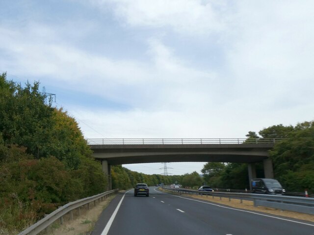
Longlevens is a suburban area located in Gloucestershire, England. Situated on the outskirts of the city of Gloucester, it is a vibrant and thriving community with a rich history. Longlevens is bordered by the A40 road to the south, which provides easy access to the rest of the county.

The area is predominantly residential, featuring a mix of housing styles ranging from traditional cottages to modern developments. Longlevens has a strong sense of community, with various local amenities available to its residents. These include a primary school, a library, a park, and a community center that hosts various events and activities throughout the year.

For those seeking recreational opportunities, Longlevens benefits from its close proximity to open green spaces, such as Elmbridge Court and the rural countryside surrounding the area. Sports enthusiasts can enjoy the facilities at Longlevens AFC, a local football club that competes in the Hellenic Football League.

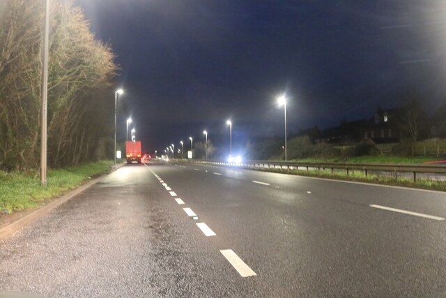
Longlevens is well-served by public transportation, with several bus routes connecting the area to Gloucester city center. The nearby M5 motorway ensures convenient access to other parts of the country, making Longlevens an attractive location for commuters.

Overall, Longlevens offers a peaceful and family-friendly environment within easy reach of both urban amenities and natural beauty. With its strong community spirit and convenient location, it continues to be a desirable place to live in Gloucestershire.

If you have any feedback on the listing, please let us know in the comments section below.
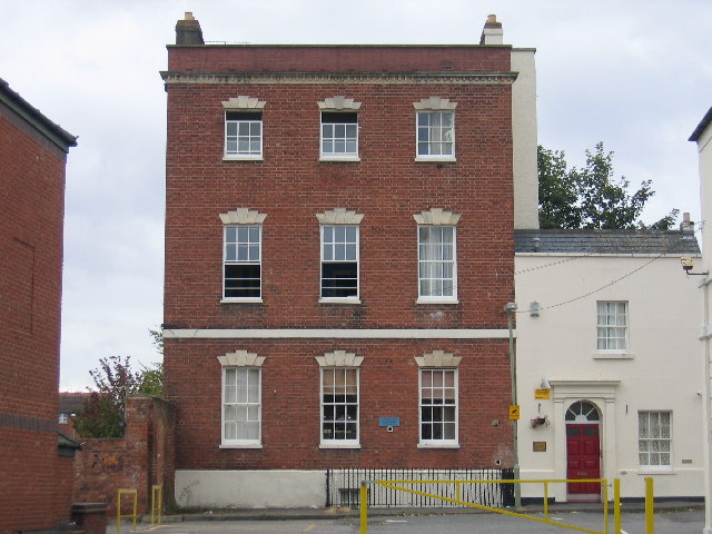
Longlevens Images

Images are sourced within 2km of 51.877337/-2.216126 or Grid Reference SO8519. Thanks to Geograph Open Source API. All images are credited.

Longford Court, Longford Late C18th. Grade II listed.
Longford Court, Longford
Late C18th. Grade II listed.
By the Horsbere Brook The A40 passes across the scene.
By the Horsbere Brook
The A40 passes across the scene.
The A40, Longlevens Approaching the end of the Gloucester Bypass
The A40, Longlevens
Approaching the end of the Gloucester Bypass
A40 Gloucester Bypass The second bypass of Gloucester to the north. Gloucester appears to have a rather complex road system.
A40 Gloucester Bypass
The second bypass of Gloucester to the north. Gloucester appears to have a rather complex road system.
Longford Lane bridge over A40 The original Longford Lane exists as two cul-de-sacs on opposite sides of the A40
Longford Lane bridge over A40
The original Longford Lane exists as two cul-de-sacs on opposite sides of the A40
Closed lay-by on eastbound A40 near Longford
Innsworth Lane overbridge over A40
Old Milestone by A38, Longford The Milestone is located by the road on the East of the road.  Parish of Longford (Tewkesbury District). Stone post (plate lost), erected by the Cheltenham & Gloucester turnpike trust in the 19th century. An earlier photograph can be found here: <a title="https://www.geograph.org.uk/photo/6049977" href="https://www.geograph.org.uk/photo/6049977">Link</a> 

Milestone Society National ID: GL_GLTW01
Old Milestone by A38, Longford
The Milestone is located by the road on the East of the road.  Parish of Longford (Tewkesbury District). Stone post (plate lost), erected by the Cheltenham & Gloucester turnpike trust in the 19th century. An earlier photograph can be found here: Link  Milestone Society National ID: GL_GLTW01
The A40, Longford, Gloucester
Small bridge on the A40, Longlevens It crosses a footpath.
Small bridge on the A40, Longlevens
It crosses a footpath.
The A40, Longford, Gloucester Here is a recent visit. <a title="https://www.geograph.org.uk/photo/7702181" href="https://www.geograph.org.uk/photo/7702181">Link</a>
The A40, Longford, Gloucester
Here is a recent visit. Link
Wotton Brook west of Queen's Bridge Looking north-west across the Severn floodplain from the A40 at Longford.
Wotton Brook west of Queen's Bridge
Looking north-west across the Severn floodplain from the A40 at Longford.
Queens Head, Longford Unremarkable from the outside but remarkable food served inside.
Viewed from the A38 Tewkesbury Road.
Queens Head, Longford
Unremarkable from the outside but remarkable food served inside. Viewed from the A38 Tewkesbury Road.
Longford evening light A gorgeous October evening sky above the northern outskirts of Gloucester.
Longford evening light
A gorgeous October evening sky above the northern outskirts of Gloucester.
Tewkesbury Rd Longford. View south along the A38 from close to its junction with Longford lane. This is just north of the major roundabout where the A38 intersects with the A40 on the north side of Gloucester.
Tewkesbury Rd Longford.
View south along the A38 from close to its junction with Longford lane. This is just north of the major roundabout where the A38 intersects with the A40 on the north side of Gloucester.
A38, Friday evening The scene looking north towards Longford Bridge, Twigworth and Tewkesbury.
A38, Friday evening
The scene looking north towards Longford Bridge, Twigworth and Tewkesbury.
Feathers Healing & Awareness Centre, Gloucester Located at 31 Tewkesbury Road, on the corner of Westfield Terrace.
Feathers Healing & Awareness Centre, Gloucester
Located at 31 Tewkesbury Road, on the corner of Westfield Terrace.
Show me another place!

Longlevens is located at Grid Ref: SO8519 (Lat: 51.877337, Lng: -2.216126)

Administrative County: Gloucestershire

District: Gloucester

Police Authority: Gloucestershire

What 3 Words

///asset.inflict.sneezing. Near Barnwood, Gloucestershire

Nearby Locations

Elmbridge Longlevens

Related Wikis

Longlevens

Longlevens, originally Longleavens, is a suburb of Gloucester, in Gloucestershire, England. It developed from a farmstead during the twentieth century...

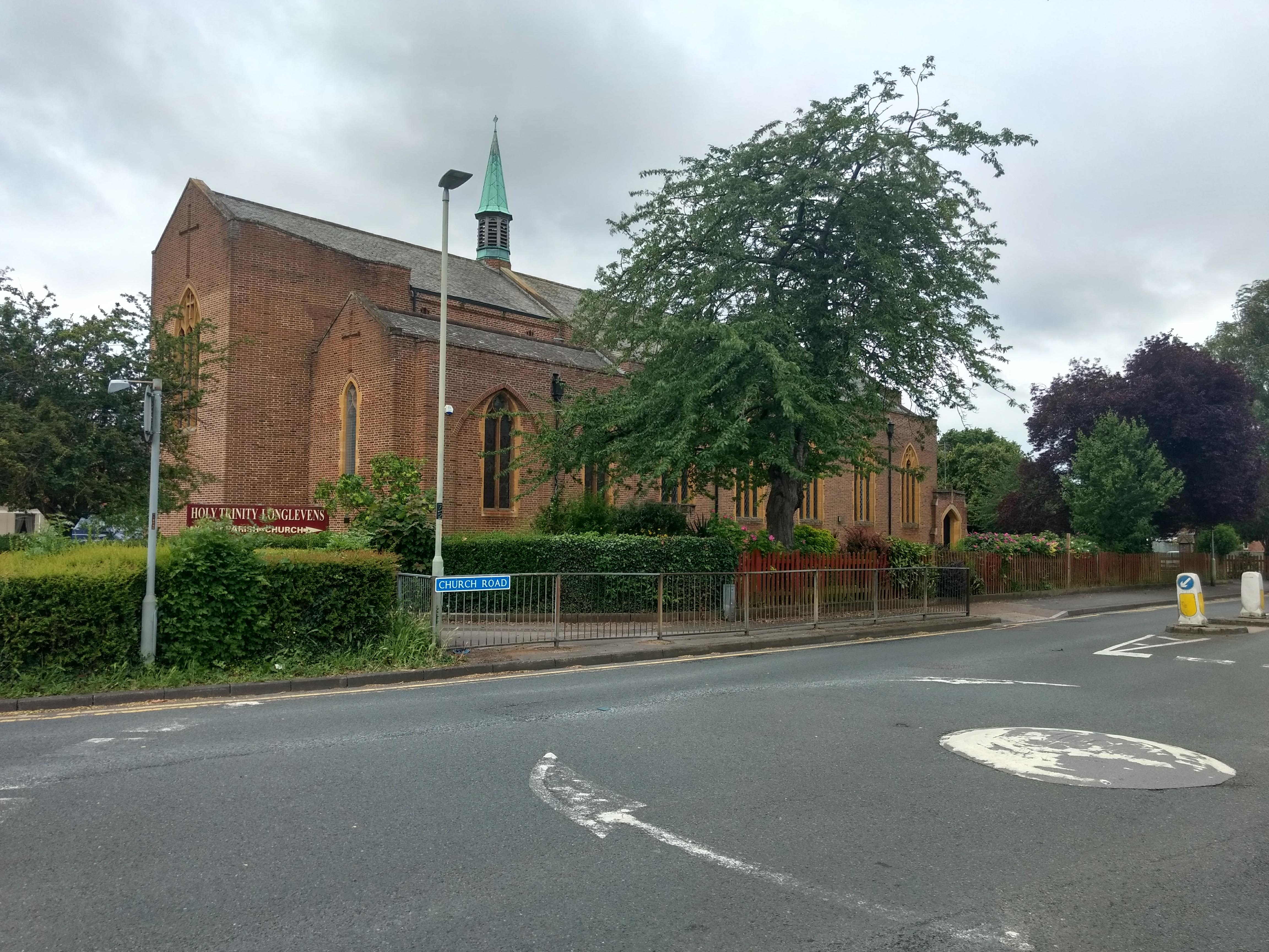
Holy Trinity Church, Longlevens

Holy Trinity Church is a Grade II listed Church of England parish church in Longlevens, Gloucester. It was designed by Harold Stratton Davis and built...

Sir Thomas Rich's School

Sir Thomas Rich's School is a grammar school with academy status for boys (aged 11–18) and girls (aged 16–18, in the sixth form) in Longlevens, Gloucester...

Elmbridge, Gloucester

Elmbridge is a suburb of Gloucester centred 2 miles (3.2 km) from the city centre. == Extent == It is south of Longlevens and northwest of Barnwood from...

Nearby Amenities

Located within 500m of 51.877337,-2.216126
Mini Roundabout
Lat/Long: 51.8754871/-2.2100214
Mini Roundabout
Lat/Long: 51.8753782/-2.2098651
Traffic Signals
Lat/Long: 51.8779193/-2.2170645
Traffic Calming: table
Lat/Long: 51.878193/-2.2230799
Bus Stop
Longlevens Crossroads
Bus: yes
Naptan AtcoCode: 1600GL3030
Naptan Bearing: NW
Naptan CommonName: Longlevens Crossroads
Naptan NaptanCode: glodgjad
Naptan PlusbusZoneRef: GLOSTER
Naptan Street: Longford Ln
Naptan Verified: no
Public Transport: platform
Shelter: no
Source: naptan_import
Tactile Paving: no
Lat/Long: 51.8780706/-2.2177464
Bus Stop
College Fields
Naptan AtcoCode: 1600GLA06152
Naptan Bearing: N
Naptan CommonName: College Fields
Naptan NaptanCode: glogpgwj
Naptan PlusbusZoneRef: GLOSTER
Naptan Street: Paygrove Lane
Naptan Verified: no
Source: naptan_import
Lat/Long: 51.8774409/-2.2088903
Bus Stop
Longlevens Crossroads
Bus: yes
Naptan AtcoCode: 1600GLA90851
Naptan Bearing: NE
Naptan CommonName: Longlevens Crossroads
Naptan NaptanCode: glogpawm
Naptan PlusbusZoneRef: GLOSTER
Naptan Street: Innsworth Ln
Naptan Verified: no
Public Transport: platform
Shelter: no
Source: naptan_import
Tactile Paving: no
Lat/Long: 51.8783421/-2.2168325
Bus Stop
Oxstalls Way
Bus: yes
Naptan AtcoCode: 1600GLB025
Naptan Bearing: E
Naptan CommonName: Oxstalls Way
Naptan Indicator: Opp
Naptan NaptanCode: glodgatj
Naptan PlusbusZoneRef: GLOSTER
Naptan Street: Longford Lane
Naptan Verified: no
Public Transport: platform
Shelter: yes
Source: naptan_import
Tactile Paving: no
Lat/Long: 51.8789437/-2.2220507
Bus Stop
Brooklands Park
Bus: yes
Naptan AtcoCode: 1600GLB029
Naptan Bearing: NE
Naptan CommonName: Brooklands Park
Naptan Indicator: Opp
Naptan NaptanCode: glodgjmj
Naptan PlusbusZoneRef: GLOSTER
Naptan Street: Innsworth Lane
Naptan Verified: no
Public Transport: platform
Shelter: no
Source: naptan_import
Tactile Paving: no
Lat/Long: 51.8804949/-2.2146928
Bus Stop
Brooklands Park
Bus: yes
Naptan AtcoCode: 1600GLB030
Naptan Bearing: SW
Naptan CommonName: Brooklands Park
Naptan NaptanCode: glodgjpd
Naptan PlusbusZoneRef: GLOSTER
Naptan Street: Innsworth Lane
Naptan Verified: no
Public Transport: platform
Shelter: yes
Source: naptan_import
Tactile Paving: no
Lat/Long: 51.8805851/-2.2145043
Bus Stop
School Grounds
Naptan AtcoCode: 1600GLB361
Naptan Bearing: NE
Naptan CommonName: School Grounds
Naptan Indicator: Opp
Naptan NaptanCode: glodgpmd
Naptan PlusbusZoneRef: GLOSTER
Naptan Street: Paygrove Lane
Naptan Verified: no
Source: naptan_import
Lat/Long: 51.8760922/-2.2101791
Bus Stop
Flower Way
Naptan AtcoCode: 1600GLB556
Naptan Bearing: S
Naptan CommonName: Flower Way
Naptan NaptanCode: glogmatd
Naptan PlusbusZoneRef: GLOSTER
Naptan Street: Oxstalls Way
Naptan Verified: no
Source: naptan_import
Lat/Long: 51.8777546/-2.2232797
Post Box
Collection Times: Mo-Fr 09:00; Sa 07:00
Post Box Type: pillar
Ref: GL2 830
Lat/Long: 51.8793518/-2.2104628
Street Lamp
Source: Bing
Lat/Long: 51.8773558/-2.215724
Power: pole
Source: Bing
Lat/Long: 51.8773959/-2.2155275
Power: pole
Source: Bing
Lat/Long: 51.8773529/-2.2157159
Barrier: cycle_barrier
Lat/Long: 51.8785037/-2.2191151
Traffic Calming: bump
Lat/Long: 51.8796504/-2.2119841
Traffic Calming: bump
Lat/Long: 51.8799508/-2.2135864
Post Box
Collection Times: Mo-Fr 09:00, Sa 07:00
Ref: GL2 120
Source: survey
Lat/Long: 51.8747767/-2.2167616
Barrier: cycle_barrier
Lat/Long: 51.873778/-2.2175757
Barrier: cycle_barrier
Lat/Long: 51.8739815/-2.2187348
Post Box
Brand: Royal Mail
Collection Times: Mo-Fr 17:45; Sa 11:00
Operator: Royal Mail
Ref: GL2 931
Royal Cypher: EIIR
Royal Cypher Wikidata: Q33102113
Lat/Long: 51.880704/-2.2159909
Post Box
Brand: Royal Mail
Collection Times: Mo-Fr 17:30; Sa 12:00
Operator: Royal Mail
Operator Wikidata: Q638098
Post Box Type: pillar
Ref: GL2 71
Royal Cypher: EIIR
Royal Cypher Wikidata: Q33102113
Lat/Long: 51.8782119/-2.216921
Post Box
Collection Times: Mo-Fr 17:15; Sa 11:00
Operator: Royal Mail
Operator Wikidata: Q638098
Post Box Type: pillar
Ref: GL2 68
Royal Cypher: EIIR
Royal Cypher Wikidata: Q33102113
Lat/Long: 51.8747811/-2.2104036
Give Way
Direction: forward
Lat/Long: 51.8763707/-2.2223812
Give Way
Direction: forward
Lat/Long: 51.8757963/-2.2225971
Atm
Operator: Tesco
Lat/Long: 51.8747195/-2.2104272
No.41 Coffee and Cake
Shop: coffee
Lat/Long: 51.875785/-2.2097487
Library
Longlevens Library
Wikidata: Q26538423
Lat/Long: 51.876445/-2.2135098
School
School: primary
Lat/Long: 51.8762097/-2.213344
Atm
Lat/Long: 51.8743423/-2.2107643
Turning Circle
Lat/Long: 51.8766255/-2.2193953
Turning Circle
Lat/Long: 51.8766425/-2.2193418
The data included in this document is from www.openstreetmap.org. The data is made available under ODbL.

Have you been to Longlevens?

Leave your review of Longlevens below (or comments, questions and feedback).