Elmbridge

Settlement in Gloucestershire Gloucester

England

Elmbridge

By the Horsbere Brook The A40 passes across the scene.
By the Horsbere Brook Credit: Jonathan Billinger

Elmbridge is a small village located in the county of Gloucestershire, England. Situated in the Cotswolds, it is surrounded by picturesque countryside and offers a tranquil and idyllic setting for residents and visitors alike. With a population of around 1,000 people, Elmbridge maintains a close-knit community atmosphere.

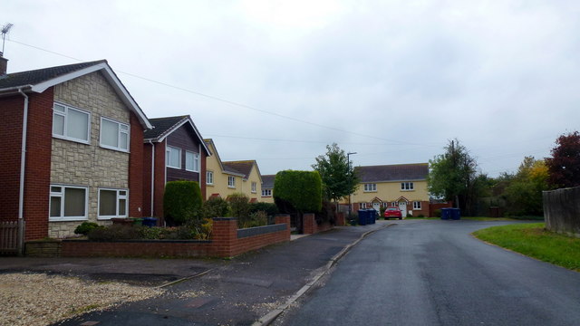
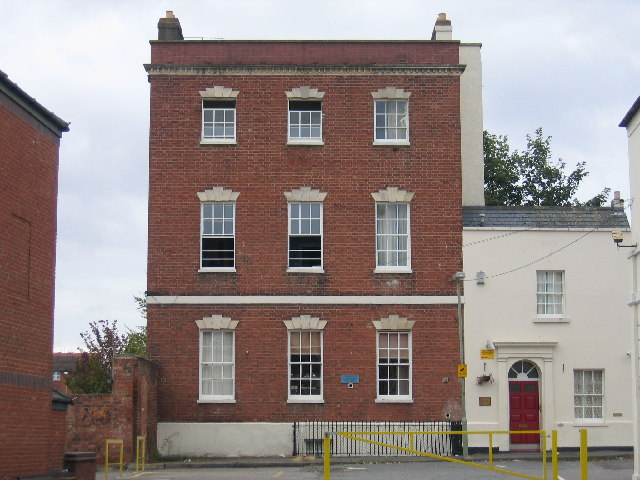
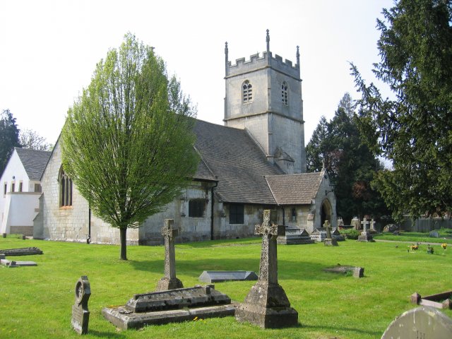
The village itself is characterized by its charming traditional architecture, with many of the buildings dating back to the 17th and 18th centuries. The local church, St. Mary's, is a prominent feature and adds to the village's historical charm.

Elmbridge offers a range of amenities to cater to its residents' needs. These include a local convenience store, a post office, and a village hall that hosts various community events throughout the year. The village also has a primary school, providing education for the local children.

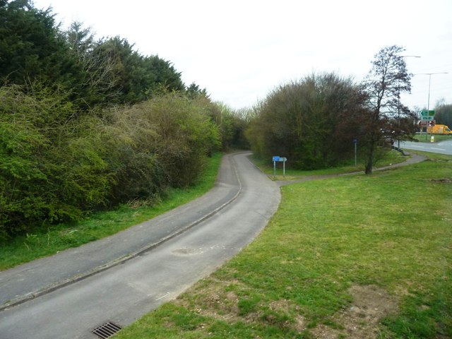
For outdoor enthusiasts, Elmbridge boasts numerous walking and cycling trails that showcase the beautiful countryside. The village is also within close proximity to several nature reserves and parks, offering opportunities for wildlife spotting and peaceful picnics.

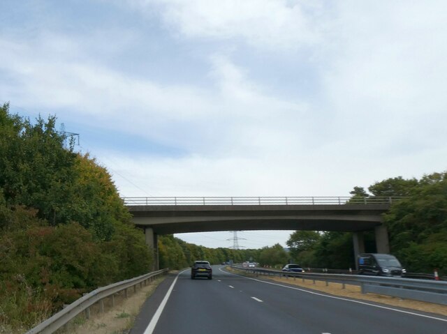
Despite its rural location, Elmbridge benefits from good transportation links. It is conveniently located near major road networks, allowing for easy access to nearby towns and cities. The village also has regular bus services that connect it to the wider region.

In conclusion, Elmbridge is a charming village in Gloucestershire that offers a peaceful and scenic environment. Its rich history, community spirit, and access to the countryside make it an attractive place to live or visit.

If you have any feedback on the listing, please let us know in the comments section below.

Elmbridge Images

Images are sourced within 2km of 51.873235/-2.212126 or Grid Reference SO8519. Thanks to Geograph Open Source API. All images are credited.

By the Horsbere Brook The A40 passes across the scene.
By the Horsbere Brook
The A40 passes across the scene.
The A40, Longlevens Approaching the end of the Gloucester Bypass
The A40, Longlevens
Approaching the end of the Gloucester Bypass
A40 Gloucester Bypass The second bypass of Gloucester to the north. Gloucester appears to have a rather complex road system.
A40 Gloucester Bypass
The second bypass of Gloucester to the north. Gloucester appears to have a rather complex road system.
Longford Lane bridge over A40 The original Longford Lane exists as two cul-de-sacs on opposite sides of the A40
Longford Lane bridge over A40
The original Longford Lane exists as two cul-de-sacs on opposite sides of the A40
Closed lay-by on eastbound A40 near Longford
Innsworth Lane overbridge over A40
Path and cycle track near busy junction Approaching the roundabout at the junction of the B4063 and the A40
Path and cycle track near busy junction
Approaching the roundabout at the junction of the B4063 and the A40
Junction of Innsworth Lane with Innsworth Lane A road realignment leaves this anomaly, but the autumn colours are nice.
Junction of Innsworth Lane with Innsworth Lane
A road realignment leaves this anomaly, but the autumn colours are nice.
Bullfinch Way Residential spur off Innsworth Lane.
Bullfinch Way
Residential spur off Innsworth Lane.
B4063 approaching Gloucester ring road Just north-east of a large roundabout where the A40 from Cheltenham meets the ring road; the skyline is dominated by the pylon; an important link in the electricity grid follows the ring road for some distance
B4063 approaching Gloucester ring road
Just north-east of a large roundabout where the A40 from Cheltenham meets the ring road; the skyline is dominated by the pylon; an important link in the electricity grid follows the ring road for some distance
Playing field by the A40, Longford
Petrol station by the A40, Longford
The A40, Longlevens
The A40, Longlevens
A40 Gloucester bypass, M5 four miles.
A40 Gloucester bypass, Longford Lane overbridge
A40 Gloucester bypass Innsworth Lane overbridge
A40 Gloucester bypass
Show me another place!

Elmbridge is located at Grid Ref: SO8519 (Lat: 51.873235, Lng: -2.212126)

Administrative County: Gloucestershire

District: Gloucester

Police Authority: Gloucestershire

What 3 Words

///palms.fans.bits. Near Barnwood, Gloucestershire

Nearby Locations

Longlevens Elmbridge

Related Wikis

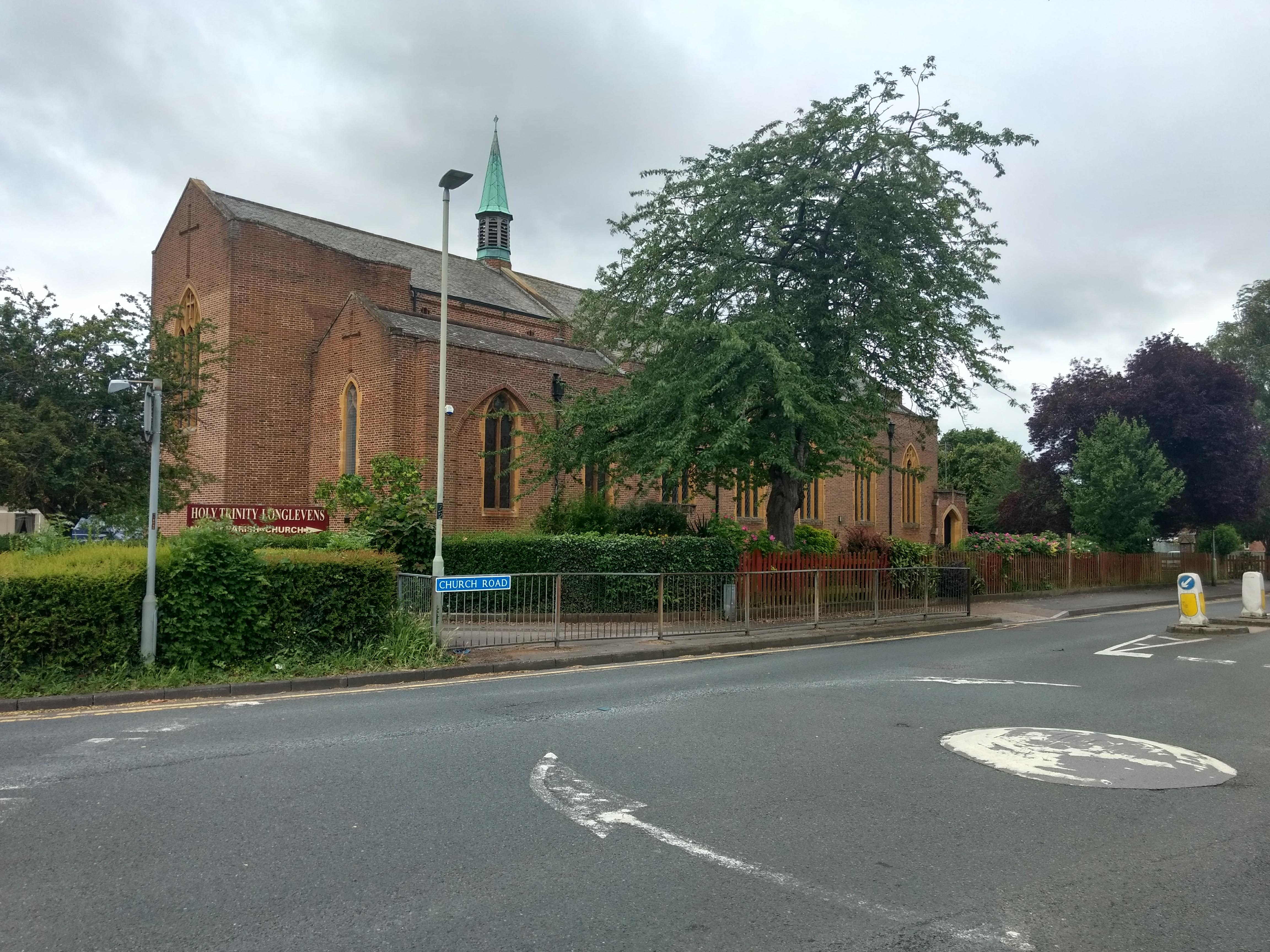
Holy Trinity Church, Longlevens

Holy Trinity Church is a Grade II listed Church of England parish church in Longlevens, Gloucester. It was designed by Harold Stratton Davis and built...

Sir Thomas Rich's School

Sir Thomas Rich's School is a grammar school with academy status for boys (aged 11–18) and girls (aged 16–18, in the sixth form) in Longlevens, Gloucester...

Longlevens

Longlevens, originally Longleavens, is a suburb of Gloucester, in Gloucestershire, England. It developed from a farmstead during the twentieth century...

Elmbridge, Gloucester

Elmbridge is a suburb of Gloucester centred 2 miles (3.2 km) from the city centre. == Extent == It is south of Longlevens and northwest of Barnwood from...

Longlevens A.F.C.

Longlevens Association Football Club is a football club based in the Longlevens suburb of Gloucester, Gloucestershire, England. They are currently members...

Gloucestershire Parkway railway station

Gloucestershire Parkway railway station is or was a proposed development in transport infrastructure for a semi-greenfield site surrounded by warehouse...

Wotton, Gloucester

Wotton is a suburb of Gloucester, in the county of Gloucestershire, England. It is situated close to the city centre (1 mile), the Royal Hospital, the...

Barnwood

Barnwood is an suburb and former civil parish in the city of Gloucester, in the county of Gloucestershire, England. It lies about 1.8 miles (2.9 km) east...

Nearby Amenities

Located within 500m of 51.873235,-2.212126
Mini Roundabout
Lat/Long: 51.8754871/-2.2100214
Mini Roundabout
Lat/Long: 51.8753782/-2.2098651
Turning Loop
Lat/Long: 51.8728552/-2.2177715
Traffic Signals
Lat/Long: 51.8750551/-2.2076985
Pub
The Teddy
Brand: Ember Inns
Brand Wikidata: Q116272278
Contact Website: https://www.emberinns.co.uk/nationalsearch/southwest/the-king-edward-vii-gloucester
Wheelchair: yes
Lat/Long: 51.8755045/-2.2092263
Crossing
Button Operated: yes
Crossing: traffic_signals
Crossing Island: no
Tactile Paving: yes
Traffic Signals Sound: yes
Lat/Long: 51.8737385/-2.2114911
Longlevens
Is In: Gloucester, Gloucestershire, England, UK
Place: suburb
Lat/Long: 51.8768283/-2.2077787
Bus Stop
Sisson Rd
Bus: yes
Naptan AtcoCode: 1600GL1825
Naptan Bearing: NE
Naptan CommonName: Sisson Rd
Naptan Indicator: Opp
Naptan NaptanCode: glodgjta
Naptan PlusbusZoneRef: GLOSTER
Naptan Street: Elmbridge Rd
Naptan Verified: no
Public Transport: platform
Shelter: no
Source: naptan_import
Tactile Paving: no
Lat/Long: 51.8698719/-2.2140601
Bus Stop
Sisson Rd
Bus: yes
Naptan AtcoCode: 1600GL1826
Naptan Bearing: SW
Naptan CommonName: Sisson Rd
Naptan NaptanCode: glodgjpm
Naptan PlusbusZoneRef: GLOSTER
Naptan Street: Elmbridge Rd
Naptan Verified: no
Public Transport: platform
Shelter: no
Source: naptan_import
Tactile Paving: no
Lat/Long: 51.8693277/-2.2143415
Bus Stop
Elmbridge Road
Bench: yes
Bin: yes
Bus: yes
Naptan AtcoCode: 1600GL5749
Naptan Bearing: NE
Naptan CommonName: BP Garage
Naptan NaptanCode: glodgmwg
Naptan PlusbusZoneRef: GLOSTER
Naptan Street: Cheltenham Road
Naptan Verified: no
Public Transport: platform
Shelter: yes
Source: naptan_import
Tactile Paving: no
Lat/Long: 51.8741001/-2.2106904
Bus Stop
Elmbridge Road
Bench: yes
Bin: yes
Bus: yes
Lit: yes
Naptan AtcoCode: 1600GL5750
Naptan Bearing: SW
Naptan CommonName: Elmbridge Road
Naptan NaptanCode: glodgmdm
Naptan PlusbusZoneRef: GLOSTER
Naptan Street: Cheltenham Road
Naptan Verified: no
Public Transport: platform
Shelter: yes
Source: naptan_import
Tactile Paving: no
Lat/Long: 51.873141/-2.2127388
Bus Stop
Old Cheltenham Road
Bench: yes
Bin: no
Bus: yes
Naptan AtcoCode: 1600GLB000
Naptan Bearing: SW
Naptan CommonName: Old Cheltenham Road
Naptan Indicator: Opp
Naptan NaptanCode: glodgpwa
Naptan PlusbusZoneRef: GLOSTER
Naptan Street: Cheltenham Road
Naptan Verified: no
Public Transport: platform
Shelter: yes
Source: naptan_import
Tactile Paving: no
Lat/Long: 51.8746189/-2.2087609
Bus Stop
Wellsprings Road
Bench: no
Bin: no
Bus: yes
Naptan AtcoCode: 1600GLB001
Naptan Bearing: E
Naptan CommonName: Wellsprings Road
Naptan NaptanCode: glodgdpd
Naptan PlusbusZoneRef: GLOSTER
Naptan Street: Cheltenham Road
Naptan Verified: no
Public Transport: platform
Shelter: no
Source: naptan_import
Tactile Paving: no
Lat/Long: 51.8718696/-2.2185591
Bus Stop
Double Gloucester
Bench: yes
Bin: yes
Bus: yes
Lit: yes
Naptan AtcoCode: 1600GLB002
Naptan Bearing: W
Naptan CommonName: Double Gloucester
Naptan NaptanCode: glodgdgw
Naptan PlusbusZoneRef: GLOSTER
Naptan Street: Cheltenham Road
Naptan Verified: no
Public Transport: platform
Shelter: yes
Source: naptan_import
Tactile Paving: no
Lat/Long: 51.8718912/-2.2170649
Bus Stop
Kimberley Close
Bus: yes
Naptan AtcoCode: 1600GLB304
Naptan Bearing: W
Naptan CommonName: Kimberley Close
Naptan Indicator: Opp
Naptan NaptanCode: glodgwdm
Naptan PlusbusZoneRef: GLOSTER
Naptan Street: Elmleaze
Naptan Verified: no
Public Transport: platform
Source: naptan_import
Lat/Long: 51.8744961/-2.2055564
Bus Stop
School Grounds
Naptan AtcoCode: 1600GLB361
Naptan Bearing: NE
Naptan CommonName: School Grounds
Naptan Indicator: Opp
Naptan NaptanCode: glodgpmd
Naptan PlusbusZoneRef: GLOSTER
Naptan Street: Paygrove Lane
Naptan Verified: no
Source: naptan_import
Lat/Long: 51.8760922/-2.2101791
Bus Stop
Meadowleaze
Naptan AtcoCode: 1600GLB366
Naptan Bearing: S
Naptan CommonName: Meadowleaze
Naptan NaptanCode: glodgmpg
Naptan PlusbusZoneRef: GLOSTER
Naptan Street: Elmleaze
Naptan Verified: no
Source: naptan_import
Lat/Long: 51.8710686/-2.2116703
Post Box
Collection Times: Mo-Fr 09:00, Sa 07:00
Ref: GL2 120
Source: survey
Lat/Long: 51.8747767/-2.2167616
Post Box
Collection Times: Mo-Fr 17:45; Sa 13:00
Ref: GL2 58
Source: survey
Lat/Long: 51.8694623/-2.2141813
Barrier: cycle_barrier
Lat/Long: 51.873778/-2.2175757
Barrier: cycle_barrier
Lat/Long: 51.8739815/-2.2187348
Turning Circle
Lat/Long: 51.8708074/-2.2158003
Post Box
Collection Times: Mo-Fr 17:45; Sa 09:30
Ref: GL2 126
Source: survey
Lat/Long: 51.8725316/-2.209049
Post Box
Collection Times: Mo-Fr 17:15; Sa 11:00
Operator: Royal Mail
Operator Wikidata: Q638098
Post Box Type: pillar
Ref: GL2 68
Royal Cypher: EIIR
Royal Cypher Wikidata: Q33102113
Lat/Long: 51.8747811/-2.2104036
Bus Stop
Sir Thomas Rich's School
Bus: yes
Naptan AtcoCode: 160000022
Naptan Bearing: SW
Naptan CommonName: Sir Thomas Rich's School
Naptan Indicator: o/s
Naptan NaptanCode: glogtdma
Naptan Street: Oakleaze
Naptan Verified: no
Public Transport: platform
Lat/Long: 51.8734643/-2.2067099
Fast Food
Subway
Brand: Subway
Brand Wikidata: Q244457
Cuisine: sandwich
Takeaway: yes
Lat/Long: 51.8743416/-2.2105642
Atm
Operator: Tesco
Lat/Long: 51.8747195/-2.2104272
No.41 Coffee and Cake
Shop: coffee
Lat/Long: 51.875785/-2.2097487
Library
Longlevens Library
Wikidata: Q26538423
Lat/Long: 51.876445/-2.2135098
School
School: primary
Lat/Long: 51.8762097/-2.213344
Atm
Lat/Long: 51.8743423/-2.2107643
The data included in this document is from www.openstreetmap.org. The data is made available under ODbL.

Have you been to Elmbridge?

Leave your review of Elmbridge below (or comments, questions and feedback).