Bwn Bach
Coastal Feature, Headland, Point in Pembrokeshire
Wales
Bwn Bach

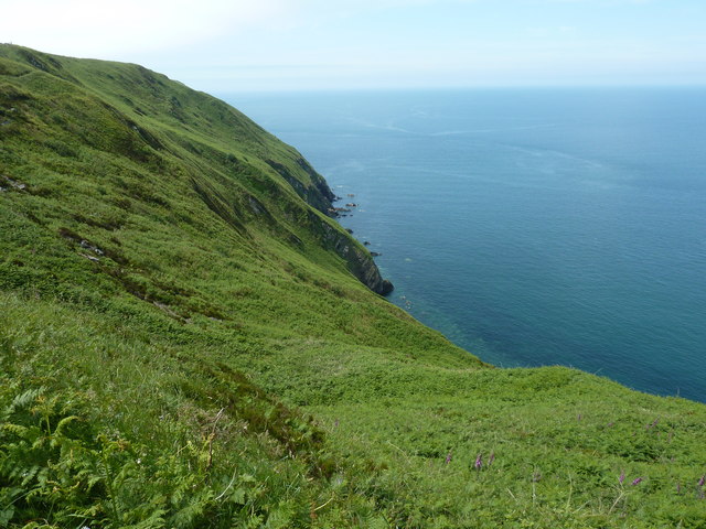
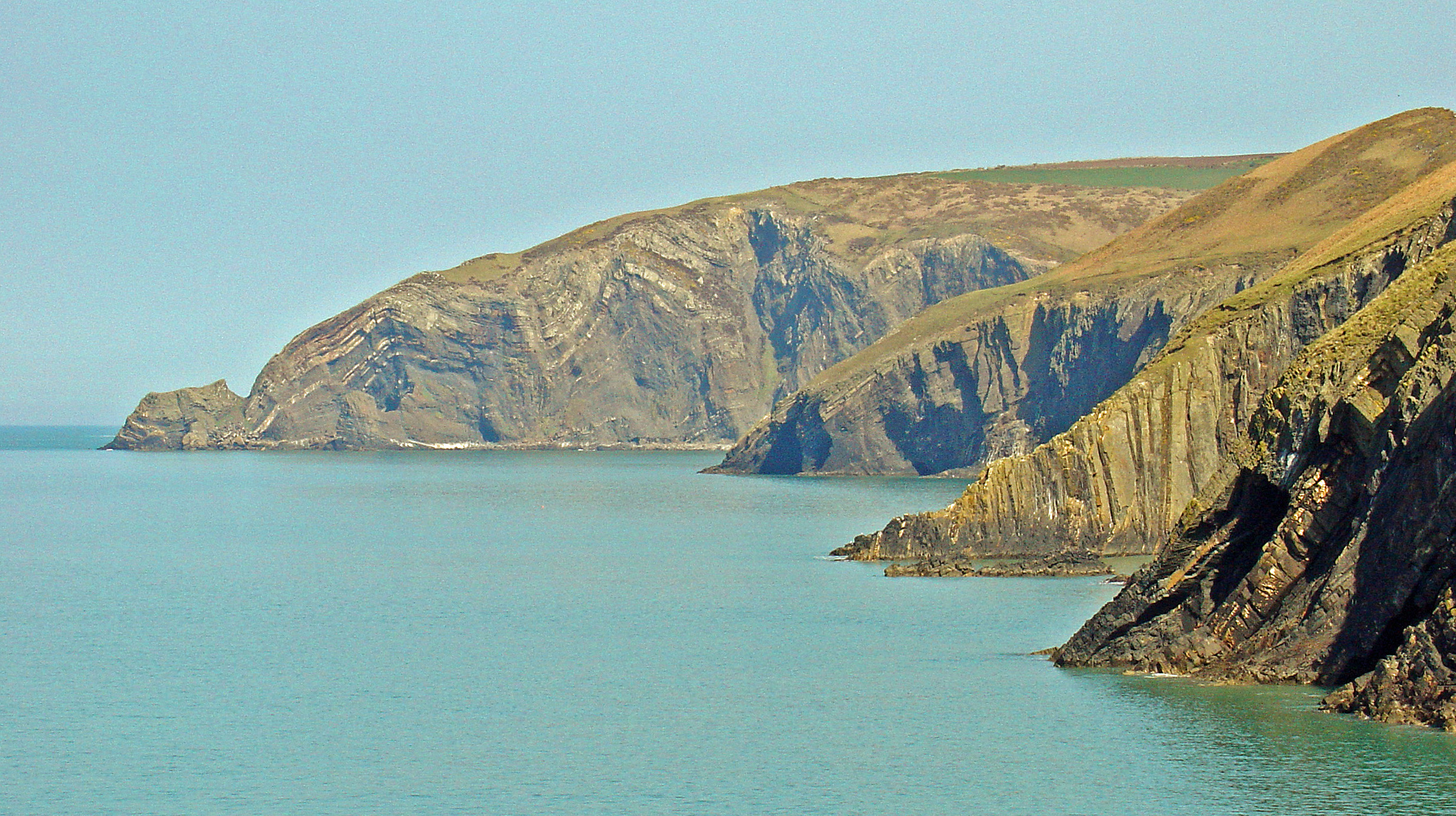
Bwn Bach is a stunning coastal feature located in Pembrokeshire, Wales. It is a headland that extends out into the Celtic Sea, forming a prominent point along the rugged coastline. The name "Bwn Bach" translates to "small mound" in Welsh, which accurately describes its physical appearance.
The headland of Bwn Bach is characterized by its dramatic cliffs, which rise steeply from the sea to a height of around 30 meters. These cliffs are composed of sedimentary rocks, displaying a range of colors from golden sandstone to gray limestone. The rugged nature of the cliffs adds to the beauty and charm of the area, while also providing a habitat for various seabirds, such as gulls and cormorants.
As a point of interest for both locals and tourists, Bwn Bach offers breathtaking panoramic views of the surrounding coastline. On clear days, visitors can see the blue expanse of the Celtic Sea stretching out to the horizon, with occasional sightings of marine wildlife, including seals and dolphins.
Access to Bwn Bach is relatively straightforward, with a coastal path leading to the headland from the nearby village. The path itself offers a pleasant walk along the clifftops, allowing visitors to appreciate the natural beauty of the area. Additionally, Bwn Bach is located within close proximity to other popular coastal destinations in Pembrokeshire, making it a convenient stop for those exploring the region.
Overall, Bwn Bach is a picturesque and captivating headland, offering both natural beauty and recreational opportunities for visitors to enjoy.
If you have any feedback on the listing, please let us know in the comments section below.
Bwn Bach Images
Images are sourced within 2km of 52.066745/-4.7813996 or Grid Reference SN0944. Thanks to Geograph Open Source API. All images are credited.


Bwn Bach is located at Grid Ref: SN0944 (Lat: 52.066745, Lng: -4.7813996)
Unitary Authority: Pembrokeshire
Police Authority: Dyfed Powys
What 3 Words
///loudness.sulky.watches. Near Nevern, Pembrokeshire
Nearby Locations
Related Wikis

Aberarth – Carreg Wylan
Aberarth – Carreg Wylan is a Site of Special Scientific Interest in Ceredigion, west Wales. It is a small coastal marine protected area with a reported...
Moylgrove
Moylgrove (Welsh: Trewyddel), also spelled Moylegrove, is a village and parish in north Pembrokeshire, Wales, about 4 miles (6.4 km) from Cardigan, in...

Ceibwr Bay
Ceibwr Bay (Welsh: Bae Ceibwr) is a bay opening into the Irish Sea in Pembrokeshire, west Wales. It is about 7 km west of Cardigan, and 3 km south of the...

St Dogmells Rural District
St Dogmells was a rural district in the administrative county of Pembrokeshire, Wales from 1894 to 1934. == Formation == The district was created by the...
Nearby Amenities
Located within 500m of 52.066745,-4.7813996Have you been to Bwn Bach?
Leave your review of Bwn Bach below (or comments, questions and feedback).