Crowberry Rock

Coastal Feature, Headland, Point in Wigtownshire

Scotland

Crowberry Rock

Oyster catchers on Ardwell Bay nx070450 Ardwell bay, looking ENE across the bay, Oyster Catchers can be seen looking for a late lunch we were waiting to eat ours as well....
Oyster catchers on Ardwell Bay nx070450 Credit: Dave Smethurst

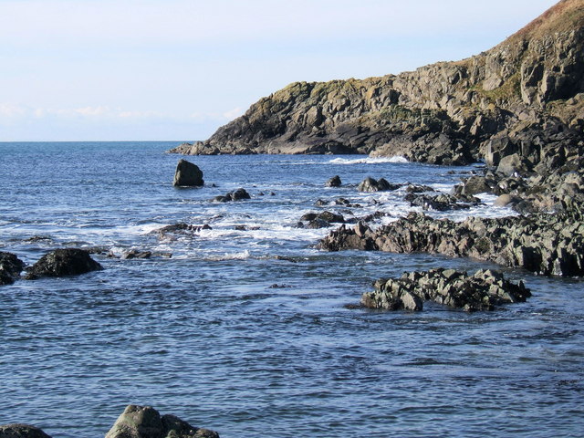
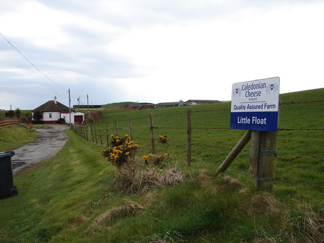
Crowberry Rock is a prominent coastal feature located in Wigtownshire, Scotland. It is a picturesque headland that juts out into the Irish Sea, offering breathtaking views and natural beauty. The rock gets its name from the abundance of crowberry plants that grow on its cliffs.

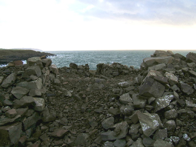
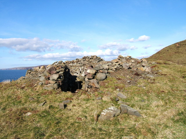
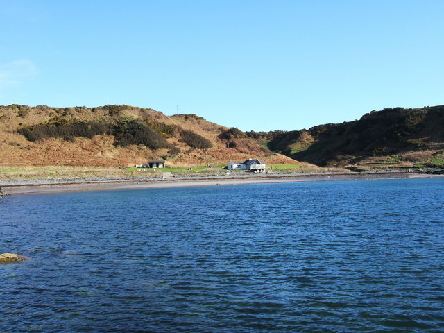
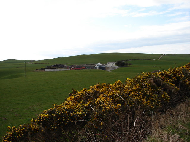
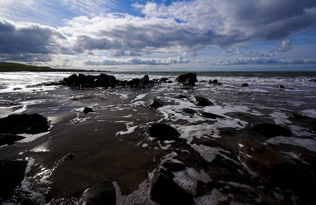
Situated along the rugged coastline, Crowberry Rock is characterized by its steep cliffs and rocky terrain, making it a striking sight against the backdrop of the sea. The headland extends out into the water, forming a point that is a popular spot for hikers, nature enthusiasts, and photographers.

The rock is made up of sedimentary layers, primarily composed of sandstone and shale, which have been shaped over centuries by the relentless crashing waves. This has resulted in the formation of caves, arches, and other intriguing geological features that attract visitors from far and wide.

The area surrounding Crowberry Rock is home to a diverse range of flora and fauna, including seabirds, seals, and various species of coastal plants. The headland provides nesting grounds for seabirds such as guillemots and puffins, making it a haven for birdwatchers.

Access to Crowberry Rock is relatively easy, with a well-maintained footpath leading to the headland. Visitors can explore the area on foot, taking in the awe-inspiring views and immersing themselves in the tranquility of the coastal landscape.

Overall, Crowberry Rock is a stunning coastal feature that showcases the raw beauty of Wigtownshire's coastline. Its dramatic cliffs, unique geological formations, and abundant wildlife make it a must-visit destination for nature lovers and those seeking a peaceful escape by the sea.

If you have any feedback on the listing, please let us know in the comments section below.

Crowberry Rock Images

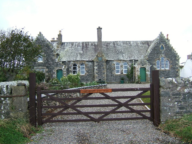
Images are sourced within 2km of 54.773776/-5.0039177 or Grid Reference NX0646. Thanks to Geograph Open Source API. All images are credited.

Oyster catchers on Ardwell Bay nx070450 Ardwell bay, looking ENE across the bay, Oyster Catchers can be seen looking for a late lunch we were waiting to eat ours as well....
Oyster catchers on Ardwell Bay nx070450
Ardwell bay, looking ENE across the bay, Oyster Catchers can be seen looking for a late lunch we were waiting to eat ours as well....
The old schoolhouse at Clachanmore, Ardwell. The old schoolhouse situated at Clachanmore crossroads near Ardwell is the former schoolhouse for Ardwell. It was recently used as an Art gallery, but has since closed and is now a private house.
The old schoolhouse at Clachanmore, Ardwell.
The old schoolhouse situated at Clachanmore crossroads near Ardwell is the former schoolhouse for Ardwell. It was recently used as an Art gallery, but has since closed and is now a private house.
Ardwell Bay (or High Ardwell Bay as the locals call it). Ardwell Bay on the west side if the Rhins of Galloway peninsula facing onto the Irish Sea with good views to Northern Ireland on a clear day.
Ardwell Bay (or High Ardwell Bay as the locals call it).
Ardwell Bay on the west side if the Rhins of Galloway peninsula facing onto the Irish Sea with good views to Northern Ireland on a clear day.
Doon Castle Broch, High Ardwell. This pile of stones is all that remains of Doon Castle Broch. Dating from approx 100BC it would have presented a spectacular sight when first built. The remains of a doorway and some lower walls can still be seen, but the remainder has collapsed. This castle occupied a prominent position at High Ardwell point and great views to the south towards the Mull of Galloway (as per photo) and west towards Northern Ireland can be had. Unfortunately, this photo was taken on a dull day, but I will endeavour to post a better photo of this location soon. Dating from approx 100BC, would have presented a spectacular sight when first built.
Doon Castle Broch, High Ardwell.
This pile of stones is all that remains of Doon Castle Broch. Dating from approx 100BC it would have presented a spectacular sight when first built. The remains of a doorway and some lower walls can still be seen, but the remainder has collapsed. This castle occupied a prominent position at High Ardwell point and great views to the south towards the Mull of Galloway (as per photo) and west towards Northern Ireland can be had. Unfortunately, this photo was taken on a dull day, but I will endeavour to post a better photo of this location soon. Dating from approx 100BC, would have presented a spectacular sight when first built.
Doon Castle Broch, High Ardwell Bay A much better view of the landmark on a pleasant February day as promised after my first photo of this.
Doon Castle Broch, High Ardwell Bay
A much better view of the landmark on a pleasant February day as promised after my first photo of this.
Float Bay near Stoneykirk, Stranraer, Wigtownshire Another beautiful bay in Southwest Scotland.
Float Bay near Stoneykirk, Stranraer, Wigtownshire
Another beautiful bay in Southwest Scotland.
The point at the end of Float Bay beyond Castle Naught A lovely seascape taken on a beautiful February day at Float Bay.
The point at the end of Float Bay beyond Castle Naught
A lovely seascape taken on a beautiful February day at Float Bay.
Cottages near the old school
Another view of the old school at Ardwell
West Ringuinea roadend The farm itself in the distance.
West Ringuinea roadend
The farm itself in the distance.
Salt Pan Cottage This cottage was where salt was obtained by the evaporation of sea water
Salt Pan Cottage
This cottage was where salt was obtained by the evaporation of sea water
Whitewashed Cottages on Quiet lane Two typical one storey cottages facing each other on a deserted country lane leading to the sea
Whitewashed Cottages on Quiet lane
Two typical one storey cottages facing each other on a deserted country lane leading to the sea
Little Float Farm Track from Little Float Cottages to Little Float Farm, sandwiched between Knockerrick and Knockmullin hills.
Little Float Farm
Track from Little Float Cottages to Little Float Farm, sandwiched between Knockerrick and Knockmullin hills.
Little Float Farm from Cairn Hill Little Float Farm viewed from the Clachanmore road on Cairn Hill.
Little Float Farm from Cairn Hill
Little Float Farm viewed from the Clachanmore road on Cairn Hill.
Retreating Tide Ardwell Bay
Clachanmore old school
Clachanmore phone box
Telephone Box at Clachanmore. This telephone box stands at the crossroads of two unclassified roads.
Telephone Box at Clachanmore.
This telephone box stands at the crossroads of two unclassified roads.
Show me another place!

Crowberry Rock is located at Grid Ref: NX0646 (Lat: 54.773776, Lng: -5.0039177)

Unitary Authority: Dumfries and Galloway

Police Authority: Dumfries and Galloway

What 3 Words

///songbook.brother.pylons. Near Drummore, Dumfries & Galloway

Related Wikis

Clachanmore

Clachanmore is a village in the South Rhins of Galloway near Ardwell in the south west of Scotland. It has also been known as Low Ardwell.The name of the...

Doon Castle Broch

Doon Castle Broch is an iron-age broch located in Dumfries and Galloway, Scotland (grid reference NX 06702 44683). == Location == The Broch is located...

Ardwell

Ardwell (from Gaelic Àrd Bhaile meaning "high town", pronounced as "Ardwell") is a village in the Scottish unitary council area of Dumfries and Galloway...

Logan Botanic Garden

Logan Botanic Garden is a botanical garden near Port Logan on the Rhins of Galloway, at the south-western tip of Scotland. The Botanic Garden was established...

Sandhead

Sandhead is a small village in Dumfries and Galloway, south west Scotland. It overlooks Luce Bay, 7 miles south of Stranraer. The old main road, named...

Port Logan

Port Logan, formerly Port Nessock, is a small village in the parish of Kirkmaiden in the Rhins of Galloway in Wigtownshire. The Gaelic name is Port Neasaig...

Knockinaam Lodge

Knockinaam Lodge is a hotel and restaurant located about 3.5 miles South of Portpatrick, Dumfries & Galloway, Scotland. As of 2008, the restaurant holds...

Stoneykirk

Stoneykirk (Scottish Gaelic: Eaglais Steafain) is an area and a village in the heart of the Rhins of Galloway, Wigtownshire, in the administrative council...

Nearby Amenities

Located within 500m of 54.773776,-5.0039177
Created By: dmgroom_coastlines
Source: PGS
Lat/Long: 54.777637/-5.007912
Created By: dmgroom_coastlines
Source: PGS
Lat/Long: 54.777513/-5.007685
Created By: dmgroom_coastlines
Source: PGS
Lat/Long: 54.776497/-5.007192
Created By: dmgroom_coastlines
Source: PGS
Lat/Long: 54.776372/-5.006963
Created By: dmgroom_coastlines
Source: PGS
Lat/Long: 54.776248/-5.006736
Created By: dmgroom_coastlines
Source: PGS
Lat/Long: 54.775992/-5.006723
Created By: dmgroom_coastlines
Source: PGS
Lat/Long: 54.775736/-5.006711
Created By: dmgroom_coastlines
Source: PGS
Lat/Long: 54.774716/-5.006438
Created By: dmgroom_coastlines
Source: PGS
Lat/Long: 54.77461/-5.005103
Created By: dmgroom_coastlines
Source: PGS
Lat/Long: 54.774368/-5.004205
Created By: dmgroom_coastlines
Source: PGS
Lat/Long: 54.774244/-5.003978
Created By: dmgroom_coastlines
Source: PGS
Lat/Long: 54.77412/-5.003749
Created By: dmgroom_coastlines
Source: PGS
Lat/Long: 54.773996/-5.003522
Created By: dmgroom_coastlines
Source: PGS
Lat/Long: 54.773871/-5.003294
Created By: dmgroom_coastlines
Source: PGS
Lat/Long: 54.773747/-5.003067
Created By: dmgroom_coastlines
Source: PGS
Lat/Long: 54.773622/-5.002839
Created By: dmgroom_coastlines
Source: PGS
Lat/Long: 54.773498/-5.002612
Created By: dmgroom_coastlines
Source: PGS
Lat/Long: 54.773374/-5.002383
Created By: dmgroom_coastlines
Source: PGS
Lat/Long: 54.77325/-5.002156
Created By: dmgroom_coastlines
Source: PGS
Lat/Long: 54.773125/-5.001928
Created By: dmgroom_coastlines
Source: PGS
Lat/Long: 54.773001/-5.001701
Created By: dmgroom_coastlines
Source: PGS
Lat/Long: 54.772876/-5.001472
Created By: dmgroom_coastlines
Source: PGS
Lat/Long: 54.772752/-5.001245
Created By: dmgroom_coastlines
Source: PGS
Lat/Long: 54.772248/-5.000777
Created By: dmgroom_coastlines
Source: PGS
Lat/Long: 54.771736/-5.000752
Created By: dmgroom_coastlines
Source: PGS
Lat/Long: 54.77148/-5.00074
Created By: dmgroom_coastlines
Source: PGS
Lat/Long: 54.770975/-5.000272
The data included in this document is from www.openstreetmap.org. The data is made available under ODbL.

Have you been to Crowberry Rock?

Leave your review of Crowberry Rock below (or comments, questions and feedback).