Dun Stone

Coastal Feature, Headland, Point in Wigtownshire

Scotland

Dun Stone

Oyster catchers on Ardwell Bay nx070450 Ardwell bay, looking ENE across the bay, Oyster Catchers can be seen looking for a late lunch we were waiting to eat ours as well....
Oyster catchers on Ardwell Bay nx070450 Credit: Dave Smethurst

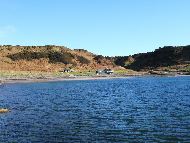
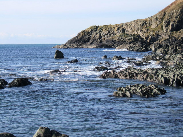
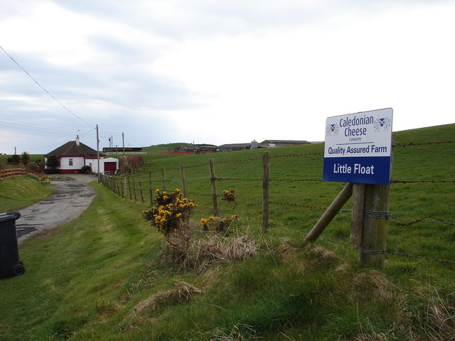
Dun Stone is a prominent coastal feature located in Wigtownshire, Scotland. It is a headland and point that juts out into the Irish Sea, offering stunning views of the surrounding coastline. The name "Dun Stone" derives from the Gaelic word "dun," meaning fort, indicating that this location may have had historical significance as a defensive site.

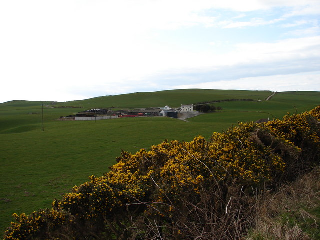
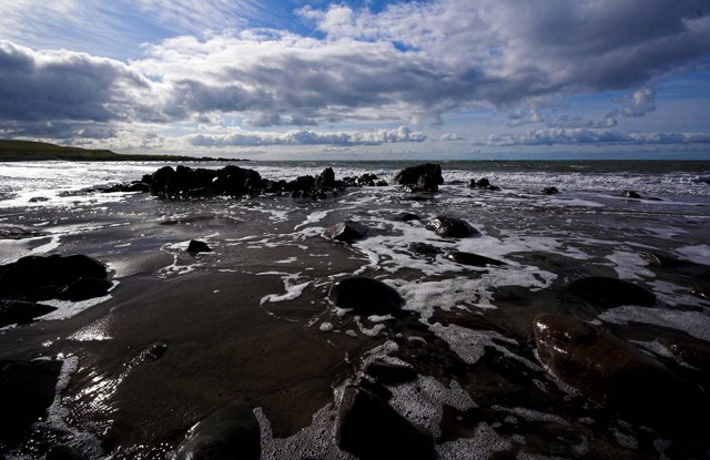
The headland is characterized by its rugged and rocky terrain, with cliffs that rise dramatically from the sea. These cliffs provide a nesting site for various seabird species, including gulls, fulmars, and kittiwakes. Visitors to Dun Stone can observe these birds in their natural habitat, making it a popular destination for birdwatchers and nature enthusiasts.

The point also offers panoramic views of the surrounding landscape, including the nearby village of Portpatrick and the rolling hills of Wigtownshire. On a clear day, it is even possible to catch a glimpse of the Northern Irish coast across the water.

Access to Dun Stone is relatively easy, with a well-maintained footpath leading to the headland. Along the path, visitors can enjoy the diverse flora and fauna that thrive in this coastal environment, including wildflowers, grasses, and occasional sightings of seals and dolphins.

Overall, Dun Stone is a captivating coastal feature that offers both natural beauty and historical intrigue. Its scenic location, diverse wildlife, and panoramic views make it a must-visit destination for anyone exploring the Wigtownshire coastline.

If you have any feedback on the listing, please let us know in the comments section below.
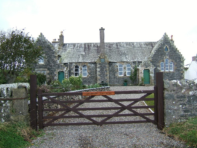
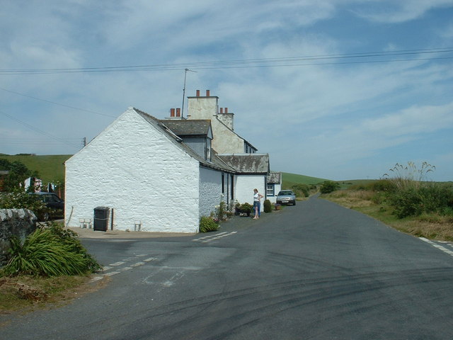
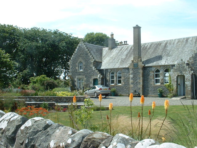
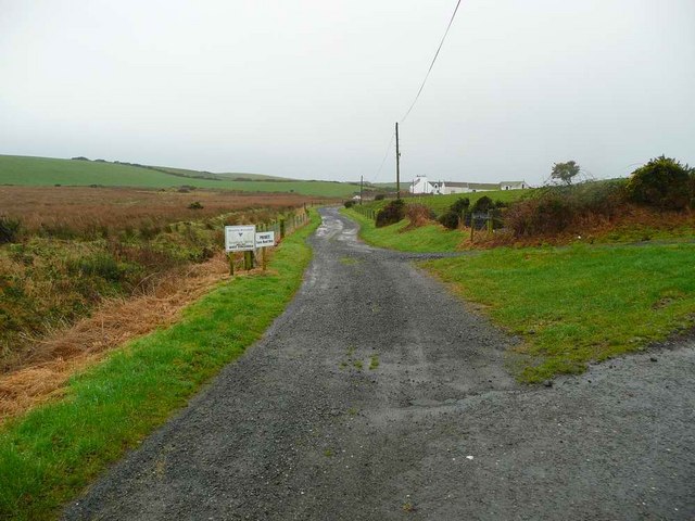
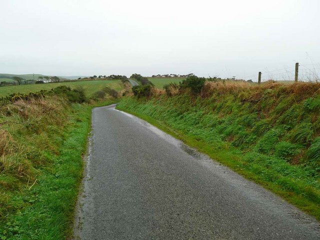
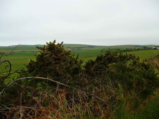
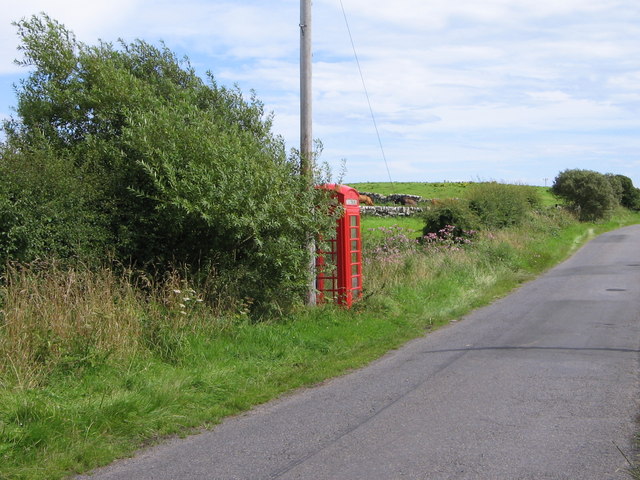
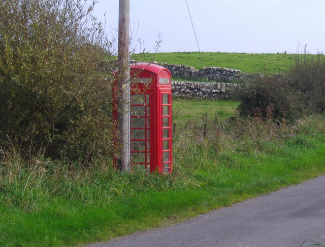
Dun Stone Images

Images are sourced within 2km of 54.779359/-5.0111756 or Grid Reference NX0646. Thanks to Geograph Open Source API. All images are credited.

Oyster catchers on Ardwell Bay nx070450 Ardwell bay, looking ENE across the bay, Oyster Catchers can be seen looking for a late lunch we were waiting to eat ours as well....
Oyster catchers on Ardwell Bay nx070450
Ardwell bay, looking ENE across the bay, Oyster Catchers can be seen looking for a late lunch we were waiting to eat ours as well....
The old schoolhouse at Clachanmore, Ardwell. The old schoolhouse situated at Clachanmore crossroads near Ardwell is the former schoolhouse for Ardwell. It was recently used as an Art gallery, but has since closed and is now a private house.
The old schoolhouse at Clachanmore, Ardwell.
The old schoolhouse situated at Clachanmore crossroads near Ardwell is the former schoolhouse for Ardwell. It was recently used as an Art gallery, but has since closed and is now a private house.
Ardwell Bay (or High Ardwell Bay as the locals call it). Ardwell Bay on the west side if the Rhins of Galloway peninsula facing onto the Irish Sea with good views to Northern Ireland on a clear day.
Ardwell Bay (or High Ardwell Bay as the locals call it).
Ardwell Bay on the west side if the Rhins of Galloway peninsula facing onto the Irish Sea with good views to Northern Ireland on a clear day.
Float Bay near Stoneykirk, Stranraer, Wigtownshire Another beautiful bay in Southwest Scotland.
Float Bay near Stoneykirk, Stranraer, Wigtownshire
Another beautiful bay in Southwest Scotland.
The point at the end of Float Bay beyond Castle Naught A lovely seascape taken on a beautiful February day at Float Bay.
The point at the end of Float Bay beyond Castle Naught
A lovely seascape taken on a beautiful February day at Float Bay.
Cottages near the old school
Another view of the old school at Ardwell
West Ringuinea roadend The farm itself in the distance.
West Ringuinea roadend
The farm itself in the distance.
Looking towards Meikle Float
Low lying land near Meikle Float And the gorse in bloom in late November.
Low lying land near Meikle Float
And the gorse in bloom in late November.
Salt Pan Cottage This cottage was where salt was obtained by the evaporation of sea water
Salt Pan Cottage
This cottage was where salt was obtained by the evaporation of sea water
Whitewashed Cottages on Quiet lane Two typical one storey cottages facing each other on a deserted country lane leading to the sea
Whitewashed Cottages on Quiet lane
Two typical one storey cottages facing each other on a deserted country lane leading to the sea
Little Float Farm Track from Little Float Cottages to Little Float Farm, sandwiched between Knockerrick and Knockmullin hills.
Little Float Farm
Track from Little Float Cottages to Little Float Farm, sandwiched between Knockerrick and Knockmullin hills.
Little Float Farm from Cairn Hill Little Float Farm viewed from the Clachanmore road on Cairn Hill.
Little Float Farm from Cairn Hill
Little Float Farm viewed from the Clachanmore road on Cairn Hill.
Retreating Tide Ardwell Bay
Clachanmore old school
Clachanmore phone box
Telephone Box at Clachanmore. This telephone box stands at the crossroads of two unclassified roads.
Telephone Box at Clachanmore.
This telephone box stands at the crossroads of two unclassified roads.
Show me another place!

Dun Stone is located at Grid Ref: NX0646 (Lat: 54.779359, Lng: -5.0111756)

Unitary Authority: Dumfries and Galloway

Police Authority: Dumfries and Galloway

What 3 Words

///linen.remix.questions. Near Drummore, Dumfries & Galloway

Related Wikis

Clachanmore

Clachanmore is a village in the South Rhins of Galloway near Ardwell in the south west of Scotland. It has also been known as Low Ardwell.The name of the...

Doon Castle Broch

Doon Castle Broch is an iron-age broch located in Dumfries and Galloway, Scotland (grid reference NX 06702 44683). == Location == The Broch is located...

Sandhead

Sandhead is a small village in Dumfries and Galloway, south west Scotland. It overlooks Luce Bay, 7 miles south of Stranraer. The old main road, named...

Ardwell

Ardwell (from Gaelic Àrd Bhaile meaning "high town", pronounced as "Ardwell") is a village in the Scottish unitary council area of Dumfries and Galloway...

Related Videos

One Of The Scariest Places In Dumfries And Galloway Scotland: The Kirkmadrine Chapel

The Kirkmadrine Chapei is rated as one of the scariest places in Dumfries and Galloway Scotland. At the Kirkmadrine Chapel ...

live stream with @tomgirlcitysquad4820, 800s church stones, amazing find🏴󠁧󠁢󠁳󠁣󠁴󠁿 #scotland #live

Tune in to find out more, only on the live stream, I took a slow walk around They could hear me, I could not hear them ...

Nearby Amenities

Located within 500m of 54.779359,-5.0111756
Created By: dmgroom_coastlines
Source: PGS
Lat/Long: 54.782624/-5.016137
Created By: dmgroom_coastlines
Source: PGS
Lat/Long: 54.782632/-5.015694
Created By: dmgroom_coastlines
Source: PGS
Lat/Long: 54.782639/-5.015251
Created By: dmgroom_coastlines
Source: PGS
Lat/Long: 54.782654/-5.014366
Created By: dmgroom_coastlines
Source: PGS
Lat/Long: 54.782661/-5.013923
Created By: dmgroom_coastlines
Source: PGS
Lat/Long: 54.782932/-5.01305
Source: PGS
Lat/Long: 54.7837341/-5.0119839
Source: PGS
Lat/Long: 54.783415/-5.0110335
Source: PGS
Lat/Long: 54.7830546/-5.0105785
Source: PGS
Lat/Long: 54.7828574/-5.010373
Created By: dmgroom_coastlines
Source: PGS
Lat/Long: 54.78272/-5.01038
Created By: dmgroom_coastlines
Source: PGS
Lat/Long: 54.782596/-5.010153
Created By: dmgroom_coastlines
Source: PGS
Lat/Long: 54.78234/-5.01014
Created By: dmgroom_coastlines
Source: PGS
Lat/Long: 54.781821/-5.010558
Source: PGS
Lat/Long: 54.7818722/-5.0110421
Created By: dmgroom_coastlines
Source: PGS
Lat/Long: 54.781539/-5.012094
Created By: dmgroom_coastlines
Source: PGS
Lat/Long: 54.780768/-5.012278
Created By: dmgroom_coastlines
Source: PGS
Lat/Long: 54.780512/-5.012266
Created By: dmgroom_coastlines
Source: PGS
Lat/Long: 54.780007/-5.011797
Created By: dmgroom_coastlines
Source: PGS
Lat/Long: 54.779499/-5.01155
Created By: dmgroom_coastlines
Source: PGS
Lat/Long: 54.779521/-5.010221
Created By: dmgroom_coastlines
Source: PGS
Lat/Long: 54.778757/-5.009962
Created By: dmgroom_coastlines
Source: PGS
Lat/Long: 54.778632/-5.009734
Created By: dmgroom_coastlines
Source: PGS
Lat/Long: 54.778639/-5.009291
Created By: dmgroom_coastlines
Source: PGS
Lat/Long: 54.778775/-5.008855
Created By: dmgroom_coastlines
Source: PGS
Lat/Long: 54.777751/-5.008804
Created By: dmgroom_coastlines
Source: PGS
Lat/Long: 54.777637/-5.007912
Created By: dmgroom_coastlines
Source: PGS
Lat/Long: 54.777513/-5.007685
Created By: dmgroom_coastlines
Source: PGS
Lat/Long: 54.776497/-5.007192
Created By: dmgroom_coastlines
Source: PGS
Lat/Long: 54.776372/-5.006963
Created By: dmgroom_coastlines
Source: PGS
Lat/Long: 54.776248/-5.006736
Created By: dmgroom_coastlines
Source: PGS
Lat/Long: 54.775992/-5.006723
Created By: dmgroom_coastlines
Source: PGS
Lat/Long: 54.775736/-5.006711
Power: pole
Lat/Long: 54.7833635/-5.009541
Float Bay
Natural: bay
Lat/Long: 54.7828327/-5.0115187
The data included in this document is from www.openstreetmap.org. The data is made available under ODbL.

Have you been to Dun Stone?

Leave your review of Dun Stone below (or comments, questions and feedback).