Clach Manessag

Coastal Feature, Headland, Point in Argyllshire

Scotland

Clach Manessag

Boat Moored on the River Nant at Taynuilt, Scottish Highlands
Boat Moored on the River Nant at Taynuilt, Scottish Highlands Credit: Andrew Tryon

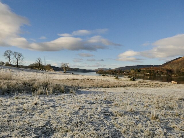
Clach Manessag is a prominent coastal feature located in Argyllshire, Scotland. This headland, also known as a point, is situated on the western coast of the region and offers breathtaking views of the surrounding landscape.

The name "Clach Manessag" originates from the Gaelic language, with "Clach" meaning stone and "Manessag" referring to a small peninsula. As the name suggests, this coastal feature is characterized by a large rock formation jutting out into the sea.

The headland is made up of rugged cliffs that provide a natural boundary between the land and the waters of the Atlantic Ocean. These cliffs are composed of various types of rock, including sandstone and granite, creating a visually striking contrast against the deep blue waters below.

Clach Manessag is a popular destination for outdoor enthusiasts, who come to explore the stunning coastal scenery and take in the fresh sea air. The headland offers excellent opportunities for hiking and photography, with several trails and viewpoints available for visitors to enjoy.

The area surrounding Clach Manessag is rich in biodiversity, with a diverse range of plant and animal species calling this coastal region home. Seabirds, such as gannets and puffins, can often be spotted nesting on the cliffs, while seals and dolphins can occasionally be seen swimming in the waters below.

Overall, Clach Manessag is a captivating coastal feature that showcases the natural beauty of Argyllshire. Its picturesque cliffs, stunning views, and abundant wildlife make it a must-visit destination for nature lovers and those seeking a tranquil escape along Scotland's western coast.

If you have any feedback on the listing, please let us know in the comments section below.

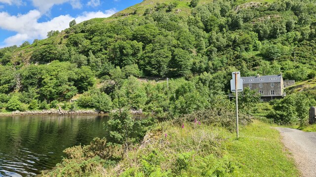
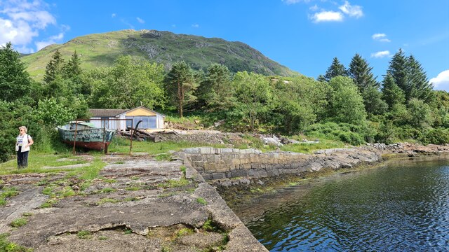
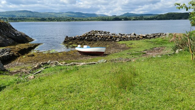
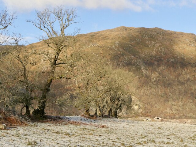
Clach Manessag Images

Images are sourced within 2km of 56.443255/-5.2516899 or Grid Reference NM9932. Thanks to Geograph Open Source API. All images are credited.

Boat Moored on the River Nant at Taynuilt, Scottish Highlands
Iron Gate at Bonawe House, Taynuilt, Scottish Highlands
View north-east from the A85
The Taynuilt Inn after the fire of 21st September 2021 A devastating fire occurred in the early morning of 21st September 2021, causing extensive damage to the structure of the historic Taynuilt Inn. Fortunately, everyone on the premises was able to escape unharmed. This photograph was taken a few days later.
The Taynuilt Inn after the fire of 21st September 2021
A devastating fire occurred in the early morning of 21st September 2021, causing extensive damage to the structure of the historic Taynuilt Inn. Fortunately, everyone on the premises was able to escape unharmed. This photograph was taken a few days later.
Furnace at Bonawe Ironworks This beautifully managed site explains the history and working of the most complete charcoal-fired furnace in the British Isles. It was founded by the Newland Company in Cumbria who, because of a shortage of charcoal there, found a good source of wood for making charcoal in Argyll and chose to establish a furnace at Bonawe, rather than transport it the 300 miles to Cumbria. The Bonawe Furnace was established in 1753 and continued working until 1876, when it succumbed to more efficient competition. There was no forge, so most of its output went to the company's base in Furness, with surplus going elsewhere. The only finished product to go from Bonawe was cannonballs.
Furnace at Bonawe Ironworks
This beautifully managed site explains the history and working of the most complete charcoal-fired furnace in the British Isles. It was founded by the Newland Company in Cumbria who, because of a shortage of charcoal there, found a good source of wood for making charcoal in Argyll and chose to establish a furnace at Bonawe, rather than transport it the 300 miles to Cumbria. The Bonawe Furnace was established in 1753 and continued working until 1876, when it succumbed to more efficient competition. There was no forge, so most of its output went to the company's base in Furness, with surplus going elsewhere. The only finished product to go from Bonawe was cannonballs.
Bonawe Furnace – 1998 Looking down the site from between the charcoal stores. 

The complete site is a designated Scheduled Monument rather than the buildings being Listed. It is in the care of Historic Environment Scotland.
Bonawe Furnace – 1998
Looking down the site from between the charcoal stores. The complete site is a designated Scheduled Monument rather than the buildings being Listed. It is in the care of Historic Environment Scotland.
Bonawe Furnace – 1998 The blast furnace.

The complete site is a designated Scheduled Monument rather than the buildings being Listed. It is in the care of Historic Environment Scotland.
Bonawe Furnace – 1998
The blast furnace. The complete site is a designated Scheduled Monument rather than the buildings being Listed. It is in the care of Historic Environment Scotland.
Footpath to Taynuilt railway station
B845 towards Bonawe
B845 towards Bonawe
Ardchattan Primary School
Woodland at Bonawe
Woodland at Bonawe
Site of old Bonawe Ferry
Port Mor, Loch Etive
Looking towards Bonawe, Loch Etive
A line of ashes A former field boundary, Inverawe
A line of ashes
A former field boundary, Inverawe
Hoar frost, Inverawe A cold day beside Loch Etive
Hoar frost, Inverawe
A cold day beside Loch Etive
Seal, Loch Etive A wave caused by something moving beneath the surface of the loch. It was fascinating to watch it turn in the otherwise calm water for some time before the head popped up. The grey patch is a reflection of Bonawe Quarry.
Seal, Loch Etive
A wave caused by something moving beneath the surface of the loch. It was fascinating to watch it turn in the otherwise calm water for some time before the head popped up. The grey patch is a reflection of Bonawe Quarry.
Show me another place!

Clach Manessag is located at Grid Ref: NM9932 (Lat: 56.443255, Lng: -5.2516899)

Unitary Authority: Argyll and Bute

Police Authority: Argyll and West Dunbartonshire

What 3 Words

///harshest.sprayer.shorthand. Near Oban, Argyll & Bute

Nearby Locations

Clach Manessag Airds Bay

Related Wikis

River Awe

The River Awe (Scottish Gaelic: Uisge Abha) is a short river in the Southwest Highlands of Scotland by which the freshwater Loch Awe empties into Loch...

Bonawe

Bonawe (Scots pronunciation: [boˈnɔː]; Scottish Gaelic: Bun Abha [puˈna.ə]) is a village in Ardchattan Parish Argyll and Bute, Scotland opposite Taynuilt...
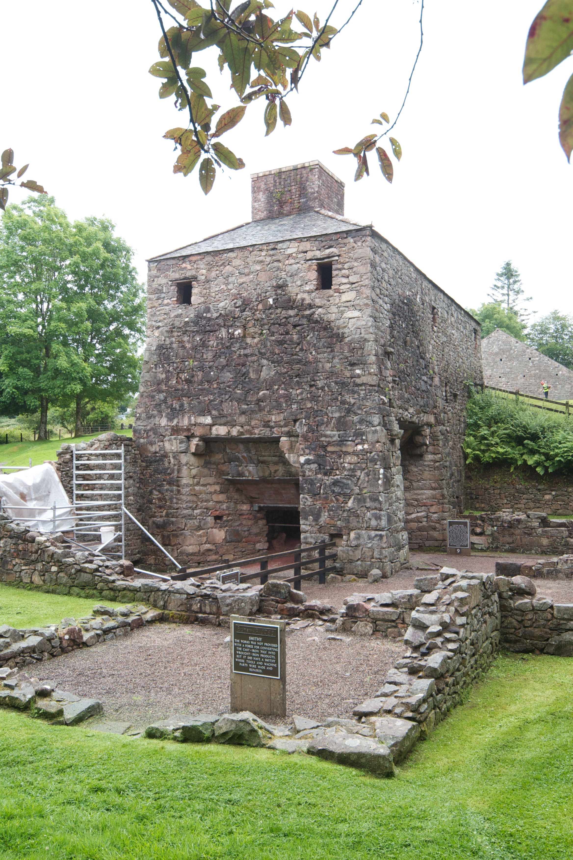
Bonawe Iron Furnace

The Bonawe Iron Furnace (also called the Lorn Furnace), was an industrial complex located in Bonawe, Lorn District, Scotland. It operated in the middle...

Taynuilt railway station

Taynuilt railway station is a railway station serving the village of Taynuilt in western Scotland. This station is on the Oban branch of the West Highland...

Taynuilt

Taynuilt (Scots: [ˈtɛinəlt]; Scottish Gaelic: Taigh an Uillt [t̪ʰɤj ən̪ˠ ˈɯiʎtʲ], meaning 'the house by the stream') is a large village in Argyll and Bute...

Fearnoch

Fearnoch is a small village in Argyll and Bute, Scotland. It is located just off the A85 road, about 2 miles (3 km) west of the village of Taynuilt....

Ardchattan and Muckairn

Ardchattan and Muckairn is a civil parish within Argyll and Bute in Scotland. It lies north of Oban, bordering Loch Etive and includes Glen Ure, Glen Creran...

Ach-na-Cloich railway station

Ach-na-Cloich is a closed railway station located on the south shore of Loch Etive, in Argyll and Bute. Its site is located on the Oban route of the scenic...

Nearby Amenities

Located within 500m of 56.443255,-5.2516899
Post Box
Ref: PA35 50
Lat/Long: 56.4410011/-5.2524177
Power: pole
Lat/Long: 56.4433241/-5.2529105
Power: pole
Lat/Long: 56.442901/-5.2531688
Power: pole
Lat/Long: 56.4422925/-5.2535382
Power: pole
Lat/Long: 56.4415905/-5.2539607
Power: pole
Lat/Long: 56.4409406/-5.2543373
Power: pole
Lat/Long: 56.4405042/-5.253036
Power: pole
Lat/Long: 56.4402492/-5.2522587
Power: pole
Lat/Long: 56.4398782/-5.2522852
Power: pole
Lat/Long: 56.4391869/-5.2523238
The data included in this document is from www.openstreetmap.org. The data is made available under ODbL.

Have you been to Clach Manessag?

Leave your review of Clach Manessag below (or comments, questions and feedback).