Craig Hesgwm

Coastal Feature, Headland, Point in Pembrokeshire

Wales

Craig Hesgwm

Dinas Head Seen from the road from Fishguard to Newport
Dinas Head Credit: Deborah Tilley

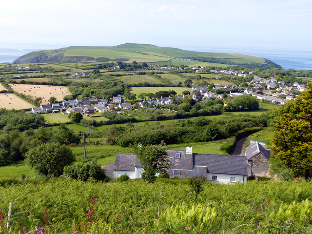
Craig Hesgwm is a prominent coastal feature located in Pembrokeshire, Wales. It is a headland that juts out into the Celtic Sea, offering stunning views of the surrounding coastline. The name "Craig Hesgwm" translates to "ravine rock" in English, which aptly describes its rugged and rocky terrain.

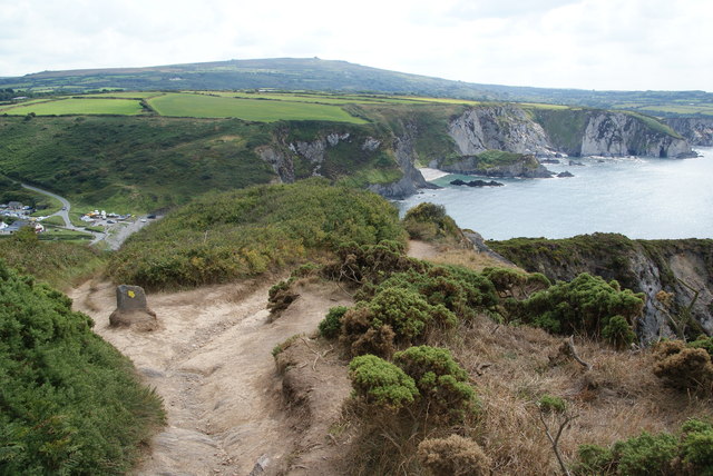
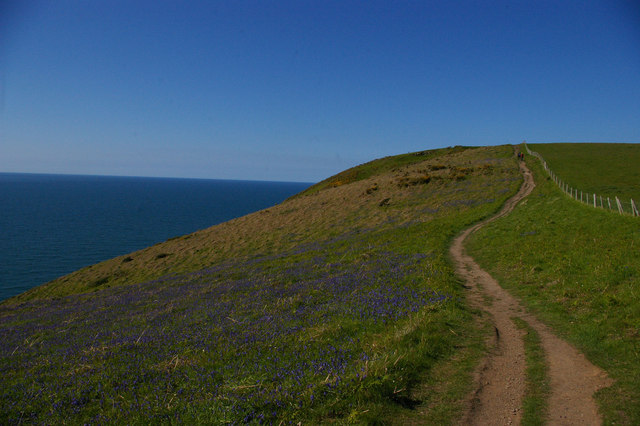
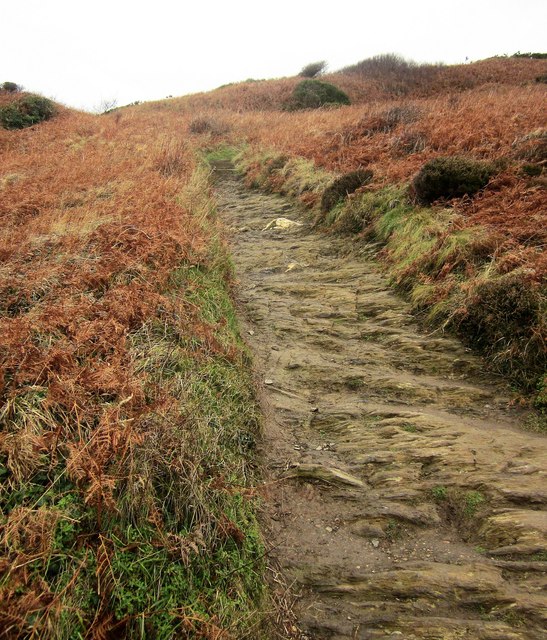
This headland is characterized by its towering cliffs, which reach heights of up to 100 meters (328 feet) above sea level. These cliffs are composed of sedimentary rocks, including sandstone and shale, which have been shaped by years of erosion from wind and waves. The result is a dramatic landscape with sheer cliffs and deep crevices.

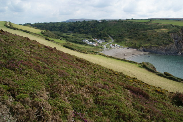
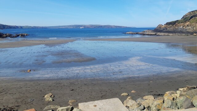
Craig Hesgwm is a popular destination for nature enthusiasts and hikers due to its breathtaking scenery and diverse wildlife. The headland is home to a variety of bird species, including puffins, razorbills, and guillemots, making it an ideal spot for birdwatching. Visitors can also spot seals and dolphins swimming in the clear blue waters surrounding the headland.

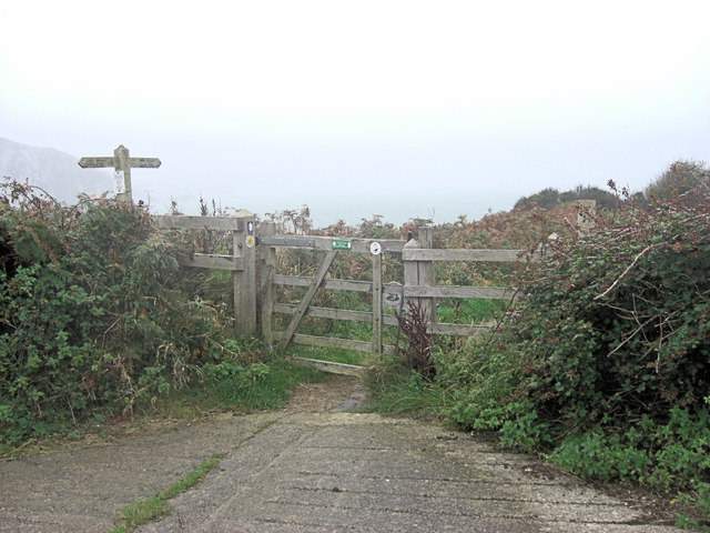
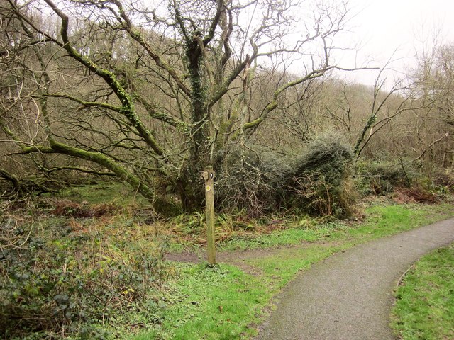
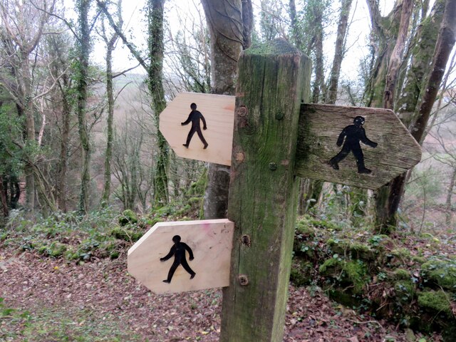
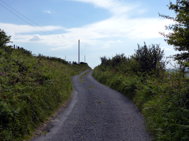
Access to Craig Hesgwm is relatively easy, with several walking trails leading to the headland from nearby coastal villages. These trails offer visitors the opportunity to explore the rugged coastline, enjoy panoramic views, and even discover hidden coves and secluded beaches along the way.

Overall, Craig Hesgwm is a must-visit destination for nature lovers and those seeking an escape to a picturesque and untouched coastal landscape. Its towering cliffs, diverse wildlife, and sweeping ocean views make it a truly remarkable coastal feature in Pembrokeshire.

If you have any feedback on the listing, please let us know in the comments section below.

Craig Hesgwm Images

Images are sourced within 2km of 52.012493/-4.9208327 or Grid Reference SM9938. Thanks to Geograph Open Source API. All images are credited.

Dinas Head Seen from the road from Fishguard to Newport
Dinas Head
Seen from the road from Fishguard to Newport
Perilous point There is some inconsistency between different versions of the Ordnance Survey as to whether this or the next headland is Pen Sidan. Either way, the only reason for scrambling down here was to claim another green square! It's very steep and accessible only via paths made by sheep - and even they sometimes come a cropper, as reported in the local newspaper recently:

"Things went a bit woolly for Fishguard's inshore lifeboat crew yesterday afternoon, as they had a sheep on board.
The animal had become stranded at the bottom of a cliff near Dinas Head. Fishguard coastguard rescue team was also called to the scene.
The baaad sheep was helped aboard the inshore lifeboat, who landed in a safe place. They then delivered the animal to the coastguard team who took her back to the farmer."
Perilous point
There is some inconsistency between different versions of the Ordnance Survey as to whether this or the next headland is Pen Sidan. Either way, the only reason for scrambling down here was to claim another green square! It's very steep and accessible only via paths made by sheep - and even they sometimes come a cropper, as reported in the local newspaper recently: "Things went a bit woolly for Fishguard's inshore lifeboat crew yesterday afternoon, as they had a sheep on board. The animal had become stranded at the bottom of a cliff near Dinas Head. Fishguard coastguard rescue team was also called to the scene. The baaad sheep was helped aboard the inshore lifeboat, who landed in a safe place. They then delivered the animal to the coastguard team who took her back to the farmer."
Inaccessible cove Tiny bay visitable only by boat: note the float and line left to mark the spot a lobster pot has been dropped.
Inaccessible cove
Tiny bay visitable only by boat: note the float and line left to mark the spot a lobster pot has been dropped.
Gull's egg The egg has been broken into and the torn shell left lying in the grass. Another bird is most likely to have been the culprit.
Gull's egg
The egg has been broken into and the torn shell left lying in the grass. Another bird is most likely to have been the culprit.
Cliffs at Pen Castell
View of the coast from near Pen Castell
Coast path heading north
Coastal path on Dinas Island There is a diversion in place to avoid an eroded section of cliff, but the diversion is not enforced. The marker on the stone to the left acts merely as a recommendation.
Coastal path on Dinas Island
There is a diversion in place to avoid an eroded section of cliff, but the diversion is not enforced. The marker on the stone to the left acts merely as a recommendation.
Hillside above Pwllgwaelod The whole of Dinas Island is on a slope but it is steeper at this southern end.
Hillside above Pwllgwaelod
The whole of Dinas Island is on a slope but it is steeper at this southern end.
Start of Dinas Head footpath
Pembrokeshire coast path on the west side of Dinas Island
Coast path on Dinas Island A steep ascent away from Pwllgwaelod up footpath PP16 46/1, with the path's surface the rock itself.
Coast path on Dinas Island
A steep ascent away from Pwllgwaelod up footpath PP16 46/1, with the path's surface the rock itself.
Path junction, Cwm-yr-Eglwys Footpath PP16 45/2 joins the coast path here from the left. (The coast path is mapped as an alternative to the strenuous route around Dinas Island). On the left is the swampy woodland shown in <a href="https://www.geograph.org.uk/photo/4529419">SN0139 : Swampy woodland, Cwm Dewi</a>.
Path junction, Cwm-yr-Eglwys
Footpath PP16 45/2 joins the coast path here from the left. (The coast path is mapped as an alternative to the strenuous route around Dinas Island). On the left is the swampy woodland shown in SN0139 : Swampy woodland, Cwm Dewi.
Pig sty, Pen-y-wennol The pig sty at the site of the now-ruined farm of Pen-y-wennol was restored to  immaculate condition in 2011, when this photo was taken. It has since become very overgrown. It can be viewed from a footpath running along the hillside.

Pen-y-wennol: top of the shuttle, probably a reference to the steep winding road from the village to access the place - although 'gwennol' is also the word for swallow (the bird).
Pig sty, Pen-y-wennol
The pig sty at the site of the now-ruined farm of Pen-y-wennol was restored to immaculate condition in 2011, when this photo was taken. It has since become very overgrown. It can be viewed from a footpath running along the hillside. Pen-y-wennol: top of the shuttle, probably a reference to the steep winding road from the village to access the place - although 'gwennol' is also the word for swallow (the bird).
Pwllgwaelod Beach
Pwllgwaelod Beach
Foot path direction signs New signage added to old. The figures look very masculine, striding out with an apprearance of urgency rather than pleasure.
Foot path direction signs
New signage added to old. The figures look very masculine, striding out with an apprearance of urgency rather than pleasure.
Lane heading south-west on hill above Dinas Cross
Dinas Cross seen from the scenic view point
Show me another place!

Craig Hesgwm is located at Grid Ref: SM9938 (Lat: 52.012493, Lng: -4.9208327)

Unitary Authority: Pembrokeshire

Police Authority: Dyfed Powys

What 3 Words

///lake.incisions.version. Near Fishguard, Pembrokeshire

Related Wikis

Dinas Cross

Dinas Cross (Welsh: Dinas) is both a village, a community and a former parish in Pembrokeshire, Wales. Located between Fishguard and Newport in the Pembrokeshire...

Pwllgwaelod

Pwllgwaelod (originally Y Pwll Gwaelod, Welsh for The Bottom Cove/Creek) is a small scattered hamlet centred on a bay on the south-western side of the...

Cwm Dewi

Cwm Dewi is a Site of Special Scientific Interest (or SSSI) in Pembrokeshire, South Wales. It has been designated as a Site of Special Scientific Interest...

Brynhenllan

Bryn-henllan, Bryn Henllan or Brynhenllan is a small settlement in the community of Dinas Cross, north Pembrokeshire, Wales, just north of the A487 road...

Fishguard Bay

Fishguard Bay (Welsh: Bae Abergwaun) is a bay on the north Pembrokeshire coast, Wales. Much of the bay's coastline is within the Pembrokeshire Coast National...

Dinas Island

Dinas Island (Welsh: Ynys Dinas) is a peninsula, partially detached from the mainland, in the community of Dinas Cross between Fishguard and Newport, Pembrokeshire...

Cwm-yr-Eglwys

Cwm-yr-Eglwys (English: Valley of the Church) is a hamlet in a picturesque cove on the eastern side of the Dinas Island peninsula in the community of Dinas...

River Gwaun

The River Gwaun (Welsh: Afon Gwaun, "Gwaun" meaning 'marsh, moor') is a river in Pembrokeshire, West Wales, which flows west to the sea at Fishguard (Welsh...

Nearby Amenities

Located within 500m of 52.012493,-4.9208327
The data included in this document is from www.openstreetmap.org. The data is made available under ODbL.

Have you been to Craig Hesgwm?

Leave your review of Craig Hesgwm below (or comments, questions and feedback).