Fort Point

Coastal Feature, Headland, Point in Wigtownshire

Scotland

Fort Point

Pond on the road to Larbrax Shore
Pond on the road to Larbrax Shore Credit: Oliver Dixon

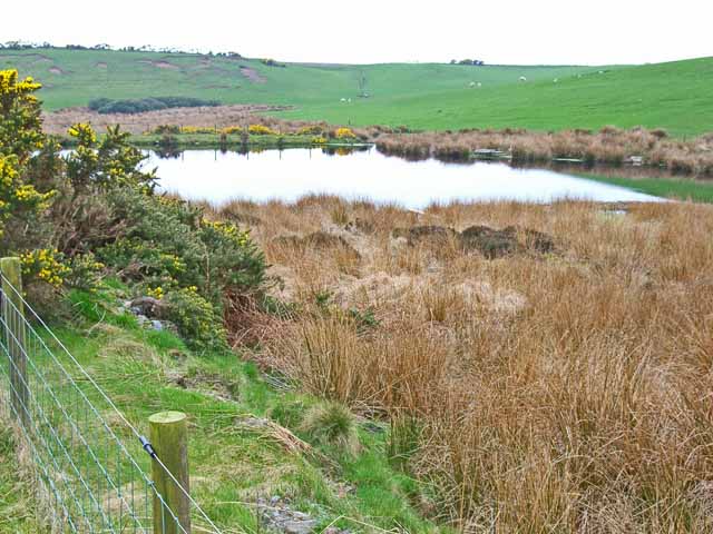
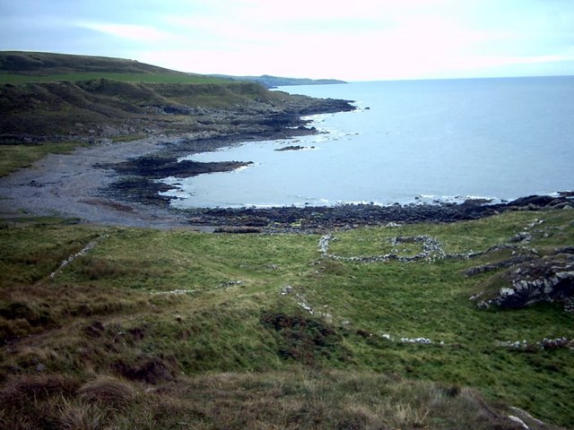
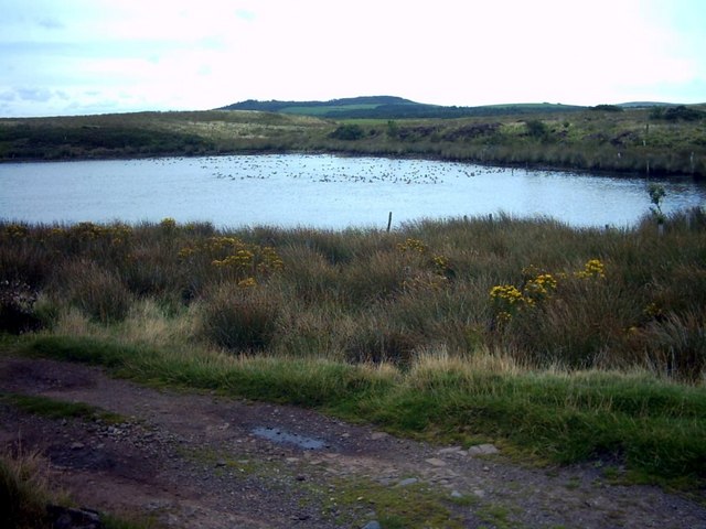
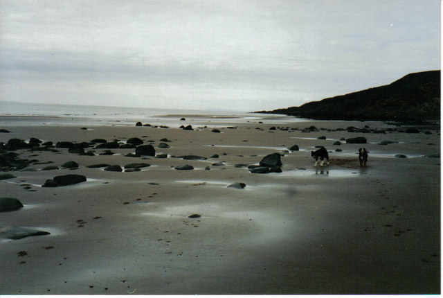
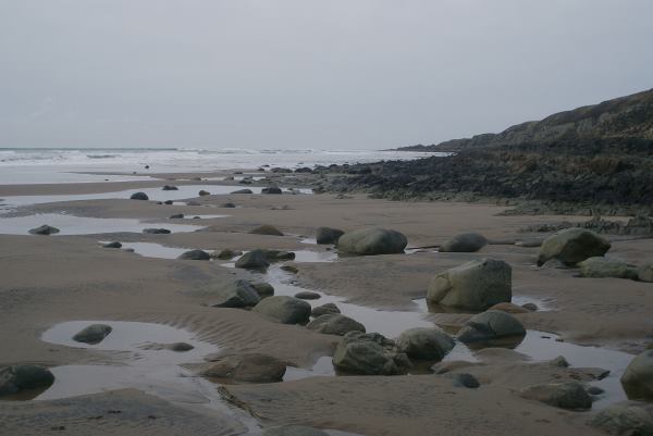
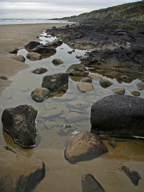
Fort Point is a prominent coastal feature located in Wigtownshire, a picturesque region in southwestern Scotland. It is a headland that juts out into the Irish Sea, forming a distinct and striking point along the coastline. The area surrounding Fort Point is renowned for its rugged beauty, with dramatic cliffs and stunning views of the sea.

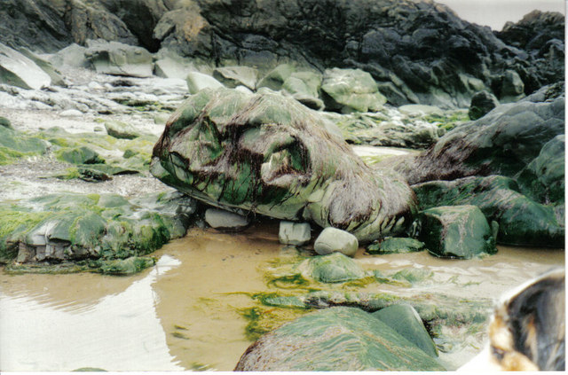
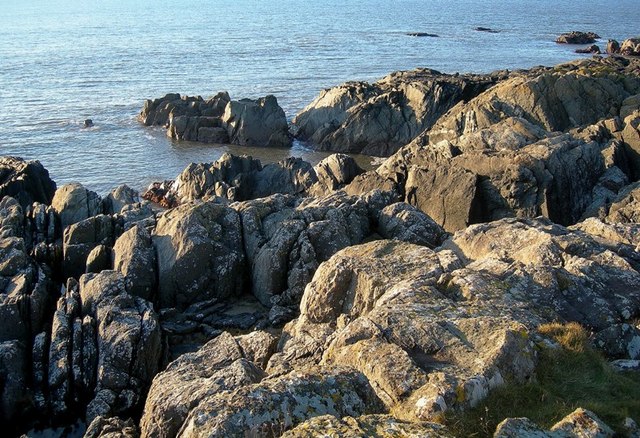
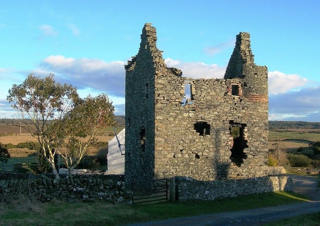
The headland itself is characterized by its steep and rocky cliffs, which provide a natural defense against the crashing waves of the Irish Sea. The cliffs are composed of layers of sedimentary rock, showcasing the area's geological history. At the top of the headland, there is a fort, hence the name "Fort Point." The fort is a historic structure dating back to the 18th century and was originally built to defend against potential invasions.

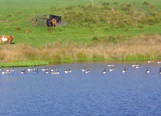
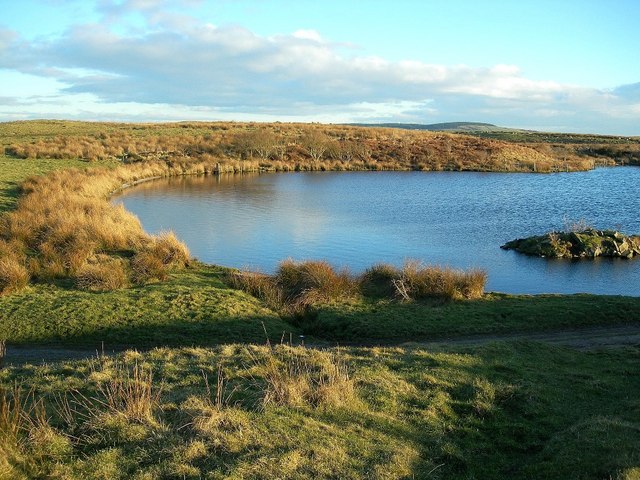
Aside from its historical significance, Fort Point is a popular destination for nature enthusiasts and outdoor adventurers. The headland offers breathtaking panoramic views of the surrounding coastal landscape, making it a favorite spot for photographers and hikers. The area is also home to a diverse range of wildlife, including seabirds, seals, and occasionally dolphins, making it a haven for nature lovers.

Visitors to Fort Point can enjoy leisurely walks along the cliff-top paths, taking in the fresh sea air and admiring the spectacular scenery. Additionally, the site provides opportunities for birdwatching, as the cliffs serve as nesting grounds for various seabird species. Overall, Fort Point is a captivating and historically significant coastal feature that showcases the natural beauty and rich heritage of Wigtownshire.

If you have any feedback on the listing, please let us know in the comments section below.

Fort Point Images

Images are sourced within 2km of 54.906929/-5.1785941 or Grid Reference NW9661. Thanks to Geograph Open Source API. All images are credited.

Pond on the road to Larbrax Shore
Rhododendrons along the B738 The "main" road up the west side of the North Rhinns of Galloway. Out-of-control rhododendron is a feature of big country estates, such as this, the Larbrax estate.
Rhododendrons along the B738
The "main" road up the west side of the North Rhinns of Galloway. Out-of-control rhododendron is a feature of big country estates, such as this, the Larbrax estate.
Larbrax Lodge, North Rhins
Salt Pans Bay Salt made in the pans was used to cure and pack herrings landed at local ports.  Salt was an immensely valuable commodity in the 18th century.
Salt Pans Bay
Salt made in the pans was used to cure and pack herrings landed at local ports. Salt was an immensely valuable commodity in the 18th century.
Loch More, Galdenoch Estate The ducks in the picture are some of the hundreds that populate this small loch.
Loch More, Galdenoch Estate
The ducks in the picture are some of the hundreds that populate this small loch.
Beach, Labrax Bay Low tide at the North end of Labrax Bay, nearing Cranberry Point.
Beach, Labrax Bay
Low tide at the North end of Labrax Bay, nearing Cranberry Point.
Rock, Labrax, Broadsea Bay Named by children "The Monster Rock", the seaweed covering it changes daily giving it differing expressions.
Rock, Labrax, Broadsea Bay
Named by children "The Monster Rock", the seaweed covering it changes daily giving it differing expressions.
Larbrax Bay Shore at Larbrax Bay at low tide looking north
Larbrax Bay
Shore at Larbrax Bay at low tide looking north
Larbrax Bay Killintringan Lighthouse in the far distance
Larbrax Bay
Killintringan Lighthouse in the far distance
Larbrax Bay Looking west, with Ireland just visible on the horizon.
Larbrax Bay
Looking west, with Ireland just visible on the horizon.
Larbrax Bay Looking northwest to Cranberry Point
Larbrax Bay
Looking northwest to Cranberry Point
Larbrax Bay Seen at high water with a gale blowing in from the North Channel. Killantringan lighthouse sits on the far distant headland. The bay takes its name from the nearby farm of Larbrax, which is from the Gaelic 'learg breac' meaning speckled slope.
Larbrax Bay
Seen at high water with a gale blowing in from the North Channel. Killantringan lighthouse sits on the far distant headland. The bay takes its name from the nearby farm of Larbrax, which is from the Gaelic 'learg breac' meaning speckled slope.
Sea View from Larbrax Beach Nice view from Larbrax beach
Sea View from Larbrax Beach
Nice view from Larbrax beach
Lochan on the track to Larbrax Bay This little lochan is beside the track which leads from the B738 to the shore at Larbrax Bay.
Lochan on the track to Larbrax Bay
This little lochan is beside the track which leads from the B738 to the shore at Larbrax Bay.
On The Rocks Bare rocks along the Galloway coast, viewed on a fine February afternoon.
On The Rocks
Bare rocks along the Galloway coast, viewed on a fine February afternoon.
Galdenoch Castle Dated 1547, this was a small 2-storey tower with attic accommodation.  It was the home of Gilbert Agnew of Lochnaw until 1570.  (Source:  "The Castles of South-West Scotland", by Mike Salter)
Galdenoch Castle
Dated 1547, this was a small 2-storey tower with attic accommodation. It was the home of Gilbert Agnew of Lochnaw until 1570. (Source: "The Castles of South-West Scotland", by Mike Salter)
Loch More A little gem of a loch in Galdenoch Moor.  Viewed near the end of a fine February day.
Loch More
A little gem of a loch in Galdenoch Moor. Viewed near the end of a fine February day.
Galdenoch Moor Viewed from the track that's shown on the Explorer map near the end of a fine February afternoon.
Galdenoch Moor
Viewed from the track that's shown on the Explorer map near the end of a fine February afternoon.
Show me another place!

Fort Point is located at Grid Ref: NW9661 (Lat: 54.906929, Lng: -5.1785941)

Unitary Authority: Dumfries and Galloway

Police Authority: Dumfries and Galloway

What 3 Words

///purses.asleep.picturing. Near Stranraer, Dumfries & Galloway

Related Wikis

Galdenoch Castle

Galdenoch Castle is a tower house near the Scottish village of Leswalt in the Council Area Dumfries and Galloway . The ruin is listed as a Scheduled Monument...

Killantringan Lighthouse

Killantringan Lighthouse is a lighthouse located near Portpatrick in Dumfries and Galloway, south-west Scotland. The light came into operation in 1900...

MV Craigantlet

MV Craigantlet was a German-owned, Cyprus-registered container ship operated on time-charter by Cawoods Containers Ltd of Belfast. She ran aground on 26...

Leswalt

Leswalt (Scottish Gaelic: Lios Uillt) is a village and civil parish in Dumfries and Galloway, south-west Scotland. It lies between Portpatrick and Stranraer...

Nearby Amenities

Located within 500m of 54.906929,-5.1785941
Created By: dmgroom_coastlines
Source: PGS
Lat/Long: 54.910536/-5.181933
Created By: dmgroom_coastlines
Source: PGS
Lat/Long: 54.909517/-5.181655
Created By: dmgroom_coastlines
Source: PGS
Lat/Long: 54.909533/-5.180767
Created By: dmgroom_coastlines
Source: PGS
Lat/Long: 54.909273/-5.180976
Created By: dmgroom_coastlines
Source: PGS
Lat/Long: 54.908501/-5.181155
Created By: dmgroom_coastlines
Source: PGS
Lat/Long: 54.908533/-5.179378
Created By: dmgroom_coastlines
Source: PGS
Lat/Long: 54.908273/-5.179588
Created By: dmgroom_coastlines
Source: PGS
Lat/Long: 54.908017/-5.179574
Created By: dmgroom_coastlines
Source: PGS
Lat/Long: 54.907893/-5.179344
Created By: dmgroom_coastlines
Source: PGS
Lat/Long: 54.907781/-5.178449
Created By: dmgroom_coastlines
Source: PGS
Lat/Long: 54.907273/-5.1782
Created By: dmgroom_coastlines
Source: PGS
Lat/Long: 54.907017/-5.178186
Created By: dmgroom_coastlines
Source: PGS
Lat/Long: 54.906761/-5.178172
Created By: dmgroom_coastlines
Source: PGS
Lat/Long: 54.906637/-5.177942
Created By: dmgroom_coastlines
Source: PGS
Lat/Long: 54.906645/-5.177498
Created By: dmgroom_coastlines
Source: PGS
Lat/Long: 54.906777/-5.177284
Created By: dmgroom_coastlines
Source: PGS
Lat/Long: 54.906909/-5.177068
Created By: dmgroom_coastlines
Source: PGS
Lat/Long: 54.90694/-5.175291
Created By: dmgroom_coastlines
Source: PGS
Lat/Long: 54.906817/-5.175063
Created By: dmgroom_coastlines
Source: PGS
Lat/Long: 54.905801/-5.174563
Created By: dmgroom_coastlines
Source: PGS
Lat/Long: 54.905545/-5.17455
Created By: dmgroom_coastlines
Source: PGS
Lat/Long: 54.905033/-5.174522
Created By: dmgroom_coastlines
Source: PGS
Lat/Long: 54.904529/-5.17405
Created By: dmgroom_coastlines
Source: PGS
Lat/Long: 54.904405/-5.17382
Created By: dmgroom_coastlines
Source: PGS
Lat/Long: 54.904282/-5.173592
The data included in this document is from www.openstreetmap.org. The data is made available under ODbL.

Have you been to Fort Point?

Leave your review of Fort Point below (or comments, questions and feedback).