Roinn a' Mhill

Coastal Feature, Headland, Point in Cromartyshire

Scotland

Roinn a' Mhill

Rocks on the west side of Rubha Mor Shown at about half tide, quite menacing in a blow when mostly covered at high tide, with a very deep water drop off just off the edge of them. Good for pollack though!
Rocks on the west side of Rubha Mor Credit: Simon Bonney

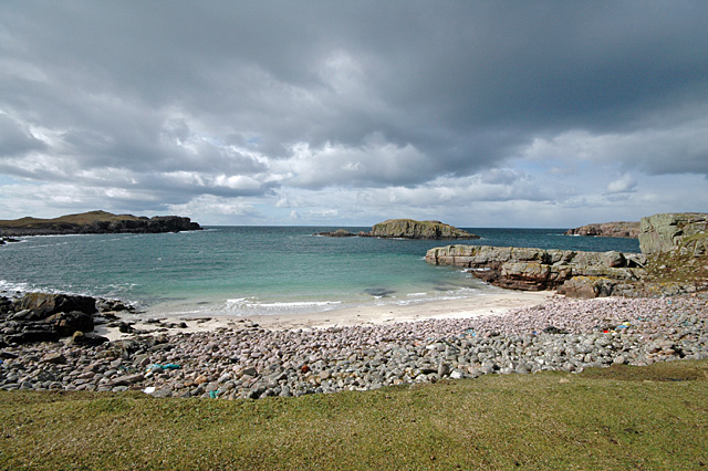
Roinn a' Mhill is a prominent coastal feature located in Cromartyshire, Scotland. It is a headland or point that juts out into the North Sea, offering stunning views of the surrounding landscape. The name "Roinn a' Mhill" translates to "Promontory of the Hill" in English, which accurately describes its physical characteristics.

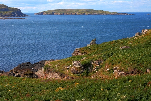
The headland is characterized by its rugged and rocky terrain, with cliffs that rise steeply from the sea. These cliffs provide nesting sites for various seabirds, including puffins, guillemots, and razorbills, making Roinn a' Mhill a popular spot for birdwatchers and nature enthusiasts.

The headland is also home to a diverse range of flora and fauna. The surrounding grasslands are dotted with wildflowers, such as sea thrift and harebells, while the coastal waters support a variety of marine life, including seals and dolphins.

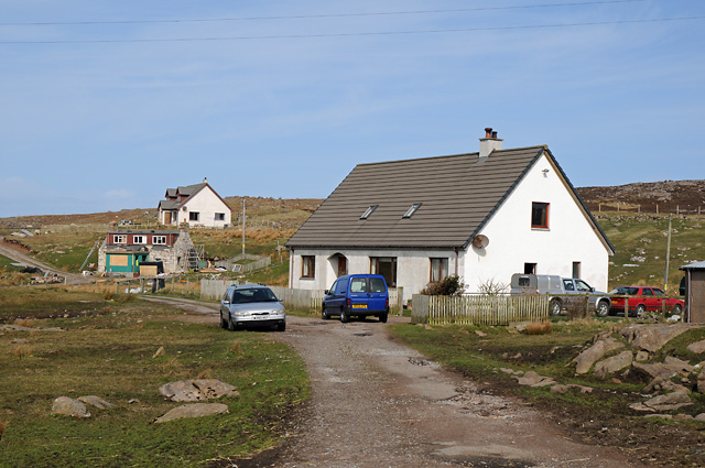
Access to Roinn a' Mhill is relatively easy, with a well-maintained footpath leading visitors from the nearby village of Cromarty to the headland. Along the way, visitors can enjoy breathtaking views of the coastline and the Cromarty Firth, a natural inlet that adds to the beauty of the area.

Due to its strategic location and natural beauty, Roinn a' Mhill has historical significance as well. It is believed to have been used as a lookout point during World War II, with remnants of military structures still visible on the headland.

Overall, Roinn a' Mhill is a captivating coastal feature in Cromartyshire, offering a perfect blend of natural beauty, wildlife, and historical importance.

If you have any feedback on the listing, please let us know in the comments section below.

Roinn a' Mhill Images

Images are sourced within 2km of 58.076902/-5.4582146 or Grid Reference NB9614. Thanks to Geograph Open Source API. All images are credited.

Rocks on the west side of Rubha Mor Shown at about half tide, quite menacing in a blow when mostly covered at high tide, with a very deep water drop off just off the edge of them. Good for pollack though!
Rocks on the west side of Rubha Mor
Shown at about half tide, quite menacing in a blow when mostly covered at high tide, with a very deep water drop off just off the edge of them. Good for pollack though!
Reiff The very end of the road!
Reiff
The very end of the road!
Camas Eilean Ghlais - Rubha Mor Beach at Camas Eilean Ghlais on Rubha Mor with Eilean Glas.
Camas Eilean Ghlais - Rubha Mor
Beach at Camas Eilean Ghlais on Rubha Mor with Eilean Glas.
Coastline near Reiff
Coastline Rubha Mor
Coastline Rubha Mor
Reiff jetty High tide and high winds combine almost to drown this little-used jetty at the end of the road on the Coigach Peninsula.
Reiff jetty
High tide and high winds combine almost to drown this little-used jetty at the end of the road on the Coigach Peninsula.
Houses at Blairbuie
Houses at Blairbuie
Reiff Loch Reiff in foreground
Reiff
Loch Reiff in foreground
Geodha an Dà Fheannag Looking across Geodha an Dà Fheannag and Geodha an Glaic Bàine towards Reiff Bay. In the foreground is an outcrop of Torridean sandstone.
Geodha an Dà Fheannag
Looking across Geodha an Dà Fheannag and Geodha an Glaic Bàine towards Reiff Bay. In the foreground is an outcrop of Torridean sandstone.
Reiff Bay
Reiff Bay
Loch of Reiff
Loch of Reiff
Reiff Bay, Low Tide
Reiff Bay, Low Tide
Reiff Bay, Low Tide
Reiff Bay, Low Tide
Isolated Boulders Looking south from the same position as <a href="https://www.geograph.org.uk/photo/930531">NB9613 : Geodha an Dà Fheannag</a>.
Isolated Boulders
Looking south from the same position as NB9613 : Geodha an Dà Fheannag.
Headland at Reiff
Headland at Reiff
Rocky Outcrop on Rubha Mòr and Loch na Totaig
Drystane Dyke and Fence Post on Rubha Mòr
Ruins of Croft at Camas,a'ghlais'lean
Show me another place!

Roinn a' Mhill is located at Grid Ref: NB9614 (Lat: 58.076902, Lng: -5.4582146)

Unitary Authority: Highland

Police Authority: Highlands and Islands

What 3 Words

///plates.greyhound.standing. Near Clachtoll, Highland

Related Wikis

Reiff, Ross-shire

Reiff is a small remote coastal crofting and fishing village, situated on Reiff Bay on the Ruhba Mòr peninsula, in western Ross-shire, Scottish Highlands...

Blairbuie

Blairbuie is a hamlet in Coigach, Scotland. It has just 6 houses and a sheep shed. When driving past the junction which connects Blairbuie to the rest...

Eilean Mullagrach

Eilean Mullagrach is an island in the Summer Isles of Scotland. It is located in Highland council area, in the northwestern part of the country, 800 km...

Altandhu

Altandhu is a small hamlet, overlooking the sea loch, Loch an Alltain Duibh to the west, on the western shore of the Rubha Mor Peninsula, in the Achiltibuie...

Nearby Amenities

Located within 500m of 58.076902,-5.4582146
Source: PGS
Lat/Long: 58.0782862/-5.4512316
Source: PGS
Lat/Long: 58.0783755/-5.4513014
Source: PGS
Lat/Long: 58.0783317/-5.4546078
Created By: almien_coastlines
Source: PGS
Lat/Long: 58.07791/-5.454719
Source: PGS
Lat/Long: 58.0779616/-5.4557263
Source: PGS
Lat/Long: 58.077803/-5.4566443
Source: PGS
Lat/Long: 58.0774769/-5.4580001
Source: PGS
Lat/Long: 58.0763733/-5.4573549
Source: PGS
Lat/Long: 58.076281/-5.4571455
Source: PGS
Lat/Long: 58.0762787/-5.45697
Source: PGS
Lat/Long: 58.0761125/-5.456936
Source: PGS
Lat/Long: 58.0753496/-5.456431
Source: PGS
Lat/Long: 58.0753117/-5.4567082
Source: PGS
Lat/Long: 58.0753469/-5.456868
Source: PGS
Lat/Long: 58.0748973/-5.4580128
Source: PGS
Lat/Long: 58.073634/-5.4578332
Source: PGS
Lat/Long: 58.0731762/-5.4580072
Source: PGS
Lat/Long: 58.0727592/-5.4583177
Source: PGS
Lat/Long: 58.0725369/-5.4583152
The data included in this document is from www.openstreetmap.org. The data is made available under ODbL.

Have you been to Roinn a' Mhill?

Leave your review of Roinn a' Mhill below (or comments, questions and feedback).