Longborough

Settlement in Gloucestershire Cotswold

England

Longborough

Crop field next to A424 near Sezincote House
Crop field next to A424 near Sezincote House Credit: David Gearing

Longborough is a charming village located in the Cotswold district of Gloucestershire, England. Nestled in the heart of the picturesque Cotswolds, this rural settlement is surrounded by rolling countryside and offers a tranquil escape from the hustle and bustle of city life.

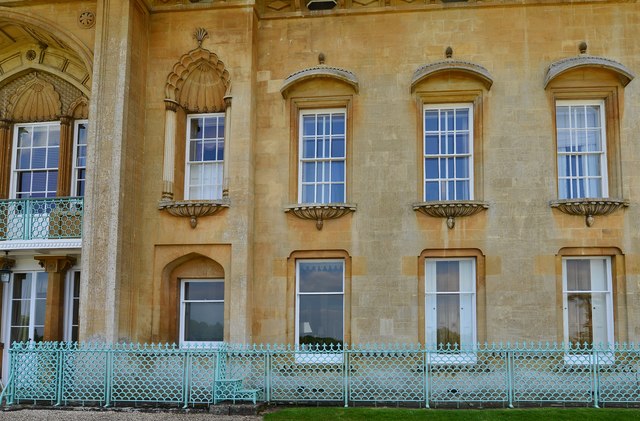
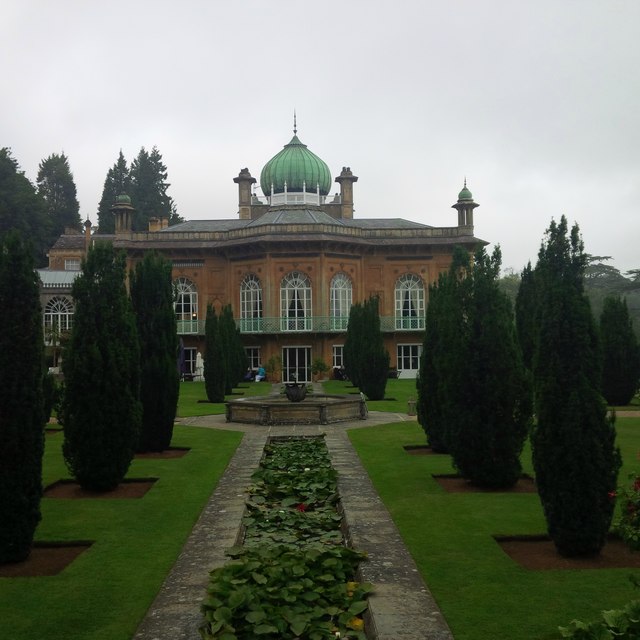
With a population of around 400 residents, Longborough exudes a sense of community and a peaceful ambiance. The village is known for its idyllic stone cottages, many of which date back centuries and showcase the traditional Cotswold architectural style. These quaint houses, along with the well-maintained gardens and neatly trimmed hedges, contribute to the village's timeless charm.

Longborough boasts a rich history, with evidence of settlement dating back to the Roman period. The village is home to St. James' Church, a Grade II listed building that dates back to the 12th century. The church's architecture and intricate stained glass windows are a testament to the village's historical significance.

In addition to its historical appeal, Longborough is renowned for its vibrant arts scene. The Longborough Festival Opera, held in the village every summer, attracts opera enthusiasts from far and wide. The festival takes place in a purpose-built theatre and showcases world-class performances of renowned operas.

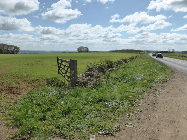
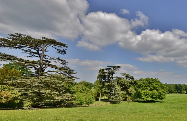
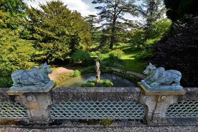
Nature lovers will also find plenty to enjoy in Longborough, as the village is surrounded by stunning countryside. The nearby Cotswold Way offers breathtaking walking trails, allowing visitors to explore the area's natural beauty.

Overall, Longborough is a quintessential Cotswold village, combining history, natural beauty, and a strong sense of community to create a truly enchanting destination.

If you have any feedback on the listing, please let us know in the comments section below.
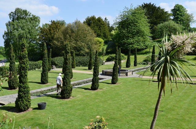
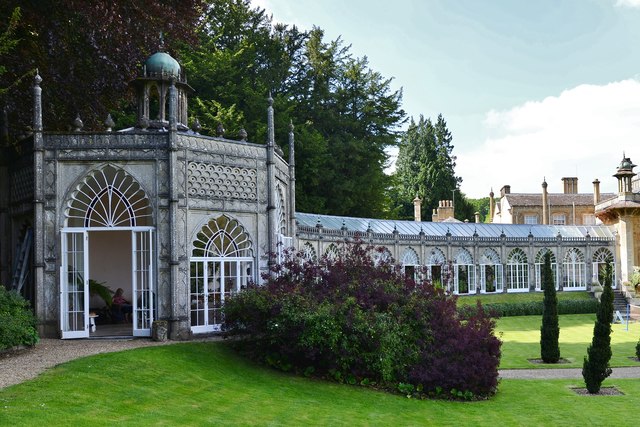
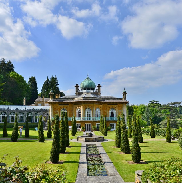
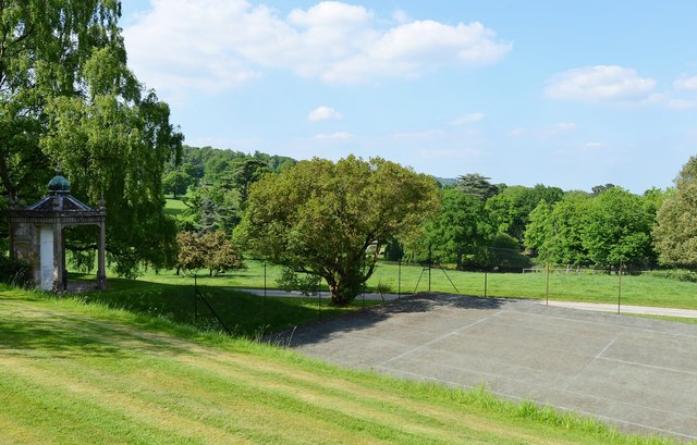
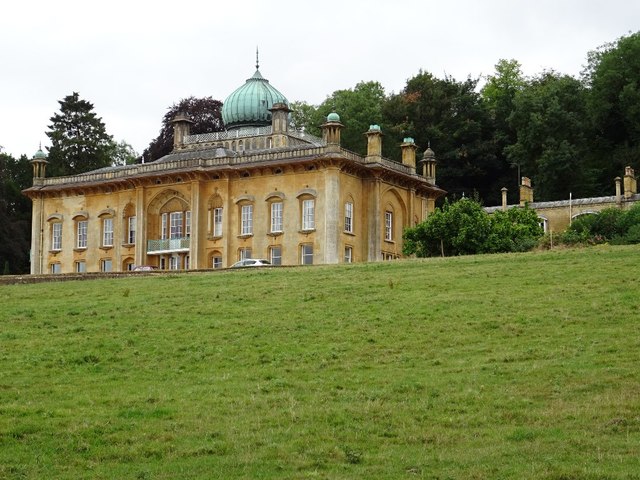
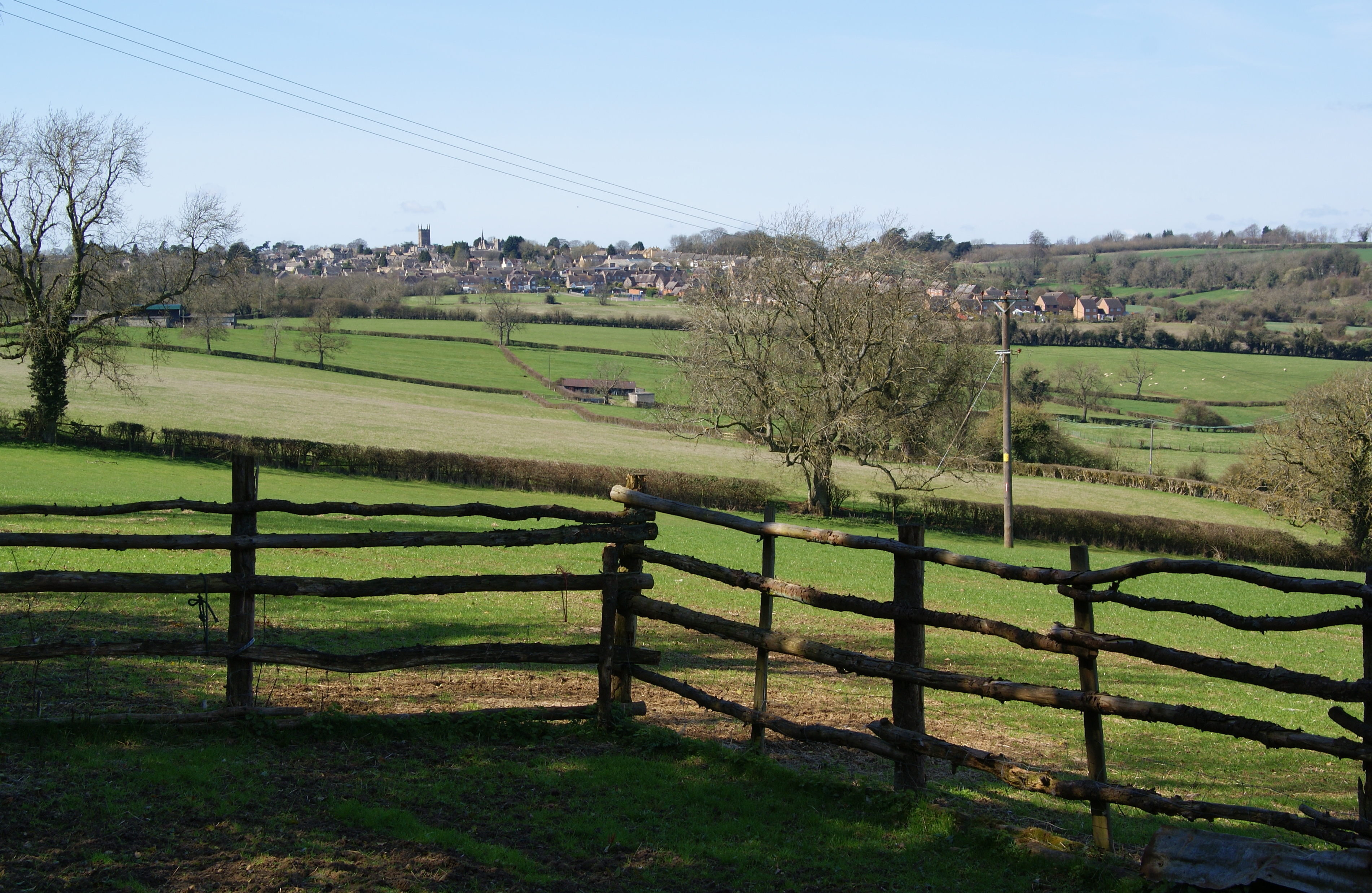
Longborough Images

Images are sourced within 2km of 51.962458/-1.741034 or Grid Reference SP1729. Thanks to Geograph Open Source API. All images are credited.

Crop field next to A424 near Sezincote House
Sezincote House
Sezincote House
Sezincote House northern aspect
Sezincote House architectural detail 1
Sezincote House from the Persian Garden
Sezincote House: The Orangery tea room
Sezincote House: The Persian Garden
Sezincote House: The Orangery
Sezincote House and Persian Garden
Sezincote House: The Tennis Pavilion and Court
Sezincote House architectural detail 2
Sezincote Garden: Cedars of Lebanon
Sezincote Garden: Ornamental bulls on the Indian Bridge
Sezincote: Five minutes to go before the house tour starts
Sezincote House
Sezincote House
Sezincote House A touch of India in the Cotswolds.  The house is Grade I listed, see: <span class="nowrap"><a title="https://historicengland.org.uk/listing/the-list/list-entry/1341231" rel="nofollow ugc noopener" href="https://historicengland.org.uk/listing/the-list/list-entry/1341231">Link</a><img style="margin-left:2px;" alt="External link" title="External link - shift click to open in new window" src="https://s1.geograph.org.uk/img/external.png" width="10" height="10"/></span>
Sezincote House
A touch of India in the Cotswolds. The house is Grade I listed, see: LinkExternal link
A touch of India... A Hindustan Ambassador car parked at the front of Sezincote House, adding to the flavour of India thousands of miles away in the Cotswolds.
A touch of India...
A Hindustan Ambassador car parked at the front of Sezincote House, adding to the flavour of India thousands of miles away in the Cotswolds.
Show me another place!

Longborough is located at Grid Ref: SP1729 (Lat: 51.962458, Lng: -1.741034)

Administrative County: Gloucestershire

District: Cotswold

Police Authority: Gloucestershire

What 3 Words

///simmer.reclusive.printers. Near Donnington, Gloucestershire

Nearby Locations

Longborough Ganborough

Related Wikis

St James' Church, Longborough

St James' Church is the Church of England parish church of Longborough, Gloucestershire, England. It is in the deanery of Stow, the archdeaconry of Cheltenham...

Ganborough

Ganborough is a hamlet located along the A424 road, approximately 2 miles NNW of Stow on the Wold. Ganborough is located in Gloucestershire, a county in...

New Park Quarry

New Park Quarry (grid reference SP175282) is a 1.3-hectare (3.2-acre) geological Site of Special Scientific Interest in Gloucestershire, notified in 1987...

Battle of Stow-on-the-Wold

The Battle of Stow-on-the-Wold (21 March 1646) took place during the First English Civil War. It was a Parliamentarian victory by detachments of the New...

Nearby Amenities

Located within 500m of 51.962458,-1.741034
Longborough
Created By: Potlatch 0.9c
Place: village
Lat/Long: 51.9639458/-1.7394489
Bus Stop
Longborough School
Bus: yes
Naptan AtcoCode: 1600GL2993;1600GL2995
Naptan Bearing: N;NW
Naptan CommonName: Longborough School
Naptan NaptanCode: glogjawa;glogjatw
Naptan Street: High Street;Ganborough Rd
Naptan Verified: no
Public Transport: platform
Source: naptan_import
Lat/Long: 51.9642827/-1.7405873
Bus Stop
Longborough School
Bus: yes
Naptan AtcoCode: 1600GL2994
Naptan Bearing: S
Naptan CommonName: Longborough School
Naptan Indicator: Opp
Naptan NaptanCode: glogjawd
Naptan Street: High Street
Naptan Verified: no
Public Transport: platform
Source: naptan_import
Lat/Long: 51.9642734/-1.7404564
Bus Stop
Longborough School
Bus: yes
Naptan AtcoCode: 1600GL2996
Naptan Bearing: E
Naptan CommonName: Longborough School
Naptan Indicator: Opp
Naptan NaptanCode: glogjawg
Naptan Street: Ganborough Rd
Naptan Verified: no
Public Transport: platform
Source: naptan_import
Lat/Long: 51.9646913/-1.7408452
Longborough Village Shop
Shop: convenience
Lat/Long: 51.9647618/-1.7398578
Turning Circle
Lat/Long: 51.9639281/-1.7418535
Turning Circle
Lat/Long: 51.9641949/-1.7418377
Generator Method: photovoltaic
Generator Output Electricity: yes
Generator Source: solar
Generator Type: solar_photovoltaic_panel
Location: roof
Power: generator
Lat/Long: 51.9613015/-1.7402682
Generator Method: photovoltaic
Generator Output Electricity: yes
Generator Source: solar
Generator Type: solar_photovoltaic_panel
Location: roof
Power: generator
Lat/Long: 51.9613296/-1.7403567
Generator Method: photovoltaic
Generator Output Electricity: yes
Generator Source: solar
Generator Type: solar_photovoltaic_panel
Location: roof
Power: generator
Lat/Long: 51.9656811/-1.7379373
Generator Method: photovoltaic
Generator Output Electricity: yes
Generator Source: solar
Generator Type: solar_photovoltaic_panel
Location: roof
Power: generator
Lat/Long: 51.9656678/-1.7376959
Generator Method: photovoltaic
Generator Output Electricity: yes
Generator Source: solar
Generator Type: solar_photovoltaic_panel
Location: roof
Power: generator
Lat/Long: 51.9656678/-1.7374679
Generator Method: photovoltaic
Generator Output Electricity: yes
Generator Source: solar
Generator Type: solar_photovoltaic_panel
Location: roof
Power: generator
Lat/Long: 51.9640532/-1.7415637
Generator Method: photovoltaic
Generator Output Electricity: yes
Generator Source: solar
Generator Type: solar_photovoltaic_panel
Location: roof
Power: generator
Lat/Long: 51.9639904/-1.7411453
Generator Method: photovoltaic
Generator Output Electricity: yes
Generator Source: solar
Generator Type: solar_photovoltaic_panel
Location: roof
Power: generator
Lat/Long: 51.9638615/-1.7397022
Historic: memorial
Memorial: war_memorial
Lat/Long: 51.96502/-1.7412552
Bench
Source: survey
Lat/Long: 51.9656406/-1.7407201
Bench
Source: survey
Lat/Long: 51.9650448/-1.7413813
Grit Bin
Source: survey
Lat/Long: 51.9647242/-1.7411989
Telephone
Defibrillator
Booth: K6
Covered: booth
Defibrillator Location: inside red phone box by Longborough Village Hall
Emergency: defibrillator
Man Made: telephone_box
Lat/Long: 51.9628643/-1.7408604
Generator Method: photovoltaic
Generator Output Electricity: yes
Generator Source: solar
Generator Type: solar_photovoltaic_panel
Location: roof
Power: generator
Lat/Long: 51.9647052/-1.7357259
Generator Method: photovoltaic
Generator Output Electricity: yes
Generator Source: solar
Generator Type: solar_photovoltaic_panel
Location: roof
Power: generator
Lat/Long: 51.9647159/-1.7358586
Generator Method: photovoltaic
Generator Output Electricity: yes
Generator Source: solar
Generator Type: solar_photovoltaic_panel
Location: roof
Power: generator
Lat/Long: 51.9647275/-1.7359753
Generator Method: photovoltaic
Generator Output Electricity: yes
Generator Source: solar
Generator Type: solar_photovoltaic_panel
Location: roof
Power: generator
Lat/Long: 51.9649523/-1.7359726
Generator Method: photovoltaic
Generator Output Electricity: yes
Generator Source: solar
Generator Type: solar_photovoltaic_panel
Location: roof
Power: generator
Lat/Long: 51.9650671/-1.7359766
Generator Method: photovoltaic
Generator Output Electricity: yes
Generator Source: solar
Generator Type: solar_photovoltaic_panel
Location: roof
Power: generator
Lat/Long: 51.9650142/-1.7359136
Generator Method: photovoltaic
Generator Output Electricity: yes
Generator Source: solar
Generator Type: solar_photovoltaic_panel
Location: roof
Power: generator
Lat/Long: 51.9649394/-1.7355073
Generator Method: photovoltaic
Generator Output Electricity: yes
Generator Source: solar
Generator Type: solar_photovoltaic_panel
Location: roof
Power: generator
Lat/Long: 51.9650153/-1.7354865
Cafe
Longborough Village Cafe
Takeaway: yes
Lat/Long: 51.9647665/-1.7398083
Post Box
Brand: Royal Mail
Brand Wikidata: Q638098
Mapillary: 148383800878244
Operator: Royal Mail
Operator Wikidata: Q638098
Post Box Mounting: building
Post Box Type: wall
Survey Date: 2021-06-05
Lat/Long: 51.9647403/-1.7398849
Longborough Church
Power: pole
Transformer: distribution
Voltage Primary: 11000
Lat/Long: 51.9662/-1.7401548
Power: pole
Lat/Long: 51.9667742/-1.7394944
Bean Hill
Location Transition: yes
Power: pole
Transformer: distribution
Voltage Primary: 11000
Lat/Long: 51.9661273/-1.737362
Longborough North
Power: pole
Transformer: distribution
Voltage Primary: 11000
Lat/Long: 51.9648023/-1.7422275
Power: pole
Lat/Long: 51.9639392/-1.7422235
Power: pole
Lat/Long: 51.9632971/-1.74311
Williams Buildings
Power: pole
Transformer: distribution
Voltage Primary: 11000
Lat/Long: 51.9641383/-1.7343673
Power: pole
Lat/Long: 51.9634583/-1.7346624
Power: pole
Lat/Long: 51.9630575/-1.7359833
Power: pole
Lat/Long: 51.9626617/-1.7372386
Power: pole
Lat/Long: 51.9623667/-1.7387735
Banks Fee Coppice
Power: pole
Transformer: distribution
Voltage Primary: 11000
Lat/Long: 51.9620663/-1.7401005
Banks Fee
Power: pole
Transformer: distribution
Voltage Primary: 11000
Lat/Long: 51.960104/-1.7418326
Power: pole
Lat/Long: 51.9603462/-1.7423013
Power: pole
Lat/Long: 51.9609064/-1.7422061
Power: pole
Transformer: distribution
Voltage Primary: 11000
Lat/Long: 51.9614452/-1.7421068
Longborough South
Power: transformer
Transformer: distribution
Voltage Primary: 11000
Lat/Long: 51.962182/-1.742426
Power: pole
Lat/Long: 51.9627013/-1.7450331
East Ridge Longborough
Power: pole
Transformer: distribution
Voltage Primary: 11000
Lat/Long: 51.9627769/-1.7437805
Power: pole
Lat/Long: 51.9626369/-1.7460966
Power: pole
Lat/Long: 51.962558/-1.7471648
Power: pole
Lat/Long: 51.9628881/-1.7478005
Location Transition: yes
Power: pole
Lat/Long: 51.9629302/-1.7478796
The data included in this document is from www.openstreetmap.org. The data is made available under ODbL.

Have you been to Longborough?

Leave your review of Longborough below (or comments, questions and feedback).