Dinas Mawr

Coastal Feature, Headland, Point in Pembrokeshire

Wales

Dinas Mawr

Reeds in the Valley above Pwll Arian A very quiet and tranquil place out of the wind
Reeds in the Valley above Pwll Arian Credit: Deborah Tilley

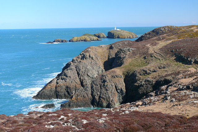
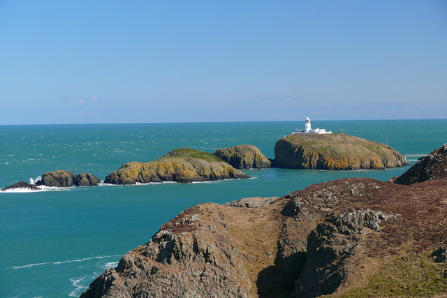
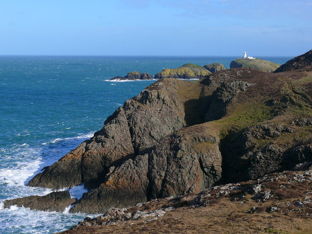
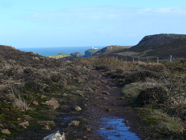
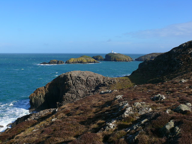
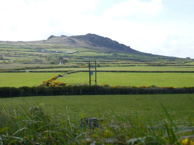
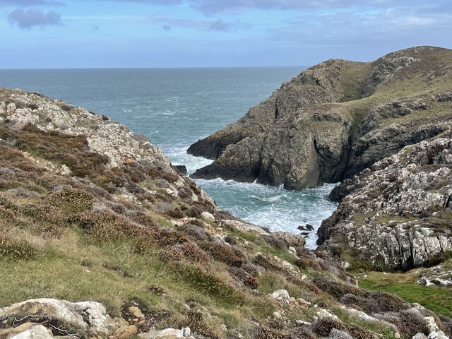
Dinas Mawr is a prominent coastal feature located in Pembrokeshire, Wales. It is a headland that juts out into the sea, creating a dramatic and picturesque landscape. The name "Dinas Mawr" translates to "Great Fort" in Welsh, alluding to the historical significance of this site.

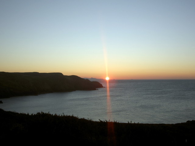
This headland is situated on the western edge of the Pembrokeshire Coast National Park, providing stunning views of the surrounding coastline. Standing at an impressive height of 164 meters (538 feet), Dinas Mawr dominates the horizon and serves as a popular landmark for both locals and tourists alike.

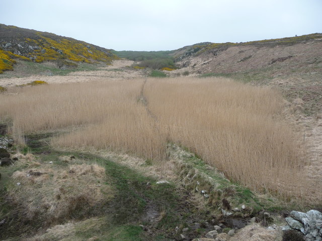
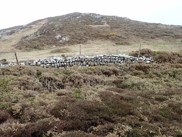
The headland is composed of rugged cliffs and rocky outcrops, which have been shaped by years of erosion by the powerful waves of the Atlantic Ocean. These cliffs provide a nesting habitat for various seabird species, including puffins, razorbills, and guillemots. The area is also home to a diverse range of flora and fauna, with wildflowers, grasses, and heather covering the landscape.

In addition to its natural beauty, Dinas Mawr has a rich historical background. The headland is believed to have been inhabited since prehistoric times, with numerous archaeological sites discovered in the surrounding area. The remnants of Iron Age hillforts and ancient burial chambers can still be seen today, adding to the intrigue and allure of this coastal feature.

Overall, Dinas Mawr is a captivating headland that offers a perfect blend of natural beauty and historical significance. Whether it's for a leisurely walk, birdwatching, or exploring ancient ruins, this coastal gem has something to offer for everyone.

If you have any feedback on the listing, please let us know in the comments section below.

Dinas Mawr Images

Images are sourced within 2km of 52.005701/-5.0810114 or Grid Reference SM8838. Thanks to Geograph Open Source API. All images are credited.

Reeds in the Valley above Pwll Arian A very quiet and tranquil place out of the wind
Reeds in the Valley above Pwll Arian
A very quiet and tranquil place out of the wind
Pwll Arian a Charreg Onnen Bay / Pwll Arian and Carreg Onnen Bay Golygfa tuag at Oleudy Pen Caer / A view towards Strumble Head Lighthouse.
Pwll Arian a Charreg Onnen Bay / Pwll Arian and Carreg Onnen Bay
Golygfa tuag at Oleudy Pen Caer / A view towards Strumble Head Lighthouse.
Carn Melyn Carn Melyn gyda Charreg Onnen a Goleudy Pen Caer y tu ol / Carn Melyn with Carreg Onnen and Strumble Head behind.
Carn Melyn
Carn Melyn gyda Charreg Onnen a Goleudy Pen Caer y tu ol / Carn Melyn with Carreg Onnen and Strumble Head behind.
Carn Melyn
Carn Melyn
Llwybr Arfordir Sir Benfro / Pembrokeshire Coast Path Goleudy Pen Caer yn y pellter / Strumble Head Lighthouse in the distance.
Llwybr Arfordir Sir Benfro / Pembrokeshire Coast Path
Goleudy Pen Caer yn y pellter / Strumble Head Lighthouse in the distance.
Carn Melyn Goleudy Pen Caer yn y pellter / Strumble Head Lighthouse in the distance.
Carn Melyn
Goleudy Pen Caer yn y pellter / Strumble Head Lighthouse in the distance.
Sunset from Strumble Head Late December and a perfect day ends with the sun tipping below the horizon off the western shore of Pencaer. Moments later we saw the 'green flash'.
Sunset from Strumble Head
Late December and a perfect day ends with the sun tipping below the horizon off the western shore of Pencaer. Moments later we saw the 'green flash'.
Coastal marsh near Strumble Head This small valley drains down into a marsh above the rocky coastline with tall reed beds and a silent, unspoilt air.
Coastal marsh near Strumble Head
This small valley drains down into a marsh above the rocky coastline with tall reed beds and a silent, unspoilt air.
Looking towards Garn Fawr
Pwll Arian Inlet on the north Pembrokeshire coast, west of Strumble Head
Pwll Arian
Inlet on the north Pembrokeshire coast, west of Strumble Head
A stretch of dry stone wall Can find no name for the hill on the other side
A stretch of dry stone wall
Can find no name for the hill on the other side
Walkers on the Pembrokeshire Coast Path, looking west
Pwll Arian Pwll Arian translates as silver pool.  Looking north from the Pembrokeshire Coast Path.
Pwll Arian
Pwll Arian translates as silver pool. Looking north from the Pembrokeshire Coast Path.
Pembrokeshire Coast Path near Carn Melyn
Carn Melyn
Carn Melyn
Pwll Arian A view of Pwll Arian from the Pembrokeshire Coast Path.
Pwll Arian
A view of Pwll Arian from the Pembrokeshire Coast Path.
Grazing ponies Ponies are used to control invasive scrub throughout the area, and walkers are advised to avoid close approach and not feed them. However, it was the ponies that approached me and they insisted on rummaging in my camera bag.
Grazing ponies
Ponies are used to control invasive scrub throughout the area, and walkers are advised to avoid close approach and not feed them. However, it was the ponies that approached me and they insisted on rummaging in my camera bag.
Coastal grazing land Moorland adjacent to Llanwnwr is home to a large number of grazing ponies. The distant horizon is formed by the long ridge marking the outcrop of an intrusion of gabbroic rocks (see <a href="https://www.geograph.org.uk/photo/4895780">SM9038 : Gabbro crags</a>). The long-distance path follows the fence, though the area is marked as access land.
Coastal grazing land
Moorland adjacent to Llanwnwr is home to a large number of grazing ponies. The distant horizon is formed by the long ridge marking the outcrop of an intrusion of gabbroic rocks (see SM9038 : Gabbro crags). The long-distance path follows the fence, though the area is marked as access land.
Show me another place!

Dinas Mawr is located at Grid Ref: SM8838 (Lat: 52.005701, Lng: -5.0810114)

Unitary Authority: Pembrokeshire

Police Authority: Dyfed Powys

What 3 Words

///mothering.howler.dynamics. Near Goodwick, Pembrokeshire

Related Wikis

Strumble Head - Llechdafad Cliffs

Strumble Head - Llechdafad Cliffs is a Site of Special Scientific Interest (SSSI) in Pembrokeshire, South Wales. It has been designated as a SSSI since...

Trefasser

Trefasser (variations: Tref-Asser, or Trêf Asser, or Asserton; translation: "town" of "Asser") is a hamlet, located to the west of Fishguard in western...

Calburga

Calburga was a Canadian barque, the last Canadian-built square-rigger of large tonnage. She was built in 1890 at South Maitland, Nova Scotia by local shipbuilder...

Strumble Head

Strumble Head (Welsh: Pen Caer,Trwyn-câr, Pen Strwmbl) is a rocky headland in the community of Pencaer in Pembrokeshire, Wales, within the Pembrokeshire...

Nearby Amenities

Located within 500m of 52.005701,-5.0810114
The data included in this document is from www.openstreetmap.org. The data is made available under ODbL.

Have you been to Dinas Mawr?

Leave your review of Dinas Mawr below (or comments, questions and feedback).