Carreg Gerwynau

Coastal Feature, Headland, Point in Pembrokeshire

Wales

Carreg Gerwynau

Llwybr Arfordir Sir Benfro / Pembrokeshire Coast Path Goleudy Pen Caer yn y pellter / Strumble Head Lighthouse in the distance.
Llwybr Arfordir Sir Benfro / Pembrokeshire Coast Path Credit: Ian Medcalf

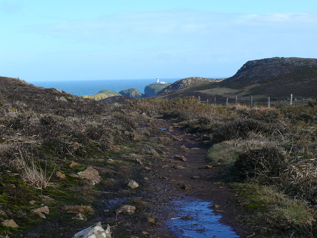
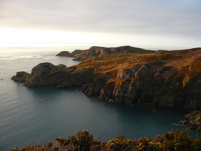
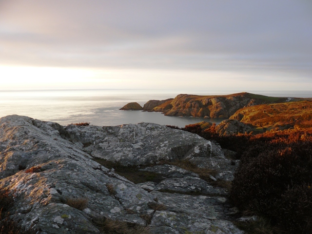
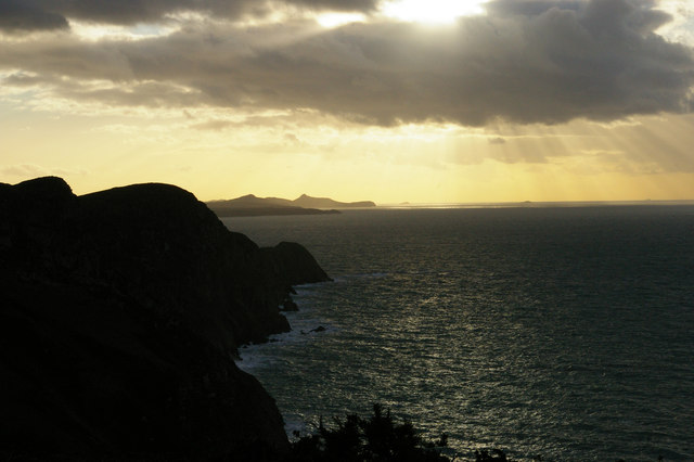
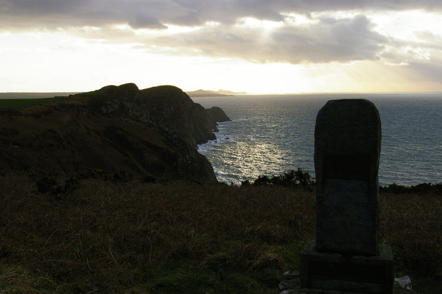
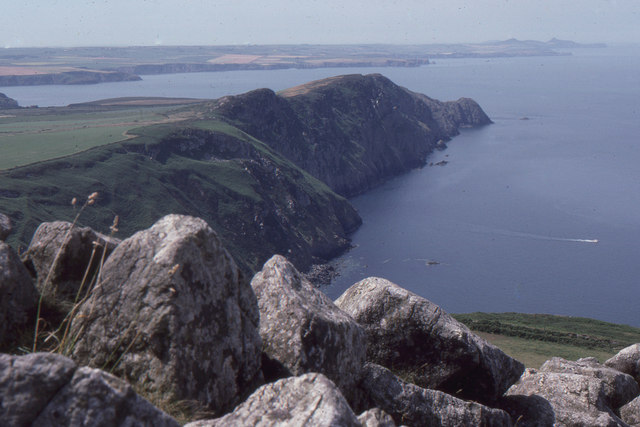
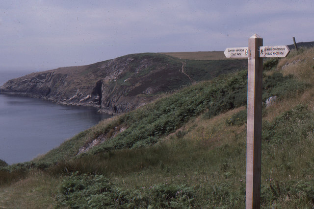
Carreg Gerwynau is a prominent headland located on the coast of Pembrokeshire, Wales. It is known for its rugged cliffs, stunning views of the Irish Sea, and diverse marine wildlife. The headland is made up of a mixture of sandstone and limestone rock formations, which have been shaped by the forces of erosion over millions of years.

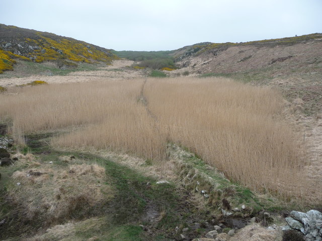
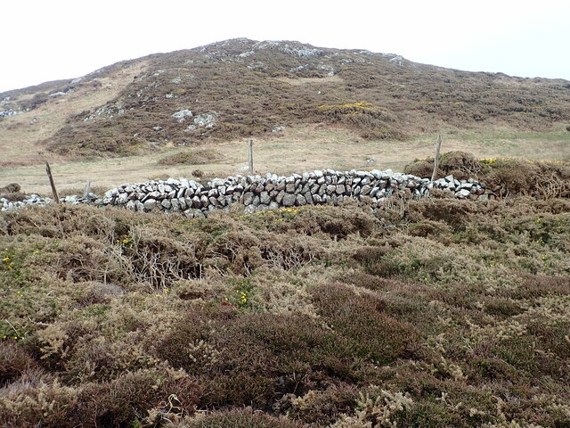
Carreg Gerwynau is a popular destination for hikers and nature enthusiasts, as it offers a variety of walking trails that showcase the area's natural beauty. Visitors can enjoy panoramic views of the surrounding coastline, as well as spot seabirds such as puffins, guillemots, and razorbills nesting on the cliffs.

The headland is also home to a variety of flora and fauna, including rare plants like sea pink and thrift, as well as seals and dolphins that can often be seen swimming in the waters below. Carreg Gerwynau is a designated Site of Special Scientific Interest (SSSI), ensuring that its unique ecosystem is protected for future generations to enjoy.

If you have any feedback on the listing, please let us know in the comments section below.

Carreg Gerwynau Images

Images are sourced within 2km of 52.002187/-5.0778409 or Grid Reference SM8838. Thanks to Geograph Open Source API. All images are credited.

Llwybr Arfordir Sir Benfro / Pembrokeshire Coast Path Goleudy Pen Caer yn y pellter / Strumble Head Lighthouse in the distance.
Llwybr Arfordir Sir Benfro / Pembrokeshire Coast Path
Goleudy Pen Caer yn y pellter / Strumble Head Lighthouse in the distance.
Coastal marsh near Strumble Head This small valley drains down into a marsh above the rocky coastline with tall reed beds and a silent, unspoilt air.
Coastal marsh near Strumble Head
This small valley drains down into a marsh above the rocky coastline with tall reed beds and a silent, unspoilt air.
A stretch of dry stone wall Can find no name for the hill on the other side
A stretch of dry stone wall
Can find no name for the hill on the other side
The Pembrokeshire Coast Path near March Bach
Coastal path leading towards Strumble Head Strumble Head lighthouse is clearly visible nearly a mile away.  But note the sea mist drifting inland.
Coastal path leading towards Strumble Head
Strumble Head lighthouse is clearly visible nearly a mile away. But note the sea mist drifting inland.
Dinas Mawr from the coast path
Rocky outcrop on the Pembrokeshire Coast Path View towards Dinas Mawr
Rocky outcrop on the Pembrokeshire Coast Path
View towards Dinas Mawr
Footpath to Trefasser
Defunct military building above Porth Maenmelyn
Milk churn stand Milk churn stand by the entrance to Tan-y-mynydd. Stumble Head lighthouse can be seen in the distance.
Milk churn stand
Milk churn stand by the entrance to Tan-y-mynydd. Stumble Head lighthouse can be seen in the distance.
Pwll Deri and the coast beyond, looking westward
Pwll Deri and memorial to Dewi Emrys Dewi Emrys (David Emrys James, 1881-1952) was a poet, working in the local North Pembrokeshire dialect of Welsh.  His poem "Pwll Deri" celebrates this precise landscape; his memorial here carries the couplet "A THINA'R MEDDILIE SY'N DWAD ICHI / PAN FOCH CHI'N ISHTE UWCHBEN PWLLDERI" ("And these are the thoughts that come to you / When you sit above Pwllderi").  
For more details of Dewi Emrys, see <span class="nowrap"><a title="http://cy.wikipedia.org/wiki/Dewi_Emrys" rel="nofollow ugc noopener" href="http://cy.wikipedia.org/wiki/Dewi_Emrys">Link</a><img style="margin-left:2px;" alt="External link" title="External link - shift click to open in new window" src="https://s1.geograph.org.uk/img/external.png" width="10" height="10"/></span> (Welsh) or <span class="nowrap"><a title="http://yba.llgc.org.uk/en/s2-JAME-EMR-1881.html" rel="nofollow ugc noopener" href="http://yba.llgc.org.uk/en/s2-JAME-EMR-1881.html">Link</a><img style="margin-left:2px;" alt="External link" title="External link - shift click to open in new window" src="https://s1.geograph.org.uk/img/external.png" width="10" height="10"/></span> (English).
For more details of the monument, see <span class="nowrap"><a title="http://www.pmsa.org.uk/pmsa-database/11630/" rel="nofollow ugc noopener" href="http://www.pmsa.org.uk/pmsa-database/11630/">Link</a><img style="margin-left:2px;" alt="External link" title="External link - shift click to open in new window" src="https://s1.geograph.org.uk/img/external.png" width="10" height="10"/></span>.
Pwll Deri and memorial to Dewi Emrys
Dewi Emrys (David Emrys James, 1881-1952) was a poet, working in the local North Pembrokeshire dialect of Welsh. His poem "Pwll Deri" celebrates this precise landscape; his memorial here carries the couplet "A THINA'R MEDDILIE SY'N DWAD ICHI / PAN FOCH CHI'N ISHTE UWCHBEN PWLLDERI" ("And these are the thoughts that come to you / When you sit above Pwllderi"). For more details of Dewi Emrys, see LinkExternal link (Welsh) or LinkExternal link (English). For more details of the monument, see LinkExternal link.
Field gate with a view near Llanferran Entrance to the field from the minor road near Llanferran. The Strumble VOR/DME aviation navigational aid can just be seen in the distance. <a href="https://www.geograph.org.uk/photo/1497633">SM9137 : The Strumble VOR</a>
Field gate with a view near Llanferran
Entrance to the field from the minor road near Llanferran. The Strumble VOR/DME aviation navigational aid can just be seen in the distance. SM9137 : The Strumble VOR
Pwll Deri and the coast beyond, looking westward, from the summit of Garn Fawr
Pwllcrochan from the south
The Old Post Office - Trefasser
The Lane between Garn Fawr and Garn Fechan
Milk Churn Stand by the entrance to Tan-y-mynydd
Show me another place!

Carreg Gerwynau is located at Grid Ref: SM8838 (Lat: 52.002187, Lng: -5.0778409)

Unitary Authority: Pembrokeshire

Police Authority: Dyfed Powys

What 3 Words

///scenes.clerk.convinced. Near Goodwick, Pembrokeshire

Related Wikis

Strumble Head - Llechdafad Cliffs

Strumble Head - Llechdafad Cliffs is a Site of Special Scientific Interest (SSSI) in Pembrokeshire, South Wales. It has been designated as a SSSI since...

Trefasser

Trefasser (variations: Tref-Asser, or Trêf Asser, or Asserton; translation: "town" of "Asser") is a hamlet, located to the west of Fishguard in western...

Calburga

Calburga was a Canadian barque, the last Canadian-built square-rigger of large tonnage. She was built in 1890 at South Maitland, Nova Scotia by local shipbuilder...

Strumble Head

Strumble Head (Welsh: Pen Caer,Trwyn-câr, Pen Strwmbl) is a rocky headland in the community of Pencaer in Pembrokeshire, Wales, within the Pembrokeshire...

Have you been to Carreg Gerwynau?

Leave your review of Carreg Gerwynau below (or comments, questions and feedback).