A' Chiste Dhubh

Coastal Feature, Headland, Point in Inverness-shire

Scotland

A' Chiste Dhubh

Beach of Loch Hourn beside Fraoch Eilean Fraoch Eilean is a tiny island on the south side of Loch Hourn; it's out of view to the right.
Ladhar Bheinn is the incomparable mountain beyond!
Beach of Loch Hourn beside Fraoch Eilean Credit: Trevor Littlewood

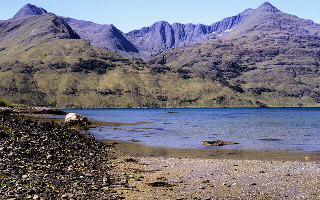
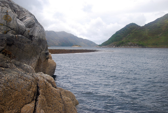
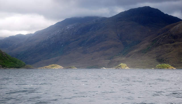
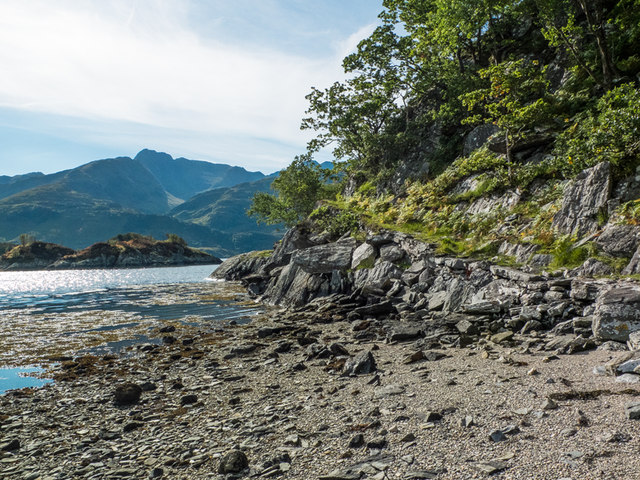
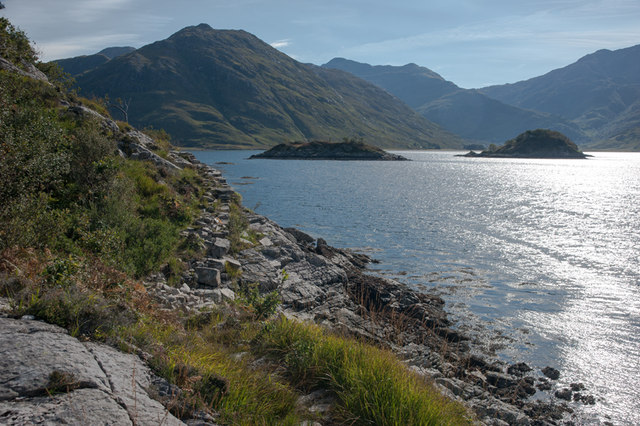
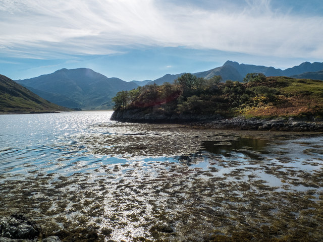
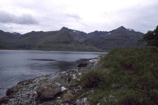
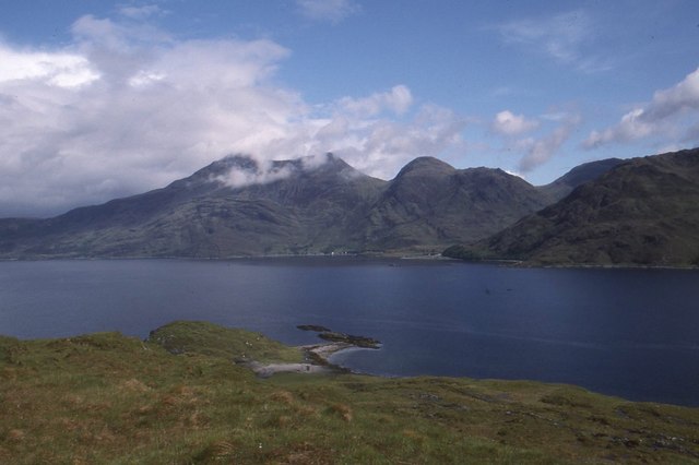
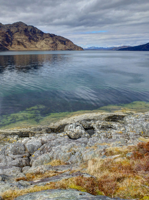
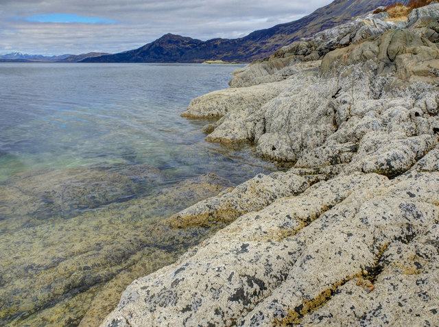
A' Chiste Dhubh is a prominent headland located in Inverness-shire, Scotland. This coastal feature is situated on the western coast of the country, specifically in the region of Lochaber. A' Chiste Dhubh is known for its rugged and dramatic cliffs that overlook the Atlantic Ocean.

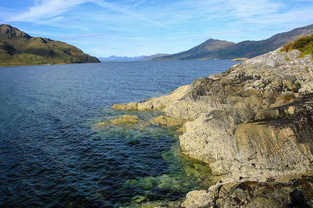
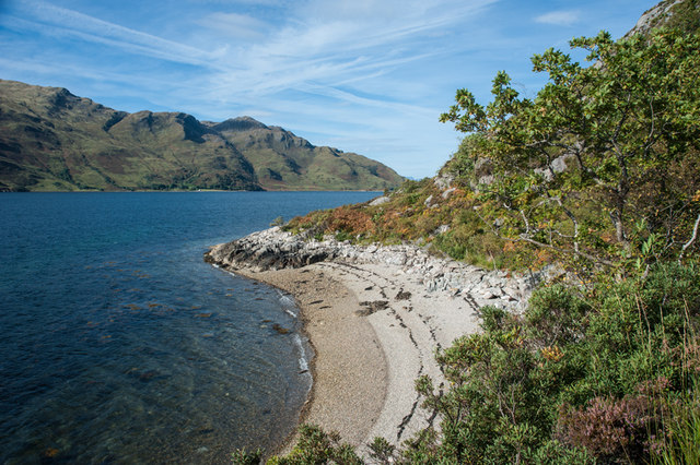
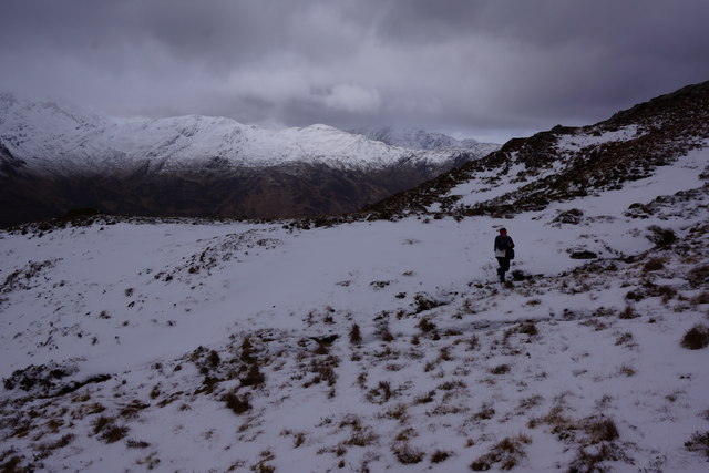
The headland is characterized by its towering height, as it rises from the sea to form a commanding point along the coastline. Its elevation offers breathtaking panoramic views of the surrounding area, including the nearby islands and the vast open sea.

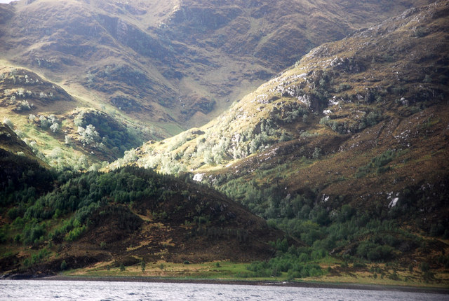
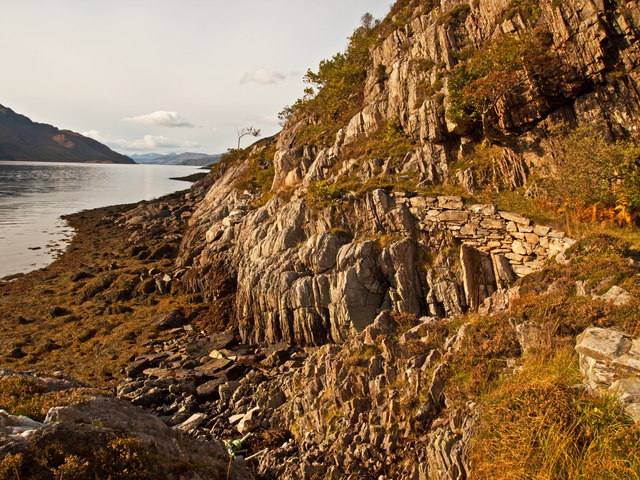
A' Chiste Dhubh is also notable for its unique geological formations. The headland is composed of several layers of sedimentary rock, which have been shaped by centuries of erosion from wind and water. This has resulted in the creation of fascinating rock formations, caves, and arches that add to its scenic beauty.

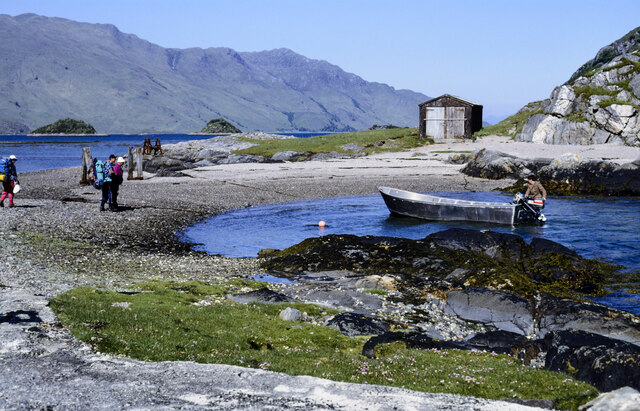
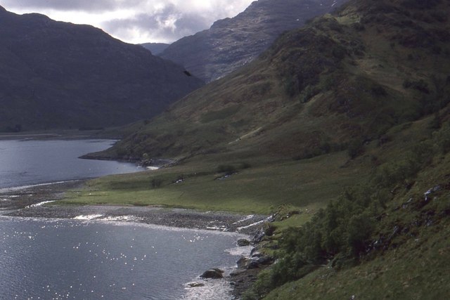
The headland is a popular destination for outdoor enthusiasts and nature lovers. It offers opportunities for hiking, bird watching, and photography. The coastal path that traverses the headland provides visitors with a chance to explore the diverse flora and fauna that inhabit the area.

In addition to its natural beauty, A' Chiste Dhubh holds historical significance. It is believed that the headland was used as a lookout point during ancient times, serving as a vantage point for spotting approaching ships or potential threats.

Overall, A' Chiste Dhubh in Inverness-shire is a stunning coastal feature that combines rugged beauty, geological interest, and historical significance, making it a must-visit destination for those exploring the Scottish coast.

If you have any feedback on the listing, please let us know in the comments section below.

A' Chiste Dhubh Images

Images are sourced within 2km of 57.101991/-5.5281172 or Grid Reference NG8606. Thanks to Geograph Open Source API. All images are credited.

Beach of Loch Hourn beside Fraoch Eilean Fraoch Eilean is a tiny island on the south side of Loch Hourn; it's out of view to the right.
Ladhar Bheinn is the incomparable mountain beyond!
Beach of Loch Hourn beside Fraoch Eilean
Fraoch Eilean is a tiny island on the south side of Loch Hourn; it's out of view to the right. Ladhar Bheinn is the incomparable mountain beyond!
Isthmus at Fraoch Eilean Fraoch Eilean is across the isthmus where there's the boathouse. The boat on the water to the right of the beach was manned by David Mackenzie, a keeper or ghillie at Barrisdale. He was to carry out passengers - some can be seen - to Kinloch Hourn.
Isthmus at Fraoch Eilean
Fraoch Eilean is across the isthmus where there's the boathouse. The boat on the water to the right of the beach was manned by David Mackenzie, a keeper or ghillie at Barrisdale. He was to carry out passengers - some can be seen - to Kinloch Hourn.
Inbhir Dhorrcail The famous north corrie of Ladhar Bheinn lies off the top of the photo. This coastal area is wild and remote as is Knoydart!
Inbhir Dhorrcail
The famous north corrie of Ladhar Bheinn lies off the top of the photo. This coastal area is wild and remote as is Knoydart!
Loch Hourn From Fraoch Eilean a view west with Barrisdale Bay off to the left of the photo.
Loch Hourn
From Fraoch Eilean a view west with Barrisdale Bay off to the left of the photo.
Corr Eileanan Pretty islets studding Loch Hourn near Barrisdale Bay.
Corr Eileanan
Pretty islets studding Loch Hourn near Barrisdale Bay.
Herring Route to Corran Path constructed in 1900 century by locals to facilitate the transportation on foot of herring catches to the
village of Corran
Herring Route to Corran
Path constructed in 1900 century by locals to facilitate the transportation on foot of herring catches to the village of Corran
Rubha Camas na Cailinn Only at low tide as shown here by the barnacle encrusted rocks does the very tip of Rubha Camas na Cailinn become the only land in this square
Rubha Camas na Cailinn
Only at low tide as shown here by the barnacle encrusted rocks does the very tip of Rubha Camas na Cailinn become the only land in this square
Small pebble beach Loch Hourn
A' Chiste Dhubh The coastal path from Corran to all intents ends here at the narrows in Loch Hourn. Progress from here to Kinloch Hourn starts to get difficult certainly beyond this septuagenarian.
A' Chiste Dhubh
The coastal path from Corran to all intents ends here at the narrows in Loch Hourn. Progress from here to Kinloch Hourn starts to get difficult certainly beyond this septuagenarian.
Coastal path from Corran Approaching the islands in Loch Hourn at A'Chiste Dhubh with Barrisdale in the distance.
Coastal path from Corran
Approaching the islands in Loch Hourn at A'Chiste Dhubh with Barrisdale in the distance.
Tidal Island on Loch Hourn Accessible at low tide, Eilean a' Gharb-làin is pictured here with the hills of Knoydart behind.
Tidal Island on Loch Hourn
Accessible at low tide, Eilean a' Gharb-làin is pictured here with the hills of Knoydart behind.
Approaching Druim Fada ridge This was us nearing the ridge of Druim Fada from Loch Hourn.  
Beinn na Caillich (NG 79600 06703) and the western ridge of Ladhar Bheinn can be seen in the background
Approaching Druim Fada ridge
This was us nearing the ridge of Druim Fada from Loch Hourn. Beinn na Caillich (NG 79600 06703) and the western ridge of Ladhar Bheinn can be seen in the background
Shore of Loch Hourn Opposite Barrisdale at the end of the Herring path from Corran.
Shore of Loch Hourn
Opposite Barrisdale at the end of the Herring path from Corran.
Eilean a'Mhuineil Some rocks connected to mainland Knoydart by tombolos.  There is a fine view across Loch Hourn towards Beinn Sgritheall.
Eilean a'Mhuineil
Some rocks connected to mainland Knoydart by tombolos. There is a fine view across Loch Hourn towards Beinn Sgritheall.
Inbhir Dhorrcail An alluvial fan beneath the great northern corrie of Ladhar Bheinn.
Inbhir Dhorrcail
An alluvial fan beneath the great northern corrie of Ladhar Bheinn.
Highland cattle at Barrisdale Bay
Rubha Camas na Cailinn Looking across Loch Hourn to Rubha Ruadha.
Rubha Camas na Cailinn
Looking across Loch Hourn to Rubha Ruadha.
South side of Rubha Camas na Cailinn Unsurprisingly similar photo to the only other in this square. <a href="https://www.geograph.org.uk/photo/3688595">NG8407 : Rubha Camas na Cailinn</a>
This is the only land in it.
South side of Rubha Camas na Cailinn
Unsurprisingly similar photo to the only other in this square. NG8407 : Rubha Camas na Cailinn This is the only land in it.
Show me another place!

A' Chiste Dhubh is located at Grid Ref: NG8606 (Lat: 57.101991, Lng: -5.5281172)

Unitary Authority: Highland

Police Authority: Highlands and Islands

What 3 Words

///helpers.framework.buckling. Near Glenelg, Highland

Related Wikis

Corran, Loch Hourn

Corran (Scottish Gaelic: An Corran) is a hamlet on the northern shore of Loch Hourn, in Lochalsh in Inverness-shire in the Highlands of Scotland. It is...

Druim Fada (Loch Hourn)

Druim Fada (711 m) is a mountain in the Northwest Highlands of Scotland. Located on the northern shore of Loch Hourn in Ross and Cromarty. A long, craggy...

Arnisdale

Arnisdale (Scottish Gaelic: Àrnasdal) is a hamlet in the historic county of Inverness-shire in the local authority area of Highlands of Scotland. It lies...

Arnisdale Free Church

Arnisdale Free Church is a church building at one time connected to the Free Church of Scotland. It is sited in Arnisdale, Inverness-shire, Scotland. According...

Loch Hourn

Loch Hourn (Scottish Gaelic: Loch Shubhairne) is a sea loch which separates the peninsulas of Glenelg to the north and Knoydart to the south, on the west...

Ladhar Bheinn

Ladhar Bheinn is the highest mountain in the Knoydart region of the Highlands of Scotland. It is the most westerly Munro on the Scottish mainland. The...

Beinn nan Caorach

Beinn nan Caorach (774 m) is a mountain in the Northwest Highlands of Scotland, It is located near the village of Corran in Lochalsh. One of the smaller...

Luinne Bheinn

Luinne Bheinn (939 m) is a mountain in the Northwest Highlands of Scotland, on the Knoydart Peninsula in Lochaber. The mountain is rough and rocky. The...

Nearby Amenities

Located within 500m of 57.101991,-5.5281172
Source: PGS
Lat/Long: 57.100588/-5.5274937
Source: PGS
Lat/Long: 57.1006842/-5.5281602
Source: PGS
Lat/Long: 57.1007852/-5.5283815
Source: PGS
Lat/Long: 57.1008436/-5.5280603
Source: PGS
Lat/Long: 57.1011068/-5.5268235
Source: PGS
Lat/Long: 57.1006286/-5.526662
Source: PGS
Lat/Long: 57.0990713/-5.527885
Source: PGS
Lat/Long: 57.0989782/-5.5281946
Source: PGS
Lat/Long: 57.0988954/-5.5290405
Source: PGS
Lat/Long: 57.0993891/-5.5291091
Created By: almien_coastlines
Source: PGS
Lat/Long: 57.099529/-5.528481
Source: PGS
Lat/Long: 57.0995147/-5.5280424
Source: PGS
Lat/Long: 57.0993134/-5.5277046
Source: PGS
Lat/Long: 57.0992167/-5.5276956
Source: PGS
Lat/Long: 57.0976618/-5.5284232
Created By: almien_coastlines
Source: PGS
Lat/Long: 57.097862/-5.528603
Source: PGS
Lat/Long: 57.0978492/-5.5284737
Source: PGS
Lat/Long: 57.098084/-5.5270535
Source: PGS
Lat/Long: 57.0979366/-5.5269371
Source: PGS
Lat/Long: 57.0976185/-5.5269534
Source: PGS
Lat/Long: 57.1046807/-5.5343802
Source: PGS
Lat/Long: 57.1043872/-5.5339202
Source: PGS
Lat/Long: 57.1041824/-5.5327595
Source: PGS
Lat/Long: 57.1040773/-5.5322316
Source: PGS
Lat/Long: 57.1038699/-5.5317815
Source: PGS
Lat/Long: 57.1035548/-5.5313244
Created By: almien_coastlines
Source: PGS
Lat/Long: 57.1032/-5.530614
Source: PGS
Lat/Long: 57.1026292/-5.5288966
Source: PGS
Lat/Long: 57.1023124/-5.5281355
Source: PGS
Lat/Long: 57.1021884/-5.5281791
Source: PGS
Lat/Long: 57.101841/-5.5274271
Created By: almien_coastlines
Source: PGS
Lat/Long: 57.101859/-5.527228
Source: PGS
Lat/Long: 57.1023704/-5.522113
Source: PGS
Lat/Long: 57.1022768/-5.5208975
Source: PGS
Lat/Long: 57.1020175/-5.5212243
Source: PGS
Lat/Long: 57.1017109/-5.5215995
The data included in this document is from www.openstreetmap.org. The data is made available under ODbL.

Have you been to A' Chiste Dhubh?

Leave your review of A' Chiste Dhubh below (or comments, questions and feedback).