Eilean a' Gharb-làin

Island in Inverness-shire

Scotland

Eilean a' Gharb-làin

Beach of Loch Hourn beside Fraoch Eilean Fraoch Eilean is a tiny island on the south side of Loch Hourn; it's out of view to the right.
Ladhar Bheinn is the incomparable mountain beyond!
Beach of Loch Hourn beside Fraoch Eilean Credit: Trevor Littlewood

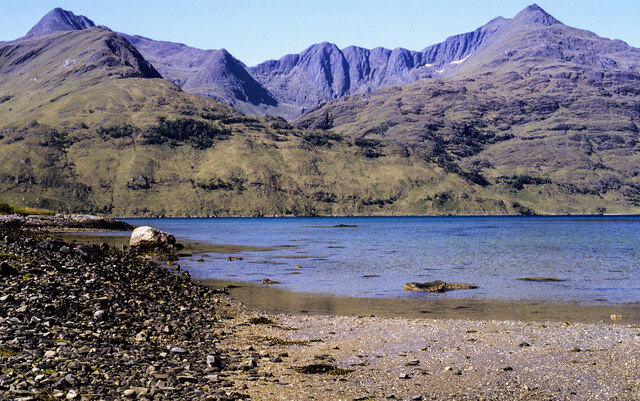
Eilean a' Gharb-làin is a small island located off the coast of Inverness-shire, Scotland. The island is situated in the Inner Hebrides, specifically in the Sound of Iona. It is approximately 1.5 kilometers long and 300 meters wide, with a total area of about 30 hectares.

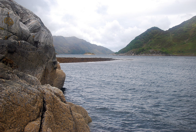
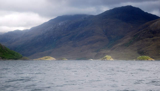
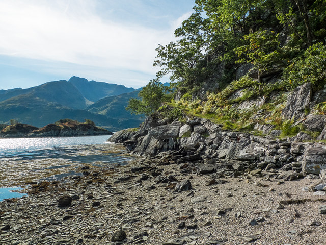
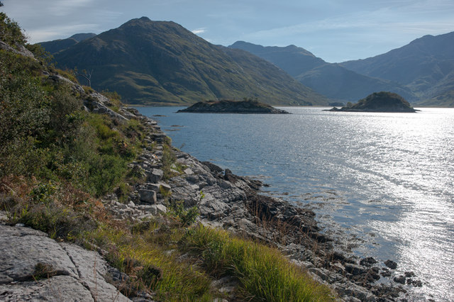
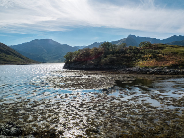
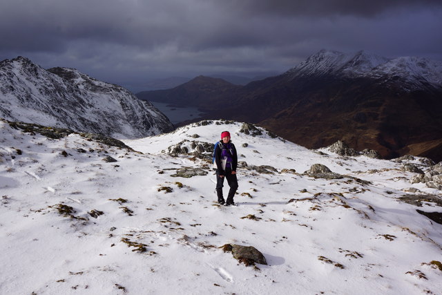
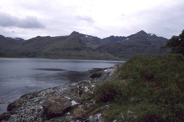
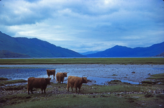
The island is known for its rugged and picturesque landscape, characterized by rocky cliffs, grassy slopes, and stunning views of the surrounding sea and neighboring islands. It is home to a diverse range of wildlife, including seabirds such as puffins, guillemots, and razorbills, as well as seals and otters that can often be spotted along the shoreline.

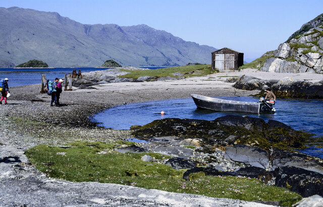
Eilean a' Gharb-làin has a rich history dating back centuries. It was once inhabited by a small community of crofters, who relied on fishing and farming for their livelihoods. Today, the island remains uninhabited, but it continues to attract visitors who are drawn to its natural beauty and tranquil atmosphere.

Access to Eilean a' Gharb-làin is primarily by boat, with regular ferry services available from nearby ports. Visitors can explore the island on foot, taking in the breathtaking scenery and enjoying the opportunity for wildlife spotting. The island also offers opportunities for outdoor activities such as hiking, birdwatching, and photography.

Overall, Eilean a' Gharb-làin is a hidden gem in Inverness-shire, offering a peaceful and unspoiled retreat for nature lovers and those seeking a unique island experience.

If you have any feedback on the listing, please let us know in the comments section below.

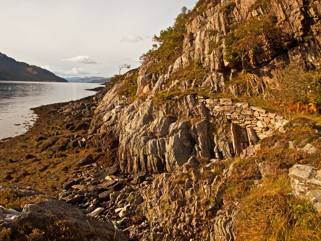
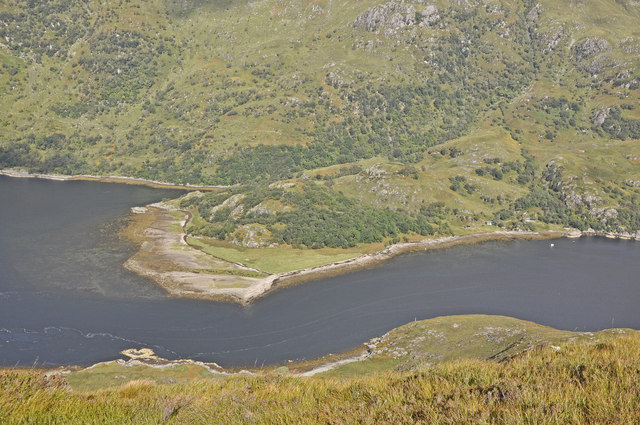
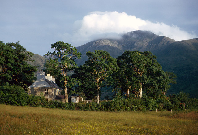
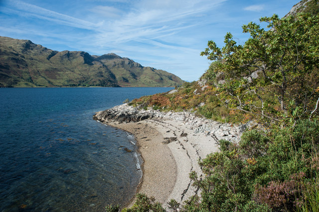
Eilean a' Gharb-làin Images

Images are sourced within 2km of 57.100942/-5.5187505 or Grid Reference NG8606. Thanks to Geograph Open Source API. All images are credited.

Beach of Loch Hourn beside Fraoch Eilean Fraoch Eilean is a tiny island on the south side of Loch Hourn; it's out of view to the right.
Ladhar Bheinn is the incomparable mountain beyond!
Beach of Loch Hourn beside Fraoch Eilean
Fraoch Eilean is a tiny island on the south side of Loch Hourn; it's out of view to the right. Ladhar Bheinn is the incomparable mountain beyond!
Isthmus at Fraoch Eilean Fraoch Eilean is across the isthmus where there's the boathouse. The boat on the water to the right of the beach was manned by David Mackenzie, a keeper or ghillie at Barrisdale. He was to carry out passengers - some can be seen - to Kinloch Hourn.
Isthmus at Fraoch Eilean
Fraoch Eilean is across the isthmus where there's the boathouse. The boat on the water to the right of the beach was manned by David Mackenzie, a keeper or ghillie at Barrisdale. He was to carry out passengers - some can be seen - to Kinloch Hourn.
Caolas Mor Shingly beach on the west side of this promontory which gives rise to the narrows of the same name.
Caolas Mor
Shingly beach on the west side of this promontory which gives rise to the narrows of the same name.
Loch Hourn From Fraoch Eilean a view west with Barrisdale Bay off to the left of the photo.
Loch Hourn
From Fraoch Eilean a view west with Barrisdale Bay off to the left of the photo.
Corr Eileanan Pretty islets studding Loch Hourn near Barrisdale Bay.
Corr Eileanan
Pretty islets studding Loch Hourn near Barrisdale Bay.
Herring Route to Corran Path constructed in 1900 century by locals to facilitate the transportation on foot of herring catches to the
village of Corran
Herring Route to Corran
Path constructed in 1900 century by locals to facilitate the transportation on foot of herring catches to the village of Corran
The Caolas Mor from the slopes of Meall nan Eun
Barrisdale Lodge in 1965 Some fine Scots Pine trees surrounded Barrisdale Lodge in 1965.  The mix of trees in 2009 appear a little different <a href="https://www.geograph.org.uk/photo/1353608">NG8704 : Barrisdale Lodge</a>.  Luinne Bheinn dominates the view into Knoydart.
Barrisdale Lodge in 1965
Some fine Scots Pine trees surrounded Barrisdale Lodge in 1965. The mix of trees in 2009 appear a little different NG8704 : Barrisdale Lodge. Luinne Bheinn dominates the view into Knoydart.
Unnamed lochan above the corrie of the Allt Ban, Druim Fada Beinn Sgritheall lies to the west.
Unnamed lochan above the corrie of the Allt Ban, Druim Fada
Beinn Sgritheall lies to the west.
Small pebble beach Loch Hourn
A' Chiste Dhubh The coastal path from Corran to all intents ends here at the narrows in Loch Hourn. Progress from here to Kinloch Hourn starts to get difficult certainly beyond this septuagenarian.
A' Chiste Dhubh
The coastal path from Corran to all intents ends here at the narrows in Loch Hourn. Progress from here to Kinloch Hourn starts to get difficult certainly beyond this septuagenarian.
Coastal path from Corran Approaching the islands in Loch Hourn at A'Chiste Dhubh with Barrisdale in the distance.
Coastal path from Corran
Approaching the islands in Loch Hourn at A'Chiste Dhubh with Barrisdale in the distance.
Tidal Island on Loch Hourn Accessible at low tide, Eilean a' Gharb-làin is pictured here with the hills of Knoydart behind.
Tidal Island on Loch Hourn
Accessible at low tide, Eilean a' Gharb-làin is pictured here with the hills of Knoydart behind.
Approaching Druim Fada ridge This was us nearing the ridge of Druim Fada from Loch Hourn.  
Beinn na Caillich (NG 79600 06703) and the western ridge of Ladhar Bheinn can be seen in the background
Approaching Druim Fada ridge
This was us nearing the ridge of Druim Fada from Loch Hourn. Beinn na Caillich (NG 79600 06703) and the western ridge of Ladhar Bheinn can be seen in the background
Druim Fada ridge Beinn Sgritheall in the background
Druim Fada ridge
Beinn Sgritheall in the background
Shore of Loch Hourn Opposite Barrisdale at the end of the Herring path from Corran.
Shore of Loch Hourn
Opposite Barrisdale at the end of the Herring path from Corran.
Highland cattle at Barrisdale Bay
Barisdale House Glimpsed through the trees to its east; there is a scaffolding tower erected against the rear wall, presumably some work taking place on the upper walls or roof.
Barisdale House
Glimpsed through the trees to its east; there is a scaffolding tower erected against the rear wall, presumably some work taking place on the upper walls or roof.
Show me another place!

Eilean a' Gharb-làin is located at Grid Ref: NG8606 (Lat: 57.100942, Lng: -5.5187505)

Unitary Authority: Highland

Police Authority: Highlands and Islands

What 3 Words

///thighs.hurls.iceberg. Near Glenelg, Highland

Related Wikis

Druim Fada (Loch Hourn)

Druim Fada (711 m) is a mountain in the Northwest Highlands of Scotland. Located on the northern shore of Loch Hourn in Ross and Cromarty. A long, craggy...

Corran, Loch Hourn

Corran (Scottish Gaelic: An Corran) is a hamlet on the northern shore of Loch Hourn, in Lochalsh in Inverness-shire in the Highlands of Scotland. It is...

Arnisdale

Arnisdale (Scottish Gaelic: Àrnasdal) is a hamlet in the historic county of Inverness-shire in the local authority area of Highlands of Scotland. It lies...

Arnisdale Free Church

Arnisdale Free Church is a church building at one time connected to the Free Church of Scotland. It is sited in Arnisdale, Inverness-shire, Scotland. According...

Nearby Amenities

Located within 500m of 57.100942,-5.5187505
Source: PGS
Lat/Long: 57.1011068/-5.5268235
Source: PGS
Lat/Long: 57.1006286/-5.526662
Source: PGS
Lat/Long: 57.1023704/-5.522113
Source: PGS
Lat/Long: 57.1022768/-5.5208975
Source: PGS
Lat/Long: 57.1020175/-5.5212243
Source: PGS
Lat/Long: 57.1017109/-5.5215995
Source: PGS
Lat/Long: 57.1018477/-5.5170171
Source: PGS
Lat/Long: 57.101643/-5.5163363
Source: PGS
Lat/Long: 57.1015764/-5.5150568
Source: PGS
Lat/Long: 57.1014874/-5.5143467
Source: PGS
Lat/Long: 57.101819/-5.5129077
Source: PGS
Lat/Long: 57.1022054/-5.5125936
Source: PGS
Lat/Long: 57.1025388/-5.5122216
Created By: almien_coastlines
Source: PGS
Lat/Long: 57.102692/-5.511283
Rubha Leac an Aoil
Natural: cape
Lat/Long: 57.1016011/-5.5144657
The data included in this document is from www.openstreetmap.org. The data is made available under ODbL.

Have you been to Eilean a' Gharb-làin?

Leave your review of Eilean a' Gharb-làin below (or comments, questions and feedback).