Rubha Buidhe
Coastal Feature, Headland, Point in Argyllshire
Scotland
Rubha Buidhe

Rubha Buidhe, located in Argyllshire, Scotland, is a prominent coastal feature known for its stunning headland and picturesque point. This scenic location is situated on the western coast of Scotland, overlooking the vast expanse of the Atlantic Ocean.
The headland of Rubha Buidhe is characterized by its rugged and rocky terrain, jutting out into the sea. The cliffs that line the headland offer breathtaking panoramic views of the surrounding coastline, with waves crashing against the rocks below. The area is also dotted with small caves and crevices, adding to its natural allure.
At the tip of Rubha Buidhe is the point, which offers unobstructed vistas of the ocean and the distant horizon. The point is an ideal spot for nature enthusiasts and photographers, as it provides a unique vantage point to observe marine life and seabirds, such as gannets and puffins, that frequent the area.
In addition to its natural beauty, Rubha Buidhe holds historical significance. The ruins of an ancient fort can be found on the headland, serving as a reminder of the area's rich heritage. Exploring the remnants of this fort allows visitors to step back in time and imagine the lives of those who once inhabited the area.
Access to Rubha Buidhe is relatively straightforward, with a well-maintained footpath leading visitors along the headland. The path meanders through grassy fields and heather-covered moorland, providing opportunities for leisurely walks and hikes. The area is also a popular spot for fishing, offering anglers the chance to cast their lines into the abundant waters.
Overall, Rubha Buidhe is a captivating coastal feature that showcases the wild beauty of Scotland's western coastline. Its dramatic headland, stunning point, and rich history make it a must-visit destination for nature enthusiasts and history buffs alike.
If you have any feedback on the listing, please let us know in the comments section below.
Rubha Buidhe Images
Images are sourced within 2km of 56.010992/-5.4282207 or Grid Reference NR8685. Thanks to Geograph Open Source API. All images are credited.


Rubha Buidhe is located at Grid Ref: NR8685 (Lat: 56.010992, Lng: -5.4282207)
Unitary Authority: Argyll and Bute
Police Authority: Argyll and West Dunbartonshire
What 3 Words
///functions.also.suitably. Near Ardrishaig, Argyll & Bute
Nearby Locations
Related Wikis

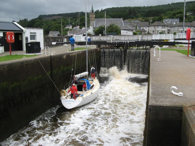
Ardrishaig
Ardrishaig (Scottish Gaelic: Àird Driseig) is a coastal village on Loch Gilp, at the southern (eastern) entrance to the Crinan Canal in Argyll and Bute...

Loch Gilp
Loch Gilp (Scottish Gaelic: Loch Gilb) is a small inlet on Loch Fyne which gives its name to Lochgilphead. The Crinan Canal extends from the loch across...
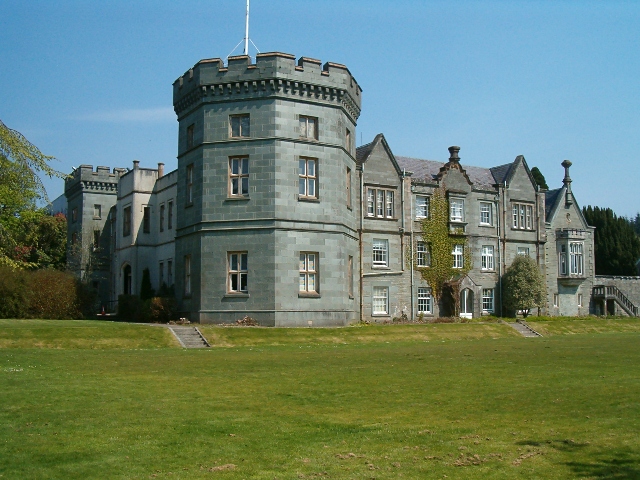
Kilmory Castle
Kilmory Castle, also known as Kilmory House, is a large 19th century house located just to the south of Lochgilphead, in old county Argyll, on the west...

Glengilp distillery
Glengilp distillery (also known as Glenfyne distillery and Glendarroch distillery) was a whisky distillery located, from 1831 to 1937, on the banks of...
Nearby Amenities
Located within 500m of 56.010992,-5.4282207Have you been to Rubha Buidhe?
Leave your review of Rubha Buidhe below (or comments, questions and feedback).