Fern Cavern

Coastal Feature, Headland, Point in Cornwall

England

Fern Cavern

Rocks at Trevelgue Head View north from the footbridge joining the promontory to the mainland.
Rocks at Trevelgue Head Credit: David Weston

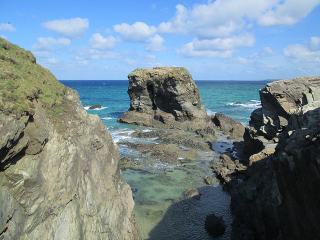
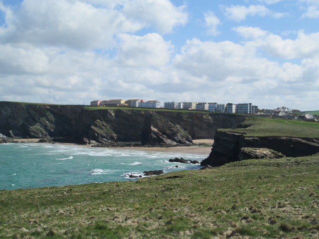
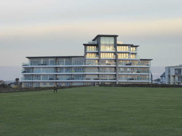
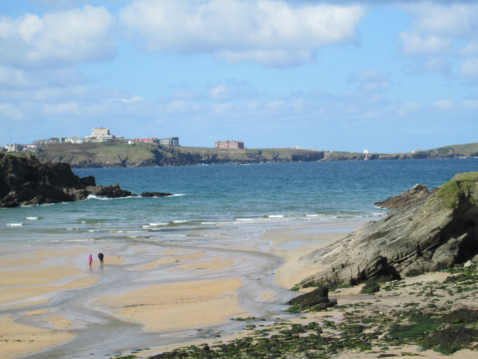
Fern Cavern is a prominent coastal feature located in Cornwall, England. This captivating headland, also known as Fern Point, juts out into the Atlantic Ocean, offering stunning panoramic views of the surrounding coastline. Situated approximately 10 miles southwest of Penzance, it is a popular destination for locals and tourists alike.

The name "Fern Cavern" is derived from the lush vegetation that adorns the cliffs and crevices of the headland. It is home to a diverse range of fern species, which thrive in the mild and humid climate of Cornwall. This abundance of flora adds to the area's natural beauty, providing a verdant backdrop for visitors to enjoy.

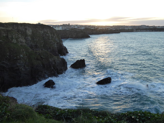
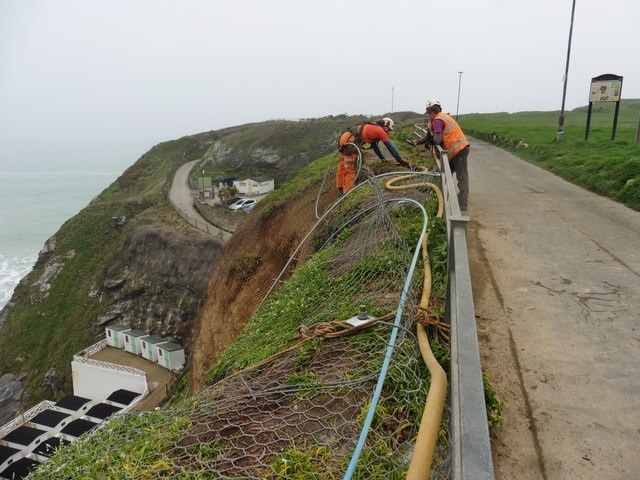
As visitors venture along the rugged coastal path towards Fern Cavern, they are greeted with breathtaking vistas of the sparkling turquoise sea. The headland itself boasts dramatic cliffs, which have been shaped by centuries of relentless waves crashing against the shore. These towering cliffs provide a habitat for a variety of seabirds, including gulls and cormorants, which can be observed nesting and fishing in the surrounding waters.

Fern Cavern is also renowned for its impressive sea caves, which have been carved out by the relentless force of the ocean. These caves serve as a refuge for seals and other marine life, making it a popular spot for wildlife enthusiasts. Exploring these caves is an exhilarating experience, but caution is advised due to the unpredictable nature of the tides and waves.

Overall, Fern Cavern is a captivating coastal feature that offers visitors a chance to immerse themselves in the natural beauty of the Cornwall coastline. Whether it's the stunning views, the abundant ferns, or the intriguing sea caves, this headland is a must-visit destination for nature lovers and adventure seekers alike.

If you have any feedback on the listing, please let us know in the comments section below.

Fern Cavern Images

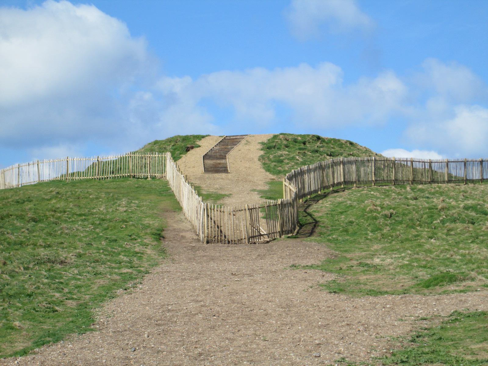
Images are sourced within 2km of 50.430254/-5.0537103 or Grid Reference SW8363. Thanks to Geograph Open Source API. All images are credited.

Rocks at Trevelgue Head View north from the footbridge joining the promontory to the mainland.
Rocks at Trevelgue Head
View north from the footbridge joining the promontory to the mainland.
View east from Trevelgue Head Seen from Trevelgue Head, the coastline to the north-east.
View east from Trevelgue Head
Seen from Trevelgue Head, the coastline to the north-east.
Northward at Watergate Bay, 1995 Northward on the B3276 road to Stem Point and Griffins Point, past the celebrated Watergate Bay Hotel. {Cf. <a href="https://www.geograph.org.uk/photo/523402">SW8464 : Watergate Bay Hotel</a>}.
Northward at Watergate Bay, 1995
Northward on the B3276 road to Stem Point and Griffins Point, past the celebrated Watergate Bay Hotel. {Cf. SW8464 : Watergate Bay Hotel}.
Block of flats overlooking Barrowfields One of many such modern blocks which have been built in the town in recent years.
Block of flats overlooking Barrowfields
One of many such modern blocks which have been built in the town in recent years.
Looking down onto Tolcarne Beach
Tumulus on the Barrowfields One of several tumuli which give rise to the name of this open space.
Tumulus on the Barrowfields
One of several tumuli which give rise to the name of this open space.
Modern flats seen from the Barrowfields Another view of <a href="https://www.geograph.org.uk/photo/5192575">SW8262 : Block of flats overlooking Barrowfields</a>.
Modern flats seen from the Barrowfields
Evening light at Tolcarne Looking along the cliffs towards the town.
Evening light at Tolcarne
Looking along the cliffs towards the town.
Beach at Porth
Beach at Porth
Old Milestone by the A392, Quintrell Road, Newquay Carved stone post by the A392, in parish of NEWQUAY (RESTORMEL District), Gusti Veor, opposite St Columb Minor old school, near Newquay town sign, on South side of road. Erected by the Local Highways Board in the 19th century. 

Inscription reads:-
NEWQUAY
2 
Carved benchmark and rivet on top.

Grade II Listed. List Entry Number: 1144137
<span class="nowrap"><a title="https://historicengland.org.uk/listing/the-list/list-entry/1144137" rel="nofollow ugc noopener" href="https://historicengland.org.uk/listing/the-list/list-entry/1144137">Link</a><img style="margin-left:2px;" alt="External link" title="External link - shift click to open in new window" src="https://s1.geograph.org.uk/img/external.png" width="10" height="10"/></span>

Milestone Society National ID: CW_NQIQ02.
Old Milestone by the A392, Quintrell Road, Newquay
Carved stone post by the A392, in parish of NEWQUAY (RESTORMEL District), Gusti Veor, opposite St Columb Minor old school, near Newquay town sign, on South side of road. Erected by the Local Highways Board in the 19th century. Inscription reads:- NEWQUAY 2 Carved benchmark and rivet on top. Grade II Listed. List Entry Number: 1144137 LinkExternal link Milestone Society National ID: CW_NQIQ02.
Old Milestone by the A3059, Church Street, St Columb Minor Carved stone post by the A3059, in parish of NEWQUAY (RESTORMEL District), Church Street, St Columb Minor; by bungalow, by the road, on North side of road.   Erected by the Local Highways Board in the 19th century. 

Inscription reads:-
: St COLUMB / 5¼ MILES : : NEWQUAY / 2 MILES : 
Carved benchmark and rivet on top.

Grade II Listed. List Entry Number: 1312187
<span class="nowrap"><a title="https://historicengland.org.uk/listing/the-list/list-entry/1312187" rel="nofollow ugc noopener" href="https://historicengland.org.uk/listing/the-list/list-entry/1312187">Link</a><img style="margin-left:2px;" alt="External link" title="External link - shift click to open in new window" src="https://s1.geograph.org.uk/img/external.png" width="10" height="10"/></span>

Milestone Society National ID: CW_NQSC02.
Old Milestone by the A3059, Church Street, St Columb Minor
Carved stone post by the A3059, in parish of NEWQUAY (RESTORMEL District), Church Street, St Columb Minor; by bungalow, by the road, on North side of road. Erected by the Local Highways Board in the 19th century. Inscription reads:- : St COLUMB / 5¼ MILES : : NEWQUAY / 2 MILES : Carved benchmark and rivet on top. Grade II Listed. List Entry Number: 1312187 LinkExternal link Milestone Society National ID: CW_NQSC02.
Old Milestone by the A3058 in Henver Road, Newquay Carved stone post by the A3058, in parish of NEWQUAY (RESTORMEL District), Henver Road, by No.34, half buried in pavement, on South side of road. Erected by the Local Highways Board in the 19th century. 

Inscription reads:-
NEWQUAY
1 
Carved benchmark on top of front face.

Grade II Listed. List Entry Number: 1395368
<span class="nowrap"><a title="https://historicengland.org.uk/listing/the-list/list-entry/1395368" rel="nofollow ugc noopener" href="https://historicengland.org.uk/listing/the-list/list-entry/1395368">Link</a><img style="margin-left:2px;" alt="External link" title="External link - shift click to open in new window" src="https://s1.geograph.org.uk/img/external.png" width="10" height="10"/></span>

Milestone Society National ID: CW_NQSE01.
Old Milestone by the A3058 in Henver Road, Newquay
Carved stone post by the A3058, in parish of NEWQUAY (RESTORMEL District), Henver Road, by No.34, half buried in pavement, on South side of road. Erected by the Local Highways Board in the 19th century. Inscription reads:- NEWQUAY 1 Carved benchmark on top of front face. Grade II Listed. List Entry Number: 1395368 LinkExternal link Milestone Society National ID: CW_NQSE01.
Old Milestone by the B3276, Watergate Road Carved stone post by the B3276, in parish of NEWQUAY (RESTORMEL District), in lay-by, to left of footpath sign, on North side of road, remains of white paint (2001). Gravestone, erected by the parish in the 19th century. 

Inscription invisible.

Milestone Society National ID: CW_PSNQ.
Old Milestone by the B3276, Watergate Road
Carved stone post by the B3276, in parish of NEWQUAY (RESTORMEL District), in lay-by, to left of footpath sign, on North side of road, remains of white paint (2001). Gravestone, erected by the parish in the 19th century. Inscription invisible. Milestone Society National ID: CW_PSNQ.
Hotel Bristol, Newquay
Cliff stabilization work above Tolcarne Beach
Hotel refurbishment on Narrowcliff
New development of retirement apartments on Narrowcliff
Telephone exchange, Hilgrove Road
Show me another place!

Fern Cavern is located at Grid Ref: SW8363 (Lat: 50.430254, Lng: -5.0537103)

Unitary Authority: Cornwall

Police Authority: Devon and Cornwall

What 3 Words

///fidget.hedgehog.yourself. Near Newquay, Cornwall

Related Wikis

Trevelgue Head

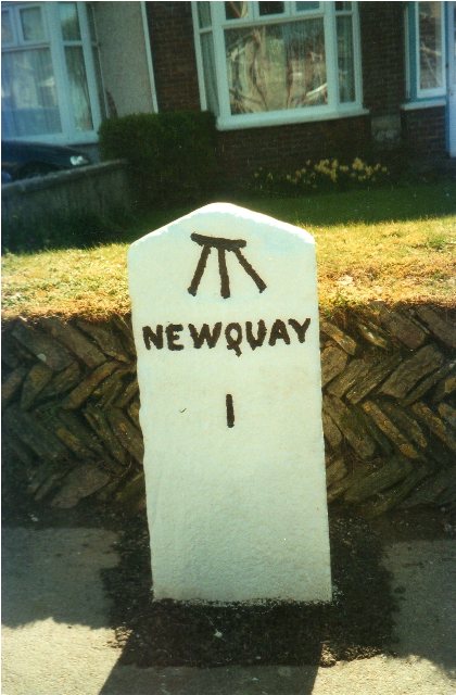
Trevelgue Head, also known as Porth Island, is a headland north-east of Newquay, Cornwall, England, next to Porth at the eastern end of Newquay Bay. It...

Porth, Cornwall

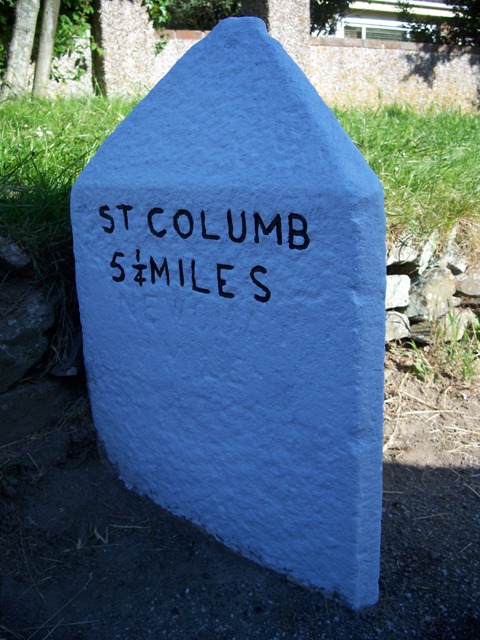
Porth is a seaside hamlet in the civil parish of Newquay, Cornwall, England.Porth is near the village of St Columb Minor. It was known as St. Columb Porth...

Rialton Grange

Rialton Grange was a monastic grange in St Columb Minor in Cornwall, UK, belonging to the priors of Bodmin. == References ==

Lusty Glaze

Lusty Glaze (Cornish: Lostyn Glas, meaning "a place to view blue boats") also known as Lusty Glaze Beach, is a beach in Newquay, Cornwall. Lusty Glaze...

Nearby Amenities

Located within 500m of 50.430254,-5.0537103
Source: PGS
Lat/Long: 50.4337754/-5.0511627
Source: PGS
Lat/Long: 50.4337002/-5.0514846
Source: PGS
Lat/Long: 50.4340153/-5.0525152
Source: PGS
Lat/Long: 50.4325248/-5.0524824
Source: PGS
Lat/Long: 50.4324086/-5.0527077
Source: PGS
Lat/Long: 50.4321762/-5.0531154
Source: PGS
Lat/Long: 50.430728/-5.0533707
Source: PGS
Lat/Long: 50.4305776/-5.05336
Source: PGS
Lat/Long: 50.4305161/-5.0532205
Source: PGS
Lat/Long: 50.4295046/-5.0555165
Source: PGS
Lat/Long: 50.428763/-5.055239
Source: PGS
Lat/Long: 50.428054/-5.0551222
Source: PGS
Lat/Long: 50.4277549/-5.0555057
Source: PGS
Lat/Long: 50.4276456/-5.0563748
Source: PGS
Lat/Long: 50.4275294/-5.0585956
Source: PGS
Lat/Long: 50.4260324/-5.0551676
Trevelgue
Is In: Cornwall, England, UK
Name Kw: Trevelgi
Place: hamlet
Lat/Long: 50.4299747/-5.0475428
Bus Stop
Porth Coastline Court
Bench: no
Bin: no
Bus: yes
Naptan AtcoCode: 0800FWW38468
Naptan Bearing: SW
Naptan CommonName: Porth Coastline Court
Naptan NaptanCode: corawtja
Naptan PlusbusZoneRef: NEWQUAY
Naptan Street: Watergate Road
Naptan Verified: no
Public Transport: platform
Shelter: no
Source: naptan_import
Tactile Paving: no
Lat/Long: 50.4290354/-5.0540601
Bus Stop
Gull Rock Hotel
Bench: no
Bus: yes
Naptan AtcoCode: 0800FWX38535
Naptan Bearing: N
Naptan CommonName: Gull Rock Hotel
Naptan Crossing: Trevelgue Road
Naptan Indicator: Opp
Naptan NaptanCode: corawtdm
Naptan PlusbusZoneRef: NEWQUAY
Naptan Street: Watergate Road
Naptan Verified: no
Public Transport: platform
Shelter: no
Source: naptan_import
Lat/Long: 50.4282161/-5.0547734
Bus Stop
Gull Rock Hotel
Bus: yes
Naptan AtcoCode: 0800FWX38579
Naptan Bearing: S
Naptan CommonName: Gull Rock Hotel
Naptan Crossing: Trevelgue Road
Naptan NaptanCode: corawtdp
Naptan PlusbusZoneRef: NEWQUAY
Naptan Street: Watergate Road
Naptan Verified: no
Public Transport: platform
Source: naptan_import
Lat/Long: 50.4282044/-5.0545303
Bus Stop
Gull Rock Hotel
Bus: yes
Naptan AtcoCode: 0800FWZ38598
Naptan Bearing: W
Naptan CommonName: Gull Rock Hotel
Naptan Crossing: Watergate Road
Naptan Indicator: Opp
Naptan NaptanCode: corawtgd
Naptan PlusbusZoneRef: NEWQUAY
Naptan Street: Trevelgue Road
Naptan Verified: no
Public Transport: platform
Source: naptan_import
Lat/Long: 50.4277914/-5.0541692
Fast Food
Lat/Long: 50.42646/-5.0560059
Tourism: caravan_site
Lat/Long: 50.4264/-5.0522241
Spindrift apartments x6
Addr Housenumber: flat 6
Addr Postcode: TR7 3LX
Addr Street: Watergate Road
Email: spindrift.porth@gmail.com
Internet Access: wlan
Operator: Roger & Caroline Jamison
Tourism: guest_house
Lat/Long: 50.4287491/-5.0540843
Burial mound tumuli
Historic: memorial
Lat/Long: 50.4318934/-5.0527405
Burial mound tumuli
Historic: memorial
Lat/Long: 50.4317075/-5.0528881
Barrier: kissing_gate
Lat/Long: 50.4308263/-5.0530245
Bus Stop
Car Park
Bus: yes
Naptan AtcoCode: 0800COC31570
Naptan Bearing: SE
Naptan BusStopType: CUS
Naptan CommonName: Car Park
Naptan Indicator: SE-bound
Naptan NaptanCode: corawtga
Naptan Street: Alexandra Road
Naptan Verified: no
Public Transport: platform
Source: naptan;bing
Lat/Long: 50.4260125/-5.0541012
Power: pole
Lat/Long: 50.4298101/-5.04849
Power: pole
Lat/Long: 50.4297221/-5.0481641
Bench
Lat/Long: 50.4281145/-5.0548329
Bus Stop
Car Park
Bus: yes
Naptan AtcoCode: 0800COC31569
Naptan Bearing: NW
Naptan BusStopType: CUS
Naptan CommonName: Car Park
Naptan Indicator: opp
Naptan NaptanCode: corawtdw
Naptan Street: Alexandra Road
Naptan Verified: no
Public Transport: platform
Source: naptan;bing
Lat/Long: 50.4258647/-5.0540992
Generator Method: photovoltaic
Generator Output Electricity: yes
Generator Source: solar
Generator Type: solar_photovoltaic_panel
Location: roof
Power: generator
Lat/Long: 50.428104/-5.0494811
Generator Method: photovoltaic
Generator Output Electricity: yes
Generator Source: solar
Generator Type: solar_photovoltaic_panel
Location: roof
Power: generator
Lat/Long: 50.428204/-5.0494878
Generator Method: photovoltaic
Generator Output Electricity: yes
Generator Source: solar
Generator Type: solar_photovoltaic_panel
Location: roof
Power: generator
Lat/Long: 50.4283193/-5.0494717
Generator Method: photovoltaic
Generator Output Electricity: yes
Generator Source: solar
Generator Type: solar_photovoltaic_panel
Location: roof
Power: generator
Lat/Long: 50.4283783/-5.0494476
Generator Method: photovoltaic
Generator Output Electricity: yes
Generator Source: solar
Generator Type: solar_photovoltaic_panel
Location: roof
Power: generator
Lat/Long: 50.4293078/-5.0523323
Generator Method: photovoltaic
Generator Output Electricity: yes
Generator Source: solar
Generator Type: solar_photovoltaic_panel
Location: roof
Power: generator
Lat/Long: 50.4277119/-5.0541186
Generator Method: photovoltaic
Generator Output Electricity: yes
Generator Source: solar
Generator Type: solar_photovoltaic_panel
Location: roof
Power: generator
Lat/Long: 50.4273565/-5.0548214
Generator Method: photovoltaic
Generator Output Electricity: yes
Generator Source: solar
Generator Type: solar_photovoltaic_panel
Location: roof
Power: generator
Lat/Long: 50.4270181/-5.0544995
Generator Method: photovoltaic
Generator Output Electricity: yes
Generator Source: solar
Generator Type: solar_photovoltaic_panel
Location: roof
Power: generator
Lat/Long: 50.4270147/-5.0540033
Life Ring
Emergency: life_ring
Survey Date: 2024-02-18
Lat/Long: 50.4260627/-5.0550773
Waste Basket
Survey Date: 2024-02-18
Lat/Long: 50.4264255/-5.0559985
Bench
Survey Date: 2024-02-18
Lat/Long: 50.4264095/-5.0563828
Bench
Survey Date: 2024-02-18
Lat/Long: 50.4262313/-5.0567626
Waste Basket
Survey Date: 2024-02-18
Lat/Long: 50.4280913/-5.0548673
Bench
Survey Date: 2024-02-18
Lat/Long: 50.4281028/-5.0548456
Bench
Survey Date: 2024-02-18
Lat/Long: 50.4281652/-5.0547949
Bench
Survey Date: 2024-02-18
Lat/Long: 50.4281801/-5.0547895
Fire Hydrant
Emergency: fire_hydrant
Fire Hydrant Position: green
Fire Hydrant Type: underground
Survey Date: 2024-02-18
Lat/Long: 50.4302685/-5.0529295
Post Box
Collection Times: Mo-Fr 09:00, Sa 07:00
Operator: Royal Mail
Operator Wikidata: Q638098
Post Box Mounting: pier
Post Box Type: lamp
Ref: TR7 98D
Royal Cypher: EIIR
Survey Date: 2024-02-18
Lat/Long: 50.4293547/-5.053733
Waste Basket
Survey Date: 2024-02-18
Lat/Long: 50.4262068/-5.0546488
Post Box
Collection Times: Mo-Fr 09:00, Sa 07:00
Operator: Royal Mail
Operator Wikidata: Q638098
Post Box Type: pillar
Ref: TR7 85D
Royal Cypher: EIIR
Survey Date: 2024-02-18
Lat/Long: 50.4262045/-5.0546669
Bicycle Rental
Survey Date: 2024-02-18
Lat/Long: 50.4260022/-5.054467
Waste Basket
Survey Date: 2024-02-18
Lat/Long: 50.4259071/-5.0541989
The data included in this document is from www.openstreetmap.org. The data is made available under ODbL.

Have you been to Fern Cavern?

Leave your review of Fern Cavern below (or comments, questions and feedback).