Black Humphrey Rock

Island in Cornwall

England

Black Humphrey Rock

Rocks at Trevelgue Head View north from the footbridge joining the promontory to the mainland.
Rocks at Trevelgue Head Credit: David Weston

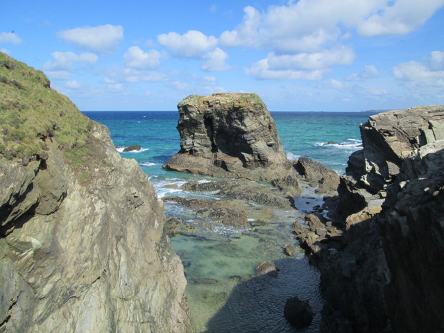
Black Humphrey Rock is a small, uninhabited island located off the coast of Cornwall, England. Situated approximately 2 miles southwest of Lands End, it is part of the Isles of Scilly archipelago. The island gets its name from a distinctive black rock formation that dominates its surface.

Measuring just 150 meters in length and 80 meters in width, Black Humphrey Rock is relatively small in size. It is composed mainly of granite, with the black rock formation forming a striking contrast against the surrounding turquoise waters of the Atlantic Ocean.

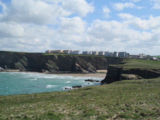
Access to the island is challenging due to its remote location and lack of facilities. Visitors can only reach it by boat, and caution is advised as the waters around the island can be treacherous. The island is not suitable for habitation and lacks any infrastructure or amenities.

Black Humphrey Rock is known for its rich biodiversity. It is home to a variety of seabirds, including fulmars, gulls, and cormorants. The surrounding waters are also teeming with marine life, making it a popular spot for diving enthusiasts.

The island's isolation and rugged beauty make it an attractive destination for nature lovers and adventurers. However, visitors must adhere to strict conservation guidelines to preserve the delicate ecosystem. As a protected area, access to certain parts of Black Humphrey Rock may be restricted during breeding seasons to protect nesting seabirds.

If you have any feedback on the listing, please let us know in the comments section below.

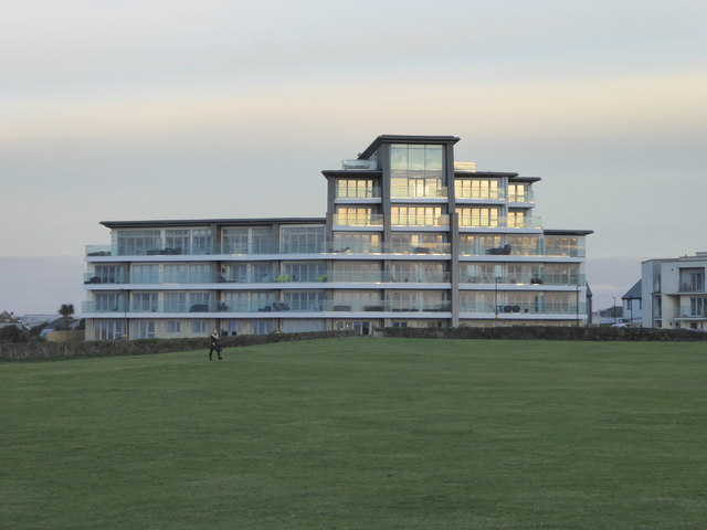
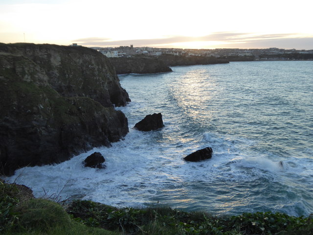
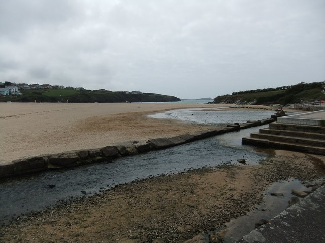
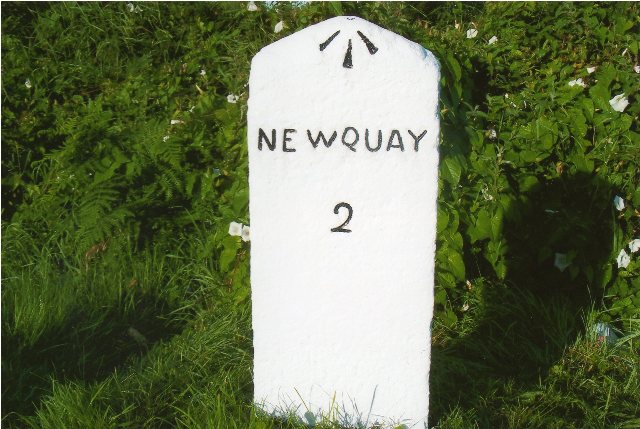
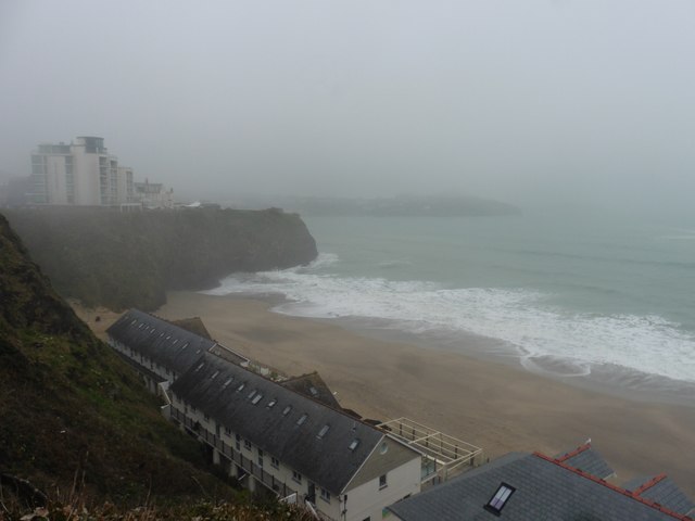
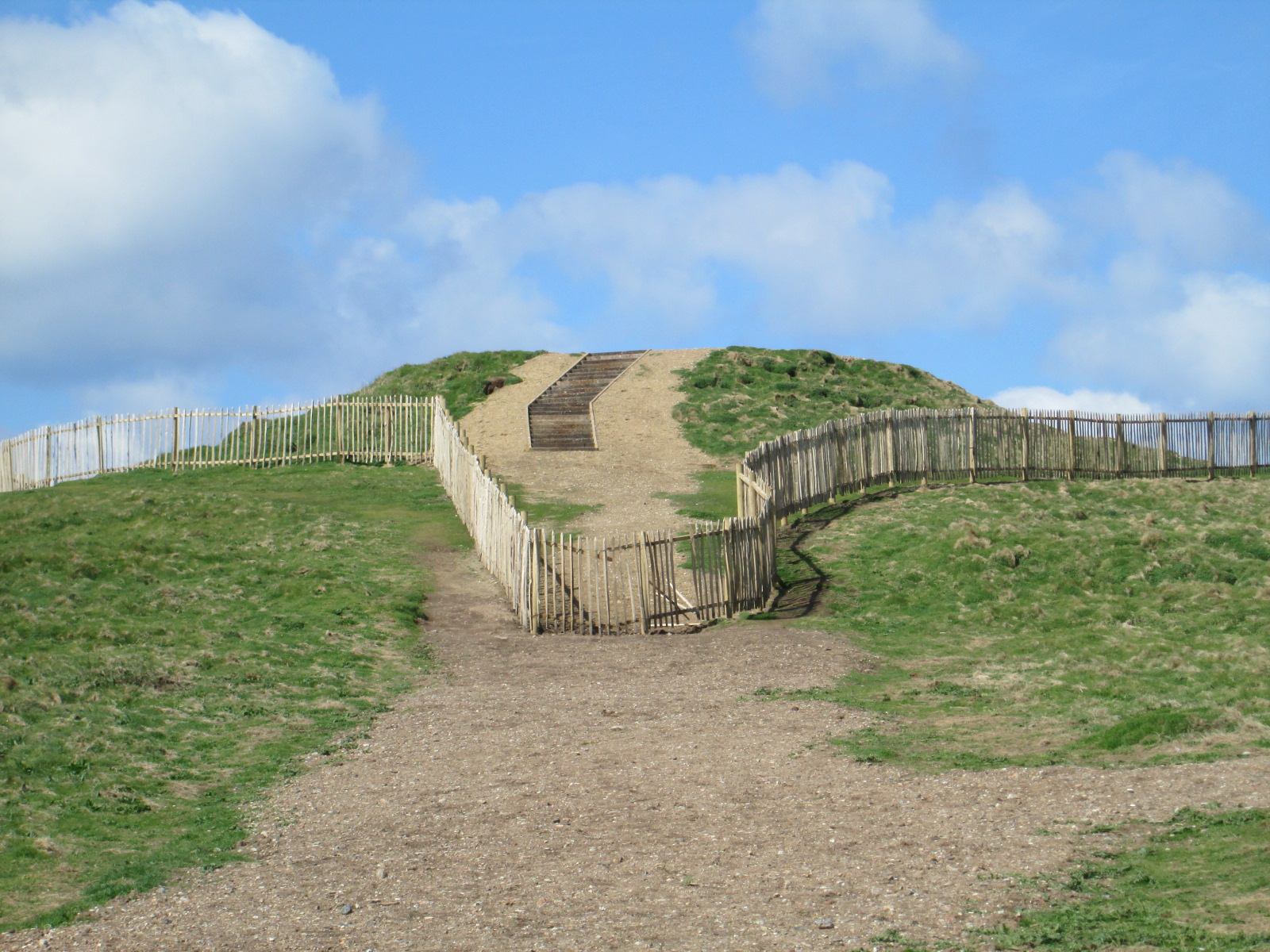
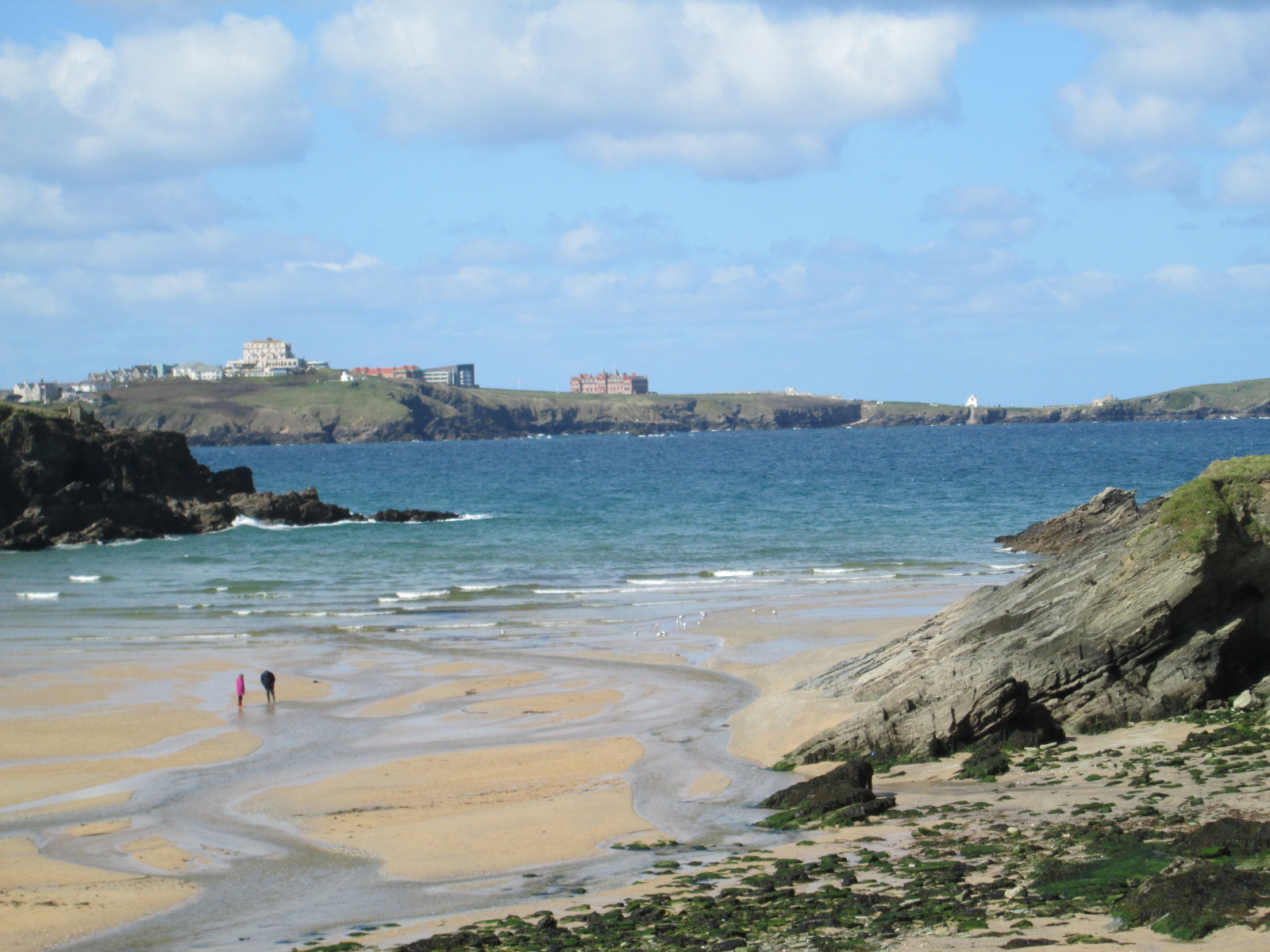
Black Humphrey Rock Images

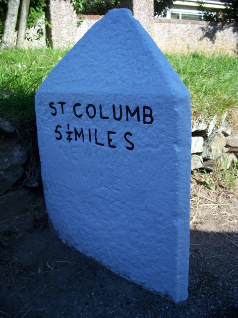
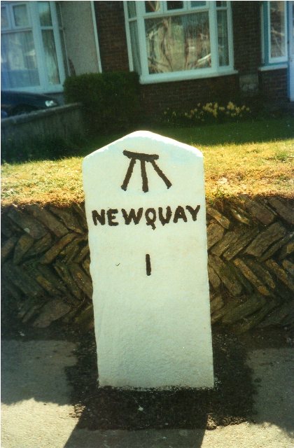
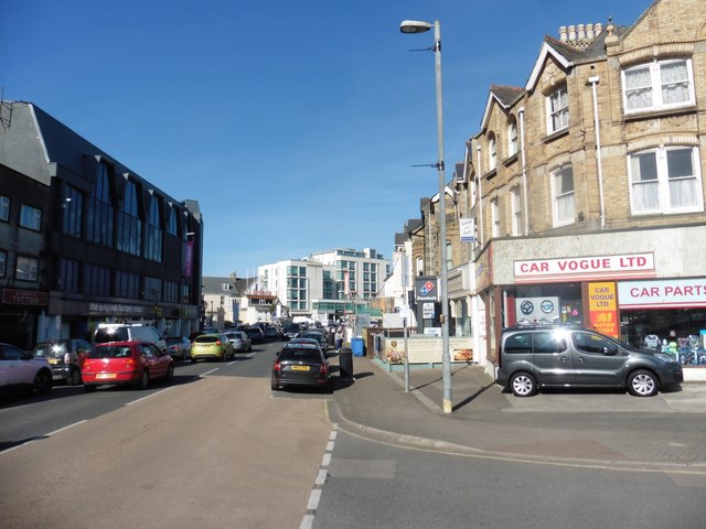
Images are sourced within 2km of 50.428569/-5.056193 or Grid Reference SW8363. Thanks to Geograph Open Source API. All images are credited.

Rocks at Trevelgue Head View north from the footbridge joining the promontory to the mainland.
Rocks at Trevelgue Head
View north from the footbridge joining the promontory to the mainland.
View east from Trevelgue Head Seen from Trevelgue Head, the coastline to the north-east.
View east from Trevelgue Head
Seen from Trevelgue Head, the coastline to the north-east.
Sea mist developing on Tolcarne Beach, Newquay, Cornwall
Northward at Watergate Bay, 1995 Northward on the B3276 road to Stem Point and Griffins Point, past the celebrated Watergate Bay Hotel. {Cf. <a href="https://www.geograph.org.uk/photo/523402">SW8464 : Watergate Bay Hotel</a>}.
Northward at Watergate Bay, 1995
Northward on the B3276 road to Stem Point and Griffins Point, past the celebrated Watergate Bay Hotel. {Cf. SW8464 : Watergate Bay Hotel}.
Block of flats overlooking Barrowfields One of many such modern blocks which have been built in the town in recent years.
Block of flats overlooking Barrowfields
One of many such modern blocks which have been built in the town in recent years.
Looking down onto Tolcarne Beach
Tumulus on the Barrowfields One of several tumuli which give rise to the name of this open space.
Tumulus on the Barrowfields
One of several tumuli which give rise to the name of this open space.
Modern flats seen from the Barrowfields Another view of <a href="https://www.geograph.org.uk/photo/5192575">SW8262 : Block of flats overlooking Barrowfields</a>.
Modern flats seen from the Barrowfields
Evening light at Tolcarne Looking along the cliffs towards the town.
Evening light at Tolcarne
Looking along the cliffs towards the town.
Beach at Porth
Beach at Porth
Old Milestone by the A392, Quintrell Road, Newquay Carved stone post by the A392, in parish of NEWQUAY (RESTORMEL District), Gusti Veor, opposite St Columb Minor old school, near Newquay town sign, on South side of road. Erected by the Local Highways Board in the 19th century. 

Inscription reads:-
NEWQUAY
2 
Carved benchmark and rivet on top.

Grade II Listed. List Entry Number: 1144137
<span class="nowrap"><a title="https://historicengland.org.uk/listing/the-list/list-entry/1144137" rel="nofollow ugc noopener" href="https://historicengland.org.uk/listing/the-list/list-entry/1144137">Link</a><img style="margin-left:2px;" alt="External link" title="External link - shift click to open in new window" src="https://s1.geograph.org.uk/img/external.png" width="10" height="10"/></span>

Milestone Society National ID: CW_NQIQ02.
Old Milestone by the A392, Quintrell Road, Newquay
Carved stone post by the A392, in parish of NEWQUAY (RESTORMEL District), Gusti Veor, opposite St Columb Minor old school, near Newquay town sign, on South side of road. Erected by the Local Highways Board in the 19th century. Inscription reads:- NEWQUAY 2 Carved benchmark and rivet on top. Grade II Listed. List Entry Number: 1144137 LinkExternal link Milestone Society National ID: CW_NQIQ02.
Old Milestone by the A3059, Church Street, St Columb Minor Carved stone post by the A3059, in parish of NEWQUAY (RESTORMEL District), Church Street, St Columb Minor; by bungalow, by the road, on North side of road.   Erected by the Local Highways Board in the 19th century. 

Inscription reads:-
: St COLUMB / 5¼ MILES : : NEWQUAY / 2 MILES : 
Carved benchmark and rivet on top.

Grade II Listed. List Entry Number: 1312187
<span class="nowrap"><a title="https://historicengland.org.uk/listing/the-list/list-entry/1312187" rel="nofollow ugc noopener" href="https://historicengland.org.uk/listing/the-list/list-entry/1312187">Link</a><img style="margin-left:2px;" alt="External link" title="External link - shift click to open in new window" src="https://s1.geograph.org.uk/img/external.png" width="10" height="10"/></span>

Milestone Society National ID: CW_NQSC02.
Old Milestone by the A3059, Church Street, St Columb Minor
Carved stone post by the A3059, in parish of NEWQUAY (RESTORMEL District), Church Street, St Columb Minor; by bungalow, by the road, on North side of road. Erected by the Local Highways Board in the 19th century. Inscription reads:- : St COLUMB / 5¼ MILES : : NEWQUAY / 2 MILES : Carved benchmark and rivet on top. Grade II Listed. List Entry Number: 1312187 LinkExternal link Milestone Society National ID: CW_NQSC02.
Old Milestone by the A3058 in Henver Road, Newquay Carved stone post by the A3058, in parish of NEWQUAY (RESTORMEL District), Henver Road, by No.34, half buried in pavement, on South side of road. Erected by the Local Highways Board in the 19th century. 

Inscription reads:-
NEWQUAY
1 
Carved benchmark on top of front face.

Grade II Listed. List Entry Number: 1395368
<span class="nowrap"><a title="https://historicengland.org.uk/listing/the-list/list-entry/1395368" rel="nofollow ugc noopener" href="https://historicengland.org.uk/listing/the-list/list-entry/1395368">Link</a><img style="margin-left:2px;" alt="External link" title="External link - shift click to open in new window" src="https://s1.geograph.org.uk/img/external.png" width="10" height="10"/></span>

Milestone Society National ID: CW_NQSE01.
Old Milestone by the A3058 in Henver Road, Newquay
Carved stone post by the A3058, in parish of NEWQUAY (RESTORMEL District), Henver Road, by No.34, half buried in pavement, on South side of road. Erected by the Local Highways Board in the 19th century. Inscription reads:- NEWQUAY 1 Carved benchmark on top of front face. Grade II Listed. List Entry Number: 1395368 LinkExternal link Milestone Society National ID: CW_NQSE01.
Old Milestone by the B3276, Watergate Road Carved stone post by the B3276, in parish of NEWQUAY (RESTORMEL District), in lay-by, to left of footpath sign, on North side of road, remains of white paint (2001). Gravestone, erected by the parish in the 19th century. 

Inscription invisible.

Milestone Society National ID: CW_PSNQ.
Old Milestone by the B3276, Watergate Road
Carved stone post by the B3276, in parish of NEWQUAY (RESTORMEL District), in lay-by, to left of footpath sign, on North side of road, remains of white paint (2001). Gravestone, erected by the parish in the 19th century. Inscription invisible. Milestone Society National ID: CW_PSNQ.
Cliff road, Newquay
Cliff road, Newquay
Tolcarne Point
Tolcarne Point
A misty morning on Tolcarne Beach
Hotel Bristol, Newquay
Show me another place!

Black Humphrey Rock is located at Grid Ref: SW8363 (Lat: 50.428569, Lng: -5.056193)

Unitary Authority: Cornwall

Police Authority: Devon and Cornwall

Also known as: Flory Island

What 3 Words

///unstated.land.ultra. Near Newquay, Cornwall

Related Wikis

Trevelgue Head

Trevelgue Head, also known as Porth Island, is a headland north-east of Newquay, Cornwall, England, next to Porth at the eastern end of Newquay Bay. It...

Porth, Cornwall

Porth is a seaside hamlet in the civil parish of Newquay, Cornwall, England.Porth is near the village of St Columb Minor. It was known as St. Columb Porth...

Rialton Grange

Rialton Grange was a monastic grange in St Columb Minor in Cornwall, UK, belonging to the priors of Bodmin. == References ==

Lusty Glaze

Lusty Glaze (Cornish: Lostyn Glas, meaning "a place to view blue boats") also known as Lusty Glaze Beach, is a beach in Newquay, Cornwall. Lusty Glaze...

Nearby Amenities

Located within 500m of 50.428569,-5.056193
Source: PGS
Lat/Long: 50.4324086/-5.0527077
Source: PGS
Lat/Long: 50.4321762/-5.0531154
Source: PGS
Lat/Long: 50.430728/-5.0533707
Source: PGS
Lat/Long: 50.4305776/-5.05336
Source: PGS
Lat/Long: 50.4305161/-5.0532205
Source: PGS
Lat/Long: 50.4295046/-5.0555165
Source: PGS
Lat/Long: 50.428763/-5.055239
Source: PGS
Lat/Long: 50.428054/-5.0551222
Source: PGS
Lat/Long: 50.4277549/-5.0555057
Source: PGS
Lat/Long: 50.4276456/-5.0563748
Source: PGS
Lat/Long: 50.4275294/-5.0585956
Source: PGS
Lat/Long: 50.4274383/-5.0600629
Source: PGS
Lat/Long: 50.4271944/-5.0600492
Source: PGS
Lat/Long: 50.4261987/-5.0601052
Source: PGS
Lat/Long: 50.4261008/-5.0595557
Source: PGS
Lat/Long: 50.4259436/-5.0589978
Source: PGS
Lat/Long: 50.4258393/-5.0588397
Source: PGS
Lat/Long: 50.4258216/-5.0584296
Source: PGS
Lat/Long: 50.4257636/-5.057917
Source: PGS
Lat/Long: 50.4260324/-5.0551676
Source: PGS
Lat/Long: 50.4243227/-5.0560229
Bus Stop
Porth Coastline Court
Bench: no
Bin: no
Bus: yes
Naptan AtcoCode: 0800FWW38468
Naptan Bearing: SW
Naptan CommonName: Porth Coastline Court
Naptan NaptanCode: corawtja
Naptan PlusbusZoneRef: NEWQUAY
Naptan Street: Watergate Road
Naptan Verified: no
Public Transport: platform
Shelter: no
Source: naptan_import
Tactile Paving: no
Lat/Long: 50.4290354/-5.0540601
Bus Stop
Bus Shelter
Bus: yes
Naptan AtcoCode: 0800FWX38533
Naptan Bearing: E
Naptan CommonName: Bus Shelter
Naptan Crossing: Lewarn Road
Naptan NaptanCode: corawtgt
Naptan PlusbusZoneRef: NEWQUAY
Naptan Street: Alexandra Road
Naptan Verified: no
Public Transport: platform
Source: naptan_import
Lat/Long: 50.4247343/-5.0537321
Bus Stop
Gull Rock Hotel
Bench: no
Bus: yes
Naptan AtcoCode: 0800FWX38535
Naptan Bearing: N
Naptan CommonName: Gull Rock Hotel
Naptan Crossing: Trevelgue Road
Naptan Indicator: Opp
Naptan NaptanCode: corawtdm
Naptan PlusbusZoneRef: NEWQUAY
Naptan Street: Watergate Road
Naptan Verified: no
Public Transport: platform
Shelter: no
Source: naptan_import
Lat/Long: 50.4282161/-5.0547734
Bus Stop
Gull Rock Hotel
Bus: yes
Naptan AtcoCode: 0800FWX38579
Naptan Bearing: S
Naptan CommonName: Gull Rock Hotel
Naptan Crossing: Trevelgue Road
Naptan NaptanCode: corawtdp
Naptan PlusbusZoneRef: NEWQUAY
Naptan Street: Watergate Road
Naptan Verified: no
Public Transport: platform
Source: naptan_import
Lat/Long: 50.4282044/-5.0545303
Bus Stop
Lewarne Road
Bus: yes
Naptan AtcoCode: 0800FWX38580
Naptan Bearing: SE
Naptan CommonName: Bus Shelter
Naptan Crossing: Alexandra Road
Naptan NaptanCode: corawtgw
Naptan PlusbusZoneRef: NEWQUAY
Naptan Street: Lewarne Road
Naptan Verified: no
Public Transport: platform
Source: naptan_import
Lat/Long: 50.4246803/-5.0536581
Bus Stop
Gull Rock Hotel
Bus: yes
Naptan AtcoCode: 0800FWZ38598
Naptan Bearing: W
Naptan CommonName: Gull Rock Hotel
Naptan Crossing: Watergate Road
Naptan Indicator: Opp
Naptan NaptanCode: corawtgd
Naptan PlusbusZoneRef: NEWQUAY
Naptan Street: Trevelgue Road
Naptan Verified: no
Public Transport: platform
Source: naptan_import
Lat/Long: 50.4277914/-5.0541692
Fast Food
Lat/Long: 50.42646/-5.0560059
Tourism: caravan_site
Lat/Long: 50.4264/-5.0522241
Spindrift apartments x6
Addr Housenumber: flat 6
Addr Postcode: TR7 3LX
Addr Street: Watergate Road
Email: spindrift.porth@gmail.com
Internet Access: wlan
Operator: Roger & Caroline Jamison
Tourism: guest_house
Lat/Long: 50.4287491/-5.0540843
Burial mound tumuli
Historic: memorial
Lat/Long: 50.4318934/-5.0527405
Burial mound tumuli
Historic: memorial
Lat/Long: 50.4317075/-5.0528881
Barrier: kissing_gate
Lat/Long: 50.4308263/-5.0530245
Bus Stop
Car Park
Bus: yes
Naptan AtcoCode: 0800COC31570
Naptan Bearing: SE
Naptan BusStopType: CUS
Naptan CommonName: Car Park
Naptan Indicator: SE-bound
Naptan NaptanCode: corawtga
Naptan Street: Alexandra Road
Naptan Verified: no
Public Transport: platform
Source: naptan;bing
Lat/Long: 50.4260125/-5.0541012
Power: pole
Lat/Long: 50.4255085/-5.0520453
Bench
Lat/Long: 50.426064/-5.0571544
Bench
Backrest: yes
Lat/Long: 50.4259384/-5.0580985
Bench
Backrest: yes
Lat/Long: 50.4270833/-5.0593163
Bench
Backrest: yes
Lat/Long: 50.4271824/-5.059036
Bench
Lat/Long: 50.4281145/-5.0548329
Bus Stop
Car Park
Bus: yes
Naptan AtcoCode: 0800COC31569
Naptan Bearing: NW
Naptan BusStopType: CUS
Naptan CommonName: Car Park
Naptan Indicator: opp
Naptan NaptanCode: corawtdw
Naptan Street: Alexandra Road
Naptan Verified: no
Public Transport: platform
Source: naptan;bing
Lat/Long: 50.4258647/-5.0540992
Generator Method: photovoltaic
Generator Output Electricity: yes
Generator Source: solar
Generator Type: solar_photovoltaic_panel
Location: roof
Power: generator
Lat/Long: 50.428104/-5.0494811
Generator Method: photovoltaic
Generator Output Electricity: yes
Generator Source: solar
Generator Type: solar_photovoltaic_panel
Location: roof
Power: generator
Lat/Long: 50.428204/-5.0494878
Generator Method: photovoltaic
Generator Output Electricity: yes
Generator Source: solar
Generator Type: solar_photovoltaic_panel
Location: roof
Power: generator
Lat/Long: 50.4283193/-5.0494717
Generator Method: photovoltaic
Generator Output Electricity: yes
Generator Source: solar
Generator Type: solar_photovoltaic_panel
Location: roof
Power: generator
Lat/Long: 50.4283783/-5.0494476
Generator Method: photovoltaic
Generator Output Electricity: yes
Generator Source: solar
Generator Type: solar_photovoltaic_panel
Location: roof
Power: generator
Lat/Long: 50.4293078/-5.0523323
Generator Method: photovoltaic
Generator Output Electricity: yes
Generator Source: solar
Generator Type: solar_photovoltaic_panel
Location: roof
Power: generator
Lat/Long: 50.4277119/-5.0541186
Generator Method: photovoltaic
Generator Output Electricity: yes
Generator Source: solar
Generator Type: solar_photovoltaic_panel
Location: roof
Power: generator
Lat/Long: 50.4273565/-5.0548214
Generator Method: photovoltaic
Generator Output Electricity: yes
Generator Source: solar
Generator Type: solar_photovoltaic_panel
Location: roof
Power: generator
Lat/Long: 50.4270181/-5.0544995
Generator Method: photovoltaic
Generator Output Electricity: yes
Generator Source: solar
Generator Type: solar_photovoltaic_panel
Location: roof
Power: generator
Lat/Long: 50.4270147/-5.0540033
Life Ring
Emergency: life_ring
Survey Date: 2024-02-18
Lat/Long: 50.4260627/-5.0550773
Waste Basket
Survey Date: 2024-02-18
Lat/Long: 50.4264255/-5.0559985
Bench
Survey Date: 2024-02-18
Lat/Long: 50.4264095/-5.0563828
Bench
Survey Date: 2024-02-18
Lat/Long: 50.4262313/-5.0567626
Bench
Survey Date: 2024-02-18
Lat/Long: 50.4259071/-5.0576712
Bench
Survey Date: 2024-02-18
Lat/Long: 50.4260391/-5.0585432
Bench
Survey Date: 2024-02-18
Lat/Long: 50.4260874/-5.0586878
Bench
Survey Date: 2024-02-18
Lat/Long: 50.4261531/-5.0590071
Bench
Survey Date: 2024-02-18
Lat/Long: 50.4262096/-5.0594842
Bench
Survey Date: 2024-02-18
Lat/Long: 50.4262317/-5.0594626
Life Ring
Emergency: life_ring
Survey Date: 2024-02-18
Lat/Long: 50.4265126/-5.0605644
Bench
Backrest: no
Survey Date: 2024-02-18
Lat/Long: 50.4265244/-5.0609647
Waste Basket
Survey Date: 2024-02-18
Lat/Long: 50.4280913/-5.0548673
Bench
Survey Date: 2024-02-18
Lat/Long: 50.4281028/-5.0548456
Bench
Survey Date: 2024-02-18
Lat/Long: 50.4281652/-5.0547949
Bench
Survey Date: 2024-02-18
Lat/Long: 50.4281801/-5.0547895
Fire Hydrant
Emergency: fire_hydrant
Fire Hydrant Position: green
Fire Hydrant Type: underground
Survey Date: 2024-02-18
Lat/Long: 50.4302685/-5.0529295
Post Box
Collection Times: Mo-Fr 09:00, Sa 07:00
Operator: Royal Mail
Operator Wikidata: Q638098
Post Box Mounting: pier
Post Box Type: lamp
Ref: TR7 98D
Royal Cypher: EIIR
Survey Date: 2024-02-18
Lat/Long: 50.4293547/-5.053733
Waste Basket
Survey Date: 2024-02-18
Lat/Long: 50.4262068/-5.0546488
Post Box
Collection Times: Mo-Fr 09:00, Sa 07:00
Operator: Royal Mail
Operator Wikidata: Q638098
Post Box Type: pillar
Ref: TR7 85D
Royal Cypher: EIIR
Survey Date: 2024-02-18
Lat/Long: 50.4262045/-5.0546669
Bicycle Rental
Survey Date: 2024-02-18
Lat/Long: 50.4260022/-5.054467
Waste Basket
Survey Date: 2024-02-18
Lat/Long: 50.4259071/-5.0541989
Waste Basket
Survey Date: 2024-02-18
Lat/Long: 50.4255149/-5.0536259
Defibrillator
Defibrillator Location: On outside wall of The Mermaid, facing staff car park
Emergency: defibrillator
Indoor: no
Survey Date: 2024-02-18
Lat/Long: 50.4252822/-5.0537652
The data included in this document is from www.openstreetmap.org. The data is made available under ODbL.

Have you been to Black Humphrey Rock?

Leave your review of Black Humphrey Rock below (or comments, questions and feedback).