Carreg Twnpib

Coastal Feature, Headland, Point in Pembrokeshire

Wales

Carreg Twnpib

Solva harbour Low tide at Solva harbour, lime kilns on the far shore.
Solva harbour Credit: E Gammie

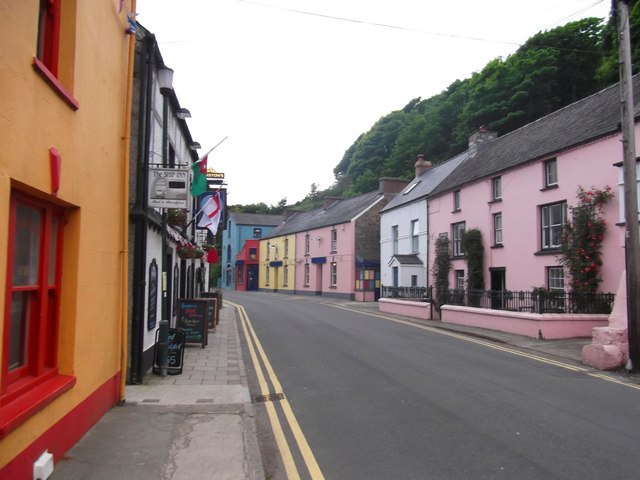
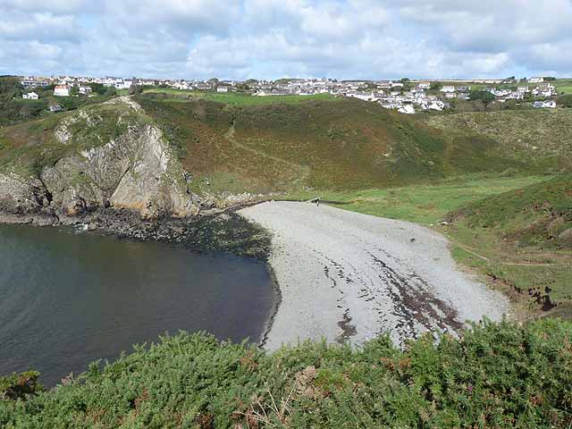
Carreg Twnpib is a prominent coastal feature located in Pembrokeshire, Wales. It is classified as a headland or point due to its geographical characteristics. The site is situated on the western coast of Wales, near the village of Abercastle.

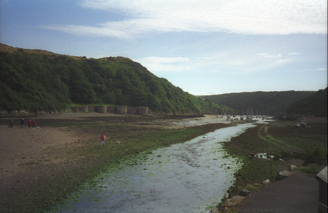
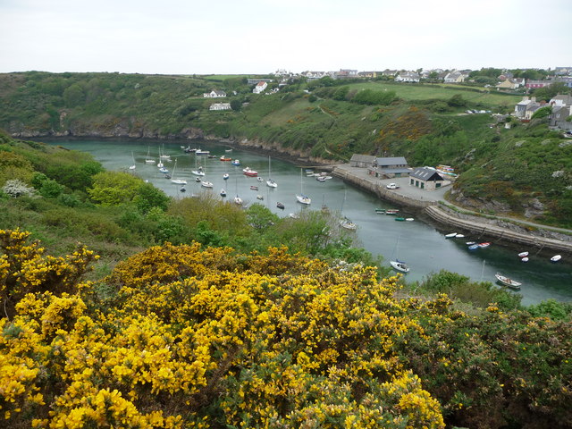
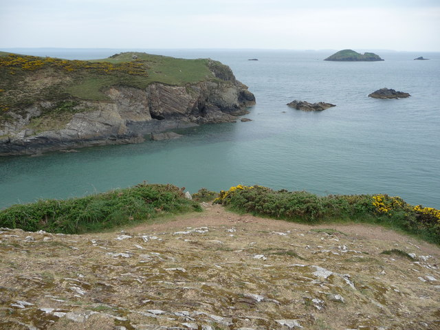
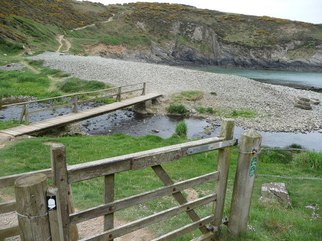
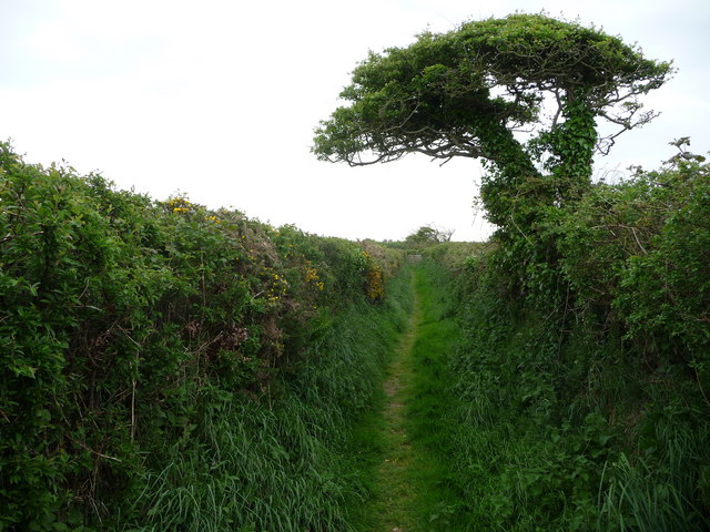
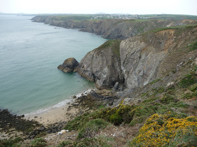
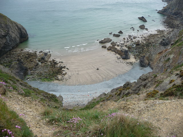
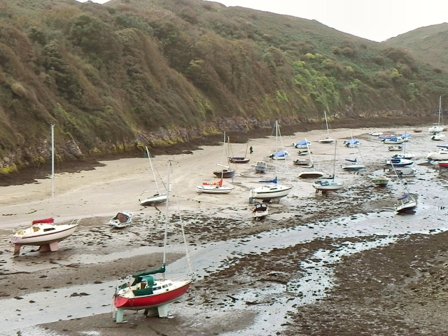
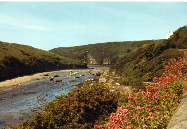
Carreg Twnpib is known for its rugged and dramatic landscape, with towering cliffs that drop steeply into the Atlantic Ocean below. The headland offers breathtaking views of the surrounding coastline and is a popular spot for nature enthusiasts and hikers.

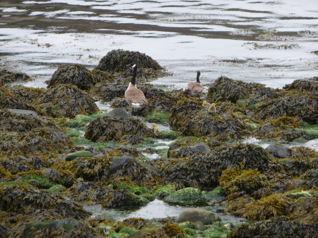
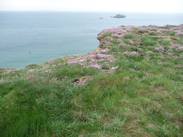
The area is rich in biodiversity, with a diverse range of flora and fauna. Visitors to Carreg Twnpib may spot various seabirds nesting on the cliffs, such as puffins, razorbills, and guillemots. The coastal waters are also home to a variety of marine life, including seals and dolphins.

The headland is an important landmark for maritime navigation, as its distinctive shape and prominent position make it easily recognizable from the sea. It has served as a reference point for sailors and fishermen for centuries.

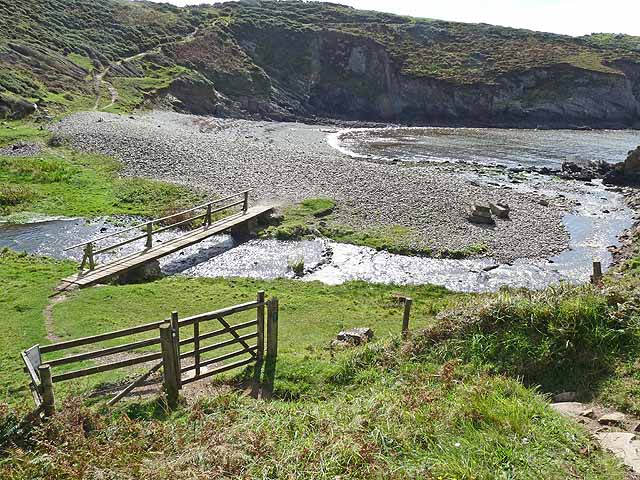
Carreg Twnpib is accessible to the public via a network of footpaths that wind through the surrounding countryside. The area is managed by local authorities and efforts are made to preserve its natural beauty and protect the wildlife that inhabits it.

In summary, Carreg Twnpib is a stunning coastal feature in Pembrokeshire, Wales, offering breathtaking views, diverse wildlife, and a rich maritime history. It is a must-visit destination for those seeking to explore the natural beauty of the Welsh coastline.

If you have any feedback on the listing, please let us know in the comments section below.

Carreg Twnpib Images

Images are sourced within 2km of 51.869933/-5.1954029 or Grid Reference SM8023. Thanks to Geograph Open Source API. All images are credited.

Solva harbour Low tide at Solva harbour, lime kilns on the far shore.
Solva harbour
Low tide at Solva harbour, lime kilns on the far shore.
Lower Solva from Gribin Lower Solva lies behind Solva Harbour, which itself is in a 'fjord-like' inlet in the coastline here. Gribin is also known as the Cribyn ridge locally.
Lower Solva from Gribin
Lower Solva lies behind Solva Harbour, which itself is in a 'fjord-like' inlet in the coastline here. Gribin is also known as the Cribyn ridge locally.
Solva harbour from Gribin The houses of Upper Solva lie above the inlet, some overlooking the picturesque harbour.
Solva harbour from Gribin
The houses of Upper Solva lie above the inlet, some overlooking the picturesque harbour.
Rocks and islands off Solva harbour Beyond Penrhyn Head are St. Elvis' Rock and Black Rock and out to sea is larger Green Scar with The Mare and Black Scar each side. Quite a coastline.
Rocks and islands off Solva harbour
Beyond Penrhyn Head are St. Elvis' Rock and Black Rock and out to sea is larger Green Scar with The Mare and Black Scar each side. Quite a coastline.
Gate and footbridge at Gwadn The pebbly storm beach here is interesting and it's a lovely spot.
Gate and footbridge at Gwadn
The pebbly storm beach here is interesting and it's a lovely spot.
Canada Geese with goslings on Gwadn This little family waddled off seawards at my approach, just as well as a dog off its lead came in a few minutes later.
Canada Geese with goslings on Gwadn
This little family waddled off seawards at my approach, just as well as a dog off its lead came in a few minutes later.
St. Elvis cromlech This Neolithic burial chamber is around 5,000 years old and sited between farm tracks. Saint Elvis was an Irish saint in the 6th century and baptised St. David and an old church dedicated to St. Elvis was sited nearby, now somewhere underneath St. Elvis Farm adjacent.
St. Elvis cromlech
This Neolithic burial chamber is around 5,000 years old and sited between farm tracks. Saint Elvis was an Irish saint in the 6th century and baptised St. David and an old church dedicated to St. Elvis was sited nearby, now somewhere underneath St. Elvis Farm adjacent.
St. Elvis cromlech One of the oldest man-made structures in Pembrokeshire lies sandwiched between farm tracks.
St. Elvis cromlech
One of the oldest man-made structures in Pembrokeshire lies sandwiched between farm tracks.
Footpath between St. Elvis Farm and Lochvane This narrow and quiet path between cow pastures is warm and sheltered and a haven for wildlife.
Footpath between St. Elvis Farm and Lochvane
This narrow and quiet path between cow pastures is warm and sheltered and a haven for wildlife.
Aber West bay looking west towards Solva It's easy to see how this section of coast is so popular with walkers.
Aber West bay looking west towards Solva
It's easy to see how this section of coast is so popular with walkers.
Bay near Solva The high tide line shows the usual collection of flotsam and jetsam, mainly plastic in various forms. Hardly surprising with all the traffic out to sea and inshore.
Bay near Solva
The high tide line shows the usual collection of flotsam and jetsam, mainly plastic in various forms. Hardly surprising with all the traffic out to sea and inshore.
Thrift growing on the cliff top near Solva Rabbits have colonised the fenced-off cliff edge and Thrift grows well here also, always a beautiful sight.
Thrift growing on the cliff top near Solva
Rabbits have colonised the fenced-off cliff edge and Thrift grows well here also, always a beautiful sight.
Solva 1971
Solva 1971
St Elvis Farm, nr Solva This is a chapel like building now used by the farm
St Elvis Farm, nr Solva
This is a chapel like building now used by the farm
Lower Solva
Lower Solva
Footbridge at Gwadn Bay A steep descent on the Pembrokeshire Coast Path to cross this stream is immediately followed by a steep climb.
Footbridge at Gwadn Bay
A steep descent on the Pembrokeshire Coast Path to cross this stream is immediately followed by a steep climb.
Gwadn Bay A steep descent on the Pembrokeshire Coast Path to cross this deeply incised valley with stony beach is immediately followed by a steep climb. Solva village can be seen in the distance.
Gwadn Bay
A steep descent on the Pembrokeshire Coast Path to cross this deeply incised valley with stony beach is immediately followed by a steep climb. Solva village can be seen in the distance.
Show me another place!

Carreg Twnpib is located at Grid Ref: SM8023 (Lat: 51.869933, Lng: -5.1954029)

Unitary Authority: Pembrokeshire

Police Authority: Dyfed Powys

What 3 Words

///lyrics.purest.catchers. Near St Davids, Pembrokeshire

Related Wikis

Solva limekilns

The Solva limekilns are a row of disused limekilns in the harbour of the village of Solva, Pembrokeshire, Wales. The kilns have a Grade II heritage listing...
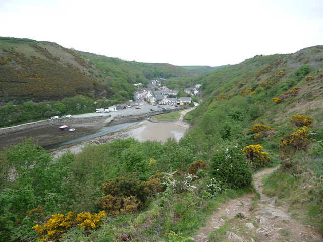
Solva

Solva (Welsh: Solfach) is a village, community and electoral ward in Pembrokeshire, Wales. The village comprises principally Lower Solva and Upper Solva...

River Solva

The River Solva (Welsh: Afon Solfach) is a small river in Pembrokeshire, Wales. Its source is a few hundred metres southeast of Croesgoch and flows ten...

St Elvis, Pembrokeshire

St Elvis (Welsh: Llaneilfyw, [ɬanəilvəu]) is a parish in Pembrokeshire, Wales, about 4 miles (6 km) east of St David's. At 200 acres (81 ha) it is one...

Nearby Amenities

Located within 500m of 51.869933,-5.1954029
Solva
Name Cy: Solfach
Place: village
Source: npe
Wikidata: Q1022259
Lat/Long: 51.8735554/-5.1979167
Tourism: viewpoint
Lat/Long: 51.8689207/-5.198447
Tourism: viewpoint
Lat/Long: 51.8692883/-5.1986401
Source: OS_Opendata_Vectormap_District
Lat/Long: 51.8677289/-5.1901532
Source: OS_Opendata_Vectormap_District
Lat/Long: 51.8686258/-5.1923088
Source: OS_Opendata_Vectormap_District
Lat/Long: 51.8693376/-5.1926864
Source: OS_Opendata_Vectormap_District
Lat/Long: 51.8700652/-5.1977264
Source: OS_Opendata_Vectormap_District
Lat/Long: 51.8706184/-5.1956121
Toilets
Check Date: 2022-09-07
Fee: no
Lat/Long: 51.8722194/-5.1943918
Natural: cave_entrance
Lat/Long: 51.8676817/-5.200738
Natural: cave_entrance
Lat/Long: 51.8679352/-5.1997258
Natural: cave_entrance
Lat/Long: 51.8679012/-5.1941716
Source: OS_Opendata_Vectormap_District
Lat/Long: 51.872743/-5.1900644
Source: OS_Opendata_Vectormap_District
Lat/Long: 51.8709531/-5.1942318
Source: OS_Opendata_Vectormap_District
Lat/Long: 51.8708074/-5.1954629
Source: OS_Opendata_Vectormap_District
Lat/Long: 51.8708243/-5.1950532
Source: OS_Opendata_Vectormap_District
Lat/Long: 51.870915/-5.1943708
Source: OS_Opendata_Vectormap_District
Lat/Long: 51.871091/-5.1938513
Source: OS_Opendata_Vectormap_District
Lat/Long: 51.8718113/-5.1926414
Source: OS_Opendata_Vectormap_District
Lat/Long: 51.8714919/-5.1930969
Source: OS_Opendata_Vectormap_District
Lat/Long: 51.8723498/-5.1916887
Source: OS_Opendata_Vectormap_District
Lat/Long: 51.8721408/-5.1921018
Source: OS_Opendata_Vectormap_District
Lat/Long: 51.8722853/-5.1918326
Source: OS_Opendata_Vectormap_District
Lat/Long: 51.8725518/-5.1910493
Source: OS_Opendata_Vectormap_District
Lat/Long: 51.8726459/-5.1907928
Source: OS_Opendata_Vectormap_District
Lat/Long: 51.8725925/-5.1909556
Source: OS_Opendata_Vectormap_District
Lat/Long: 51.8726587/-5.1906999
Source: OS_Opendata_Vectormap_District
Lat/Long: 51.8726752/-5.1904637
Source: OS_Opendata_Vectormap_District
Lat/Long: 51.8727128/-5.1902425
Cafe on the Quay
Opening Hours: Mo-Sa 10:00-16:00
Shop: beverages
Lat/Long: 51.8721653/-5.1947809
Direction: SSW
Generator Method: photovoltaic
Generator Output Electricity: yes
Generator Solar Modules: 4
Generator Source: solar
Generator Type: solar_photovoltaic_panel
Location: roof
Power: generator
Lat/Long: 51.8739135/-5.1968417
Direction: SSW
Generator Method: photovoltaic
Generator Output Electricity: yes
Generator Solar Modules: 8
Generator Source: solar
Generator Type: solar_photovoltaic_panel
Location: roof
Power: generator
Lat/Long: 51.8739185/-5.1969275
Direction: ESE
Generator Method: photovoltaic
Generator Output Electricity: yes
Generator Solar Modules: 4
Generator Source: solar
Generator Type: solar_photovoltaic_panel
Location: roof
Power: generator
Lat/Long: 51.8739143/-5.1969717
Direction: 215
Generator Method: photovoltaic
Generator Output Electricity: yes
Generator Solar Modules: 15
Generator Source: solar
Generator Type: solar_photovoltaic_panel
Location: roof
Power: generator
Lat/Long: 51.873093/-5.1984322
Direction: SW
Generator Method: photovoltaic
Generator Output Electricity: yes
Generator Solar Modules: 16
Generator Source: solar
Generator Type: solar_photovoltaic_panel
Location: roof
Power: generator
Lat/Long: 51.8731625/-5.1964487
Direction: SW
Generator Method: photovoltaic
Generator Output Electricity: yes
Generator Solar Modules: 10
Generator Source: solar
Generator Type: solar_photovoltaic_panel
Location: roof
Power: generator
Lat/Long: 51.8732288/-5.1965359
Direction: 185
Generator Method: photovoltaic
Generator Output Electricity: yes
Generator Solar Modules: 4
Generator Source: solar
Generator Type: solar_photovoltaic_panel
Location: roof
Power: generator
Lat/Long: 51.8734796/-5.1943378
Direction: 185
Generator Method: photovoltaic
Generator Output Electricity: yes
Generator Solar Modules: 4
Generator Source: solar
Generator Type: solar_photovoltaic_panel
Location: roof
Power: generator
Lat/Long: 51.8734888/-5.1944022
Direction: 185
Generator Method: photovoltaic
Generator Output Electricity: yes
Generator Solar Modules: 6
Generator Source: solar
Generator Type: solar_photovoltaic_panel
Location: roof
Power: generator
Lat/Long: 51.8734589/-5.1943727
Direction: 175
Generator Method: photovoltaic
Generator Output Electricity: yes
Generator Solar Modules: 8
Generator Source: solar
Generator Type: solar_photovoltaic_panel
Location: roof
Power: generator
Lat/Long: 51.8740601/-5.1946664
Direction: 175
Generator Method: photovoltaic
Generator Output Electricity: yes
Generator Solar Modules: 2
Generator Source: solar
Generator Type: solar_photovoltaic_panel
Location: roof
Power: generator
Lat/Long: 51.874147/-5.1935573
Direction: 175
Generator Method: photovoltaic
Generator Output Electricity: yes
Generator Solar Modules: 6
Generator Source: solar
Generator Type: solar_photovoltaic_panel
Location: roof
Power: generator
Lat/Long: 51.8741445/-5.1934379
Post Box
Post Box Type: lamp
Lat/Long: 51.8741516/-5.1970699
Defibrillator
Defibrillator Location: outside the Memorial Hall, High Street, Solva
Emergency: defibrillator
Indoor: no
Lat/Long: 51.8740344/-5.1971683
Defibrillator
Emergency: defibrillator
Indoor: no
Lat/Long: 51.8721575/-5.1946868
Historic: memorial
Memorial: cross
Lat/Long: 51.8735724/-5.1930434
The data included in this document is from www.openstreetmap.org. The data is made available under ODbL.

Have you been to Carreg Twnpib?

Leave your review of Carreg Twnpib below (or comments, questions and feedback).