An Doirlinn

Coastal Feature, Headland, Point in Argyllshire

Scotland

An Doirlinn

Western coast of Lismore A view over the western coastline of Lismore, with the Isle of Mull visible in the distance. Lismore is largely composed of Dalradian Limestone, which gives rise to an extremely fertile soil supporting a rich plant life.
Western coast of Lismore Credit: William Starkey

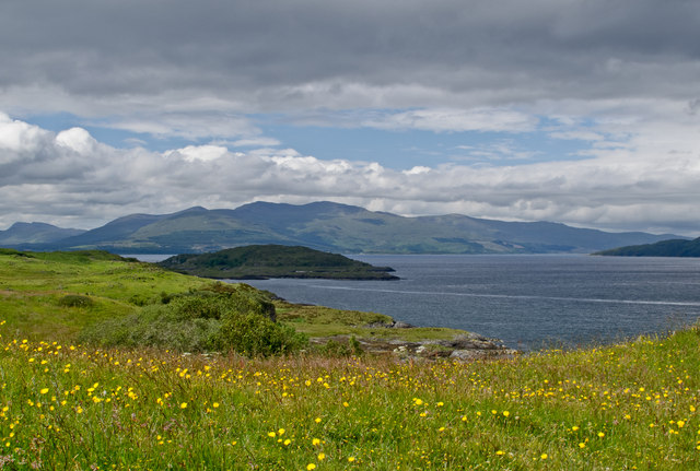
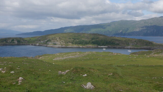
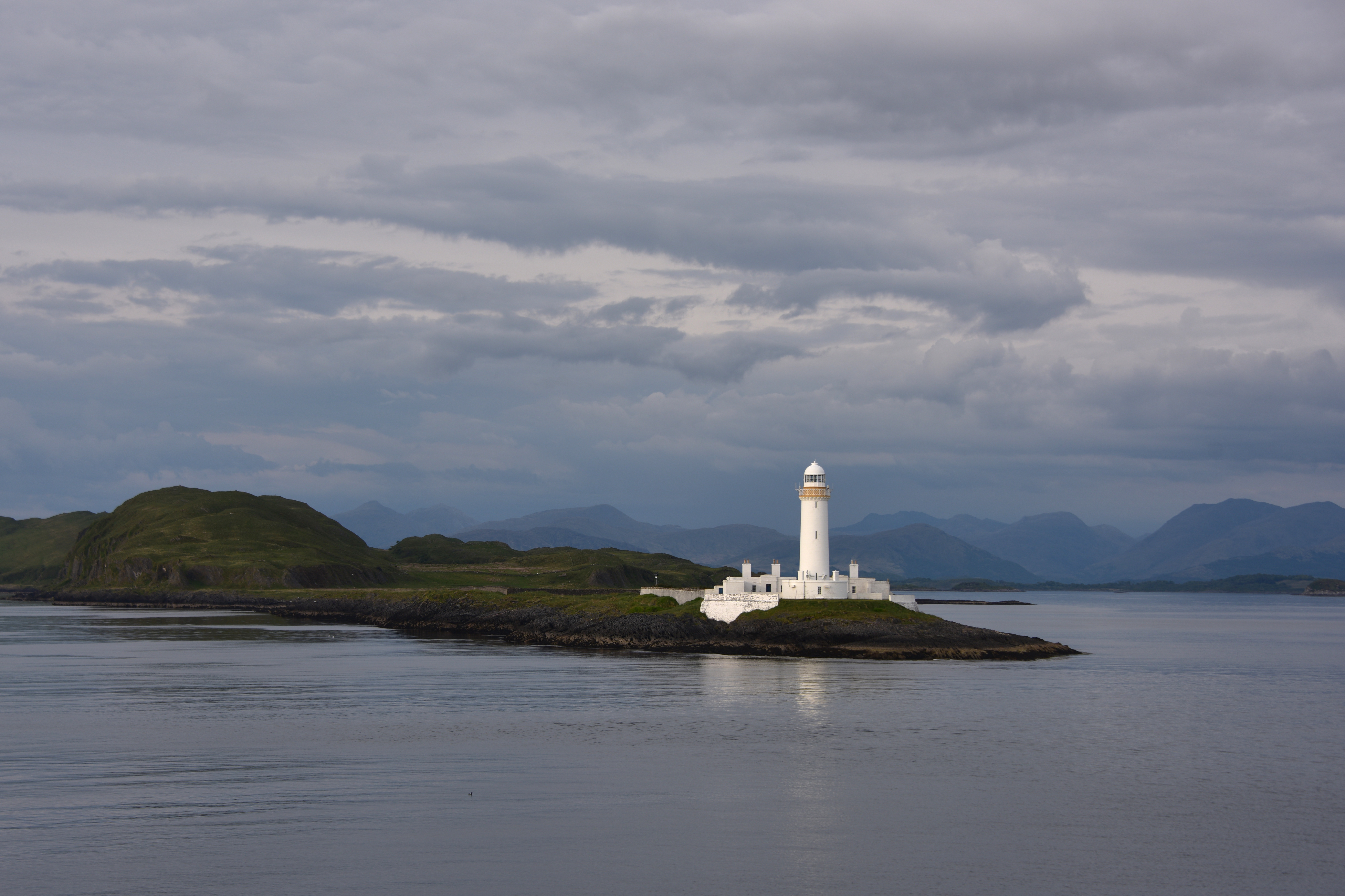
An Doirlinn is a prominent headland located in the region of Argyllshire, on the west coast of Scotland. Situated on the scenic coastline, this coastal feature has become a popular destination for both locals and tourists due to its stunning natural beauty and historical significance.

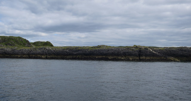
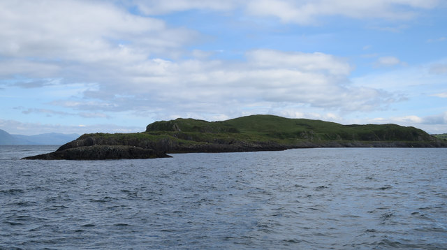
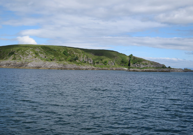
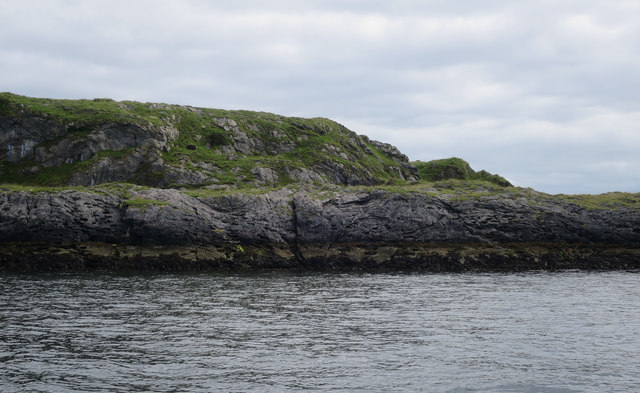
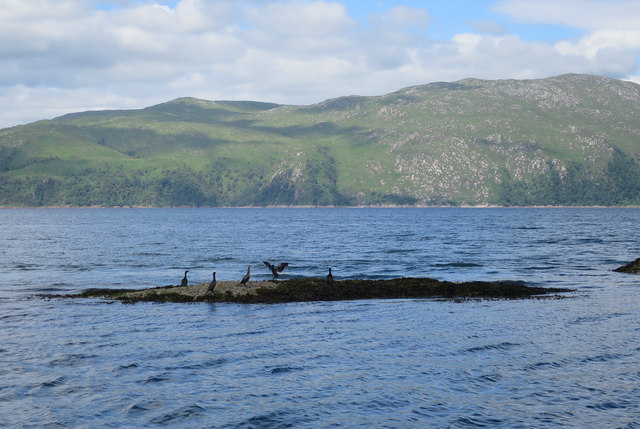
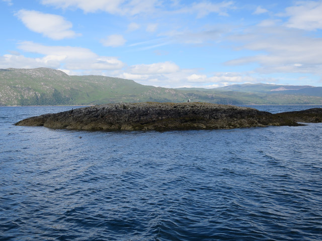
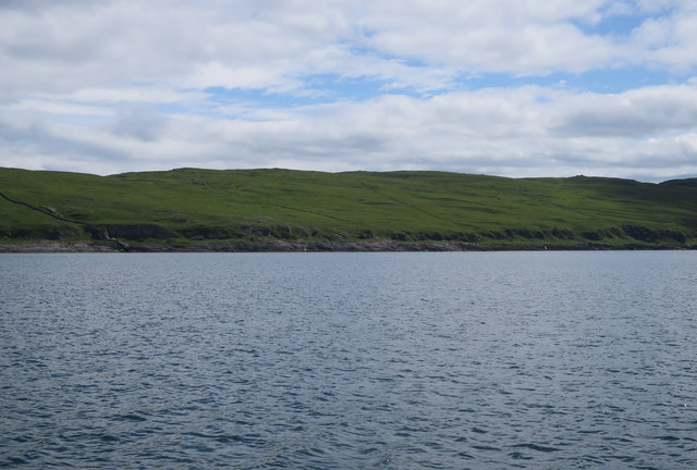
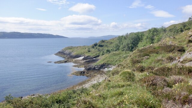
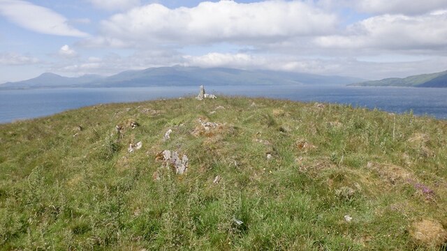
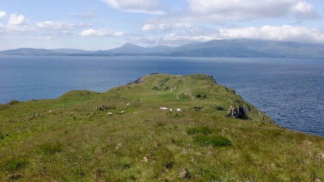
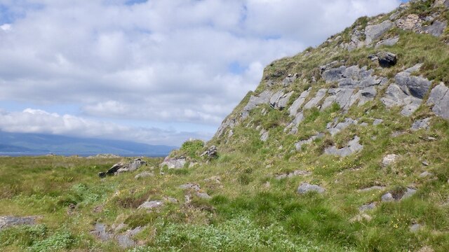
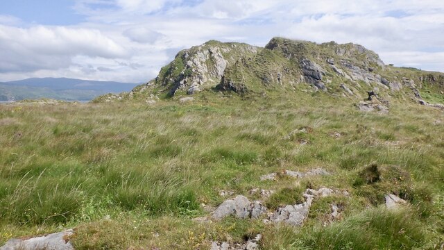
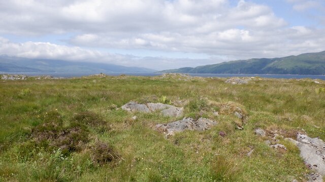
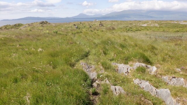
The headland, also known as The Point, is characterized by its rugged cliffs and rocky terrain, which provide a dramatic backdrop against the backdrop of the sea. The area is rich in diverse wildlife, making it a haven for birdwatchers and nature enthusiasts. The rugged landscape also offers breathtaking panoramic views of the surrounding coastline and nearby islands.

An Doirlinn is steeped in history, with evidence of ancient settlements dating back thousands of years. The site has been of strategic importance throughout history, serving as a lookout point and defensive position during times of conflict. Ruins of old fortifications can still be seen on the headland, adding to its historical allure.

Visitors to An Doirlinn can explore the area through various walking trails, offering opportunities to discover the unique flora and fauna of the region. The nearby beach is a popular spot for picnicking, beachcombing, and enjoying the tranquil surroundings.

Overall, An Doirlinn is a captivating coastal feature that offers a blend of natural beauty and historical significance. Its rugged cliffs, diverse wildlife, and rich history make it a must-visit destination for those exploring the Argyllshire region in Scotland.

If you have any feedback on the listing, please let us know in the comments section below.

An Doirlinn Images

Images are sourced within 2km of 56.496997/-5.5742159 or Grid Reference NM8039. Thanks to Geograph Open Source API. All images are credited.

Western coast of Lismore A view over the western coastline of Lismore, with the Isle of Mull visible in the distance. Lismore is largely composed of Dalradian Limestone, which gives rise to an extremely fertile soil supporting a rich plant life.
Western coast of Lismore
A view over the western coastline of Lismore, with the Isle of Mull visible in the distance. Lismore is largely composed of Dalradian Limestone, which gives rise to an extremely fertile soil supporting a rich plant life.
Bernera Island Tidally connected to Lismore, with one of several igneous intrusions.
Bernera Island
Tidally connected to Lismore, with one of several igneous intrusions.
South end of Bernera Island Tidally connected to Lismore.
South end of Bernera Island
Tidally connected to Lismore.
Bernera Island Tidally connected to Lismore.
Bernera Island
Tidally connected to Lismore.
Bernera Island Small cove on the northwest side.
Bernera Island
Small cove on the northwest side.
Bernera Island Tidally connected to Lismore.
Bernera Island
Tidally connected to Lismore.
Rubha Croinn Shags drying their wings between feeding dives. Looking across the deep part of Loch Linnhe, which we were using to test our kit.
Rubha Croinn
Shags drying their wings between feeding dives. Looking across the deep part of Loch Linnhe, which we were using to test our kit.
Rubha Croinn With a Grey seal, Shag and Great Black-backed Gull.
Rubha Croinn
With a Grey seal, Shag and Great Black-backed Gull.
Coast of Lismore On the left, a dry stone wall merges with a protruding igneous dyke, which finishes the job down to the coast.
Coast of Lismore
On the left, a dry stone wall merges with a protruding igneous dyke, which finishes the job down to the coast.
Bernera, Lismore A tidal island off Lismore.
Bernera, Lismore
A tidal island off Lismore.
Coast of Bernera Some rough going on raised beaches.
Coast of Bernera
Some rough going on raised beaches.
Summit, Bernera There is a sheep path up to here from the tidal crossing. The island is grazed.
Summit, Bernera
There is a sheep path up to here from the tidal crossing. The island is grazed.
Westward view, Bernera Mull in the background.
Westward view, Bernera
Mull in the background.
Gully, Bernera Possibly due to a dyke from the Mull or Ardnamurchan volcanic complexes. Bernera, like Lismore is mostly limestone. View towards Morvern.
Gully, Bernera
Possibly due to a dyke from the Mull or Ardnamurchan volcanic complexes. Bernera, like Lismore is mostly limestone. View towards Morvern.
West end of Bernera A prow of limestone above an old wave cut platform.
West end of Bernera
A prow of limestone above an old wave cut platform.
Limestone prows, Bernera Former sea cliffs rise above a wave cut platform.
Limestone prows, Bernera
Former sea cliffs rise above a wave cut platform.
Raised beach, Bernera A former wave cut platform at the west end of Bernera.
Raised beach, Bernera
A former wave cut platform at the west end of Bernera.
Wave cut platform, Bernera The far west end of the tidal island with a massive and very rough raised beach.
Wave cut platform, Bernera
The far west end of the tidal island with a massive and very rough raised beach.
Show me another place!

An Doirlinn is located at Grid Ref: NM8039 (Lat: 56.496997, Lng: -5.5742159)

Unitary Authority: Argyll and Bute

Police Authority: Argyll and West Dunbartonshire

What 3 Words

///than.irony.drift. Near Craignure, Argyll & Bute

Related Wikis

Achanduin Castle

Achanduin Castle, (also known as Achadun Castle and Acha-Dun), is a castle, now in ruins, located about 5.0 kilometres (3.1 mi) west of Achnacroish on...

Bernera Island

Bernera Island (Scottish Gaelic: Beàrnaraigh) or simply Bernera is a tidal island off Lismore, in Argyll, Scotland. == History == In the 6th century, Bernera...

Lismore Seminary

Lismore Seminary was situated in Kilcheran House on the island of Lismore in the Inner Hebrides part of Argyll, Scotland. It served as a seminary for the...

Creag Island

Creag Island is an island in Scotland. It is located in Argyll and Bute council area, in the northwestern part of the country, 600 km northwest of the...

Eilean Musdile

Eilean Musdile (Mansedale) is an islet, and lighthouse to the south west of Lismore in the Inner Hebrides. The island lies in the entrance to Loch Linnhe...

Lismore, Scotland

Lismore (Scottish Gaelic: Lios Mòr, pronounced [ʎis̪ ˈmoːɾ] possibly meaning "great enclosure" or "garden") is an island of some 2,351 hectares (9.1 square...

Achnacroish

Achnacroish (Scottish Gaelic: Achadh na Croise) is a hamlet on the Scottish island of Lismore. The harbour serves the ferry between Lismore and Oban.The...

Lady's Rock

Lady's Rock is an uninhabited skerry to the south west of Lismore in the Inner Hebrides. It is submerged at high tide and carries a navigation beacon....

Nearby Amenities

Located within 500m of 56.496997,-5.5742159
Rubh' Àird Eirnish
Natural: cape
Lat/Long: 56.499268/-5.569989
Achadun Bay
Natural: bay
Lat/Long: 56.4984745/-5.5674355
An Doirlinn
Place: locality
Lat/Long: 56.4968992/-5.5737226
Memorial Cairn to Jozef Kijowski
Man Made: cairn
Lat/Long: 56.4940089/-5.5689815
The data included in this document is from www.openstreetmap.org. The data is made available under ODbL.

Have you been to An Doirlinn?

Leave your review of An Doirlinn below (or comments, questions and feedback).