Port Challtuinn

Sea, Estuary, Creek in Argyllshire

Scotland

Port Challtuinn

Western coast of Lismore A view over the western coastline of Lismore, with the Isle of Mull visible in the distance. Lismore is largely composed of Dalradian Limestone, which gives rise to an extremely fertile soil supporting a rich plant life.
Western coast of Lismore Credit: William Starkey

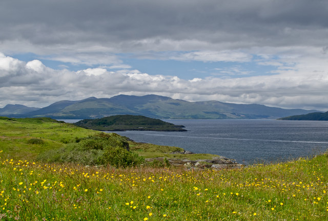
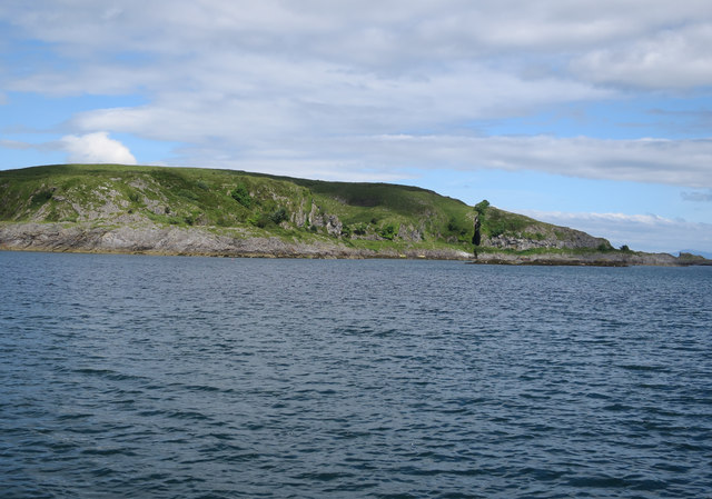
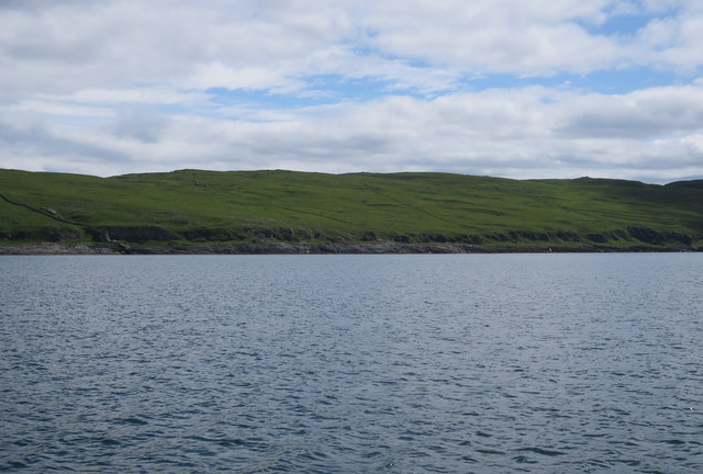
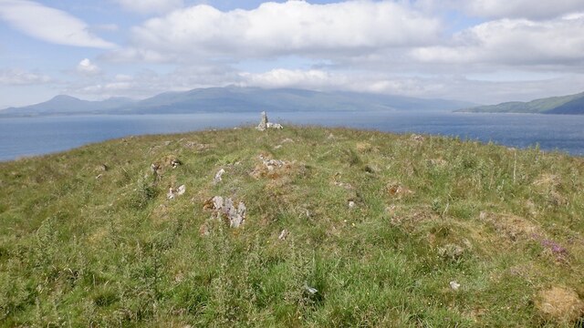
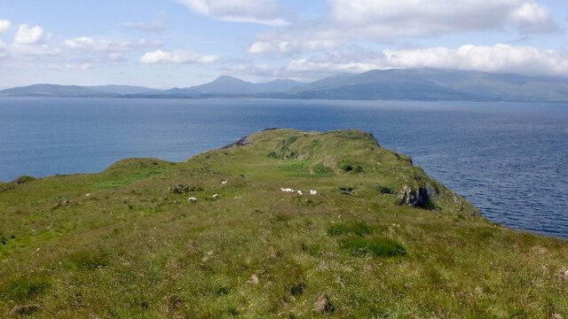
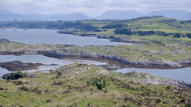
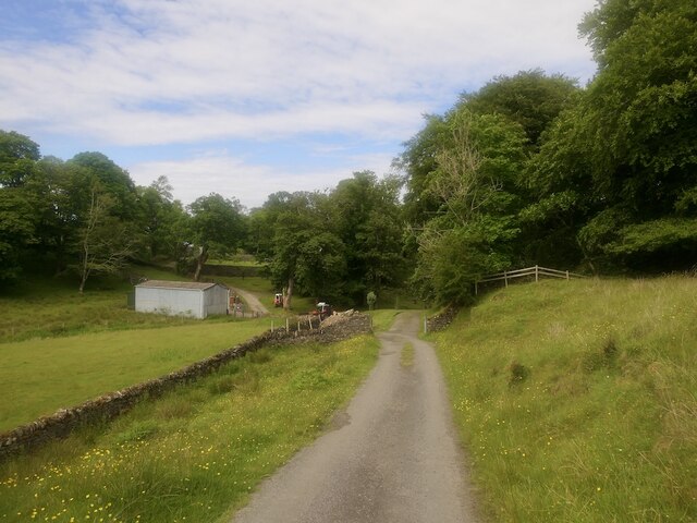
Port Challtuinn, located in Argyllshire, Scotland, is a picturesque coastal settlement nestled along the shores of a sea loch. This charming little village is surrounded by stunning natural beauty, with rolling hills and dense woodlands providing a backdrop to the sparkling waters of the loch.

The sea loch at Port Challtuinn serves as both an estuary and a creek, as it is influenced by the tides and the freshwater rivers that flow into it. This unique combination creates a diverse and thriving ecosystem, supporting a wide range of marine and bird life. The loch is also a popular spot for fishing, with anglers often seen casting their lines from the rocky shoreline.

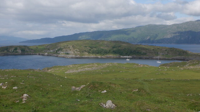
The village itself is small, with a handful of quaint cottages and a small harbor where local fishermen moor their boats. The harbor serves as a hub of activity, with fishing vessels coming and going, and the occasional pleasure craft stopping by. Visitors can often witness fishermen unloading their catches of the day, bringing in a bounty of fresh seafood to be enjoyed by locals and visitors alike.

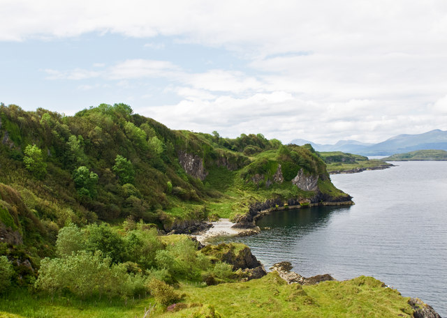
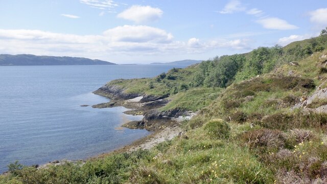
For nature enthusiasts, Port Challtuinn offers several walking trails along the coastline, providing breathtaking views of the loch and the surrounding landscape. These trails allow visitors to immerse themselves in the tranquility of the area, taking in the sights and sounds of the coastal ecosystem.

Overall, Port Challtuinn is a hidden gem in Argyllshire, offering a peaceful retreat for those seeking natural beauty and a taste of traditional Scottish coastal life.

If you have any feedback on the listing, please let us know in the comments section below.

Port Challtuinn Images

Images are sourced within 2km of 56.499425/-5.5607409 or Grid Reference NM8039. Thanks to Geograph Open Source API. All images are credited.

Western coast of Lismore A view over the western coastline of Lismore, with the Isle of Mull visible in the distance. Lismore is largely composed of Dalradian Limestone, which gives rise to an extremely fertile soil supporting a rich plant life.
Western coast of Lismore
A view over the western coastline of Lismore, with the Isle of Mull visible in the distance. Lismore is largely composed of Dalradian Limestone, which gives rise to an extremely fertile soil supporting a rich plant life.
Lismore coastline Raised beaches and cliffs on the western coast of Lismore, which is largely composed of Dalradian limestone. The island of Bernera, accessible from Lismore at low tide can be seen in the distance.
Lismore coastline
Raised beaches and cliffs on the western coast of Lismore, which is largely composed of Dalradian limestone. The island of Bernera, accessible from Lismore at low tide can be seen in the distance.
Standing stone - Lismore At the side of the minor road to Achinduin and Achadun Castle.
Standing stone - Lismore
At the side of the minor road to Achinduin and Achadun Castle.
Lochan at Frackersaig
Bernera Island Tidally connected to Lismore.
Bernera Island
Tidally connected to Lismore.
Bernera Island Small cove on the northwest side.
Bernera Island
Small cove on the northwest side.
Coast of Lismore On the left, a dry stone wall merges with a protruding igneous dyke, which finishes the job down to the coast.
Coast of Lismore
On the left, a dry stone wall merges with a protruding igneous dyke, which finishes the job down to the coast.
Bernera, Lismore A tidal island off Lismore.
Bernera, Lismore
A tidal island off Lismore.
Coast of Bernera Some rough going on raised beaches.
Coast of Bernera
Some rough going on raised beaches.
Summit, Bernera There is a sheep path up to here from the tidal crossing. The island is grazed.
Summit, Bernera
There is a sheep path up to here from the tidal crossing. The island is grazed.
Westward view, Bernera Mull in the background.
Westward view, Bernera
Mull in the background.
Gully, Bernera Possibly due to a dyke from the Mull or Ardnamurchan volcanic complexes. Bernera, like Lismore is mostly limestone. View towards Morvern.
Gully, Bernera
Possibly due to a dyke from the Mull or Ardnamurchan volcanic complexes. Bernera, like Lismore is mostly limestone. View towards Morvern.
East end of Bernera Showing the narrow drying beach which allows access at low water. Taken an hour after a neap low water.
East end of Bernera
Showing the narrow drying beach which allows access at low water. Taken an hour after a neap low water.
Summit, Barr Treshtil
Limestone pavement, Barr Treshtil
View of Loch Fiart The very scenic southern end of Lismore with two limestone ridges.
View of Loch Fiart
The very scenic southern end of Lismore with two limestone ridges.
Kilcheran, Lismore
Kilcheran, Lismore
Achadun Castle
Achadun Castle
Show me another place!

Port Challtuinn is located at Grid Ref: NM8039 (Lat: 56.499425, Lng: -5.5607409)

Unitary Authority: Argyll and Bute

Police Authority: Argyll and West Dunbartonshire

What 3 Words

///premature.squeaks.crisps. Near Craignure, Argyll & Bute

Related Wikis

Achanduin Castle

Achanduin Castle, (also known as Achadun Castle and Acha-Dun), is a castle, now in ruins, located about 5.0 kilometres (3.1 mi) west of Achnacroish on...

Bernera Island

Bernera Island (Scottish Gaelic: Beàrnaraigh) or simply Bernera is a tidal island off Lismore, in Argyll, Scotland. == History == In the 6th century, Bernera...

Lismore Seminary

Lismore Seminary was situated in Kilcheran House on the island of Lismore in the Inner Hebrides part of Argyll, Scotland. It served as a seminary for the...

Creag Island

Creag Island is an island in Scotland. It is located in Argyll and Bute council area, in the northwestern part of the country, 600 km northwest of the...

Nearby Amenities

Located within 500m of 56.499425,-5.5607409
Source: PGS
Lat/Long: 56.4991166/-5.5614718
Achadun Bay
Natural: bay
Lat/Long: 56.4984745/-5.5674355
Port Challtuinn
Natural: bay
Lat/Long: 56.4994812/-5.5603759
The data included in this document is from www.openstreetmap.org. The data is made available under ODbL.

Have you been to Port Challtuinn?

Leave your review of Port Challtuinn below (or comments, questions and feedback).