Rubha Àird a' Chròtha

Coastal Feature, Headland, Point in Argyllshire

Scotland

Rubha Àird a' Chròtha

Barr Meadhonach This name means something like 'middle extremity' and refers to one of a series of headlands on this stretch of coast.
Barr Meadhonach Credit: Anne Burgess

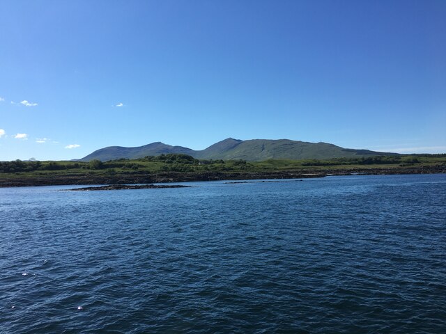
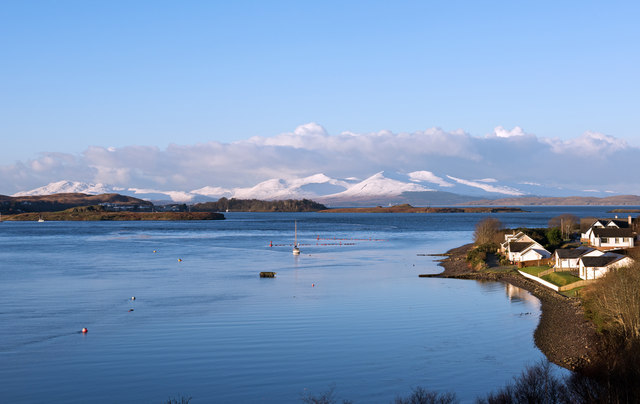
Rubha Àird a' Chròtha is a prominent headland located in Argyllshire, Scotland. Situated on the western coast of the country, it overlooks the majestic waters of the Atlantic Ocean. This coastal feature is known for its stunning natural beauty and rugged charm, attracting both locals and tourists alike.

Standing tall at an elevation of approximately 100 meters, Rubha Àird a' Chròtha offers breathtaking panoramic views of the surrounding landscape. The headland is characterized by its sheer cliffs, which plunge dramatically into the sea below. These cliffs are composed of ancient rocks, showcasing the geological history of the area.

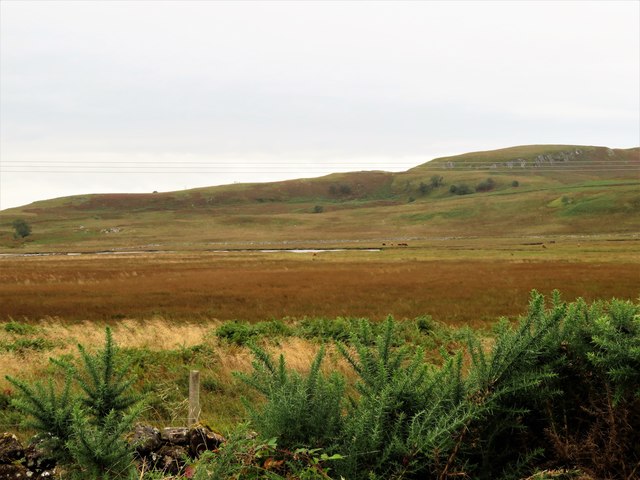
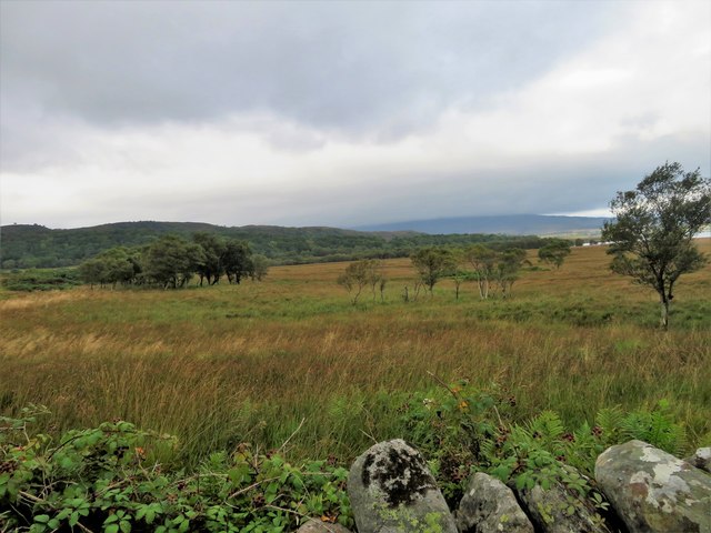
The headland is also adorned with lush vegetation, as hardy plants and grasses cling to the rocky terrain. Seabirds can often be seen circling above, adding to the picturesque atmosphere. The waters surrounding Rubha Àird a' Chròtha are teeming with marine life, making it a popular spot for fishing and birdwatching.

Access to the headland is relatively easy, with a well-maintained footpath leading to the top. This path offers stunning vistas along the way, making the hike an enjoyable experience. Visitors are advised to take caution, as the cliffs can be steep and precarious.

Rubha Àird a' Chròtha is a place of natural beauty and tranquility, providing a serene escape from the hustle and bustle of daily life. Whether one is seeking a peaceful retreat or an opportunity to appreciate Scotland's awe-inspiring coastal scenery, this headland is sure to leave a lasting impression.

If you have any feedback on the listing, please let us know in the comments section below.

Rubha Àird a' Chròtha Images

Images are sourced within 2km of 56.422778/-5.6671306 or Grid Reference NM7331. Thanks to Geograph Open Source API. All images are credited.

Barr Meadhonach This name means something like 'middle extremity' and refers to one of a series of headlands on this stretch of coast.
Barr Meadhonach
This name means something like 'middle extremity' and refers to one of a series of headlands on this stretch of coast.
Eilean Ban, Lochdon A small tidal island in the middle of the bay.
Eilean Ban, Lochdon
A small tidal island in the middle of the bay.
Coastline of Mull near Gorsten
Rainbow at Barr Meadhonach Another two minute downpour followed by the sun, makes the damp feet, tired legs etc, etc all worthwhile. LHS of the rainbow touching down in front of the trees, but no pot of gold.
Rainbow at Barr Meadhonach
Another two minute downpour followed by the sun, makes the damp feet, tired legs etc, etc all worthwhile. LHS of the rainbow touching down in front of the trees, but no pot of gold.
Eastern shoreline of Mull near Port na Tairbeirt Title edited
Eastern shoreline of Mull near Port na Tairbeirt
Title edited
Loch a' Ghleannain Looking north from over the Firth of Lorn, en route from Glasgow to Barra, to the settlement and loch of Loch Don.
Loch a' Ghleannain
Looking north from over the Firth of Lorn, en route from Glasgow to Barra, to the settlement and loch of Loch Don.
Bridge over Leth-fhonn near Lochdon, Mull Category B Listed bridge probably built in 1790 when the road from Grass Point to Aros was constructed at the instigation of the 5th Duke of Argyll. The span is 10.7m with a 3.7m wide road.
Bridge over Leth-fhonn near Lochdon, Mull
Category B Listed bridge probably built in 1790 when the road from Grass Point to Aros was constructed at the instigation of the 5th Duke of Argyll. The span is 10.7m with a 3.7m wide road.
View from Connel Bridge - January 2016 (1) Showing a snow-covered Mull, the entrance to Loch Etive and part of the hamlet of North Connel (West).
View from Connel Bridge - January 2016 (1)
Showing a snow-covered Mull, the entrance to Loch Etive and part of the hamlet of North Connel (West).
Grass Point Pier
Grass Point Pier
Looking east from Auchnacraig Ben Cruachan in the distance
Looking east from Auchnacraig
Ben Cruachan in the distance
Bridge on the road to Grass Point
Grass Point With Sgurr Dearg and Dun da Ghaoithe on the skyline.
Viewed from the Oban to Colonsay ferry.
Grass Point
With Sgurr Dearg and Dun da Ghaoithe on the skyline. Viewed from the Oban to Colonsay ferry.
Grass Point at the mouth of Loch Don Sgurr Dearg on the left skyline with Dun da Ghaoithe mostly hidden.
Grass Point at the mouth of Loch Don
Sgurr Dearg on the left skyline with Dun da Ghaoithe mostly hidden.
Leth-fhonn Marshes Marshland by Loch Don and Grasspoint.
Leth-fhonn Marshes
Marshland by Loch Don and Grasspoint.
Grass Point Moss The wide grassy wetland which gives Grass Point its name.
Grass Point Moss
The wide grassy wetland which gives Grass Point its name.
Grass Point Pier Grass Point, or Auchnacraig as it was known then, was the main ferry terminal before Craignure took over. Road traffic must have been interesting! The site has good access to the sea and sheltered as it sits in Loch Don.
Grass Point Pier
Grass Point, or Auchnacraig as it was known then, was the main ferry terminal before Craignure took over. Road traffic must have been interesting! The site has good access to the sea and sheltered as it sits in Loch Don.
Loch Don Estuary Loch Don meets the Forth of Lorn. From beside Rhuba nan Gall Mòr north across the channel lies Eilean nan Caorach.
Loch Don Estuary
Loch Don meets the Forth of Lorn. From beside Rhuba nan Gall Mòr north across the channel lies Eilean nan Caorach.
Show me another place!

Rubha Àird a' Chròtha is located at Grid Ref: NM7331 (Lat: 56.422778, Lng: -5.6671306)

Unitary Authority: Argyll and Bute

Police Authority: Argyll and West Dunbartonshire

What 3 Words

///validated.spell.rarely. Near Craignure, Argyll & Bute

Related Wikis

Loch Don

Loch Don is a sea loch on the east coast of the Isle of Mull, off the west coast of Scotland. It is an intricately shaped loch opening onto the Firth of...

Lochdon Free Church

The Lochdon Free Church is a place of worship of the Free Church of Scotland in Lochdon on the Isle of Mull, Scotland. The church was built in 1852....

Lochdon

Lochdon or Lochdonhead (Scottish Gaelic: Loch Dona or Scottish Gaelic: Cheann Loch Dona) is a small village on the Isle of Mull, in the council area of...

Gruline

Gruline (Scottish Gaelic: Grùilinn) is a small settlement on the Isle of Mull, in Argyll and Bute, off the west coast of Scotland. The hamlet is located...

Nearby Amenities

Located within 500m of 56.422778,-5.6671306
Source: PGS
Lat/Long: 56.426389/-5.6637465
Source: PGS
Lat/Long: 56.4260135/-5.6638254
Source: PGS
Lat/Long: 56.4261448/-5.6642591
Source: PGS
Lat/Long: 56.426516/-5.6644659
Source: PGS
Lat/Long: 56.426729/-5.6645664
Source: PGS
Lat/Long: 56.4269341/-5.6648805
Created By: dmgroom_coastlines
Source: PGS
Lat/Long: 56.423707/-5.675028
Created By: dmgroom_coastlines
Source: PGS
Lat/Long: 56.422939/-5.674974
Created By: dmgroom_coastlines
Source: PGS
Lat/Long: 56.422683/-5.674956
Created By: dmgroom_coastlines
Source: PGS
Lat/Long: 56.422172/-5.67492
Source: PGS
Lat/Long: 56.420467/-5.6738906
Source: PGS
Lat/Long: 56.4208823/-5.6733567
Source: PGS
Lat/Long: 56.4212864/-5.6726208
Source: PGS
Lat/Long: 56.4216268/-5.6721699
Source: PGS
Lat/Long: 56.4218997/-5.6717218
Source: PGS
Lat/Long: 56.422219/-5.6715748
Source: PGS
Lat/Long: 56.4223681/-5.6713583
Source: PGS
Lat/Long: 56.4224932/-5.6711843
Source: PGS
Lat/Long: 56.4226294/-5.670678
Source: PGS
Lat/Long: 56.4227617/-5.6703476
Source: PGS
Lat/Long: 56.4228415/-5.6696909
Source: PGS
Lat/Long: 56.423001/-5.6694657
Source: PGS
Lat/Long: 56.42338/-5.6692606
Source: PGS
Lat/Long: 56.4234307/-5.6687995
Source: PGS
Lat/Long: 56.4233541/-5.6681973
Source: PGS
Lat/Long: 56.4233607/-5.6676909
Created By: dmgroom_coastlines
Source: PGS
Lat/Long: 56.422852/-5.66711
Created By: dmgroom_coastlines
Source: PGS
Lat/Long: 56.422597/-5.667092
Created By: dmgroom_coastlines
Source: PGS
Lat/Long: 56.422341/-5.667074
Created By: dmgroom_coastlines
Source: PGS
Lat/Long: 56.421318/-5.667003
Created By: dmgroom_coastlines
Source: PGS
Lat/Long: 56.42055/-5.666949
Created By: dmgroom_coastlines
Source: PGS
Lat/Long: 56.419783/-5.666895
Source: PGS
Lat/Long: 56.4198347/-5.667492
Source: PGS
Lat/Long: 56.4194414/-5.6675494
Source: PGS
Lat/Long: 56.4191361/-5.6672743
Source: PGS
Lat/Long: 56.4186942/-5.6672664
Source: PGS
Lat/Long: 56.4183069/-5.6670587
The data included in this document is from www.openstreetmap.org. The data is made available under ODbL.

Have you been to Rubha Àird a' Chròtha?

Leave your review of Rubha Àird a' Chròtha below (or comments, questions and feedback).