Sròn na Clèite

Coastal Feature, Headland, Point in Ross-shire

Scotland

Sròn na Clèite

Passing place on the road to Rubha Rèidh
Passing place on the road to Rubha Rèidh Credit: Alpin Stewart

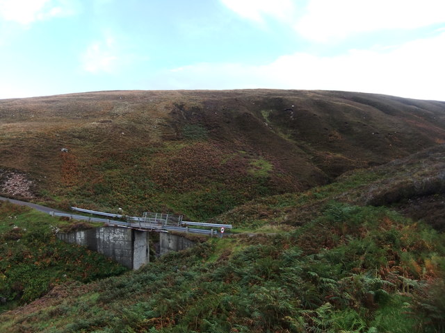
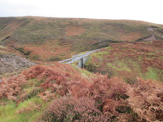
Sròn na Clèite is a prominent coastal feature located in Ross-shire, Scotland. This headland, also referred to as a point, is situated on the western coast of the Scottish Highlands and overlooks the North Atlantic Ocean. It is positioned approximately 15 miles southwest of Ullapool.

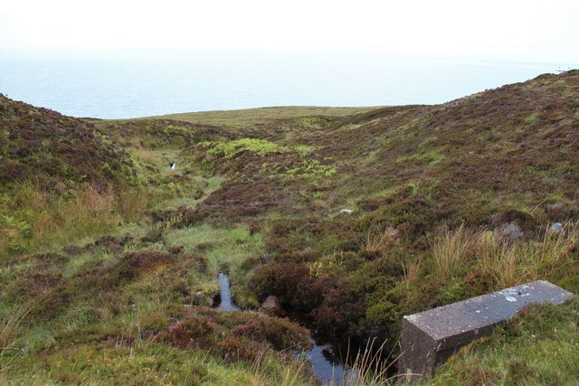
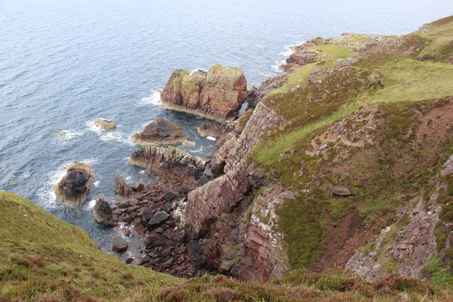
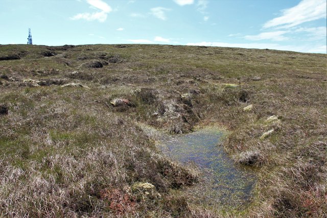
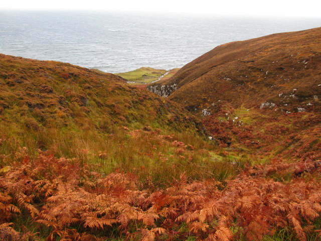
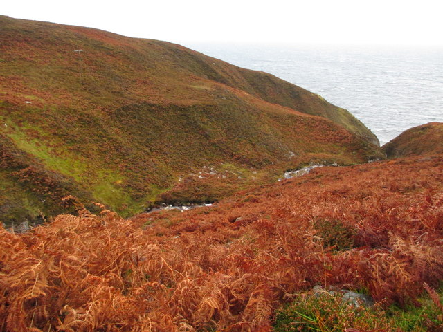
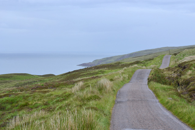
Characterized by its rugged and dramatic landscape, Sròn na Clèite offers breathtaking views of the surrounding area. Jutting out into the sea, the headland is composed of steep cliffs that rise majestically from the water below. These cliffs, formed by the erosion of ancient rocks over millions of years, provide nesting sites for various seabird species, including fulmars and kittiwakes.

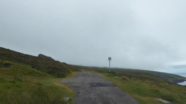
The headland is accessible by foot via a coastal path that winds through the picturesque Scottish countryside. As visitors explore the area, they can experience the wild beauty of Sròn na Clèite firsthand, observing the crashing waves, the sound of seabirds, and the stunning vistas that stretch out to the horizon.

Sròn na Clèite is also steeped in history and folklore. It is said to have served as a lookout point during ancient times, providing vantage points for clans and warriors to monitor the seas for potential invasions. The headland's name, Sròn na Clèite, translates to "Nose of the Cliff" in English, accurately reflecting its physical characteristics.

Overall, Sròn na Clèite is a captivating coastal feature that combines natural beauty with historical significance. It offers visitors an opportunity to immerse themselves in the rugged splendor of the Scottish Highlands while appreciating the rich heritage of the region.

If you have any feedback on the listing, please let us know in the comments section below.

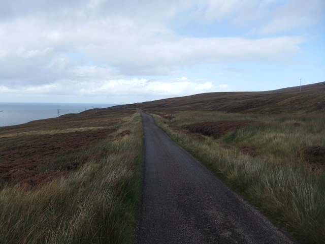
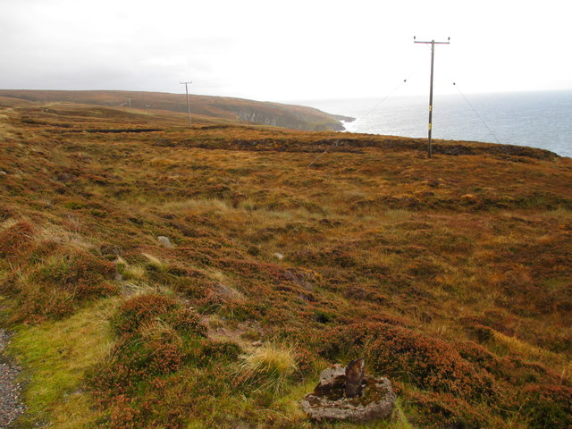
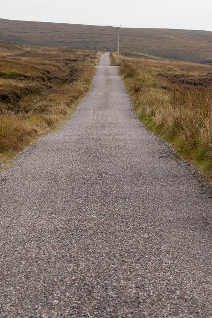
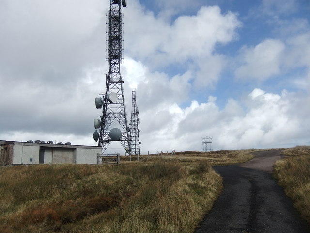
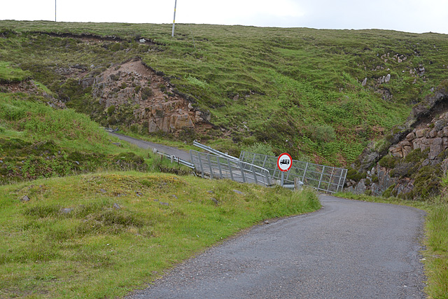
Sròn na Clèite Images

Images are sourced within 2km of 57.839193/-5.8112646 or Grid Reference NG7389. Thanks to Geograph Open Source API. All images are credited.

Passing place on the road to Rubha Rèidh
A burn dropping to Camasan Dearga
West facing cliffs at Rubha Reidh
Road to Rubha Reidh Lighthouse
Bog on Maol Breac Communication mast on the top.
Bog on Maol Breac
Communication mast on the top.
The track to the lighthouse The track that leads to Rubha Reidh lighthouse.  We were travelling on motorbikes and got to a small layby near to the lighthouse.  I wanted to see the lighthouse, but was just soo scared to venture any further.  Maybe someday I will return on a bicycle and make it to the end of the road/track.  A bonus to stopping where we did we got a sighting of Minke Whale.
The track to the lighthouse
The track that leads to Rubha Reidh lighthouse. We were travelling on motorbikes and got to a small layby near to the lighthouse. I wanted to see the lighthouse, but was just soo scared to venture any further. Maybe someday I will return on a bicycle and make it to the end of the road/track. A bonus to stopping where we did we got a sighting of Minke Whale.
Road to the Lighthouse
Coastal moorland
Coastal moorland
Road and telegraph poles Both heading for Rubha Rèidh.
Road and telegraph poles
Both heading for Rubha Rèidh.
The lighthouse road The road from Melvaig to the lighthouse is a private road owned and maintained by the Northern Lighthouse Board.  It is somewhat undulating, suffers occasional deep potholes and is best taken slowly.
The lighthouse road
The road from Melvaig to the lighthouse is a private road owned and maintained by the Northern Lighthouse Board. It is somewhat undulating, suffers occasional deep potholes and is best taken slowly.
Masts, Maol Breac
Masts, Maol Breac
Bridge over the Allt an Fheidh
Allt a' Bhùtha
Allt a' Bhùtha
Bridge over Allt a' Bhùtha
The Allt an Fheidh
The Allt an Fheidh
Bridge over the Allt a' Bhùtha Not the most confidence-inducing structure.
Bridge over the Allt a' Bhùtha
Not the most confidence-inducing structure.
The Rubha Rèidh road heading north An up and down affair, which may create problems with some vehicles.

In recent years there have been conflicts with the owner of the accomodation at the lighthouse, who has attempted to stop public use of the road. However, the land here is owned by the Inverasdale Estate, and the road is owned by the Northern Lighthouse Board, neither of whom object to the public driving the road. Highland Council, which is responsible for designating the status of roads, has declared the road as "a private road open for all public access". All of which means the driving this road is legitimate. The views are worth it.
The Rubha Rèidh road heading north
An up and down affair, which may create problems with some vehicles. In recent years there have been conflicts with the owner of the accomodation at the lighthouse, who has attempted to stop public use of the road. However, the land here is owned by the Inverasdale Estate, and the road is owned by the Northern Lighthouse Board, neither of whom object to the public driving the road. Highland Council, which is responsible for designating the status of roads, has declared the road as "a private road open for all public access". All of which means the driving this road is legitimate. The views are worth it.
Bridge over the Allt na Fhèidh With a deteriorating surface, similar to the one further south.
Bridge over the Allt na Fhèidh
With a deteriorating surface, similar to the one further south.
Show me another place!

Sròn na Clèite is located at Grid Ref: NG7389 (Lat: 57.839193, Lng: -5.8112646)

Unitary Authority: Highland

Police Authority: Highlands and Islands

What 3 Words

///feasted.defends.forehand. Near Gairloch, Highland

Related Wikis

Rua Reidh Lighthouse

Rua Reidh Lighthouse stands close to the entrance to Loch Ewe in Wester Ross, Scotland. == History == The name "Rua Reidh" is a semi-anglicisation of...

Melvaig

Melvaig is a remote village on the coast of western Ross-shire, Scottish Highlands and is in the Scottish council area of Highland. It is a cliff top...

Aultgrishan

Aultgrishan (Gaelic: ) is a small crofting community near Gairloch, Ross-shire. It adjoins Melvaig, within Highland region and is in the Scottish council...

Cove, Highland

Cove is a remote hamlet located on the northwestern shore of the sea loch Loch Ewe, and 8 mi (13 km) northwest of Poolewe in Ross-shire, Scottish Highlands...

Nearby Amenities

Located within 500m of 57.839193,-5.8112646
Source: PGS
Lat/Long: 57.8434145/-5.8093978
Source: PGS
Lat/Long: 57.8430188/-5.8091804
Source: PGS
Lat/Long: 57.8427181/-5.809166
Source: PGS
Lat/Long: 57.842483/-5.8089835
Source: PGS
Lat/Long: 57.8422795/-5.8088175
Source: PGS
Lat/Long: 57.8420531/-5.8086974
Source: PGS
Lat/Long: 57.8416494/-5.8087918
Source: PGS
Lat/Long: 57.8408888/-5.8085616
Source: PGS
Lat/Long: 57.8401482/-5.8088633
Source: PGS
Lat/Long: 57.8397609/-5.8091506
Created By: almien_coastlines
Source: PGS
Lat/Long: 57.839547/-5.809696
Source: PGS
Lat/Long: 57.839721/-5.8104699
Source: PGS
Lat/Long: 57.8396745/-5.8108437
Source: PGS
Lat/Long: 57.8396438/-5.8111904
Source: PGS
Lat/Long: 57.8386778/-5.8112174
Source: PGS
Lat/Long: 57.8387274/-5.810855
Source: PGS
Lat/Long: 57.8385061/-5.8111594
Source: PGS
Lat/Long: 57.8381853/-5.8105423
Source: PGS
Lat/Long: 57.8376043/-5.8113538
Source: PGS
Lat/Long: 57.8378276/-5.8107188
Source: PGS
Lat/Long: 57.8377107/-5.8105536
Source: PGS
Lat/Long: 57.8373144/-5.8104201
Source: PGS
Lat/Long: 57.8371498/-5.8105203
Source: PGS
Lat/Long: 57.8370279/-5.8104831
Source: PGS
Lat/Long: 57.8367779/-5.8104625
Source: PGS
Lat/Long: 57.8368903/-5.8122446
Source: PGS
Lat/Long: 57.8367118/-5.8129303
Source: PGS
Lat/Long: 57.836214/-5.8130548
Source: PGS
Lat/Long: 57.8359903/-5.813154
Source: PGS
Lat/Long: 57.8355397/-5.8131625
Source: PGS
Lat/Long: 57.8354047/-5.8132986
Created By: almien_coastlines
Source: PGS
Lat/Long: 57.83537/-5.813212
Source: PGS
Lat/Long: 57.8350038/-5.8139742
Power: pole
Lat/Long: 57.8357189/-5.8068925
Power: pole
Lat/Long: 57.8364084/-5.8066307
Power: pole
Lat/Long: 57.8371948/-5.8062945
Power: pole
Lat/Long: 57.8379004/-5.8059886
Power: pole
Lat/Long: 57.8386545/-5.8057019
Power: pole
Lat/Long: 57.8393/-5.8054346
Power: pole
Lat/Long: 57.8400965/-5.8051149
Power: pole
Lat/Long: 57.8404677/-5.8049523
Power: pole
Lat/Long: 57.8412716/-5.8046299
Power: pole
Lat/Long: 57.8418451/-5.8048311
The data included in this document is from www.openstreetmap.org. The data is made available under ODbL.

Have you been to Sròn na Clèite?

Leave your review of Sròn na Clèite below (or comments, questions and feedback).