Àird a' Chròtha
Coastal Feature, Headland, Point in Argyllshire
Scotland
Àird a' Chròtha

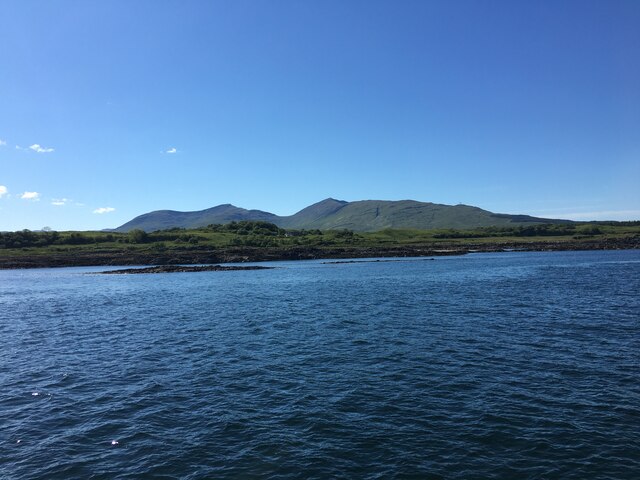
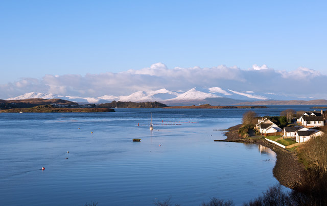
Àird a' Chròtha, also known as Croachy Point, is a prominent and picturesque headland located in Argyllshire, Scotland. Situated on the west coast of the country, this coastal feature offers breathtaking views of the surrounding landscape and the vast expanse of the Atlantic Ocean.
With its rugged cliffs and rocky shoreline, Àird a' Chròtha is a popular destination for outdoor enthusiasts and nature lovers. The headland is characterized by its towering cliffs, reaching heights of up to 100 meters, which provide nesting grounds for a variety of seabirds including puffins, guillemots, and razorbills. The area is also home to a diverse range of marine life, making it a haven for snorkelers and divers.
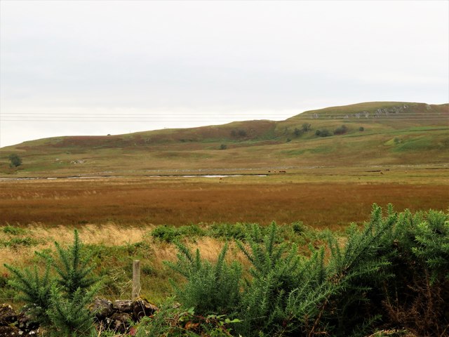
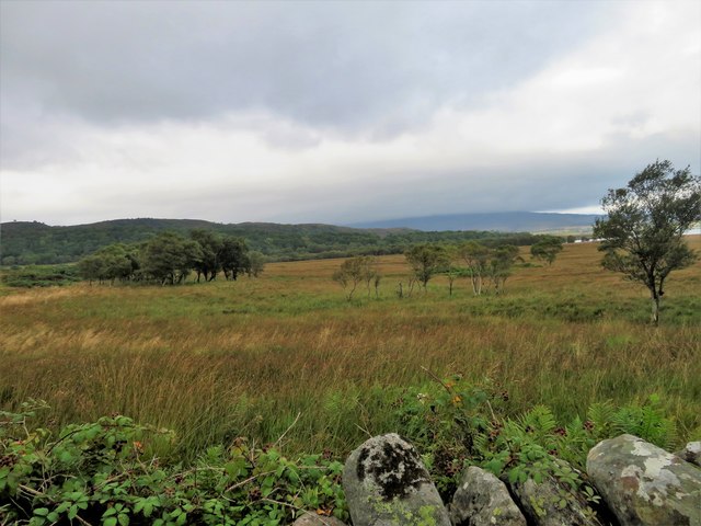
For those who prefer to keep their feet on solid ground, Àird a' Chròtha offers several walking trails that wind their way along the coastline. These trails provide stunning views of the surrounding countryside, with its rolling hills and picturesque villages. On a clear day, it is even possible to see the islands of Mull and Coll in the distance.
In addition to its natural beauty, Àird a' Chròtha also holds historical significance. The headland is dotted with ancient ruins, including the remains of a medieval chapel and a Viking burial ground. These archaeological sites provide a glimpse into the rich history of the area and offer an opportunity for visitors to immerse themselves in the past.
Overall, Àird a' Chròtha is a remarkable coastal feature that combines stunning natural scenery with a rich cultural heritage. Whether you are interested in birdwatching, hiking, or exploring ancient ruins, this headland has something to offer for everyone.
If you have any feedback on the listing, please let us know in the comments section below.
Àird a' Chròtha Images
Images are sourced within 2km of 56.421227/-5.6706314 or Grid Reference NM7331. Thanks to Geograph Open Source API. All images are credited.


Àird a' Chròtha is located at Grid Ref: NM7331 (Lat: 56.421227, Lng: -5.6706314)
Unitary Authority: Argyll and Bute
Police Authority: Argyll and West Dunbartonshire
What 3 Words
///sleeping.cares.pianists. Near Craignure, Argyll & Bute
Nearby Locations
Related Wikis

Loch Don
Loch Don is a sea loch on the east coast of the Isle of Mull, off the west coast of Scotland. It is an intricately shaped loch opening onto the Firth of...

Lochdon Free Church
The Lochdon Free Church is a place of worship of the Free Church of Scotland in Lochdon on the Isle of Mull, Scotland. The church was built in 1852....

Torosay Castle
Torosay Castle is a large house situated 1+1⁄2 miles (2.5 kilometres) south of Craignure on the Isle of Mull, in the Scottish Inner Hebrides. == Castle... ==
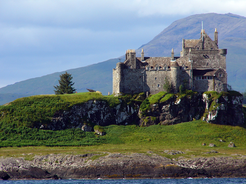
Duart Castle
Duart Castle, or Caisteal Dhubhairt in Scottish Gaelic, is a castle on the Isle of Mull, beside the Sound of Mull off the west coast of Scotland, within...
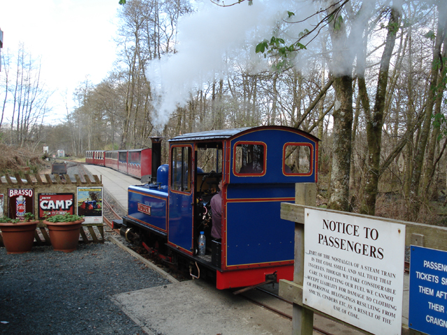
Torosay railway station
Torosay is a station on the Isle of Mull, Argyll and Bute, Scotland, on the Isle of Mull Railway line. == External links == Railway’s website

Lady's Rock
Lady's Rock is an uninhabited skerry to the south west of Lismore in the Inner Hebrides. It is submerged at high tide and carries a navigation beacon....
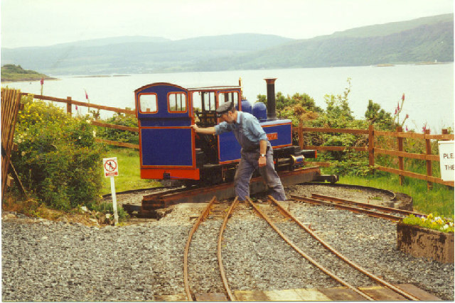
Isle of Mull Railway
The Isle of Mull Railway was a 10+1⁄4 in (260 mm) gauge line, 1+1⁄4 miles (2.0 km) long, which ran from the ferry terminal at Craignure to Torosay Castle...
Loch Spelve
Loch Spelve is a sea loch on the southeast coast of the Isle of Mull, off the west coast of Scotland. It is almost landlocked with a relatively narrow...
Nearby Amenities
Located within 500m of 56.421227,-5.6706314Have you been to Àird a' Chròtha?
Leave your review of Àird a' Chròtha below (or comments, questions and feedback).