Cobblers of Lorn

Coastal Feature, Headland, Point in Argyllshire

Scotland

Cobblers of Lorn

Cottage on Lunga On the east coast of this Slate Island, in the Sound of Luing. There is also a larger house <a href="https://www.geograph.org.uk/photo/6932677">NM7108 : House on the Slate Island of Lunga</a>, obscured by the rock behind the cottage.
Cottage on Lunga Credit: M J Richardson

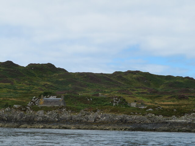
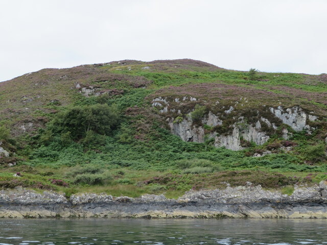
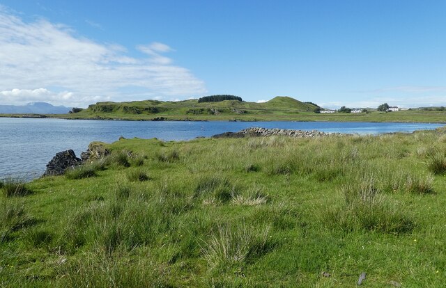
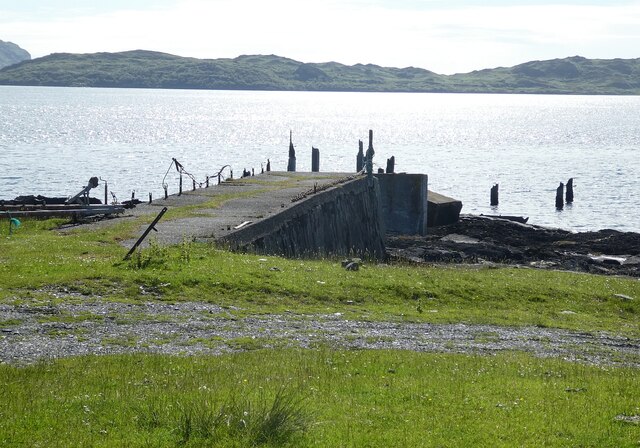
Cobblers of Lorn is a prominent coastal feature located in Argyllshire, Scotland. Situated on the western coast, it is specifically found in the region known as Lorn. This natural formation is a headland characterized by its rugged and rocky terrain, jutting out into the waters of the Atlantic Ocean.

The Cobblers of Lorn gained its name due to its distinctive resemblance to a cobbler's bench or stool, with its unique rock formations resembling the shape of a chair or seat. These formations are a result of natural erosion and weathering over centuries, giving the headland its iconic appearance.

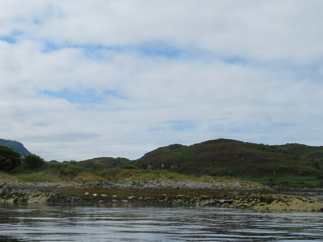
The headland is known for its stunning views and picturesque landscapes, attracting both locals and tourists alike. The rugged cliffs and rocky shores provide a dramatic backdrop against the crashing waves of the ocean. Visitors can often witness the raw power of the Atlantic as it meets the land, creating a mesmerizing display of nature's forces.

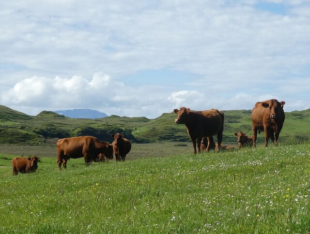
The Cobblers of Lorn is also a popular spot for wildlife enthusiasts. The surrounding waters are home to a diverse range of marine life, including seals, dolphins, and various species of seabirds. Birdwatchers can spot seabirds such as puffins, gannets, and guillemots nesting on the cliffs.

For those seeking outdoor activities, the headland offers opportunities for coastal walks, hiking, and photography. The challenging terrain and stunning vistas make it a favorite destination for adventure seekers and nature lovers.

In conclusion, Cobblers of Lorn is a remarkable coastal feature in Argyllshire, characterized by its distinctive rock formations and rugged landscape. It is a popular spot for visitors to enjoy the breathtaking views, observe wildlife, and engage in outdoor activities.

If you have any feedback on the listing, please let us know in the comments section below.

Cobblers of Lorn Images

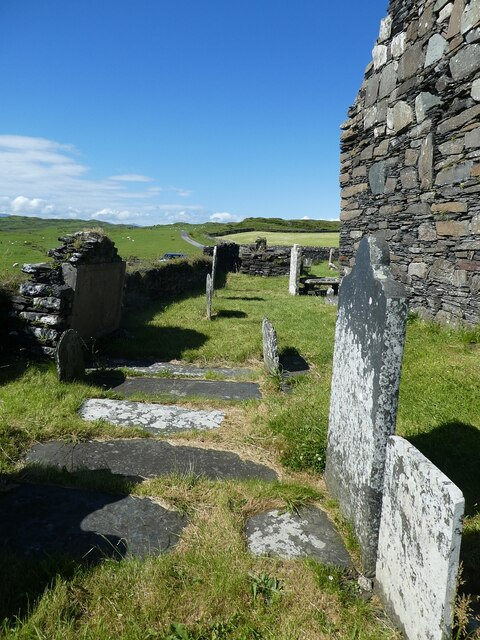
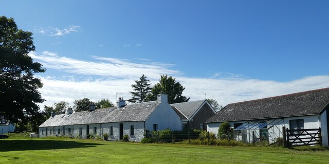
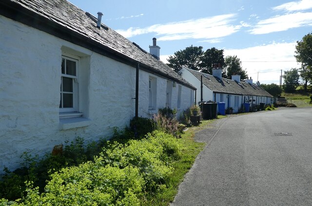
Images are sourced within 2km of 56.219665/-5.6634851 or Grid Reference NM7209. Thanks to Geograph Open Source API. All images are credited.

Cottage on Lunga On the east coast of this Slate Island, in the Sound of Luing. There is also a larger house <a href="https://www.geograph.org.uk/photo/6932677">NM7108 : House on the Slate Island of Lunga</a>, obscured by the rock behind the cottage.
Cottage on Lunga
On the east coast of this Slate Island, in the Sound of Luing. There is also a larger house NM7108 : House on the Slate Island of Lunga, obscured by the rock behind the cottage.
House on the Slate Island of Lunga Seen from the Sound of Luing.
House on the Slate Island of Lunga
Seen from the Sound of Luing.
Seals on Eilean nan Ceann Both Atlantic Grey seals and Common seals were hauled out.
Seals on Eilean nan Ceann
Both Atlantic Grey seals and Common seals were hauled out.
Barr Sligeig, on Lunga At 49 m, one of the higher points of Lunga; Bidein na h-Iolaire, at 100 m, is the highest. The rock would appear to be relatively soft - note the undercut at what would be the high tide mark?
Barr Sligeig, on Lunga
At 49 m, one of the higher points of Lunga; Bidein na h-Iolaire, at 100 m, is the highest. The rock would appear to be relatively soft - note the undercut at what would be the high tide mark?
Luing - Kilchatton - Ruined church and associated graveyard This ruined church stands in its graveyard near to a road junction in the midst of the Isle of Luing just northwest of the village of Toberonochy.
The ruins of the church are a Designated Ancient Monument <span class="nowrap"><a title="http://portal.historicenvironment.scot/designation/SM3808" rel="nofollow ugc noopener" href="http://portal.historicenvironment.scot/designation/SM3808">Link</a><img style="margin-left:2px;" alt="External link" title="External link - shift click to open in new window" src="https://s1.geograph.org.uk/img/external.png" width="10" height="10"/></span> while the graveyard is Category 'B' listed <span class="nowrap"><a title="http://portal.historicenvironment.scot/designation/LB12196" rel="nofollow ugc noopener" href="http://portal.historicenvironment.scot/designation/LB12196">Link</a><img style="margin-left:2px;" alt="External link" title="External link - shift click to open in new window" src="https://s1.geograph.org.uk/img/external.png" width="10" height="10"/></span>
Canmore website information: <span class="nowrap"><a title="https://canmore.org.uk/site/22552/luing-kilchattan-old-parish-church" rel="nofollow ugc noopener" href="https://canmore.org.uk/site/22552/luing-kilchattan-old-parish-church">Link</a><img style="margin-left:2px;" alt="External link" title="External link - shift click to open in new window" src="https://s1.geograph.org.uk/img/external.png" width="10" height="10"/></span>
See also:
<a href="https://www.geograph.org.uk/photo/7258575">NM7409 : Luing - Kilchatton - Ruined church from its graveyard</a>
<a href="https://www.geograph.org.uk/photo/7258583">NM7409 : Luing - Kilchatton ruined church - grave slabs</a>
<a href="https://www.geograph.org.uk/photo/7258588">NM7409 : Luing - Kilchatton - Interior of ruined church</a>
<a href="https://www.geograph.org.uk/photo/7258592">NM7409 : Luing - Kilchatton - Graveyard to the west of ruined church</a>
Luing - Kilchatton - Ruined church and associated graveyard
This ruined church stands in its graveyard near to a road junction in the midst of the Isle of Luing just northwest of the village of Toberonochy. The ruins of the church are a Designated Ancient Monument LinkExternal link while the graveyard is Category 'B' listed LinkExternal link Canmore website information: LinkExternal link See also: NM7409 : Luing - Kilchatton - Ruined church from its graveyard NM7409 : Luing - Kilchatton ruined church - grave slabs NM7409 : Luing - Kilchatton - Interior of ruined church NM7409 : Luing - Kilchatton - Graveyard to the west of ruined church
Luing - Boat in Black Mill Bay This striking little red boat moored in Black Mill Bay on the west coast of the Isle of Luing caught my attention with its almost perfect reflection in the water.
The hill in the background is Cnoc Mòr which rises to 184' (56m).
Luing - Boat in Black Mill Bay
This striking little red boat moored in Black Mill Bay on the west coast of the Isle of Luing caught my attention with its almost perfect reflection in the water. The hill in the background is Cnoc Mòr which rises to 184' (56m).
Luing - Kilchatton - Ruined church from its graveyard Looking at the ruined church at Kilchatton near Toberonochy from the north.
The ruins of the church are a Designated Ancient Monument <span class="nowrap"><a title="http://portal.historicenvironment.scot/designation/SM3808" rel="nofollow ugc noopener" href="http://portal.historicenvironment.scot/designation/SM3808">Link</a><img style="margin-left:2px;" alt="External link" title="External link - shift click to open in new window" src="https://s1.geograph.org.uk/img/external.png" width="10" height="10"/></span> while the graveyard is Category 'B' listed <span class="nowrap"><a title="http://portal.historicenvironment.scot/designation/LB12196" rel="nofollow ugc noopener" href="http://portal.historicenvironment.scot/designation/LB12196">Link</a><img style="margin-left:2px;" alt="External link" title="External link - shift click to open in new window" src="https://s1.geograph.org.uk/img/external.png" width="10" height="10"/></span>
Canmore website information: <span class="nowrap"><a title="https://canmore.org.uk/site/22552/luing-kilchattan-old-parish-church" rel="nofollow ugc noopener" href="https://canmore.org.uk/site/22552/luing-kilchattan-old-parish-church">Link</a><img style="margin-left:2px;" alt="External link" title="External link - shift click to open in new window" src="https://s1.geograph.org.uk/img/external.png" width="10" height="10"/></span>
See also:
<a href="https://www.geograph.org.uk/photo/7218376">NM7409 : Luing - Kilchatton - Ruined church and associated graveyard</a>
<a href="https://www.geograph.org.uk/photo/7258583">NM7409 : Luing - Kilchatton ruined church - grave slabs</a>
<a href="https://www.geograph.org.uk/photo/7258588">NM7409 : Luing - Kilchatton - Interior of ruined church</a>
<a href="https://www.geograph.org.uk/photo/7258592">NM7409 : Luing - Kilchatton - Graveyard to the west of ruined church</a>
Luing - Kilchatton - Ruined church from its graveyard
Looking at the ruined church at Kilchatton near Toberonochy from the north. The ruins of the church are a Designated Ancient Monument LinkExternal link while the graveyard is Category 'B' listed LinkExternal link Canmore website information: LinkExternal link See also: NM7409 : Luing - Kilchatton - Ruined church and associated graveyard NM7409 : Luing - Kilchatton ruined church - grave slabs NM7409 : Luing - Kilchatton - Interior of ruined church NM7409 : Luing - Kilchatton - Graveyard to the west of ruined church
Luing - Kilchatton - Interior of ruined church Looking from the open eastern end of the ruined church at Kilchatton near Toberonochy on the Isle of Luing. The gravestones must post-date the ruination of the church.
See also:
<a href="https://www.geograph.org.uk/photo/7218376">NM7409 : Luing - Kilchatton - Ruined church and associated graveyard</a>
<a href="https://www.geograph.org.uk/photo/7258575">NM7409 : Luing - Kilchatton - Ruined church from its graveyard</a>
<a href="https://www.geograph.org.uk/photo/7258583">NM7409 : Luing - Kilchatton ruined church - grave slabs</a>
<a href="https://www.geograph.org.uk/photo/7258592">NM7409 : Luing - Kilchatton - Graveyard to the west of ruined church</a>
Luing - Kilchatton - Interior of ruined church
Looking from the open eastern end of the ruined church at Kilchatton near Toberonochy on the Isle of Luing. The gravestones must post-date the ruination of the church. See also: NM7409 : Luing - Kilchatton - Ruined church and associated graveyard NM7409 : Luing - Kilchatton - Ruined church from its graveyard NM7409 : Luing - Kilchatton ruined church - grave slabs NM7409 : Luing - Kilchatton - Graveyard to the west of ruined church
Luing - Kilchatton - Graveyard to the west of ruined church Looking along the western end of the ruined church at Kilchatton near Toberonochy on the Isle of Luing, with numerous gravestones between the church and the graveyard wall.
See also:
<a href="https://www.geograph.org.uk/photo/7218376">NM7409 : Luing - Kilchatton - Ruined church and associated graveyard</a>
<a href="https://www.geograph.org.uk/photo/7258575">NM7409 : Luing - Kilchatton - Ruined church from its graveyard</a>
<a href="https://www.geograph.org.uk/photo/7258583">NM7409 : Luing - Kilchatton ruined church - grave slabs</a>
<a href="https://www.geograph.org.uk/photo/7258588">NM7409 : Luing - Kilchatton - Interior of ruined church</a>
Luing - Kilchatton - Graveyard to the west of ruined church
Looking along the western end of the ruined church at Kilchatton near Toberonochy on the Isle of Luing, with numerous gravestones between the church and the graveyard wall. See also: NM7409 : Luing - Kilchatton - Ruined church and associated graveyard NM7409 : Luing - Kilchatton - Ruined church from its graveyard NM7409 : Luing - Kilchatton ruined church - grave slabs NM7409 : Luing - Kilchatton - Interior of ruined church
Luing - Toberonochy - Cottages Most of the older cottages in Toberonochy are Category 'B' listed, including this row of rubble-built cottages.
See listing here: <span class="nowrap"><a title="http://portal.historicenvironment.scot/designation/LB12198" rel="nofollow ugc noopener" href="http://portal.historicenvironment.scot/designation/LB12198">Link</a><img style="margin-left:2px;" alt="External link" title="External link - shift click to open in new window" src="https://s1.geograph.org.uk/img/external.png" width="10" height="10"/></span>
Pretty-much the whole of Toberonochy is a conservation area - see <span class="nowrap"><a title="https://www.argyll-bute.gov.uk/sites/default/files/planning-and-environment/Toberonochy%20Conservation%20Area.pdf" rel="nofollow ugc noopener" href="https://www.argyll-bute.gov.uk/sites/default/files/planning-and-environment/Toberonochy%20Conservation%20Area.pdf">Link</a><img style="margin-left:2px;" alt="External link" title="External link - shift click to open in new window" src="https://s1.geograph.org.uk/img/external.png" width="10" height="10"/></span>
Luing - Toberonochy - Cottages
Most of the older cottages in Toberonochy are Category 'B' listed, including this row of rubble-built cottages. See listing here: LinkExternal link Pretty-much the whole of Toberonochy is a conservation area - see LinkExternal link
Luing - Toberonochy - The road out of the village Looking along the street that leads out of the picturesque little village of Toberonochy on the Isle of Luing. Almost the entire village is HES Category 'B' listed - see <span class="nowrap"><a title="http://portal.historicenvironment.scot/designation/LB12198" rel="nofollow ugc noopener" href="http://portal.historicenvironment.scot/designation/LB12198">Link</a><img style="margin-left:2px;" alt="External link" title="External link - shift click to open in new window" src="https://s1.geograph.org.uk/img/external.png" width="10" height="10"/></span>
Luing - Toberonochy - The road out of the village
Looking along the street that leads out of the picturesque little village of Toberonochy on the Isle of Luing. Almost the entire village is HES Category 'B' listed - see LinkExternal link
Luing - Looking across Black Mill Bay to Ardlarach A view across the semicircular Black Mill Bay from the eponymous settlement of Blackmillbay to the land around Ardlarach with Cnoc Mòr rising behind it to the left (west).
Luing - Looking across Black Mill Bay to Ardlarach
A view across the semicircular Black Mill Bay from the eponymous settlement of Blackmillbay to the land around Ardlarach with Cnoc Mòr rising behind it to the left (west).
Luing - Blackmillbay - Jetty The concrete section of this jetty at Blackmillbay on Luing still stands but what looks as though was a wooden continuation of it looks to be long gone. The jetty juts out to the west into the Sound of Luing. The island seen in the distance is Lunga (Population: 0, Area: 250ha (1 mile²), Highest point: Bidean na h-Iolaire 98m (322'))
Luing - Blackmillbay - Jetty
The concrete section of this jetty at Blackmillbay on Luing still stands but what looks as though was a wooden continuation of it looks to be long gone. The jetty juts out to the west into the Sound of Luing. The island seen in the distance is Lunga (Population: 0, Area: 250ha (1 mile²), Highest point: Bidean na h-Iolaire 98m (322'))
Luing - Luing Cattle - a small herd A little group of the good-looking Luing Cattle a breed named after the island. The breed is three quarters Beef Shorthorn and one quarter Highland. They are a very hardy beef cow that can raise their calves in harsh conditions.
See Wikipedia article here: <span class="nowrap"><a title="https://en.wikipedia.org/wiki/Luing_cattle" rel="nofollow ugc noopener" href="https://en.wikipedia.org/wiki/Luing_cattle">Link</a><img style="margin-left:2px;" alt="External link" title="External link - shift click to open in new window" src="https://s1.geograph.org.uk/img/external.png" width="10" height="10"/></span>
Luing Cattle Society webpage here: <span class="nowrap"><a title="https://luingcattlesociety.co.uk" rel="nofollow ugc noopener" href="https://luingcattlesociety.co.uk">Link</a><img style="margin-left:2px;" alt="External link" title="External link - shift click to open in new window" src="https://s1.geograph.org.uk/img/external.png" width="10" height="10"/></span>
See also:
<a href="https://www.geograph.org.uk/photo/7259236">NM7409 : Luing - A small herd of Luing cattle on a ridge</a>
<a href="https://www.geograph.org.uk/photo/7259238">NM7409 : Luing - A Luing cow</a>
Luing - Luing Cattle - a small herd
A little group of the good-looking Luing Cattle a breed named after the island. The breed is three quarters Beef Shorthorn and one quarter Highland. They are a very hardy beef cow that can raise their calves in harsh conditions. See Wikipedia article here: LinkExternal link Luing Cattle Society webpage here: LinkExternal link See also: NM7409 : Luing - A small herd of Luing cattle on a ridge NM7409 : Luing - A Luing cow
Luing - A small herd of Luing cattle on a ridge This little group of the Luing Cattle were moving slowly across the ridge north of the lane from Blackmillbay to Toberonochy on the island from which they get their name.
The breed is three quarters Beef Shorthorn and one quarter Highland. They are a very hardy beef cow that can raise their calves in harsh conditions.
See Wikipedia article here: <span class="nowrap"><a title="https://en.wikipedia.org/wiki/Luing_cattle" rel="nofollow ugc noopener" href="https://en.wikipedia.org/wiki/Luing_cattle">Link</a><img style="margin-left:2px;" alt="External link" title="External link - shift click to open in new window" src="https://s1.geograph.org.uk/img/external.png" width="10" height="10"/></span>
Luing Cattle Society webpage here: <span class="nowrap"><a title="https://luingcattlesociety.co.uk" rel="nofollow ugc noopener" href="https://luingcattlesociety.co.uk">Link</a><img style="margin-left:2px;" alt="External link" title="External link - shift click to open in new window" src="https://s1.geograph.org.uk/img/external.png" width="10" height="10"/></span>
See also:
<a href="https://www.geograph.org.uk/photo/7259232">NM7409 : Luing - Luing Cattle - a small herd</a>
<a href="https://www.geograph.org.uk/photo/7259238">NM7409 : Luing - A Luing cow</a>
Luing - A small herd of Luing cattle on a ridge
This little group of the Luing Cattle were moving slowly across the ridge north of the lane from Blackmillbay to Toberonochy on the island from which they get their name. The breed is three quarters Beef Shorthorn and one quarter Highland. They are a very hardy beef cow that can raise their calves in harsh conditions. See Wikipedia article here: LinkExternal link Luing Cattle Society webpage here: LinkExternal link See also: NM7409 : Luing - Luing Cattle - a small herd NM7409 : Luing - A Luing cow
Luing - A Luing cow This fine beast was munching on the grassland of the Isle of Luing from which the breed gets its name.
The breed is three quarters Beef Shorthorn and one quarter Highland. They are a very hardy beef cow that can raise their calves in harsh conditions.
See Wikipedia article here: <span class="nowrap"><a title="https://en.wikipedia.org/wiki/Luing_cattle" rel="nofollow ugc noopener" href="https://en.wikipedia.org/wiki/Luing_cattle">Link</a><img style="margin-left:2px;" alt="External link" title="External link - shift click to open in new window" src="https://s1.geograph.org.uk/img/external.png" width="10" height="10"/></span>
Luing Cattle Society webpage here: <span class="nowrap"><a title="https://luingcattlesociety.co.uk" rel="nofollow ugc noopener" href="https://luingcattlesociety.co.uk">Link</a><img style="margin-left:2px;" alt="External link" title="External link - shift click to open in new window" src="https://s1.geograph.org.uk/img/external.png" width="10" height="10"/></span>
See also:
<a href="https://www.geograph.org.uk/photo/7259232">NM7409 : Luing - Luing Cattle - a small herd</a>
<a href="https://www.geograph.org.uk/photo/7259236">NM7409 : Luing - A small herd of Luing cattle on a ridge</a>
Luing - A Luing cow
This fine beast was munching on the grassland of the Isle of Luing from which the breed gets its name. The breed is three quarters Beef Shorthorn and one quarter Highland. They are a very hardy beef cow that can raise their calves in harsh conditions. See Wikipedia article here: LinkExternal link Luing Cattle Society webpage here: LinkExternal link See also: NM7409 : Luing - Luing Cattle - a small herd NM7409 : Luing - A small herd of Luing cattle on a ridge
Blackmill Bay, Luing
Show me another place!

Cobblers of Lorn is located at Grid Ref: NM7209 (Lat: 56.219665, Lng: -5.6634851)

Unitary Authority: Argyll and Bute

Police Authority: Argyll and West Dunbartonshire

What 3 Words

///shuttling.shuts.appear. Near Lochbuie, Argyll & Bute

Related Wikis

Luing

Luing ( LING; Scottish Gaelic: Luinn) is one of the Slate Islands, Firth of Lorn, in the west of Argyll in Scotland, about 16 miles (26 km) south of Oban...

Lunga, Firth of Lorn

Lunga is one of the Slate Islands in the Firth of Lorn in Argyll and Bute, Scotland. The "Grey Dog" tidal race, which runs in the sea channel to the south...

Scarba, Lunga and the Garvellachs National Scenic Area

Scarba, Lunga and the Garvellachs is the name of one of the 40 national scenic areas of Scotland. The designated area covers the islands of Scarba, Lunga...

Ardinamir

Ardinamir is an anchorage and small settlement on the island of Luing in Argyll and Bute, Scotland. == References ==

Nearby Amenities

Located within 500m of 56.219665,-5.6634851
Source: PGS
Lat/Long: 56.2171461/-5.6571838
Source: PGS
Lat/Long: 56.2171722/-5.6575056
Source: PGS
Lat/Long: 56.2171127/-5.6588689
Source: PGS
Lat/Long: 56.217137/-5.6606621
Source: PGS
Lat/Long: 56.2173656/-5.6614956
Source: PGS
Lat/Long: 56.2175168/-5.6619094
Source: PGS
Lat/Long: 56.2178285/-5.6619523
Source: PGS
Lat/Long: 56.2179235/-5.663246
Source: PGS
Lat/Long: 56.218381/-5.6642596
Source: PGS
Lat/Long: 56.2183865/-5.6644943
Source: PGS
Lat/Long: 56.2185077/-5.6645552
Source: PGS
Lat/Long: 56.2186345/-5.6650042
Source: PGS
Lat/Long: 56.2187896/-5.6657764
Source: PGS
Lat/Long: 56.2196307/-5.6657458
Source: PGS
Lat/Long: 56.220241/-5.6652836
Source: PGS
Lat/Long: 56.2204219/-5.6649047
Source: PGS
Lat/Long: 56.2208804/-5.664424
Source: PGS
Lat/Long: 56.221944/-5.6641778
Source: PGS
Lat/Long: 56.2222997/-5.6643041
Source: PGS
Lat/Long: 56.2225157/-5.6642454
Source: PGS
Lat/Long: 56.2228777/-5.6633345
Source: PGS
Lat/Long: 56.2234467/-5.6631379
Cnoc Mòr
Corbett: no
Ele: 56
Graham: no
Marilyn: no
Munro: no
Natural: peak
Lat/Long: 56.2209792/-5.6574508
The data included in this document is from www.openstreetmap.org. The data is made available under ODbL.

Have you been to Cobblers of Lorn?

Leave your review of Cobblers of Lorn below (or comments, questions and feedback).