Sound of Luing

Sea, Estuary, Creek in Argyllshire

Scotland

Sound of Luing

Ordnance Survey Cut Mark This OS cut mark can be found on the NE face of the farmhouse.
Ordnance Survey Cut Mark Credit: Adrian Dust

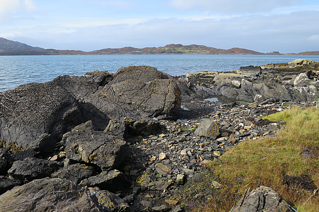
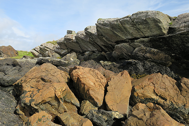
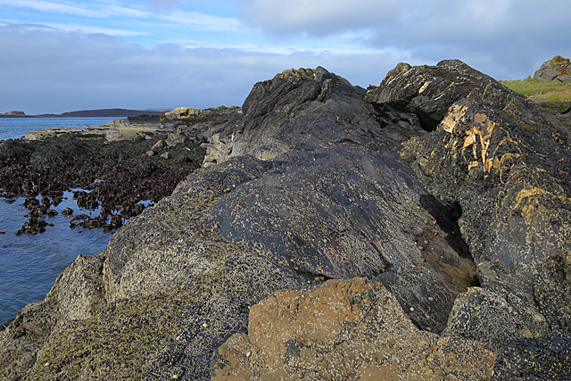
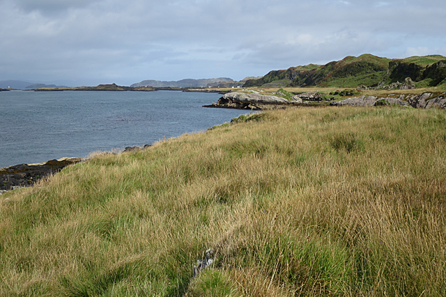
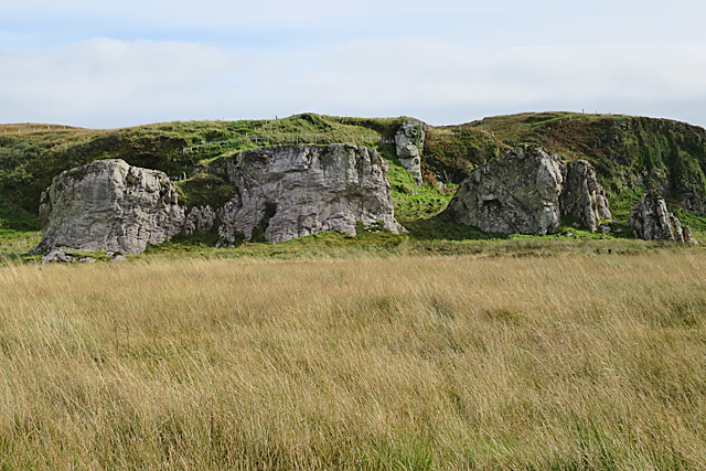
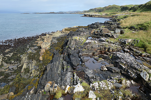
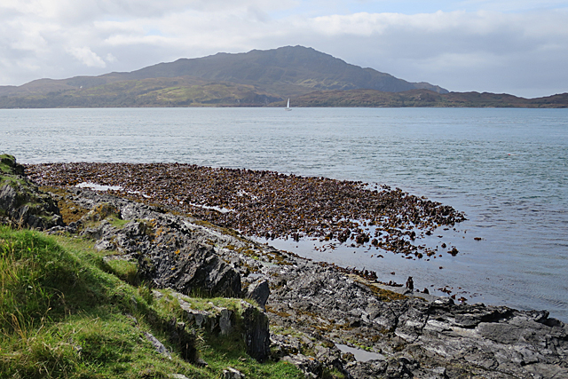
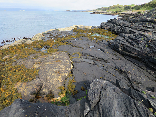
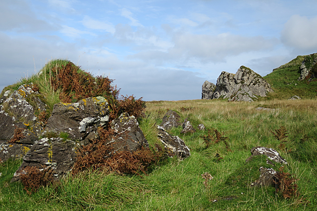
The Sound of Luing is a picturesque body of water located in Argyllshire, Scotland. It is classified as a sea loch, which is a narrow inlet of the sea surrounded by land. Specifically, the Sound of Luing separates the island of Luing from the mainland of Scotland.

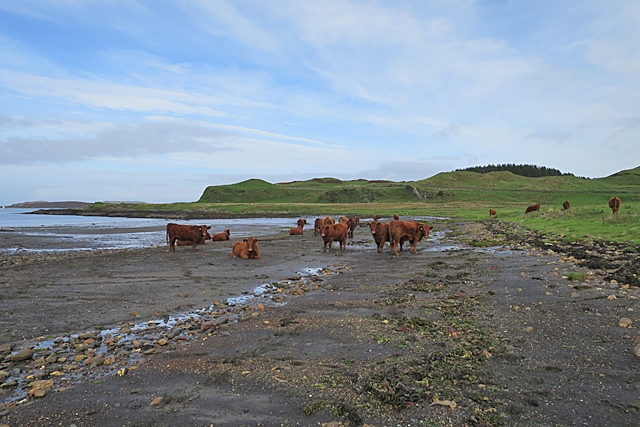
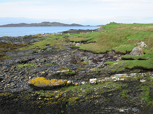
With its stunning views and tranquil atmosphere, the Sound of Luing attracts visitors and locals alike. The sea loch is surrounded by rolling hills and lush greenery, creating a breathtaking backdrop for those who visit. The calm and clear waters of the sound are also home to a variety of marine life, making it a popular spot for fishing and wildlife enthusiasts.

The tidal nature of the Sound of Luing creates a unique estuarine environment, as the water levels rise and fall with the tides. This ebb and flow of the tides create a dynamic ecosystem that supports a diverse range of flora and fauna. Seals, dolphins, and porpoises are often spotted swimming in these waters, delighting those who have the opportunity to witness their playful antics.

The Sound of Luing also features several small creeks that branch out from the main body of water. These creeks offer a sense of exploration and adventure, as visitors can kayak or sail through them, discovering hidden coves and secluded beaches along the way.

Overall, the Sound of Luing is a natural wonder that showcases the beauty of Scotland's coastal landscape. Whether it's the sea, estuary, or creeks, this area offers a tranquil escape for those seeking a peaceful retreat or an opportunity to immerse themselves in nature.

If you have any feedback on the listing, please let us know in the comments section below.

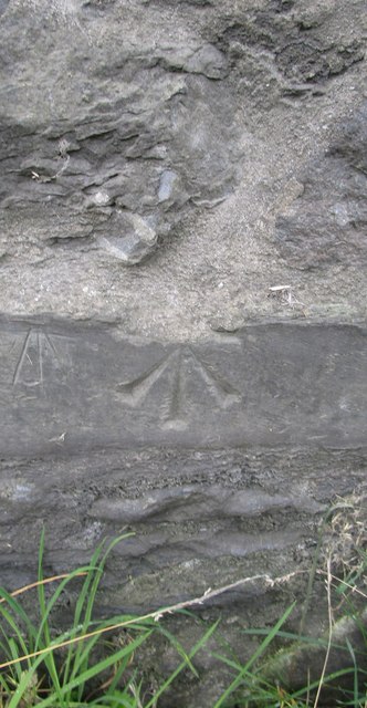
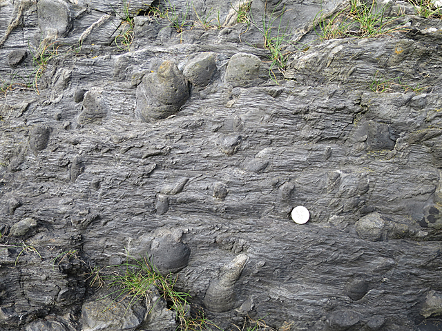
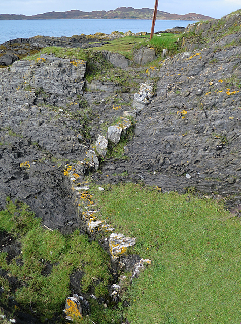
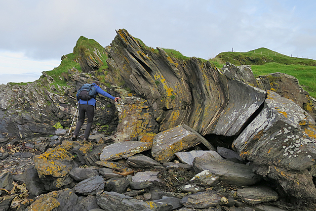
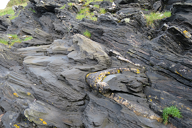
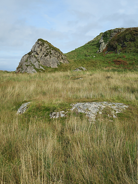
Sound of Luing Images

Images are sourced within 2km of 56.221813/-5.6692742 or Grid Reference NM7209. Thanks to Geograph Open Source API. All images are credited.

Ordnance Survey Cut Mark This OS cut mark can be found on the NE face of the farmhouse.
Ordnance Survey Cut Mark
This OS cut mark can be found on the NE face of the farmhouse.
Cattle on the Beach A herd of the famous Luing cattle on the beach at Black Mill Bay. See <span class="nowrap"><a title="http://www.luingcattlesociety.co.uk/index.php?page=history" rel="nofollow ugc noopener" href="http://www.luingcattlesociety.co.uk/index.php?page=history">Link</a><img style="margin-left:2px;" alt="External link" title="External link - shift click to open in new window" src="https://s1.geograph.org.uk/img/external.png" width="10" height="10"/></span> for the history of the breed.
Cattle on the Beach
A herd of the famous Luing cattle on the beach at Black Mill Bay. See LinkExternal link for the history of the breed.
Shore north of Black Mill Bay Most of the rock here is slate, but the rock covered with yellow lichen is part of a much deformed bed of sandstone. The distant island is Lunga.
Shore north of Black Mill Bay
Most of the rock here is slate, but the rock covered with yellow lichen is part of a much deformed bed of sandstone. The distant island is Lunga.
Debrite This peculiar-looking rock is a debrite, or metamorphosed debris flow. Pebbles in the muddy deposit have been stretched and deformed to produce strange shapes, while the mud itself has been altered to slate.
Debrite
This peculiar-looking rock is a debrite, or metamorphosed debris flow. Pebbles in the muddy deposit have been stretched and deformed to produce strange shapes, while the mud itself has been altered to slate.
Sandstone Dyke The pale zigzag is a sandstone dyke. It must have been injected into the mud from the underlying sandstone while the sediment was still fairly liquid, and has since been deformed, lithified and cleaved into what looks like a row of separate blocks.
Sandstone Dyke
The pale zigzag is a sandstone dyke. It must have been injected into the mud from the underlying sandstone while the sediment was still fairly liquid, and has since been deformed, lithified and cleaved into what looks like a row of separate blocks.
Recumbent Fold The curving rock is the remnant of the hinge of a fold in metamorphosed sandstone. The fold has been overturned to lie horizontally. Sedimentary features in the sandstone indicate that the rocks are younging to the east, or in other words the rocks on the left here are older than the rock on the right, and the whole pile has been rotated about 90º and complexly folded by tectonic movements.
Recumbent Fold
The curving rock is the remnant of the hinge of a fold in metamorphosed sandstone. The fold has been overturned to lie horizontally. Sedimentary features in the sandstone indicate that the rocks are younging to the east, or in other words the rocks on the left here are older than the rock on the right, and the whole pile has been rotated about 90º and complexly folded by tectonic movements.
Folds Back-to-back Folds here are picked out by the sandstone bed which is pale in colour and has yellow lichen on it. Above it is a similar fold in the opposite direction in the slate. The slate is cleaved so that it looks as if it is made up of a sheaf of thin leaves. The cleavage is perpendicular to the direction of the force that caused the folding, and it is termed axial planar cleavage because it is in the hinge of the fold. If you look at the darker rock above the folds, you can see lots of tiny folds. Small folds like these on the limbs of larger folds are called parasitic folds.
Folds Back-to-back
Folds here are picked out by the sandstone bed which is pale in colour and has yellow lichen on it. Above it is a similar fold in the opposite direction in the slate. The slate is cleaved so that it looks as if it is made up of a sheaf of thin leaves. The cleavage is perpendicular to the direction of the force that caused the folding, and it is termed axial planar cleavage because it is in the hinge of the fold. If you look at the darker rock above the folds, you can see lots of tiny folds. Small folds like these on the limbs of larger folds are called parasitic folds.
Felsic Intrusion Felsic rock is igneous rock that is low in iron and magnesium and high in silica. It is usually pale in colour. Here at Black Mill Bay the Easdale Slates are cut by several sheets of felsic rock, and the outcrop in the foreground is part of the largest of these. It continues beneath the vegetation to form the Cobblers of Lorn, one of which is the conical rock just left of centre a little further north.
Felsic Intrusion
Felsic rock is igneous rock that is low in iron and magnesium and high in silica. It is usually pale in colour. Here at Black Mill Bay the Easdale Slates are cut by several sheets of felsic rock, and the outcrop in the foreground is part of the largest of these. It continues beneath the vegetation to form the Cobblers of Lorn, one of which is the conical rock just left of centre a little further north.
Coast of Luing The rocks on the shore here are principally Easdale Slate. The pock-marked surface of the largest blocks is probably the result of molluscs boring holes in the surface. In the background is the island of Lunga.
Coast of Luing
The rocks on the shore here are principally Easdale Slate. The pock-marked surface of the largest blocks is probably the result of molluscs boring holes in the surface. In the background is the island of Lunga.
Dyke and Dolostone The reddish boulders in the foreground are composed of dolostone, which is a type of limestone in which some of the calcium has been replaced by magnesium. Above them is a dark layer of slate, and on top is a felsic sheet. Felsic rocks are igneous rocks that contain little or no iron or magnesium, but are rich in feldspar and silica. They are usually pale in colour.
Dyke and Dolostone
The reddish boulders in the foreground are composed of dolostone, which is a type of limestone in which some of the calcium has been replaced by magnesium. Above them is a dark layer of slate, and on top is a felsic sheet. Felsic rocks are igneous rocks that contain little or no iron or magnesium, but are rich in feldspar and silica. They are usually pale in colour.
Mostly Slate The almost black rock is Easdale Slate, with lots of pale veins, probably of calcite. In the foreground is a block of dolostone, a type of limestone in which some of the calcium has been replaced by magnesium.
Mostly Slate
The almost black rock is Easdale Slate, with lots of pale veins, probably of calcite. In the foreground is a block of dolostone, a type of limestone in which some of the calcium has been replaced by magnesium.
Raised Beach Raised beaches are a feature of much of the coast of Scotland, and especially noticeable in parts of Argyll. They occur when sea level falls fairly rapidly relative to the level of the land, leaving former shores high and dry. You can see that there is a level area between the low cliffs and the present shore right up the length of the coast here.
Raised Beach
Raised beaches are a feature of much of the coast of Scotland, and especially noticeable in parts of Argyll. They occur when sea level falls fairly rapidly relative to the level of the land, leaving former shores high and dry. You can see that there is a level area between the low cliffs and the present shore right up the length of the coast here.
The Cobblers of Lorn The row of rock stacks at the shoreward side of the raised beach is a prominent feature of the west coast of Luing, and a useful landmark for sailors. They are parts of a thick sheet of felsic rock that has been intruded into the Easdale Slates which are the commonest type of rock in this area. Felsic rock is pale-coloured igneous rock which is low in iron and magnesium but high in feldspar and silica. The felsic sheet was eroded into stacks by the action of the sea when the relative level of the sea was higher, and what is now grassland was the shore. Compare with <a href="https://www.geograph.org.uk/photo/168924">NM7209 : The Cobblers of Lorne</a>.
The Cobblers of Lorn
The row of rock stacks at the shoreward side of the raised beach is a prominent feature of the west coast of Luing, and a useful landmark for sailors. They are parts of a thick sheet of felsic rock that has been intruded into the Easdale Slates which are the commonest type of rock in this area. Felsic rock is pale-coloured igneous rock which is low in iron and magnesium but high in feldspar and silica. The felsic sheet was eroded into stacks by the action of the sea when the relative level of the sea was higher, and what is now grassland was the shore. Compare with NM7209 : The Cobblers of Lorne.
Fold on the Foreshore The rock pool occupies the eroded hinge zone of a fold in the Easdale Slate. You can just about make out the curve of the beds round the fold.
Fold on the Foreshore
The rock pool occupies the eroded hinge zone of a fold in the Easdale Slate. You can just about make out the curve of the beds round the fold.
Sound of Luing In the foreground is a forest of kelp, probably Oarweed or Tangle. The hill at the far side of the Sound is the island of Scarba.
Sound of Luing
In the foreground is a forest of kelp, probably Oarweed or Tangle. The hill at the far side of the Sound is the island of Scarba.
Truncated Slate The dark rock here is Easdale Slate, and you can easily make out that it is folded. It has been cut through by the pale rock on the left, which is a felsic sheet. Felsic rock is a pale igneous rock rich in feldspar and silica but low in magnesium and iron.
Truncated Slate
The dark rock here is Easdale Slate, and you can easily make out that it is folded. It has been cut through by the pale rock on the left, which is a felsic sheet. Felsic rock is a pale igneous rock rich in feldspar and silica but low in magnesium and iron.
Pyrite Holes Pyrite is a sulphide of iron, a mineral that forms in anoxic conditions. It crystallises in little cubes a few millimetres across, and its colour when fresh is brassy gold, so that it is commonly called Fool's Gold. When exposed to air, it weathers away quite readily. Each of these square holes once held a pyrite crystal which has weathered out, and most of the holes are surrounded by a ring of chemical alteration. One rusty-looking crystal is still in its hole at the very top of the image.
Pyrite Holes
Pyrite is a sulphide of iron, a mineral that forms in anoxic conditions. It crystallises in little cubes a few millimetres across, and its colour when fresh is brassy gold, so that it is commonly called Fool's Gold. When exposed to air, it weathers away quite readily. Each of these square holes once held a pyrite crystal which has weathered out, and most of the holes are surrounded by a ring of chemical alteration. One rusty-looking crystal is still in its hole at the very top of the image.
The Cobblers of Lorn Looking towards the former sea stacks from the south. The Cobblers are actually just in the next square, but the slate outcrop at left and all of the grassy land are in this square.
The Cobblers of Lorn
Looking towards the former sea stacks from the south. The Cobblers are actually just in the next square, but the slate outcrop at left and all of the grassy land are in this square.
Show me another place!

Sound of Luing is located at Grid Ref: NM7209 (Lat: 56.221813, Lng: -5.6692742)

Unitary Authority: Argyll and Bute

Police Authority: Argyll and West Dunbartonshire

What 3 Words

///motoring.absorbing.rebounder. Near Lochbuie, Argyll & Bute

Related Wikis

Luing

Luing ( LING; Scottish Gaelic: Luinn) is one of the Slate Islands, Firth of Lorn, in the west of Argyll in Scotland, about 16 miles (26 km) south of Oban...

Lunga, Firth of Lorn

Lunga is one of the Slate Islands in the Firth of Lorn in Argyll and Bute, Scotland. The "Grey Dog" tidal race, which runs in the sea channel to the south...

Scarba, Lunga and the Garvellachs National Scenic Area

Scarba, Lunga and the Garvellachs is the name of one of the 40 national scenic areas of Scotland. The designated area covers the islands of Scarba, Lunga...

Ardinamir

Ardinamir is an anchorage and small settlement on the island of Luing in Argyll and Bute, Scotland. == References ==

Nearby Amenities

Located within 500m of 56.221813,-5.6692742
Source: PGS
Lat/Long: 56.218381/-5.6642596
Source: PGS
Lat/Long: 56.2183865/-5.6644943
Source: PGS
Lat/Long: 56.2185077/-5.6645552
Source: PGS
Lat/Long: 56.2186345/-5.6650042
Source: PGS
Lat/Long: 56.2187896/-5.6657764
Source: PGS
Lat/Long: 56.2196307/-5.6657458
Source: PGS
Lat/Long: 56.220241/-5.6652836
Source: PGS
Lat/Long: 56.2204219/-5.6649047
Source: PGS
Lat/Long: 56.2208804/-5.664424
Source: PGS
Lat/Long: 56.221944/-5.6641778
Source: PGS
Lat/Long: 56.2222997/-5.6643041
Source: PGS
Lat/Long: 56.2225157/-5.6642454
Source: PGS
Lat/Long: 56.2228777/-5.6633345
Source: PGS
Lat/Long: 56.2234467/-5.6631379
Source: PGS
Lat/Long: 56.2241516/-5.6626081
The data included in this document is from www.openstreetmap.org. The data is made available under ODbL.

Have you been to Sound of Luing?

Leave your review of Sound of Luing below (or comments, questions and feedback).