Ciste nan Arm

Coastal Feature, Headland, Point in Argyllshire

Scotland

Ciste nan Arm

Corryvreckan, north of Jura An area of turbulence with, behind it, a dead-flat area of sea.  Photo taken mid afternoon.  I think the tide was listed as 4.0 that day.
Corryvreckan, north of Jura Credit: Patrick Hamilton

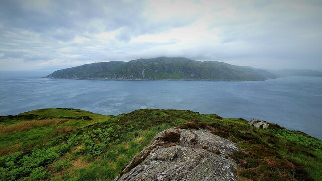
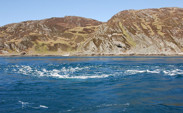
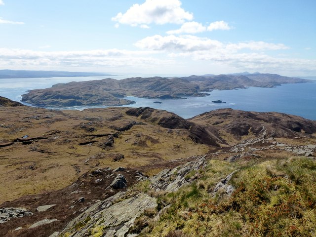
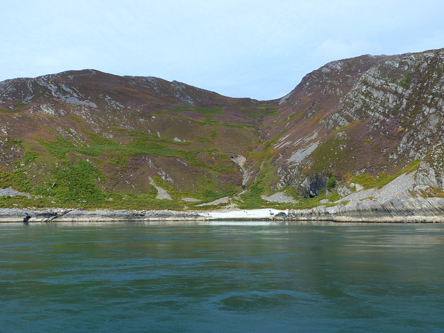
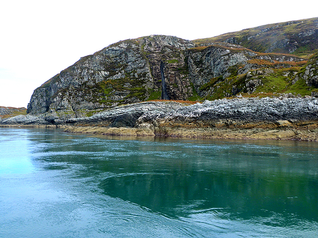
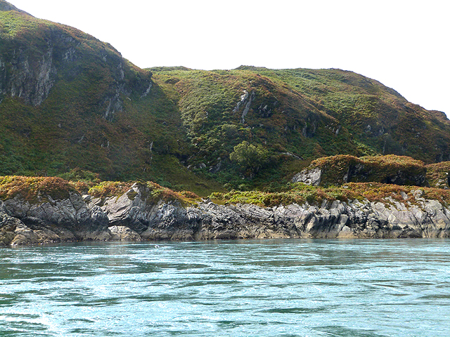
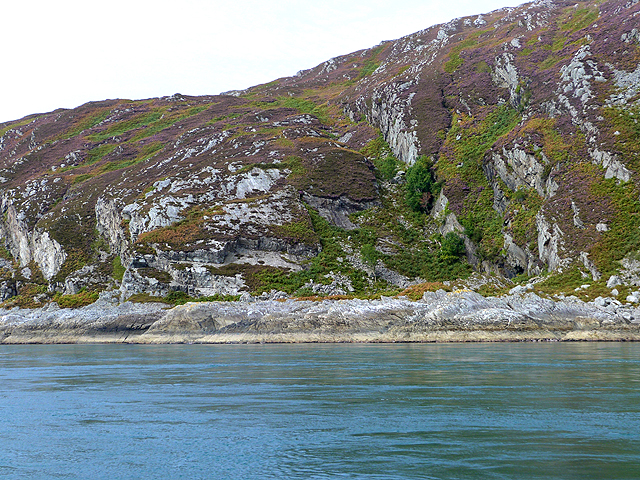
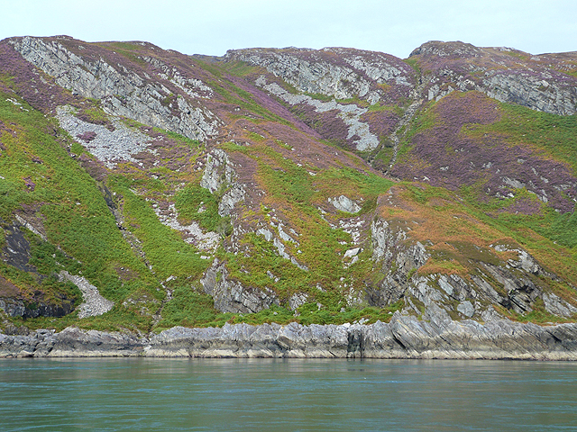
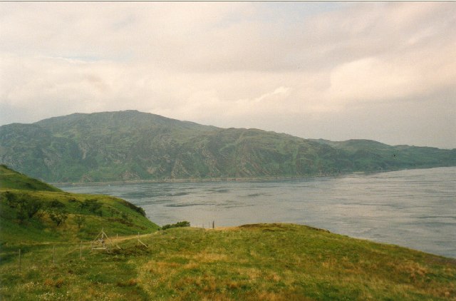
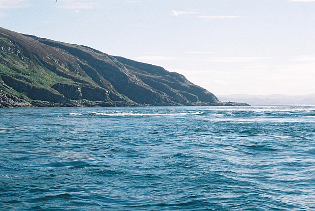
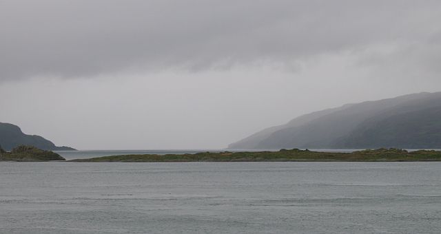
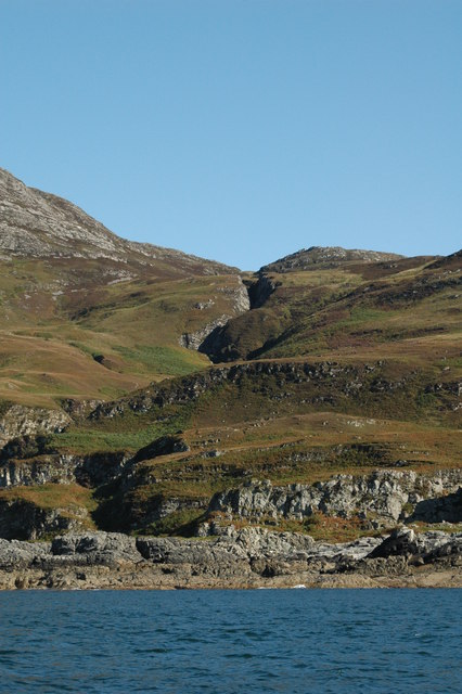
Ciste nan Arm is a prominent coastal feature located in Argyllshire, Scotland. It is a headland or point that is situated along the western coast of the region, offering breathtaking views of the surrounding landscape and the vast expanse of the Atlantic Ocean.

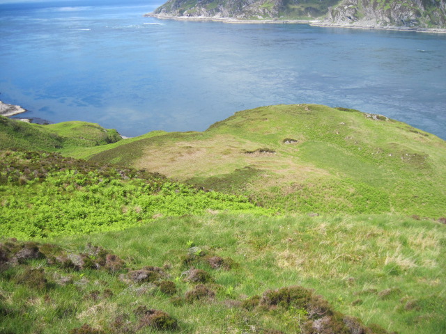
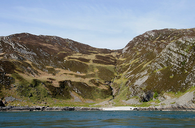
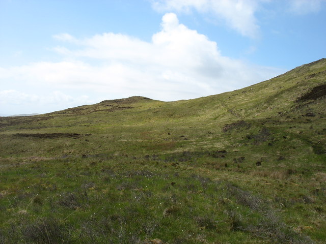
The headland is characterized by its rugged cliffs that jut out into the sea, creating a dramatic and picturesque scene. The cliffs are composed of layers of ancient rock, showcasing the geological history of the area. At the top of the headland, there is a grassy plateau that provides a perfect vantage point for visitors to admire the panoramic vistas.

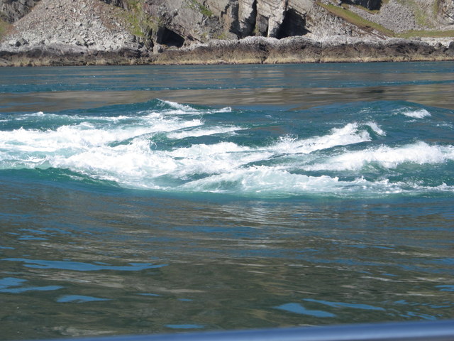
Ciste nan Arm is known for its rich biodiversity, with a variety of plant and animal species thriving in the area. The headland is home to numerous seabirds, such as gulls and fulmars, which nest along the cliffs. Visitors often spot seals and dolphins swimming in the waters below, adding to the allure of the location.

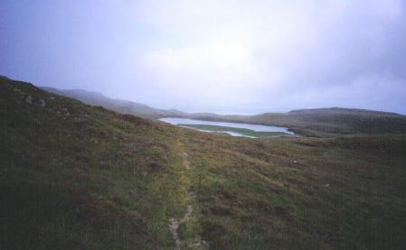
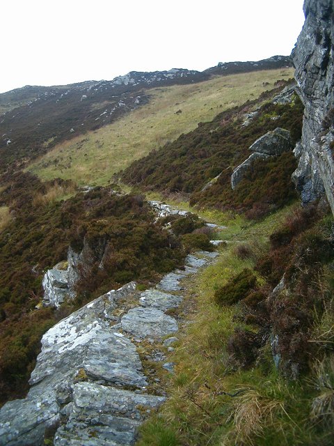
Access to Ciste nan Arm is relatively easy, with a well-maintained footpath leading to the headland. The path offers stunning views of the surrounding countryside and leads visitors through a diverse range of habitats, including heathland and coastal grasslands.

Overall, Ciste nan Arm is a must-visit destination for nature enthusiasts and those seeking solace amidst the beauty of the Scottish coast. Its rugged cliffs, diverse wildlife, and stunning vistas make it an unforgettable experience for anyone fortunate enough to explore this remarkable coastal feature.

If you have any feedback on the listing, please let us know in the comments section below.

Ciste nan Arm Images

Images are sourced within 2km of 56.161855/-5.6974027 or Grid Reference NM7002. Thanks to Geograph Open Source API. All images are credited.

Corryvreckan, north of Jura An area of turbulence with, behind it, a dead-flat area of sea.  Photo taken mid afternoon.  I think the tide was listed as 4.0 that day.
Corryvreckan, north of Jura
An area of turbulence with, behind it, a dead-flat area of sea. Photo taken mid afternoon. I think the tide was listed as 4.0 that day.
Above Creag an t-Seòil
Gulf of Corryvreckan Looking over the gulf in the direction of Scarba from the northern tip of Jura.
Gulf of Corryvreckan
Looking over the gulf in the direction of Scarba from the northern tip of Jura.
Uamh Camas nam Bairneach on Scarba This gully with a burn running down into the Camas nan Bairneach on the south side of Scarba was viewed from a small boat in the Gulf of Corryvreckan.
Uamh Camas nam Bairneach on Scarba
This gully with a burn running down into the Camas nan Bairneach on the south side of Scarba was viewed from a small boat in the Gulf of Corryvreckan.
Corryvreckan Whirlpool Taken on a trip from Crinan with small tides and good weather.
Corryvreckan Whirlpool
Taken on a trip from Crinan with small tides and good weather.
Cruach Scarba Looking towards the whirlpool and Jura from below the summit of Cruach Scarba.
Cruach Scarba
Looking towards the whirlpool and Jura from below the summit of Cruach Scarba.
Camas nam Bairneach Bay and valley on the south coast of Scarba.
Camas nam Bairneach
Bay and valley on the south coast of Scarba.
Carraig Mhòr Northernmost point of the Isle of Jura.
Carraig Mhòr
Northernmost point of the Isle of Jura.
Raised beach and old sea cliffs East of Carraig Mhòr at the north end of the Isle of Jura.
Raised beach and old sea cliffs
East of Carraig Mhòr at the north end of the Isle of Jura.
South coast of Scarba
The track across Scarba The track is seen on the right, climbing gently to almost its highest point at 285m.
The track across Scarba
The track is seen on the right, climbing gently to almost its highest point at 285m.
Scarba and the Gulf of Corryvreckan The extreme tidal race between the islands of Jura and Scarba give rise to the notorious Corryvreckan whirlpool, a condition that only occurs at a few other places in the world.  The local navigation charts describe the area as "un-navigable".
Scarba and the Gulf of Corryvreckan
The extreme tidal race between the islands of Jura and Scarba give rise to the notorious Corryvreckan whirlpool, a condition that only occurs at a few other places in the world. The local navigation charts describe the area as "un-navigable".
Loch Airidh a' Chruidh Pony path high on Scarba, heading eastward towards Loch Airidh a' Chruidh.
Loch Airidh a' Chruidh
Pony path high on Scarba, heading eastward towards Loch Airidh a' Chruidh.
Coryvreckan whirlpool from a boat
Pony track The pony track that runs around the south side of Scarba becomes almost alpine in its character at this point.
Pony track
The pony track that runs around the south side of Scarba becomes almost alpine in its character at this point.
Corryvreckan A grey view of the infamous gap between Jura (left) and hilly Scarba (right). The low island of Rèisa Mhic Phaidean in the middle distance. Taken from the Craignish Peninsula on mainland Argyll.
Corryvreckan
A grey view of the infamous gap between Jura (left) and hilly Scarba (right). The low island of Rèisa Mhic Phaidean in the middle distance. Taken from the Craignish Peninsula on mainland Argyll.
Waterfall, south Scarba
Show me another place!

Ciste nan Arm is located at Grid Ref: NM7002 (Lat: 56.161855, Lng: -5.6974027)

Unitary Authority: Argyll and Bute

Police Authority: Argyll and West Dunbartonshire

What 3 Words

///comfort.appealing.pylon. Near Lochgilphead, Argyll & Bute

Related Wikis

Gulf of Corryvreckan

The Gulf of Corryvreckan (from the Gaelic Coire Bhreacain, meaning 'cauldron of the speckled seas' or 'cauldron of the plaid'), also called the Strait...

Scarba

Scarba (Scottish Gaelic: Sgarba) is an island, in Argyll and Bute, Scotland, just north of the much larger island of Jura. The island has not been permanently...

Kinuachdrachd

Kinuachdrachd or Kinuachdrach is a place about 22 miles from Craighouse on the island of Jura, in the council area of Argyll and Bute, Scotland. It comprises...

Barnhill, Jura

Barnhill is a farmhouse in the north of the island of Jura in the Scottish Inner Hebrides overlooking the Sound of Jura. It stands on the site of a larger...

Lunga, Firth of Lorn

Lunga is one of the Slate Islands in the Firth of Lorn in Argyll and Bute, Scotland. The "Grey Dog" tidal race, which runs in the sea channel to the south...

Scarba, Lunga and the Garvellachs National Scenic Area

Scarba, Lunga and the Garvellachs is the name of one of the 40 national scenic areas of Scotland. The designated area covers the islands of Scarba, Lunga...

Craignish Castle

Craignish Castle is located on the Craignish peninsula in Argyll, western Scotland and is a category B listed building. The present castle includes a 16th...

Shuna, Slate Islands

Shuna (Scottish Gaelic: Siuna) is one of the Slate Islands lying east of Luing on the west coast of Scotland. == History == In 1815, James Yates, a Glasgow...

Nearby Amenities

Located within 500m of 56.161855,-5.6974027
Bagh Creagan nan Deargann
Natural: bay
Source: OS_OpenData_StreetView
Lat/Long: 56.1628378/-5.6934615
Coire Bhreacain
Natural: bay
Source: OS_OpenData_StreetView
Lat/Long: 56.1597467/-5.7033536
Uamh nan Deargann
Natural: cave_entrance
Source: OS_OpenData_StreetView
Lat/Long: 56.1643547/-5.6915071
Ciste nan Arm
Place: locality
Source: OS_OpenData_StreetView
Lat/Long: 56.1621457/-5.6974901
The data included in this document is from www.openstreetmap.org. The data is made available under ODbL.

Have you been to Ciste nan Arm?

Leave your review of Ciste nan Arm below (or comments, questions and feedback).